Overview
Approximately a half dozen trails access upper South Mountain from Ahwatukee. This trail is located just east of Eagle Pass. It serves as a great segment for loops with Corona de Loma - West, Guadalupe Ridge & Gabriel Canyon.
Warning
Sections of the trail are loose gravel on steep inclines. Going up is the preferred direction of travel.
Hike
Finding the trail your first time may require a GPS unit or some trial and error. Once you know it you'll be glad you took the time to figure it out. I suggest checking out the Official Route for specifics.
From the lower end, the trail parts from an access loop off the Desert Classic Trail. Nobody loses sleep over hiking South Mountain but this is a pretty good hike from the beginning. The trail shoots up a ravine before a switchback takes you to a ridge ascent. This is one of the more strenuous ascents on South Mountain. Fear not, it's still a tad under nearby Camelback or Piestewa grade-wise. The trail is easy to follow with no real sucker trails of concern.
On the way up I noticed a good population of Ironwood trees. Most are medium to small and healthy. When you see an Ironwood you know you're in the Sonoran Desert as it's the only place they grow. They can live up to 1,500 years providing microclimates necessary for other desert life. The dense wood wards off birds from burrowing. On the same token, the dense canopy provides shade for birds and vegetation underneath.
In the upper reaches, Ironwoods give way to Paloverde trees. You have a nice overview of Eagle pass on your left. Look closely and you'll notice Corona de Loma (west) coming down inside the pass. At about 2,380 feet the trail levels off for a while. You get a chance to catch your breath in a nice stretch of desert flora. After 0.15mi (a couple of minutes) you're climbing in elevation again. Views to the north open up before you top out. The Guadalupe Ridge trail junctions at 33.34270,-112.03435. Continuing up you soon come to the highest undeveloped ridge stretch on South Mountain. The radio towers sit about a hundred feet higher if you want to top out. The views of the entire South Mountain range unfold in all directions. There's a nice perch to admire down into Eagle Pass and a fifty-yard side trail to the high point.
The trail continues on down to the National Trail at 33.34297,-112.03893. The most popular looping option is probably with Corona de Loma West. From the Warpaint Trailhead, it's a nice 6mi hike.
Popular nearby section to consider for various loops:
When hiking several trails on a single "hike", log it with a generic name that describes the hike. Then link the trails traveled, check out the example.
WARNING! Hiking and outdoor related sports can be dangerous. Be responsible and prepare for the trip. Study the area you are entering and plan accordingly. Dress for the current and unexpected weather changes. Take plenty of water. Never go alone. Make an itinerary with your plan(s), route(s), destination(s) and expected return time. Give your itinerary to trusted family and/or friends.
Permit $$
no fees or permits reported
if incorrect tell us about it
Directions
Road
Paved - Car Okay
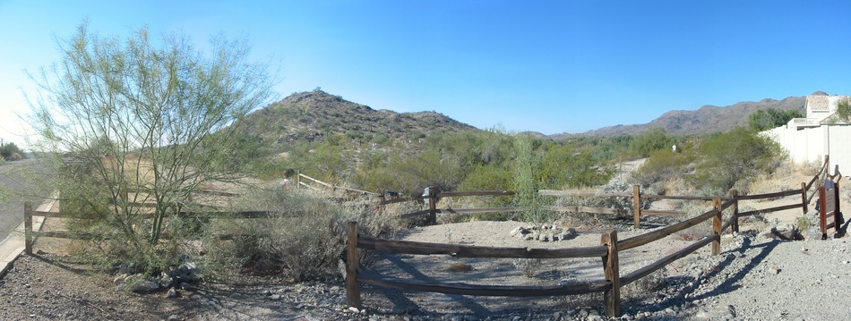
To Warpaint Trailhead Take the I-10 to exit 159 for Ray Road. Travel west on Ray Road about 1/4 mile until you reach the signaled intersection for 48th Street. Take 48th Street north until you reach the signaled intersection for E. Knox Road. Travel west on E. Knox Road until you reach Warpaint Drive. Travel north on Warpaint Drive about 1/4 mile. There is parking on the street. Trail head is on the west side of Warpaint Drive.
From PHX (I-10 & AZ-51) 14.0 mi - about 21 mins From TUC (Jct 1-10 & Grant) 99.7 mi - about 1 hour 32 mins From FLG (Jct I-17 & I-40) 158 mi - about 2 hours 27 mins
 Route Editor

 Overview
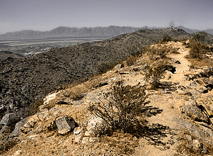


