 Route Editor

| Guide | ♦ | 69 Triplogs | 0 Topics |
details | drive | permit | forecast | 🔥 route |
stats |
photos | triplogs | topics | location |
| 299 | 69 | 0 |
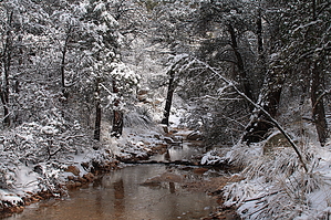
You can put it on the map! by fricknaley   Background BackgroundThe Coronado National Forest has recently resurrected an old, forgotten trail in the Catalinas. Bug Springs is a newly constructed trail that was just finished this March. It somewhat overlays an old route from the Prison Camp at Hirabayashi Campground up to the Middle Bear Campground and picnic area. This new trail offers a nice dichotomy of midlevel basin-type scenery typical of the Molino Basin area with pristine, unburned low pine forest typical of the lower Green Mountain trail. Nice...a new trail in the Catalinas. Hike The Bug Springs trail leaves its small parking area and almost immediately starts switchbacking up the ridge just towering above the lot, at first heading east then sharply turning west and north to attain the ridge. At first, you have views up the canyon housing the old Bug Spring. You can see an old empty lot with the foundation of some old building. A small trail runs up the canyon floor from here, likely heading to the spring. As the trail climbs away from this canyon you gain the ridge separating it from the next canyon north. The trail follows this ridgeline northeast for a while, passing through areas of recovering burn. There are lovely views up the highway and you can see Cathedral Rock way in the distance. As the trail runs the ridgeline, it starts to head over to the canyon on your left and eventually crosses over it at about 1.35 miles from the trailhead. It then climbs up the north wall of that canyon to gain the next ridgeline separating this canyon from the next one north again. Again, you run the ridgeline northeast. There are periodic views of Airmen Peak to your right. Many nice rock formations and progressive greenery. There are huge views out over the Rincons as well, especially Rincon Peak looming in the distance. As you run the ridgeline you can see you are heading towards a forest, beautifully untouched from any recent flames. The views down either side of the ridgeline get nicer. I labeled my GPS at 2.25 miles from the trailhead "End Burn" and it's true. There are nice mossy rock formations here and there that are quite reminiscent of Green Mountain. The trail is running right towards a prominent spire. At 2.5 miles you hit the base of the spire and the trail turns sharply left and begins to descend.
Return the way you came, and lay feet on some fine new Catalina trail. Check out the Official Route and Triplogs. Leave No Trace and +Add a Triplog after your hike to support this local community. One-Way Notice This hike is listed as One-Way. When hiking several trails on a single "hike", log it with a generic name that describes the hike. Then link the trails traveled, check out the example. | |||||||||||||||||||||||||||||||||||||||||||||||||||||||||||||||||||||||||||||||||||||||||||||||||||||||||||||||||||||||||||||||||||||||||||||||||||||||||||||||||||||||||||||||||||||||||||||||


