 Route Editor

| Guide | ♦ | 36 Triplogs | 1 Topic |
details | drive | no permit | forecast | 🔥 route |
stats |
photos | triplogs | topic | location |
| 571 | 36 | 1 |
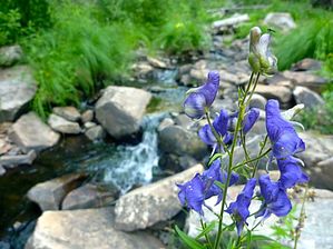
A Different Point of View by chumley  Where in the World? This hike refers to the Woods Canyon that lies downstream (north) of Woods Canyon Lake on the Mogollon Rim. It is not to be confused with the Woods Canyon in the Sedona area. Where in the World? This hike refers to the Woods Canyon that lies downstream (north) of Woods Canyon Lake on the Mogollon Rim. It is not to be confused with the Woods Canyon in the Sedona area.Overview This off-trail hike follows Woods Canyon downstream from the popular lake to the rugged, isolated junction of Chevelon Canyon and Willow Springs Canyon. The first mile or so is an easy stroll in grassy terrain but quickly turns into a treacherous boulder-hopping trek. The mileage is listed as one-way, so if you go all the way to the junction, you will have to return the way you came (doubling the mileage to 12.2) or choose one of the other options listed at the end of this description.
There is no established trail, and the going gets to be quite treacherous and occasionally unpleasant. There is a lot of overgrowth, deadfall, large boulders, and other obstacles the farther down canyon you go. If you are not comfortable with this kind of terrain, please don't attempt this hike! Hike Begin by heading downstream on the right side of the spillway. Then, descend into the canyon by using any of the established use trails. This part of the canyon is generally a pleasant grassy meadow, and the hiking is fast and easy. As the canyon meanders downstream, it begins to tighten. Pools of water appear and disappear, depending on the recent weather, though only after monsoon rains or spring snowmelt will the water actually be "flowing." As you continue, the hustle and bustle of an overpopulated Woods Canyon Lake disappear into your memory as you enjoy the solitude of this remote canyon. The canyon gets progressively more difficult to navigate. The use trails along the sides of the creek basin become overgrown and tough to get through. The rocky creek bottom is the best way to proceed, but the going is slow. Sometimes there are pools of standing water. This varies with the time of year or recent weather. Wildlife is abundant in this canyon. I witnessed both bear and mountain lion scat, plus I encountered a rafter of 4 HUGE turkeys. I mean, if you were thinking Thanksgiving dinner, these were all 20+ pounders! You will pass 2 or 3 reasonably nice dispersed campsites with established fire rings in the first couple of miles before the canyon gets more rugged. Eventually, the canyon turns into something reminiscent of Boulder Canyon in the Supes. Only there's nowhere to hike on the sides. Instead, it's just slow hiking/jumping from boulder to boulder, requiring some route-planning. The pace here slows to less than 1.5mph. Eventually, the right bank opens up a bit, and it is easy to find wildlife trails through the shaded forest. After a couple of hundred yards, the forest ends at the junction of the three canyons. Woods on the left, Willow Springs coming in from the right, and Chevelon continuing downstream toward the lake. From here, take a break and head back the way you came, or continue elsewhere based on your gear and previous plan. Backpacking Options Backpackers might continue down Chevelon Canyon another ~10-miles to the first established canyon exit point at the Telephone Ridge Trail #203, or the full 13-miles to the head of Chevelon Canyon Lake where another exit trail exists. Or they might head up Willow Springs Canyon for the 4-miles to the Willow Springs Lake dam. Except for at the junction of the three canyons, there are no good camping opportunities in the lower 2.5 miles of Woods Canyon. Check out the Official Route and Triplogs. Leave No Trace and +Add a Triplog after your hike to support this local community. One-Way Notice This hike is listed as One-Way. When hiking several trails on a single "hike", log it with a generic name that describes the hike. Then link the trails traveled, check out the example. | |||||||||||||||||||||||||||||||||||||||||||||||||||||||||||||||||||||||||||||||||||||||||||||||||||||||||||||||||||||||||||||||||||||||||||||||||||||||||||||||||||||||||||||||||||||||||||||||


