 Route Editor

| Guide | ♦ | 42 Triplogs | 0 Topics |
details | drive | permit | forecast | 🔥 route |
stats |
photos | triplogs | topics | location |
| 20 | 42 | 0 |
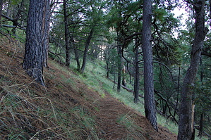
2, 4, who's counting by markthurman53  This trail does not appear to be listed as an official trail, but it is there nonetheless and is used and talked about enough that it deserves its own description. The Four Springs Trail connects Kent Spring Trail #157 to the Florida Crest Trail via the saddle just north of McCleary peak. This trail does not appear to be listed as an official trail, but it is there nonetheless and is used and talked about enough that it deserves its own description. The Four Springs Trail connects Kent Spring Trail #157 to the Florida Crest Trail via the saddle just north of McCleary peak.The Trail starts at Kent Spring, where the Kent Spring and Bog Spring Trails meet. The unsigned trail heads up the hill to the Southwest and climbs steadily over the ridge and along the ravine to the Southwest of Kent Spring, crosses back over the ridge, and eventually ends up along the upper reaches of the Kent spring canyon. The trail does about 6 switchbacks climbing 700 feet to Shovel Saddle, 1.8 miles from Kent Spring. This is a very picturesque saddle with pine trees and good views, mainly up to one of the saddles along the Florida Crest. So far, the trail has been easy to follow, but as the trail continues toward McCleary Peak, it is a little overgrown just north of Shovel Saddle. The trail is there, you just need to look through the abundance of pine tree saplings and a couple of tree falls one fairly large one. The trail becomes easy to follow once past this area (Couple hundred yards) all the way to the Saddle north of McCleary Peak, 2.5 miles from the start. There are good views from this saddle, especially of Elephant Head Rock. There is a route that takes off to the north to McCleary Peak. The Four Springs Trail heads east from this saddle down a couple of switchbacks toward Armour Spring and the Florida Crest Trail, 3.2 miles from Kent Spring. The saddle to Florida Crest Trail trail is along the north side of one of the peaks on Florida Crest and can still be in snow even after most of the other trails are clear. Armour Spring is marked with a sign and isn’t much more than a little water from under a huge rock; there was more water in the creek just 0.1 miles east of the spring. There are good views to the north from along this trail. The trail from the Florida Crest Trail, at least to the spring, is listed as Armour Spring Trail #71, not sure if this official trail goes just to the spring or continues to the saddle near McCleary Peak.
Check out the Official Route and Triplogs. Leave No Trace and +Add a Triplog after your hike to support this local community. One-Way Notice This hike is listed as One-Way. When hiking several trails on a single "hike", log it with a generic name that describes the hike. Then link the trails traveled, check out the example. | ||||||||||||||||||||||||||||||||||||||||||||||||||||||||||||||||||||||||||||||||||||||||||||||||||||||||||||||||||||||||||||||||||||||||||||||||||||||||||||||||||||||||||||||||||||||||||||||||||||||||||||


