Route Editor

| Guide | ♦ | 32 Triplogs | 1 Topic |
details | drive | permit | forecast | 🔥 route |
stats |
photos | triplogs | topic | location |
| 423 | 32 | 1 |
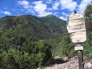
Taste great by fricknaley  I've made my stance clear on the Huachucas before; there are positives and negatives. The positives always seem to win me over. Miller Peak with its awesome panoramas, is always worth the effort. You can reach it via Miller Canyon for a tough and rewarding climb. I've made my stance clear on the Huachucas before; there are positives and negatives. The positives always seem to win me over. Miller Peak with its awesome panoramas, is always worth the effort. You can reach it via Miller Canyon for a tough and rewarding climb.The signed trailhead takes off right of the gravel road and starts climbing immediately. Within a quarter-mile, you see a signed intersection, keep going straight/left to Miller Canyon/Peak. There are plenty of manzanitas along the way. Shortly thereafter a sign welcomes you into the Miller Peak Wilderness, with a nice view of Carr Peak. After about 2/3 mile, another signed intersection for a short trail to another road breaks off to your left. Keep going straight. You may start to notice running water on your left, the lowermost drainage of Miller Canyon. It was running strong today from the recent rains.
Just climb away for about another mile. About 2 miles in, there is a sign pointing you right to the Crest Junction (also called Bathtub Spring), which it says is 2 miles away. You cross over the creek drainage here, and it's now on your left. You will start to gain altitude seriously now as you switchback up the wall of Miller Canyon. The creek drops farther away, only to come back later as you cross over it a couple more times. Every crossing is followed by climbing away. Finally, after about 3.25 miles, you really do climb out of the canyon, which you can see severely cutting away below you. You can tell that you are coming to a saddle. At 4 miles, you reach the junction with the Crest Trail #103 which runs the length of the Huachuca range. This is also a segment of the Arizona Trail. Hang a left here to Miller Peak, as the sign says (2 miles and some change). Immediately you come to Bathtub Spring, where there literally is a Bathtub spring. Keep going south along the crest trail. Sometimes this trail is nearly choked over with plants, but it is well established. You cross over the head of Miller Canyon, which is sweet. There are also intermittently great views of Miller Peak ahead. Today it was wrapped in clouds and looked sinister. Would I make it? An amazing wildflower display and intermittent aspen stand encouraged me to try. After about 1.5 miles on the Crest Trail, you come to a signed intersection for the formal trail to Miller Peak #105. This is to your left. I must say that the Crest Trail was the cleanest I have ever seen it, essentially spotless and unbelievably pleasant. Take the trail to the peak, about half a mile and 500 feet. It is no small last chore. However, the peak greets you with probably the best Sky Island summit view in southeastern Arizona (though others are very close). The threatening sky only added to the majesty. Take it in and head back the way you came. In summer, there is a good chance you will be racing the monsoons, so plan accordingly. The sky looked horrible by the time I finished. Also, beware of the border crossers. I saw none today, probably because it was a weekend? I don't know, but you may want to consider climbing this one with a buddy. In other words, be more intelligent than me. Check out the Official Route and Triplogs. Note This is a difficult hike. Arrive fit and prepared or this could get ugly. Leave No Trace and +Add a Triplog after your hike to support this local community. | ||||||||||||||||||||||||||||||||||||||||||||||||||||||||||||||||||||||||||||||||||||||||||||||||||||||||||||||||||||||||||||||||||||||||||||||||||||||||||||||||||||||||||||||||||||||||||||||||||||