 Route Editor

| Guide | ♦ | 28 Triplogs | 0 Topics |
details | drive | no permit | forecast | 🔥 route |
stats |
photos | triplogs | topics | location |
| 206 | 28 | 0 |
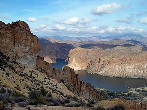
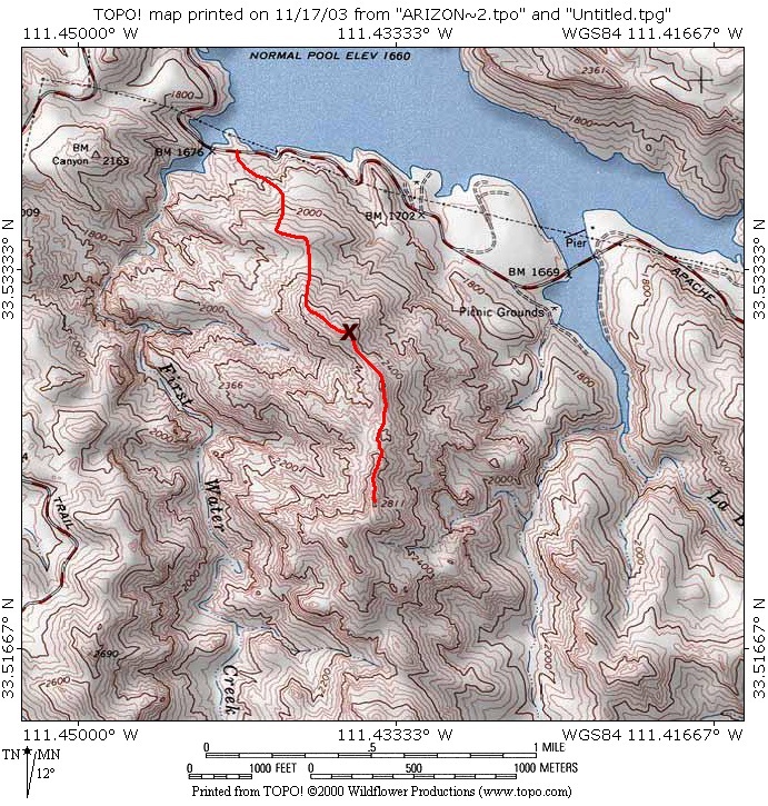
Canyon Lake Excursion by joebartels  Introduction IntroductionThis out and back off-trail hike takes you to Peak 2811. Which is the high point of a ridge between First Water Creek and La Barge Creek. Over the years, I've received compliments on my La Barge Canyon View hike. This slightly puzzled me, as it's not anything to lose sleep over, though it does have a killer view at the end. I figure the masses like it because it's moderate, different and it's near the lake!
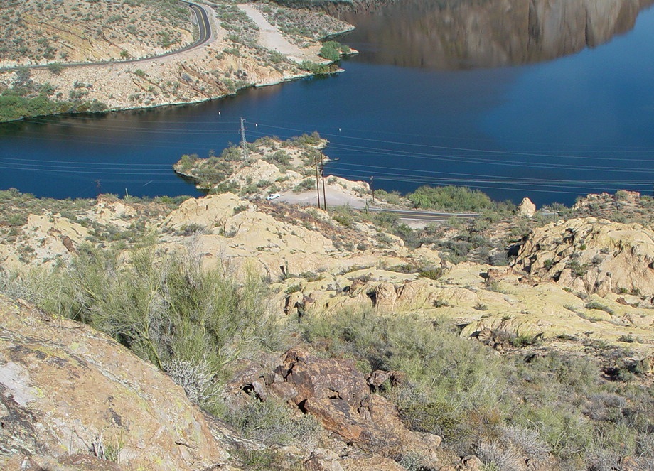
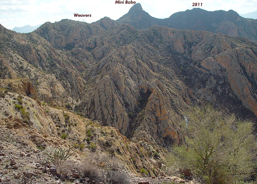
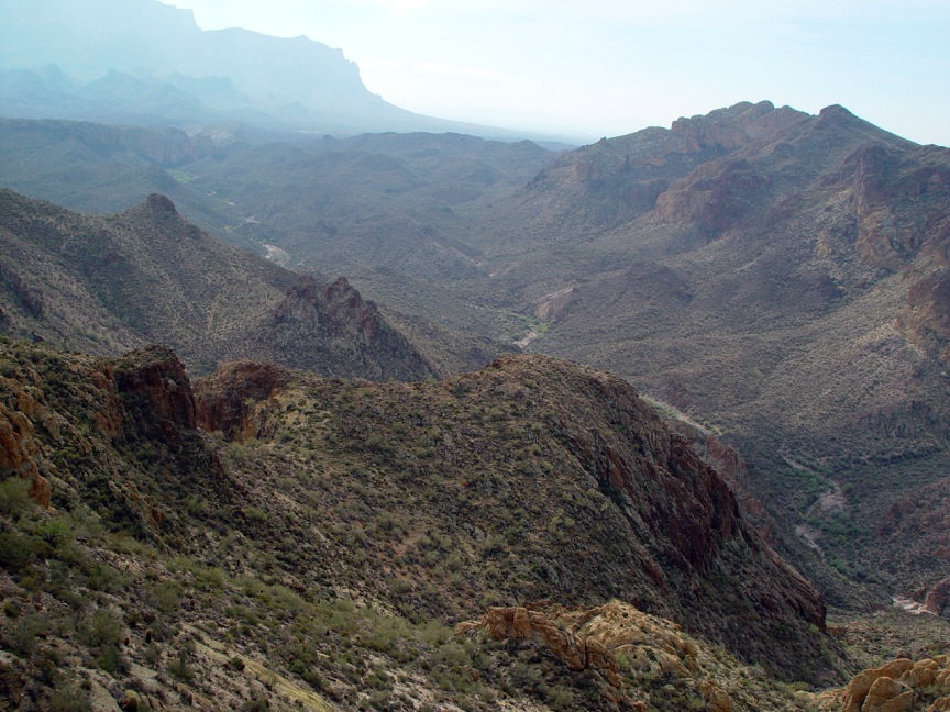
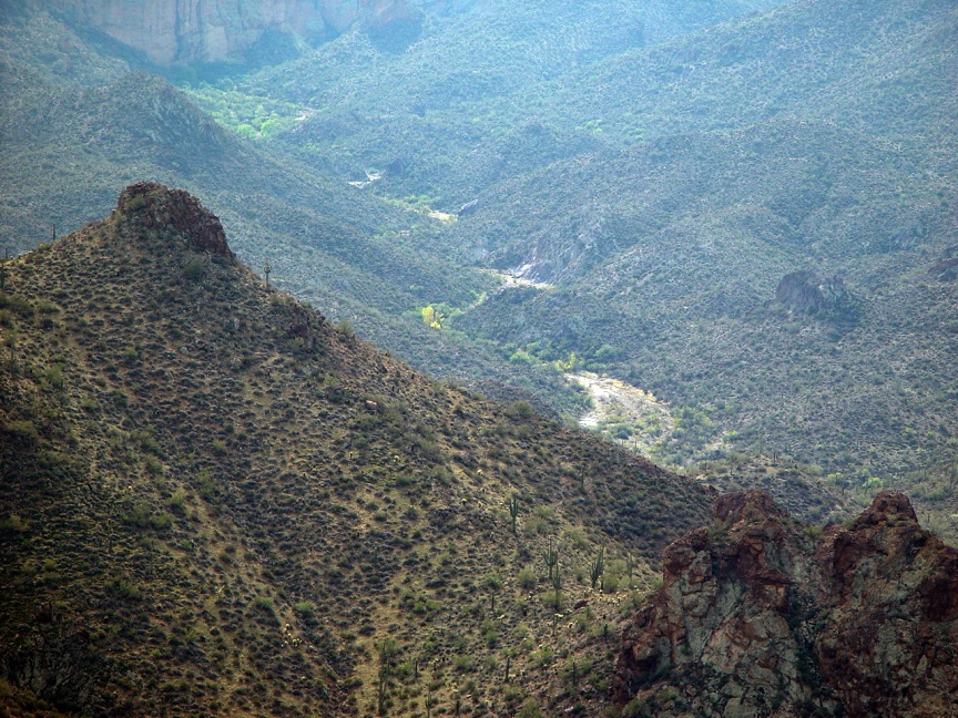
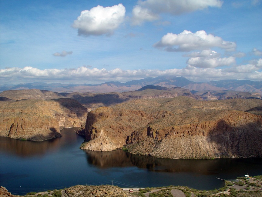
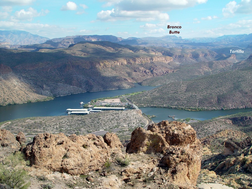
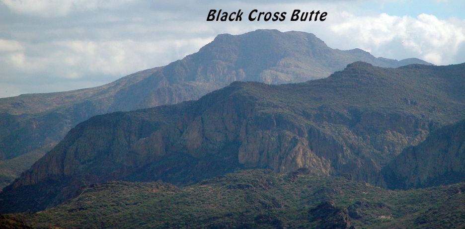
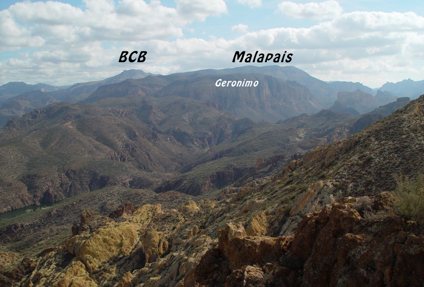
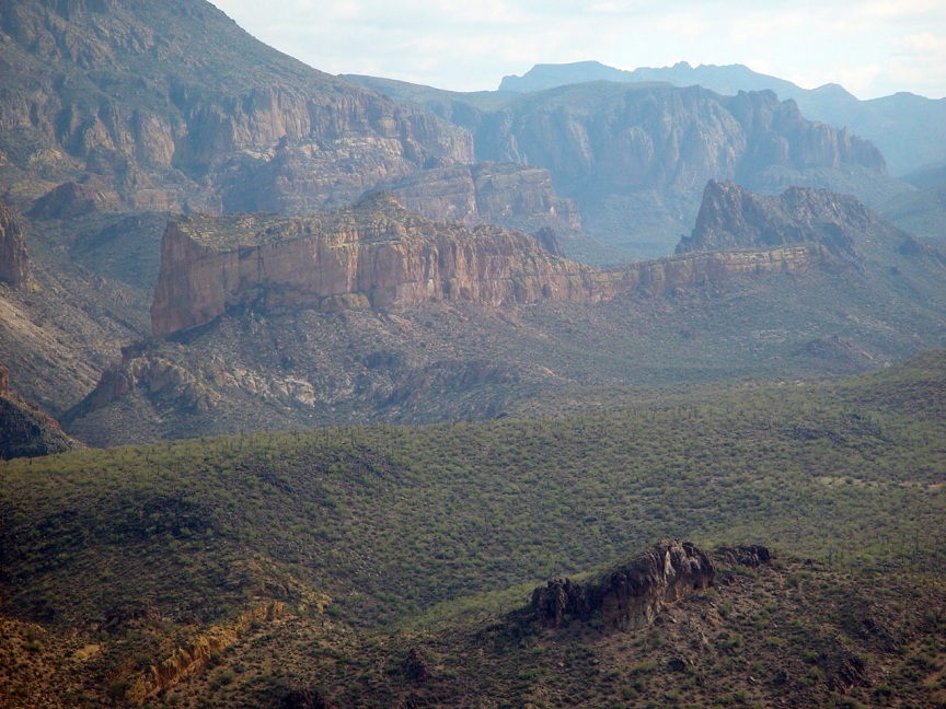
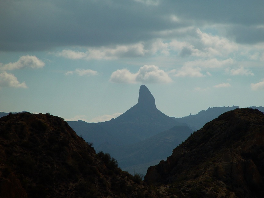
The Hike From the parking, as mentioned in the directions, head up the drainage. The first step is a good three-footer straight-up ducking under a tree branch. It would be a good idea to study the map carefully before heading out. As noted on the map, your first goal is to gain a small ridge. Going up is pretty easy on not too steep brecciated waves. The elevation gain is about 300 feet. Cross the small ridge to the east end, and you can see your next goal towering to the south. You'll dip down maybe 50 feet in elevation before tackling the intimidating slope ahead. Not to worry, it's only a 300 foot gain up this one. There's a tiny ridge that slants diagonally to the southeast. I put an X on the map for those interested in the best viewing point. This is a good turn around point for an easier hike that could be completed under two hours. Continuing is rough on the ankles, as you'll need to skirt steep slopes. The views from Peak 2811 aren't as good as from the X either. Continuing isn't recommended unless you feel you have to bag the peak. Your chances of getting lost, significantly increase because you lose view of the road and popular landmarks. You'll want to have jeans and especially well-fitted boots to continue. The route is pretty easy to figure out from the map. Don't bother trying to go over the mini Baboquivari looking peak before your destination. Skirt the slopes on the west. The slope is steep and loaded with ball bearing pebbles. Be extremely careful with each step. Atop Peak 2811, you'll be happy to note you didn't top out on a false peak. The near-distant peaks are lower but do add better overviews of First Water Creek. The return is as you came. All I can add is I did get off route coming back, so pay attention. I ended up running myself ragged, going up and down unnecessary canyons choked with brush. The hike didn't turn out as sweet as I hoped for Peak 2811. Probably on the tough end of moderate with the pebbled slopes and loose rockslide. I think those looking for a moderate, yet different hike near a lake won't be disappointed if they stop at the X on the map. The views are great: Canyon Lake, Bronco Butte, Black Cross Butte, Geronimo & Malapais, Battleship Mountain and of course Weavers Needle.
Check out the Official Route and Triplogs. Leave No Trace and +Add a Triplog after your hike to support this local community. | ||||||||||||||||||||||||||||||||||||||||||||||||||||||||||||||||||||||||||||||||||||||||||||||||||||||||||||||||||||||||||||||||||||||||||||||||||||||||||||||||||||||||||||||||||||||||||||||||||||||||||||||||


