 Route Editor

| Guide | ♦ | 31 Triplogs | 2 Topics |
details | drive | no permit | forecast | 🔥 route |
stats |
photos | triplogs | topics | location |
| 427 | 31 | 2 |
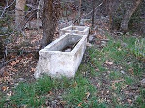
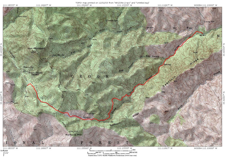
  Trailhead TrailheadThis hike begins at the Miles Trailhead which is just east of the Kennedy Ranch. Forest Service Road 287A was in very good shape and I had no problem negotiating it in my Ford Mustang. There were a couple of sedans at the trailhead so a high clearance vehicle is not a mandatory requirement by any means. 2.65 mi Access One begins the hike on the West Pinto Trail #212 which is the only exit out of the trailhead. The trail winds through the forest before coming to a wide clearing after just a 1/2 mile. The Kennedy Ranch is just north of the trail at this point and its fences and a dilapidated structure can be observed in the adjoining meadow. Shortly after this clearing one is a sign for Bull Basin Trail #270. West Pinto continues slightly to the right and drops into a creek bed which you will follow for the next mile and a half or so. The trail crosses the creek bed several times but is well-traveled and very easy to follow.
Continuing west across the Oak Flats, you will very quickly come upon the next major intersection ( 2.65 mi ) for the Spencer Spring and West Pinto Trails. This intersection was exactly 1 hour from the Miles Trailhead. Spencer Spring Trail #275 ( 0.0 mi ) The Spencer Spring Tail appears to be well-traveled and heads off to your left. It crisscrosses Spencer Spring Creek numerous times so one has to be on the lookout for cairns or risk getting off trail which will slow you down and result in catclaw encounters. At one point, the trail follows along the west side of the creek through a 50-yard gauntlet of catclaw which was simply brutal. Reportedly better in 2017. For the most part, you are hiking along the creek bed under the trees without any real views to speak of until you get about halfway up the canyon. At 2.3 mi trail then goes up the left side of the creek, up and over a narrow section of the creek, then back down to the creek. It immediately begins climbing up the right side of the creek (N) and switchbacks away from the creek. You gain 600 ft from the creek in a half-mile. The trail follows several hundred feet above the canyon. The rest of the trail is on exposed rock with little vegetation other than manzanita. It crosses the creek again at 3.75 mi near Spencer Spring. Right around 4.0 mi the trail ends at FR650. Loop You can loop Spencer with Rock Creek Trail for 13.9 mi / 2k aeg. Page History Original 2003-12-02 Tim Revision 2017-06-08 mnorris & HAZ_Hikebot
Check out the Official Route and Triplogs. Leave No Trace and +Add a Triplog after your hike to support this local community. One-Way Notice This hike is listed as One-Way. When hiking several trails on a single "hike", log it with a generic name that describes the hike. Then link the trails traveled, check out the example. | ||||||||||||||||||||||||||||||||||||||||||||||||||||||||||||||||||||||||||||||||||||||||||||||||||||||||||||||||||||||||||||||||||||||||||||||||||||||||||||||||||||||||||||||||||||||||||||||||||||||||


