 Route Editor

| Guide | ♦ | 129 Triplogs | 8 Topics |
details | drive | no permit | forecast | 🔥 route |
stats |
photos | triplogs | topics | location |
| 1.8k | 129 | 8 |
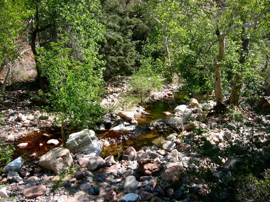
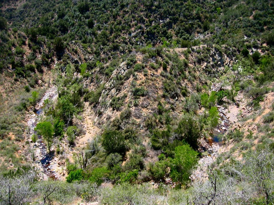
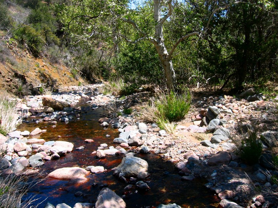
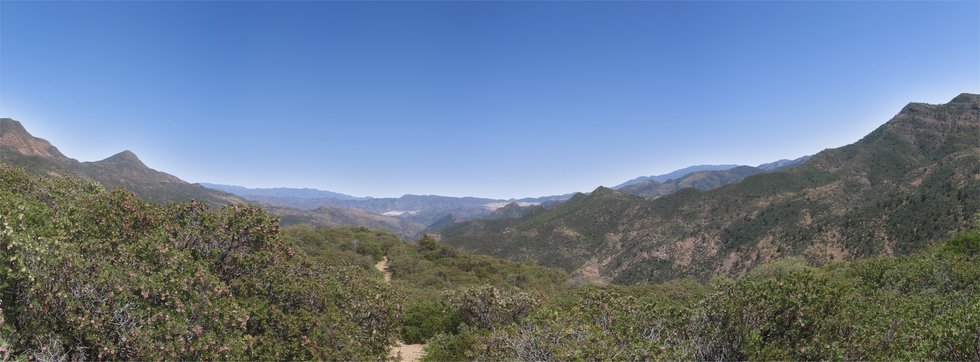
Bushwhacking ON the trail by nonot  Overview OverviewThe West Pinto Trail #212 lies in the eastern Superstitions. It starts at Miles Trailhead on the east side, goes through Oak Flat, a popular campground, and ends within 300 yards (and within sight) of the Roger's Trough Trailhead. Warning Bushwhacking, exercising trail-finding skills, climbing decent elevation gain, and preparing for isolated conditions are necessary on this route when taking its full length. Although the portion from Miles to Oak Flat sees a good deal of traffic and is not that difficult, I severely doubt the rest of this trail to Roger's Trough sees more than a few dozen hikers a year based on its present condition (2008). As usual, hiking in the summer is not recommended due to the Arizona heat. I would not recommend an undertaking of the full trail to the amateur hiker, nor would it be advisable to take inexperienced children. Furthermore, due to an atrocious shuttle setup, turning it into a full day hike (in and back) would make for a long, tiring day.
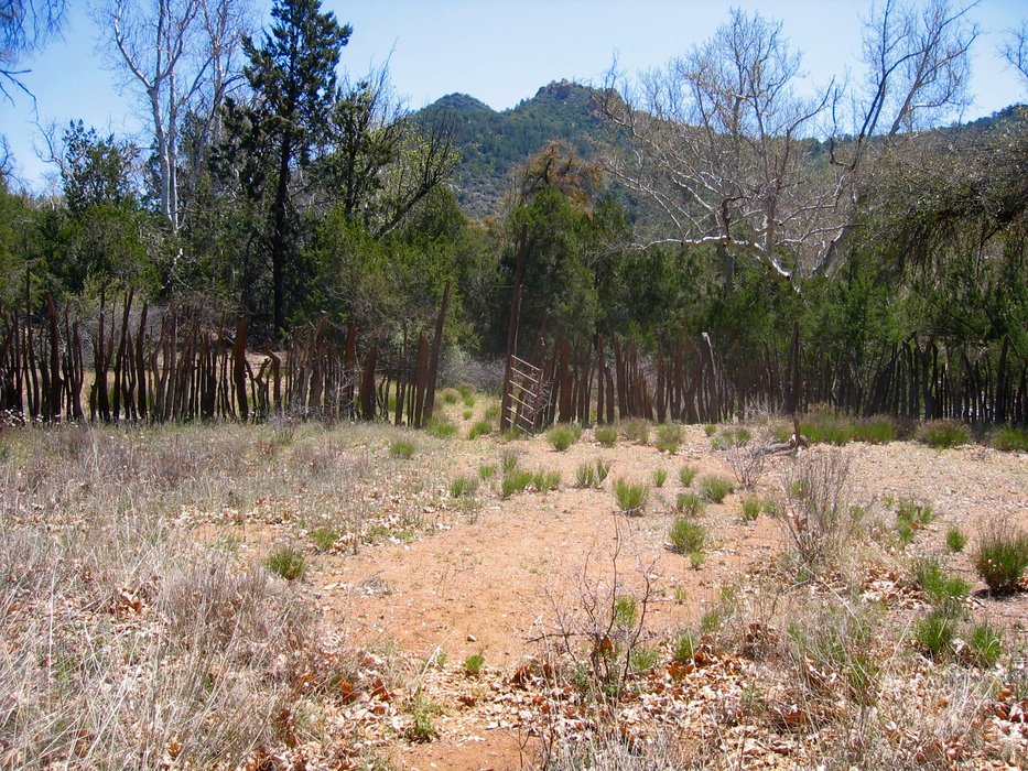
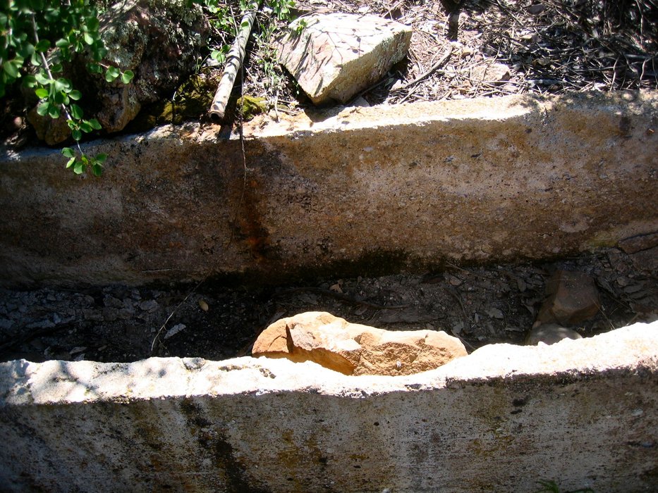
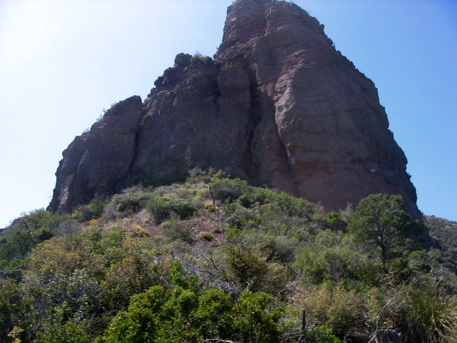
History As far as I can determine, the Kennedy Ranch was used until recently (within the last two decades?) sold to the Forest Service. I believe I read that it is still maintained by horse teams occasionally, but I can no longer locate the reference. The ranching activities near Rogers Trough seem to have been deconstructed a while ago. All evidence, except for the troughs and some piping, appears to have been removed, or at least I could not locate them. Hike This guide reads east to west. Beginning from Miles Trailhead, the hiker finds themselves next to the remnants of Kennedy Ranch. A metal-clad barn structure and substantial amounts of barbed wire fencing remain, most in reasonably good shape, so wandering around here at the beginning or end of your hike may be worthwhile. The hiking trail starts to the south of the barn and corral and follows along barbed-wire fences for a bit, allowing one to see the setup of the ranch. The walking is relatively flat and easy for a while. Approximately a half-mile in, the Bull Basin (and defunct Rock Creek Trail) junction is encountered right before a creek crossing. Continuing along West Pinto Creek, the trail crisscrosses to either side and has some rocky creek crossings. There is ample vegetation providing a good deal of shade at all times of the day. In drier months, one may be able to rock-jump their way up the creekbed, but in wetter times sticking to the trail is best. Cairns mark the important crossings, but it may take a sharp eye to spot them. If you find yourself whacking bushes, backtrack to the last crossing and search again because odds are you missed a cairn. The red coating on the submerged rocks when the water is flowing is quite unusual, as it gives the creek a bloody appearance at first glance, even though the water is clear. Perhaps it is some type of red algae? About 1.5 miles in, there is a section where the trail leaves the creekbed to the north and follows a side drainage up a hundred feet, allowing the hiker to bypass a few tenths of a mile rougher section of the creek. After dropping back into the creekbed and a bit more rock-hopping, the Cuff Button intersection sign appears on the south side of the creek. Shortly beyond this, one will find themselves at Oak Flat. A large corral is found to the north of Oak Flat. Additionally, the Campaign Trail intersection (sign found on the south side of the creek) leads across the creek and right by the corral. There is good camping to be found near the corral and just further upstream on the south side of the creek, where a vast, flat, open area is found. Just at the end of this open expanse is the intersection with the Spencer Spring Trail. Take a right at the fork with the Spencer Spring and continue following the creek upstream. After a bit, the trail proceeds from the creekbed and heads behind a ridge to the north of the creek that doesn't allow one to glimpse the water. This trail proceeds to climb, as it will continue to do for the next few hours. Throughout the next mile, the trail seems to disintegrate. One begins to start whacking bushes: notably, shrub live oak, with some catclaw and manzanita occupying what would otherwise be the trail. Pants and long sleeves are recommended! Due to the heat, I didn't, and I got pretty cut up, oh well, typical Supes hiking, I suppose. The trail eventually finds it way back to some higher ground closer to the creek on the north side, follows that for a while, descends and crosses the creek a few times more, and then leaves it for good as it proceeds to haul up the north side of the canyon heading for Iron Mountain. The bushwhacking continues and is worst in this section. The overgrowth finally relents a little as you top out on a ridge full of Manzanita. Good views can be found here, both of Iron Mountain and the trail behind you. Past this, the trail drops down to the campgrounds around Iron Mountain Spring, which had a light flow of water when I saw it, however the tank itself was dry. This is a shaded area, but the sparseness of flat spots would limit the group size of anyone intending to spend the night. Past Iron Mountain Spring, the trail climbs a short distance, drops down steeply, and climbs back up steeply until one reaches the Iron Mountain Saddle, and tops out at about 5500 feet, the high point of the trail. The views from the Iron Mountain Saddle are good, but one may be so exhausted they may fail to take in the immense granite mass to their north, hawk nests in the rocky precipices, or sheer distances one could view from this saddle. After the saddle, the trail continues steeply downhill along mostly vegetation-free ground with not much shade. A nice resting spot can be found when near Rogers Spring, but its 10-minute proximity to the Rogers Trough Trailhead, another few hundred feet downhill might make one press on for the car. Technically, this hike ends at the Reavis Ranch 109/Rogers Canyon Trail, but one could follow the trail south to the visible parking lot from the intersection in a quick 5 minutes. Water Sources Following decent winter rains, West Pinto Creek was flowing well at least three months after the last rains. However, it did disappear underground in sections, notably the entire last mile before it got to Miles Trailhead. o Iron Mountain Spring cannot be relied upon, but it did have a slow water flow during the same time period that looked quite clear. o Rogers Spring and the creek near Rogers Trough seem to have water in most winters and springs, but it is not wholly reliable. o It would be best to get a water report before one heads out for any type of extended trip. Camping Camping at Oak Flat is popular, directly next to the corral and a short distance upstream on the south side in a large flat expanse. o A campsite for a small group would be feasible near Iron Mountain Spring but might not be ideal. o There are several at-large campsites between the Miles Trailhead and Oak Flat that I saw, some better than others. Linked Hikes Moderate: o Iron Mountain o Spencer Spring Trail o West Pinto - Campaign to Divide o Rock Creek Trail - Superstitions o Bull Basin Trail Difficult o West Pinto - Spencer Springs Loop o Backpack loops and others starting on Peter's Trail - Post a trip log from here - Adjust your mileage, elevation gain & accumulated elevation gain - After it post, link other trail segments using the "Link Hikes: <- Link to other Hikes!" feature as applicable Check out the Official Route and Triplogs. Leave No Trace and +Add a Triplog after your hike to support this local community. One-Way Notice This hike is listed as One-Way. When hiking several trails on a single "hike", log it with a generic name that describes the hike. Then link the trails traveled, check out the example. | |||||||||||||||||||||||||||||||||||||||||||||||||||||||||||||||||||||||||||||||||||||||||||||||||||||||||||||||||||||||||||||||||||||||||||||||||||||||||||||||||||||||||||||||||||||||||||||||||||||||||||||||||||||


