 Route Editor

| Guide | ♦ | 10 Triplogs | 4 Topics |
details | drive | no permit | forecast | 🔥 route |
stats |
photos | triplogs | topics | location |
| 114 | 10 | 4 |
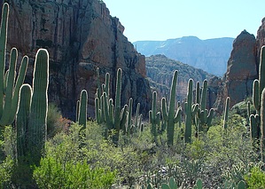
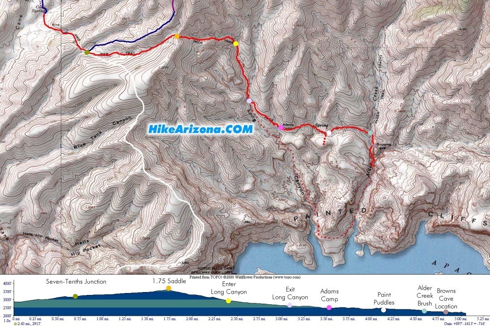
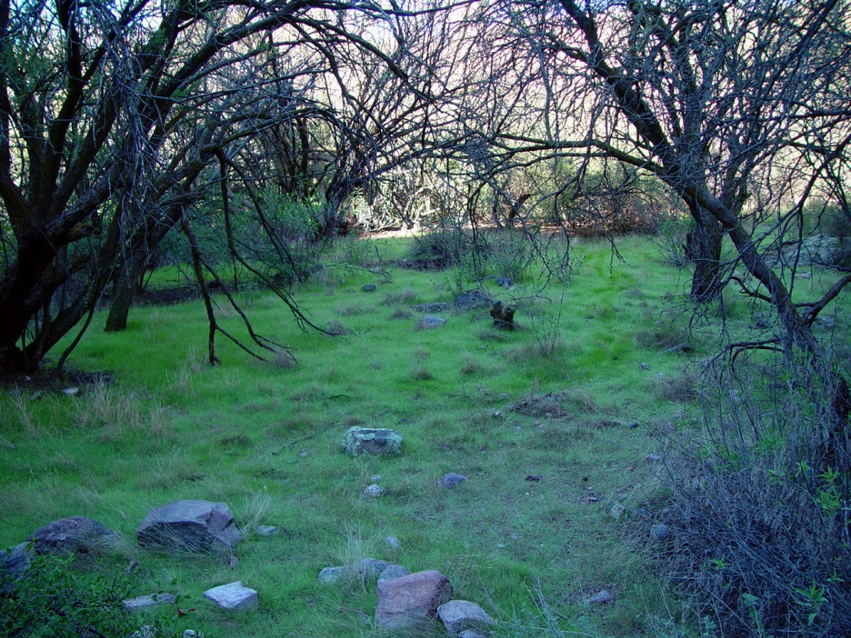
Adventures of Fritzski Jones & Teva Joe by joebartels   Overview OverviewFull-day drive and hike into the seldom traveled wilderness. The drive is jerky 4x4. The hike is from Cane Spring Trailhead following Alder Trail #82 up and down to the location of Brown's Cave. Top-notch route finding skills are necessary to follow the proper trail. Pants and long sleeves are recommended for minor bushwhacking. Return by the same route or explore other options. Hike Hip replacement marvel Fritzski Jones and I left Gilbert at 5:30 am and headed out to the Cane Spring Trailhead. The drive in is a hearty 4x4 road that proves to be simply long as opposed to overwhelmingly technical. We arrived at the trailhead and started hiking at 7:50 am. Dr. Jones mentioned he wanted to hike a nice good trail. Having hiked the first section, I assured him this was a "very good trail".
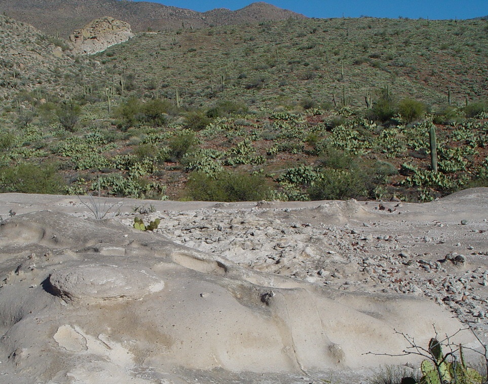
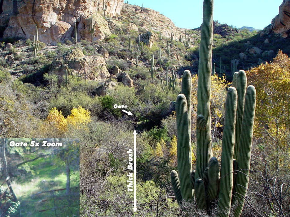
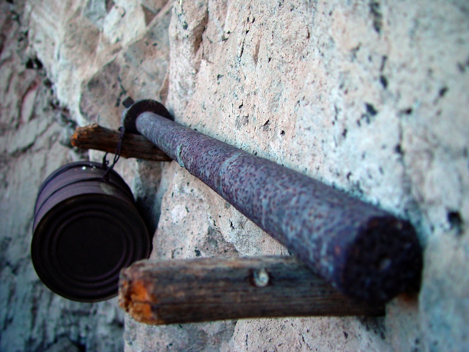
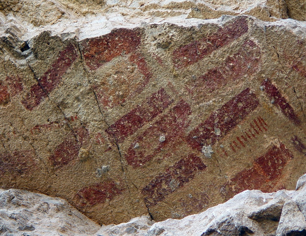
The views start to get good at the saddle(1.75 miles). The trail shortly skirts a ridge, then drops 713 feet down a ridge to Long Canyon. You can follow the actual trail, but it isn't casual by any means. Sections of the trail do surface off and on. There are cairns on occasion, and GPS will keep you on target. Once down in(2.45 miles) Long Canyon, the trail is supposed to parallel Long Canyon on the east side. Which indeed it does... however, it's overgrown and difficult to follow. The creek bed of Long Canyon is a better choice. Keep an eye on the GPS and get out of the creek around 3.0 to 3.1 miles and pick up the faint trail east. The Tonto Forest Service describes this trail (Alder Trail #82) as "MOST Difficult" capital letters and all. Keep in mind it's equal to more route-finding than physical. What concerns me most is those that ponder ideas of making the 30 some mile loop of the peaks in a day, thinking it's a nice worn trail all the way. It's just a scary thought of fast pacing it in twenty miles and then having the trail peter out! Those thoughts aside, I find the area very intriguing and worth the effort to be prepared. Trying to get Fritzski out of Long Canyon proved slightly tougher than prying a kid off the glass front of a candy store. Long Canyon is mighty inviting! Heading out of Long Canyon, it's a slight jaunt through a matrix maze of cacti to get back on Alder Trail #82. Just a hop and skip over to the 3.55-mile mark comes Adams Camp. The camp sits on the east of a small tributary to Long Canyon. It appears there's a spring, but I don't know how reliable it would be in the summer. The camp is interesting with large rock corral walls. Barbwire galore and scrap metal are scattered about. Considering the trail in is so faint, this place puts the Oh! back in old! The trail now becomes more visible in sections, and cairns are more plentiful. About a half-mile past Adams Camp (4.1 miles), brings you to the paint puddles which is undoubtedly left over from the painting of the cliffs. Another half mile in (4.6 miles) brings you to Alder Canyon. The creek looks impassable at first glance but proves negotiable with some persistent effort. If you're lucky, you might spot a prickly pear cactus growing high up in a big tree. This seems to be the prime crossing spot. The creek itself isn't a concern, just the vegetation. Once across the creek, you will pass through a makeshift gate made of welded orange fence post. Which seemed sturdy, so leave the touch-up welder at home. The trail appears to head straight into the brush. Rusty and I scouted the area out. Basically, you have to drop to a push-up stance and drag your toes to get low enough and through the vegetation. We made it to an opening with nice grassy ground cover. Then scrambled up the slopes and skirted the butte for a short distance. Rusty convinced me this was leading nowhere, so we delicately dropped back down to the creek. Hooking back up with Fritzski, we headed downstream on the east bank. It didn't take long for Dr. Jones to decipher what we believe is the location of Brown's Cave at 4.8 miles (of course, I walked right by it). The area appears to have been fenced off long ago as there's downed wire in a crescent pattern around the area. If this is the location, the cave/mine likely went down at an angle from ground level. A heavy axle of sorts leaves me thinking some serious mining took place. Which may be from a cart or mining machinery. Of course, as I'm leaving, Dr. Jones finds an intriguing matrix on a ceiling overhang. The return is simply backtracking to Cane Spring Trailhead. We did venture down Alder Canyon a bit before returning. Gate Policy: If a gate is closed upon arrival, leave it closed after you go through. If it is open, leave it open. Leaving a closed gate open may put cattle in danger. Closing an open gate may cut them off from water. Please be respectful, leave gates as found. The exception is signage on the gate directing you otherwise.
Check out the Official Route and Triplogs. Leave No Trace and +Add a Triplog after your hike to support this local community. | ||||||||||||||||||||||||||||||||||||||||||||||||||||||||||||||||||||||||||||||||||||||||||||||||||||||||||||||||||||||||


