username
X
password
register
for free!
help
  🔥

Boulder Canyon TH to Tortilla TH, AZ

Guide 4 Triplogs  0 Topics
  3 of 5  
Fav
Wish
0
details
drive
no permit
forecast
🔥
route  
stats
photos
triplogs
topics
location
11 4 0
Statistics
tap row or icons for details
Difficulty 2.5 of 5
Route Finding 2 of 5
Distance One Way 22.26 miles
Trailhead Elevation 1,678 feet
Elevation Gain 2,176 feet
Accumulated Gain 4,773 feet
Avg Time One Way 8 -11 hours
Kokopelli Seeds 38.17
 Interest Seasonal Creek & Perennial Creek
 Backpack Yes
feature photo
Photos Viewed All MineFollowing
1  2024-03-01 pseudalpine
10  2006-01-21 Old Hiker
Author
author avatar Guides 59
Routes 1,100
Photos 1,191
Trips 1,290 map ( 9,859 miles )
Age Male Gender
Location Arizona
Associated Areas
list map done
Phoenix Region
Historical Weather
Trailhead Forecast
Radar Map
Expand Map
Preferred Nov, Dec, Jan, Feb
Seasons   Autumn to Spring
Sun  6:02am - 6:47pm
Official Route
 
1 Alternative
 
Historic Fire Perimetersacres
🔥 2024 Siphon Fire35.9 mi*
🔥 2020 Superstition Fire9.6k
🔥 2020 Sawtooth Fire24.7k
🔥 2019 Woodbury Fire123.8k
🔥 2011 Tortilla Fire10.5 mi*
🔥 View (All) - over Official Route 🔥
*perimeter length in miles


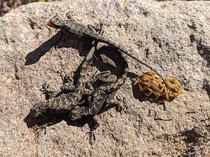
Nearly Mutualistic
by pseudalpine

Overview
A point-to-point (one-way) route that utilizes several of the Superstition Wilderness' beneficially associated northwest side trails. Requiring a shuttle to complete, it just seems to make more sense to set the pickup location first on the east side at the Tortilla Trailhead FS #213, before the Apache Trail SR 88 becomes congested later in the afternoon. It's also tougher from west to east.


Hike
The official route begins at Canyon Lake Marina, east of the La Barge Creek bridge, and follows the whole Boulder Canyon Trail #103, two separate sections of the Dutchman Trail #104, the complete Bull Pass Trail #129, a Charlebois Spring side trip, all of the Peters Trail #105 and finishes on the Tortilla Well road (where it's possible to cut three miles of hiking from the route, if a shuttle has been setup there with two capable 4x4 vehicles). An alternative is substituting the Calvary Trail #239 for Bull Pass.
remove free decal offer
Several good add-ons are possible from this route, depending on the amount of extra time one has planned. Some of these obvious options are: Battleship Mountain, Black Top Mesa, Bull Pass Ridge, Black Mountain 3707, the Peter's Mesa highpoints, and/or Fish Mesa.

Synopsis
The first half (~ eleven miles) of the route is really tame by Supes' standards. But once leaving the Dutchman Trail south of Charlebois Spring and ascending the Peters Trail, the route becomes much more obscure, prickly, and wild until about reaching Indian Spring. The symbiosis of these two vastly different route sections hopefully will help strengthen your social well-being. Or you might end up feeling parasitized?!

2024-03-01 pseudalpine


    Check out the Official Route and Triplogs.
    Leave No Trace and +Add a Triplog after your hike to support this local community.

    One-Way Notice
    This hike is listed as One-Way.

    When hiking several trails on a single "hike", log it with a generic name that describes the hike. Then link the trails traveled, check out the example.
    WARNING! Hiking and outdoor related sports can be dangerous. Be responsible and prepare for the trip. Study the area you are entering and plan accordingly. Dress for the current and unexpected weather changes. Take plenty of water. Never go alone. Make an itinerary with your plan(s), route(s), destination(s) and expected return time. Give your itinerary to trusted family and/or friends.

     Permit $$
    None


     Directions
    or
     Road
    Paved - Car Okay

    To Canyon Lake Trailhead
    From the junction of Idaho Road & SR-88 follow SR-88 14.4 miles east to just after mile marker 210. Turn left into the Canyon Lake Marina parking lot. The area closest to the SR-88 (furthest away from the Marina) is the actual trailhead parking. The area allowed is marked in front of each space.

    There's restrooms outside the restaurant. The restaurant is better than you might think for being out in the middle of nowhere. Try the stuffed Jalapeños, the berry sauce is awesome. Sit on the patio and watch the HUGE fish swim below. The 'Dolly' Steamboat (a tourist attraction) is way out of character for the area, but the snowbirds eat it up.

    From PHX (I-10 & AZ-51) 49.7 mi - about 1 hour 6 mins
    From TUC (Jct 1-10 & Grant) 143 mi - about 2 hours 23 mins
    From FLG (Jct I-17 & I-40) 194 mi - about 3 hours 10 mins
     90+° 8am - 6pm kills
    helpcorrectionissue

    end of page marker