Route Editor

| Guide | ♦ | 121 Triplogs | 1 Topic |
details | drive | no permit | forecast | route |
stats |
photos | triplogs | topic | location |
| 661 | 121 | 1 |
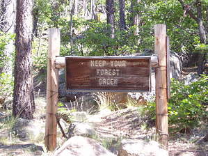
it's billy a cool hike by desertgirl  Note NoteThis trail is in the Bill Williams Mountain Watershed. The area is often ordered closed from June until enough moisture is present to reduce the risk of human-caused wildfires. Best check the Kaibab Forest for closures in June and July. Hike This hike starts at the Williams Ranger District Office, 1 mile west of Williams. (Exit 161 on I-40 and follow signs).
This trail was originally built in 1902 and operated as a toll trail for horses but eventually fell out of service. However, the Forest Service used it to reach the fire lookout on top of Bill Williams Mountain. There is a gravel road to the top. The trail accesses the summit of Bill Williams Mountain via the north face making it a lush trail. The trail quickly climbs in the 1st mile with the route leveling off for most of the 2nd mile. At 0.15 miles you will meet a side trail that takes off for Clover Spring to the left meeting back up to the main trail at 0.9 miles. In the lower elevations, you are hiking through a mostly lower-profile forest of alligator juniper, pinyon pine and Gambel oak with a few occasional ponderosa pines. The trail runs through a shady ravine where you encounter stands of Douglas-fir and incredibly tall stands of aspens and undergrowth thickening with ferns, Oregon-grape, and Wood's Rose. Past the 2-mile point, the trail begins to climb up steadily towards to summit and reach the gravel road (FR111) that accesses the fire lookout tower and the radio towers on the summit. The intersection of the trail and FR111 has a nice area with log benches. Ensure to check out the incredible views from the rock outcrop to the right (behind the benches). You can continue to hike up along FR111 to the summit and check out the 360-degree views of the area peaks from the fire lookout tower. Your return options: 1) Hike back the way you came up 2) Take the Benham Trail #38 that drops down along the East flank. You need to have a shuttle pick up at the Benham trailhead on the mountain's eastern side. 3) Hike down the road and take the Bixler Saddle Trail #72 back down the west face of the mountain. You need to have a shuttle pick up (High Clearance Vehicle recommended) at the Bixler Saddle trailhead on the mountain's western side. 4) Have a shuttle pick up at the top or drop you off at the top for - the hike
Kaibab FS Details This trail starts in ponderosa pine and oak thickets. As it crosses West Cataract Creek, it goes through stands of aspen and fir carpeted by a dense ground cover of ferns, Oregon grape, and Arizona wild rose. At several places on the trail, the hiker has a good view of the valley below and the peaks in the distance. There is no water available along the trail, but cool summer temperatures make this an enjoyable hike. Bill Williams Mountain marks the traditional boundary of lands inhabited by the early ancestors of the Hopi people. For that reason, they view the area as sacred. Your respectful use of this area, while you are visiting here, will be appreciated. This trail was originally built as a "toll road" in 1902. Builder Esan Lamb charged hikers and horseback riders a fee to ride to the top. Trail Layout: This is a short (day) hike, with moderately difficult slopes going up the mountain and easy down-grades coming back down. If arrangements can be made for someone to drive to the top of the mountain on FR 111 and meet the hikers, a one-way trip is possible. The trail ends near the end of the road at 9256 feet. By leaving a vehicle at Williams District and also at the start of Benham Trail, day-hikers can go up one trail and down the other for a total hike of about 8.5 miles. It is also possible to connect with the Bixler Saddle Trail #72 to make a longer hike. Length: 4.0 miles Hiking Time: About 5 to 6 hours round trip. Rating: Moderate Trailhead Location: Trailhead at 7000 feet. Trail starts at Williams Ranger Station (Camp Clover). Recommended Season: Late spring to early fall. USGS Map(s): Bill Williams Mountain Check out the Official Route and Triplogs. Leave No Trace and +Add a Triplog after your hike to support this local community. | |||||||||||||||||||||||||||||||||||||||||||||||||||||||||||||||||||||||||||||||||||||||||||||||||||||||||||||||||||||||||||||||||||||||||||||||||||||||||||||||||||||||||||||||||||||||||||||||||||||||||||||