| | -
| |  |
|
5 |
-
-
-
-
|
| | |
|
| Hiking | |
2,192 AEG |
| | Hiking | | | | |
| 2,192 ft AEG | | | | |
|
|
| |
| Linked |
|
none
[ show ]
| no linked trail guides |
| Partners |
|
none
[ show ]
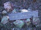
| no partners | | I have to say I was not all that impressed
with this trail. Compared to what I've come to expect from most Mazatzal
trails, I found this one just a bit dull. I'll admit it would probably be much
more pleasant if I went when there was water flowing in the creek.
One unfortunate problem is that until about the 6mi point this trail remains
mostly up out of the riparian creek bed and on the exposed sides of the
ravine. From the 6mi point it begins to
drop in and
improve.
At roughly the 7.5mi point you will come across the
Davey Gowan trail which is a short cut over to the South Fork and Gold Ridge
trails. At the upper portions of the trail it becomes more of a Douglas Fir
forest and you can catch some nice glimpses of the
surrounding peaks.
It is smooth and the elevation gain is gradual and consistent, so you can really
hump it along, but to do the entire 8.8 miles in then back out would take
considerably longer than the 5 hours posted above.
For my money, of the three trails that originate from the Deer Creek trailhead,
the South Fork trail is the hands down winner. |
| _____________________
| | |
|
|
|
|
|
| |
 Route Editor


