|
| | | |
| |
|
| Hiking | 4.00 Miles |
1,050 AEG |
| | Hiking | 4.00 Miles | 2 Hrs 30 Mns | | 1.60 mph |
| 1,050 ft AEG | | | | |
|
|
| |
| Linked |
|
none
[ show ]
| no linked trail guides |
| Partners |
|
none
[ show ]
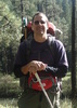
| no partners | | Our third hike and for the second time out of three, we didn't make it to our hoped for destination. We started this hike too late in the day and ended up at Bixler saddle just as storms were starting to roll in and we were afraid it could start to get dark if we continued. Hopefully we'll get smarter as we get more experienced.
The hike started out nicely, with a view of our final destination from the trail head. A nice peaceful walk for the first 30 minutes or so turned into quite a scare when our dog, who always leads the way, suddenly stopped, looked into the wooded distance, heard a noise and then ran the other way. I also heard the noise. It was like a hissing noise, maybe like a cat would make, but it wasn't a cat. It stopped me in my tracks too. Sahara (the dog) was on a leash, but she pulled me in the opposite direction and would not continue. I looked into the woods as my wife backed away, but I couldn't see or hear anything. We were just a few days away from getting our first gun, so no protection at all if something were to come out. I waited for a minute or two, scanning the entire area, but still couldn't see anything. I tried to pull the Sahara, but she planted herself and she refused to continue. My wife said she wanted to stop and go back, but I didn't want to end our hike after 30 minutes. It took 2 1/2 to drive there!
After about 5 minutes of mostly fear, I was able to slowly pull Sahara past the point where she stopped. She was definitely scared of something, but once we got past it, or where it used to be, she was fine. My wife followed and although very scared herself, we moved on and after a short while, the fear went away. I have no idea what the animal was, but I'm glad it somehow left without us seeing it. I was told afterward that it could have been a possum, but I have no idea?
The rest of the hike from that point until we made it to Bixler Saddle was very cool. Pines, Oaks, lots of green vegetation and some great views. It had rained 4 or 5 times in the last few weeks, so everything was green and a good part of the path had been overgrown. Not enough to need to cut anything back, but you can tell the rain has really helped the area. It also seems like this trail is not that widely traveled. We saw nobody on the way up or down and the overgrowth and a downed tree we had to climb over seemed to be signs of sparse use.
As mentioned above, the goal was to make it to Bill Williams L.O., but once we go to Bixler Saddle and the start of trail #21, we thought it best to turn back and try the full hike another day. We did look up the trail a bit and the rocks and trees were all mossy just as #21 starts. It looked like beautiful sceneory would have been in store for us had we continued.
The hike down was uneventful and took much less time then the hike up. We passed the scary point with no troubles and made it back to the truck and on the road just before the rain started coming down. We will definitely be back for the full hike with an earlier start next time! |
| _____________________
| | |
|
|
|
 Route Editor


](https://hikearizona.com/dex2/images/smilies/eusa_wall.gif "Brick wall") Joe likes the Oaks and we all agreed Bixler would be a good one. The Flying Focus won't make it to the Bixler trailhead so we started at Bill Williams.Great trail and weather. There were a handful of trees down that I don't think were down this summer when I was here with Wally. Bixler does have a ton of Oaks so Joe was a happy hiker. The top section has some loose dirt and lots of leaves so the footing was a little iffy. A handful of trees down on this trail too. Still a nice trail. We took a break at the bottom then headed up Bixler and on to Bill Williams summit. Bruce set the pace and it seemed easier going up. Even the footing seemed better. Some nice Aspen on the top section. We saw a couple cars up top and a only a few hikers on Bill Williams which surprised me. Nice day with these two out on the trail.
Joe likes the Oaks and we all agreed Bixler would be a good one. The Flying Focus won't make it to the Bixler trailhead so we started at Bill Williams.Great trail and weather. There were a handful of trees down that I don't think were down this summer when I was here with Wally. Bixler does have a ton of Oaks so Joe was a happy hiker. The top section has some loose dirt and lots of leaves so the footing was a little iffy. A handful of trees down on this trail too. Still a nice trail. We took a break at the bottom then headed up Bixler and on to Bill Williams summit. Bruce set the pace and it seemed easier going up. Even the footing seemed better. Some nice Aspen on the top section. We saw a couple cars up top and a only a few hikers on Bill Williams which surprised me. Nice day with these two out on the trail.


 It sports some nice Aspen views but isn't much of a hit with the secret social tourist society. Out of 2-4 groups hiking we were the young guns.


 There is no way for me to write this day up in a standard Triplog....Even for a two mile Hike, it would be pages long....
 And Killer views....