|
| | | |
| |
|
| Backpack | 10.00 Miles |
550 AEG |
| | Backpack | 10.00 Miles | 2 Days | | |
| 550 ft AEG | | | | |
|
|
| |
| Linked |
|
none
[ show ]
| no linked trail guides |
| Partners |
|
none
[ show ]
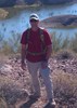
| no partners | | Kaiser Canyon caught my eye years ago while driving to Las Vegas, and if you ever happened to look up the canyon while you were crossing the bridge over it, your curiosity may have been piqued too.
Vegas lost it's allure for me after a couple of trips, but I've been back to Kaiser Canyon and the surrounding area several times over the years. I hadn't been out in the area for years though, and I was due for a visit.
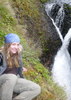
We were planning a 2 day loop including the best sections of Kaiser and some of the lower section of Burro Creek, and I thought I would take the opportunity to post a hike description. Unfortunately, a new mining operation put a bit of a damper on the trip.
While the narrows North of the highway bridge are the same as they ever were, downstream is a different story.
What used to be only the faintest hint of an old, long washed away jeep path, is now a well graded mining road right through the bottom of the canyon all the way to Burro Creek. There is a long history of mining in the area. In fact, one of the perks of exploring these canyons was the many abandoned adits and shafts to explore. These are now all gated off now though, and while I'm sure we are all much safer for it... If I can't risk my own neck in the pursuit of adventure... Well, is it adventure? I'm sure the insurance execs are sleeping better, though.
Anyways, when we came across this new road, I maintained my optimism (it is my way). There were still gems to explore down canyon. Old mines, for example, but they were blocked off like I said. That's ok though, the real prize is the warm spring. Flowing right out of the canyon wall into a rough tub of sand and rocks surrounded by towering canyon walls. A soak here with the stars and bats spinning above is far better than any show on the strip (my humble opinion). But now, the canyon (or road?) is blocked with signs just before the spring. Private Property. Absolutely no trespassing. And the sound of the Helicopter lifting heavy equipment to the ridge right above the warm spring was a little hard to ignore.
Part of our loop depended on the water in Burro Creek. Faced with the blaze orange no trespassing signs, we had the choice of turning back or...
Needless to say the miners were not very happy to see us in their camp, but, well... We were willing to press our case. whether or not this was the right thing to do, I'll not push my opinion. This was private property and we knew it. I'm sure they had all the papers they needed to prove that this section of land was theirs to do with what they wished. We are stubborn though, and in this case it payed off. After a some discussion, the guy with the radio (much thanks to him) said we could pass after the helicopter left to refuel. Two hours later, after we got the all clear, we were on our way. Another mile of hiking, and we didn't see anybody for the rest of the hike.
I am thankful that I got to go through this section of canyon one last time before the mining operation got into full swing, but I probably won't be back. I looked up the Canadian mining company after we got back, and the numerous references to "open-pitable" resources, makes my inner Hayduke boil.
There are still places out there to see, though, in this area and others. Go see them before they are gone. |
| _____________________
| | |
|
|
|
 Route Editor