|
| | | |
| |
|
| Hiking | 8.50 Miles |
1,900 AEG |
| | Hiking | 8.50 Miles | 2 Hrs 48 Mns | | 3.04 mph |
| 1,900 ft AEG | | | | |
|
|
| |
| Linked |
|
none
[ show ]
| no linked trail guides |
| Partners |
|
none
[ show ]
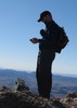
| no partners | | Wanting to hike the south road to Guthrie Peak, and to catch the flower show one more time before they vanished, I drove up highway 191 late on a toasty Sunday afternoon. The flowers were amazing, but they are definitely on the wane. Along the hike, I saw two friendly horses in a corral, a rabbit, and a huge centipede. I reached the peak at dusk, then made the return hike by flashlight, enjoying the starry sky and music from my ipod. 
Back at my truck, I realized I had lost a basket from my new hiking poles. So up the road again I went, this time driving, looking for it. Parked near the summit of Guthrie, bagged the summit again, then drove back down. I never did find the basket, I just wasted an hour of driving. Oh well. It was a great hike! |
|
Wildflowers Observation Substantial
|
|
| _____________________
| "…you never know when a hike might break out" -Jim Gaffigan |
| | |
|
|
|
 Route Editor


](https://hikearizona.com/dex2/images/smilies/eusa_wall.gif "Brick wall") I waited on the rain in my truck, but it kept coming. Greatly annoyed, I continued east on the Black Hills Scenic Byway. Slick mud caused me to turn around. So I spent the rest of the afternoon exploring by truck. I came across an interesting overhanging cliff, and stopped to explore. Beneath the edge were a half dozen metates and a few pottery sherds.
I waited on the rain in my truck, but it kept coming. Greatly annoyed, I continued east on the Black Hills Scenic Byway. Slick mud caused me to turn around. So I spent the rest of the afternoon exploring by truck. I came across an interesting overhanging cliff, and stopped to explore. Beneath the edge were a half dozen metates and a few pottery sherds.