username
X
password
register
for free!
help
ArticlesGuidesRoutes
 
Photosets
 
 Comments
triplogs   photosets   labels comments more
Alamo Canyon - Organ Pipe NM - 6 members in 17 triplogs have rated this an average 3.5 ( 1 to 5 best )
17 triplogs
login for filter options
Feb 03 2024
avatar

 Photos 268
 Triplogs 17

female
 Joined Mar 12 2021
 Seattle, WA
Peak 4180 & Peak 4220 Organ Pipe Cactus NM, AZ 
Peak 4180 & Peak 4220 Organ Pipe Cactus NM, AZ
 
Hiking avatar Feb 03 2024
rubywranglerTriplogs 17
Hiking10.00 Miles 3,000 AEG
Hiking10.00 Miles
3,000 ft AEG
 no routes
1st trip
Partners none no partners
This is a very fun and scenic mostly trailless loop out of Alamo Canyon campground with side trips to two peaks in the Ajo Range. An excellent description of the route with lots of geology info is posted on Debra Van Winegarden's blog.

Summary: follow the Alamo canyon trail to the corral. Turn left and stroll/hop up the gravel/boulders/solid rock of the north fork. After the canyon makes a hard turn to the east, hike NNW up a side drainage to a small saddle east of Peak 4180. About halfway up the side drainage the terrain becomes mostly solid rock and gets really fun. From the saddle, hike west to a broad plateau south of the summit, then north to the summit on a fun ridge. Retrace your steps to the saddle, descend to Grass Pass, and hike northeast up a steep slope to cross a yellow breccia plateau. Scramble ~20' to the summit ridge of 4220. Descend to Grass canyon by crossing a gap at ~3600' in the ridge that runs north from Grass Pass, or go back to Grass Pass and descend from there. Enjoy ~30 minutes of fun scrambling descent, then a short walk to exit the canyon to the bajada. Turn south and walk a couple miles through open desert and across many washes back to the campground.

It rained buckets a few days earlier, and I found running water at ~3300' in the NNW drainage and then more higher up on peak 4220. The only unpleasant section of the route was from the 3600' gap to Grass Canyon - loose rock and overgrown vegetation. I also made a slight routefinding error trying to make a loop down from Point 4220 and ended up having to do some Spiderman-type shenaningans across a little cliff band instead of traversing below it like I intended.

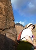
Just before leaving Grass Canyon, I passed by a big chuparosa bush about 25' long, occupied by a flock? family? charm of hummingbirds. I stopped to watch them, and then a few of them stopped to watch me, and then suddenly they swarmed and flew circles around me! So neat!!

Apparently the bajada is glorious when it blooms, but right now it's grassy and green.

There were two registers on Peak 4180 but one appeared to be burnt and crumbled to the touch. I couldn't open the other one. Both were last signed in 1998, but I found several cairns so the route seems to be used.

No register on peak 4220. Many trash piles and hiding places though. I hadn't seen any obvious signs of migration on the route until I got to the 4220 summit ridge, though I heard noises I couldn't identify after turning east in north fork Alamo canyon and nearly bailed. Sounded like rocks dropping, slowly, one at a time. Eventually I decided whatever it was was far enough away. Hiking solo down here makes me a little jumpy 8-[
 Geology
 Geology [ checklist ]
[ checklist ]  Natural Arch
  5 archives
Dec 26 2019
avatar

 Guides 2
 Routes 25
 Photos 1,890
 Triplogs 604

41 male
 Joined Sep 13 2009
 Mesa, AZ
Alamo Canyon - Organ Pipe NMSouthwest, AZ
Southwest, AZ
Hiking avatar Dec 26 2019
jochalTriplogs 604
Hiking2.60 Miles 135 AEG
Hiking2.60 Miles
135 ft AEG
 no routesno photosets
1st trip
Linked   none no linked trail guides
Partners none no partners
Ajo Mountain Drive was closed for the day due to road maintenance (delayed completion due to all the rain.) A couple we ran into at the visitor center and later on the Senita Basin Loop that highly recommended this as an alternative, so off we went. Really pretty canyon. Looks like the campground was seeing a lot of use despite the cold rainy weather.
_____________________
 
Feb 03 2018
avatar

 Photos 303
 Triplogs 13

43 male
 Joined Apr 06 2017
 Tucson
Alamo Canyon - Organ Pipe NMSouthwest, AZ
Southwest, AZ
Hiking avatar Feb 03 2018
vanillagorillaTriplogs 13
Hiking2.60 Miles 135 AEG
Hiking2.60 Miles
135 ft AEG
 no routes
1st trip
Linked   none no linked trail guides
Partners none no partners
Very enjoyable hike. Drove out from Tucson, about 2.5 hours to go on a hike with the kiddos, about 2 hours. Not a terrible drive and a very enjoyable hike. It is very pretty in this area and I think the pictures only barely do it justice. A few campers and quite a few folks, many more than I expected, on the trail hiking and enjoying a beautiful day.
_____________________
 
Feb 22 2017
avatar

 Guides 1
 Routes 136
 Photos 22,415
 Triplogs 1,041

77 male
 Joined Feb 28 2003
 Tucson, AZ
Alamo Canyon - Organ Pipe NMSouthwest, AZ
Southwest, AZ
Scenic Drive avatar Feb 22 2017
rwstormTriplogs 1,041
Scenic Drive
Scenic Drive
 no routes
1st trip
Linked   none no linked trail guides
Partners none no partners
After a morning visit to Quitobaquito, I filled in some afternoon time by driving out to the primitive campground in Alamo Canyon. I had never been there and wanted to check it out. Now that I have seen it, that's where I want to camp when I go back in March in search of wildflowers. I stress "want" because there are only four sites, and they were all taken when I visited. I have nothing against the big developed CG by the visitor center, but this is more my speed...away from the crowd and RV's.
 Named place
 Named place [ checklist ]
[ checklist ]  Montezuma Head
wildflower observationwildflower observationwildflower observationwildflower observationwildflower observation
Wildflowers Observation Isolated
_____________________
 
Mar 14 2014
avatar

 Guides 71
 Routes 98
 Photos 9,967
 Triplogs 1,009

65 male
 Joined May 14 2003
 Ahwatukee, AZ
Alamo Canyon - Organ Pipe NMSouthwest, AZ
Southwest, AZ
Hiking avatar Mar 14 2014
Randal_SchulhauserTriplogs 1,009
Hiking2.60 Miles 135 AEG
Hiking2.60 Miles   2 Hrs   30 Mns   1.04 mph
135 ft AEG
 
Linked   linked  
Partners none no partners
Alamo Canyon – Organ Pipe Cactus National Monument – March 14th, 2014

After spending the morning on a Ranger Guided Tour of Quitobaquito (check out :next: [ photoset ] ), I thought I’d make the quick drive over to secluded Alamo Canyon to enjoy a quiet lunch (check out HAZ hike description :next: [ Alamo Canyon - Organ Pipe NM ] ). To my surprise, I encountered multiple vehicles on the access road and when I arrived at the trail head, I discovered that all 4 of the primitive camping sites (check out :next: https://www.nps.gov/orpi/planyourvisit/alamo-canyon.htm ) were occupied. I’ve visited Alamo Canyon multiple times and it’s been rare for me to see other people, let alone have a full primitive campground!

After I snapped a couple of quick images, one of the primitive campsites became empty. I wheeled my F-150 into the site to use the picnic table to make some lunch and jot a few notes on my iPad from the Quitobaquito trek. I noticed the people in the next site were on the Quitobaquito trek with me and struck up a conversation. Turns out one of them is a reporter from the LA Times and is writing an article about border park safety.

After a relaxing lunch I leisurely hike Alamo Canyon looking for some prospects I noted on a Topo map. Nothing exciting to report. Alamo Canyon was totally dry – another first as there always seemed to be water up near the corral and confluence.

I expected to see water in the usual spots with some choice wildflowers. Looks like I was a couple of weeks too late... :(

Nice to be able to get the unexpected “offer” to hitch a ride to Quitobaquito and wrap it up with some exploring of mining and ranching relics in and about Alamo Canyon.
85 images on iPhone 4S
61 images on Canon Rebel XT
16 images on Canon 7D
127 images on Canon 6D
289 TOTAL IMAGES
298 TOTAL MILES RETURN ON F-150
Maybe el Pinicate (the Mexican "sister park" to Organ Pipe Cactus NM) will be next on the "to do" list :next: https://www.nps.gov/orpi/planyourvisit/pinacate.htm
Or mountain biking the 21 mile Ajo Mountain Loop Drive :next: https://www.nps.gov/orpi/planyourvisit/ ... biking.htm
:)
 Culture
 Culture [ checklist ]
[ checklist ]  Fraley Pose
wildflower observationwildflower observationwildflower observationwildflower observationwildflower observation
Wildflowers Observation Isolated
brittlebush, brittlebush, brittlebush, plus an occasional desert marigold
_____________________
 
Mar 21 2010
avatar

 Guides 19
 Routes 40
 Photos 5,624
 Triplogs 341

52 female
 Joined Nov 22 2005
 Tucson, AZ
Alamo Canyon - Organ Pipe NMSouthwest, AZ
Southwest, AZ
Hiking avatar Mar 21 2010
writelotsTriplogs 341
Hiking3.30 Miles 336 AEG
Hiking3.30 Miles   3 Hrs      1.10 mph
336 ft AEG
 no routes
1st trip
Linked   none no linked trail guides
Partners partners
tibber
Angela, Wayne and I headed up Alamo Canyon Sunday morning after our summit of Mt. Ajo to explore the ruins of the old ranch and to check out the scene up canyon. The remnants of the old ranch were fun to explore, though the ranchers I was hiking with couldn't figure out why the inhabitants had built their house downstream of the corrals. Dunno - but I suppose there was probably a reason ;)

Above the corrals Angela and I just followed the creek bed, boulder hopping and dodging for about three quarters of a mile further up stream (I think poor Wayne was broken from the climb the day before). It was slow going, but the canyon was incredible. It changed character about every 100 feet - with narrow, tree lined banks one minute, and wide open slick rock sections displaying incredible color the next. We kept being pulled on by the thought of "what's behind the next bend?". We ran into one other couple in the wash - and older lady and gentleman who said that they'd followed the "mountain route" into the canyon. Having no idea what they meant, we smiled and nodded and we went our separate ways.

When we hit our turn around time, we did just that and started hopping and scrambling back down canyon. We came to a spot where we'd spied a cairn earlier, and a trail going up the banks of the creek. We followed the track only to find the "mountain route" described by our friends. Much easier walking, with cool opportunities to view the canyon we'd just hiked through. The trail ended right at the corral - so if you're looking for it, just follow that corral fence around to the southeast.

Great morning hike, with shrimp, cheese and crackers for lunch. Gotta love it!
_____________________
-----------------------------------
Change will not come if we wait for some other person or some other time. We are the ones we've been waiting for. We are the change that we seek.- Barack Obama
 
Mar 21 2010
avatar

 Guides 21
 Routes 1,183
 Photos 36,909
 Triplogs 1,571

69 female
 Joined Feb 26 2004
 Phoenix, AZ
Alamo Canyon - Organ Pipe NMSouthwest, AZ
Southwest, AZ
Hiking avatar Mar 21 2010
tibberTriplogs 1,571
Hiking3.30 Miles 336 AEG
Hiking3.30 Miles   3 Hrs      1.10 mph
336 ft AEG
 
1st trip
Linked   none no linked trail guides
Partners partners
writelots
I had this all done and then went to go check the spelling of phainopepla and lost the whole report. It was turning out pretty good too. So let me try again.

Sunday we packed up our vehicles, stopped by the Visitors Center and then drove 10 miles back up the 85 for our 4 mile drive to the Alamo Canyon TH. As we walked toward the ranch house we admired the desert all decked out in its green finery. The saguaros seemed particulary beautiful as were the teddy cholla. The wildflowers were limited except for lots of little yellow flowers of some sort and lots of small scorpion weed.

After enjoying the ruins of the ranch and group photos at the old pump, Wendy and I began boulder-hopping east up the mostly dry creek/wash. It was a fun trek as after/around each obstacle(s) we found a different kind of area whether it be a wider/narrower channel or more/less/different vegetation. What I particularly like is that most of the many bends are short and because of that, you are drawn to continually go see what's around the corner. Also, some of the bed rock was absolutely stunning in a couple areas; I think even Preston would be impressed. There was also this one place just out of the creek bed where we saw some really talllllll chain cholla trees;I'd say at least 15 feet. I was amazed.

It was funny though cuz as we are thinking we are kind of walking in less-traversed territory, we would find cairns. After going about 1.73 miles from the TH we turned around and headed back. Since earlier in the wash we had met a couple that had mentioned a trail above and as we approached a cairn in the middle of the drainage at about the 1.5 mile area, Wendy decided we should try the trail. We did a short climb out and south of the creek bed. If the trail started going too far up, we could always come back.

Well this turned out to be extremely rewarding as the views were great. Eventually we expected the trail to take us back to the creek but everytime we started going back down the trail would just keep going west. Once again we found some very interesting rock and the phainopeplas were dancing in and around us as well. We were absolutely delighted when we ended up at the corral, who knew? :D I would suggest that if you want to do some more walking, take the path past the corral rather than going into the creek/wash. This cairned trail will take you back to the creek where you can continue up or down it.

A video at the ranch: http://www.youtube.com/watch?v=_zdNNVFTJ74&feature=channel
 Fauna
 Fauna [ checklist ]
[ checklist ]  Hooded Oriole
wildflower observationwildflower observationwildflower observationwildflower observationwildflower observation
Wildflowers Observation Light
_____________________
For me, sometimes it's just as much about the journey as the destination.
Oh, and once in awhile, don't forget to look back at the trail you've traveled.
 
Feb 07 2010
avatar

 Guides 4
 Photos 2,750
 Triplogs 402

60 male
 Joined Nov 13 2005
 Cave Creek, AZ
Alamo Canyon - Organ Pipe NMSouthwest, AZ
Southwest, AZ
Hiking avatar Feb 07 2010
cabelTriplogs 402
Hiking3.20 Miles 135 AEG
Hiking3.20 Miles   1 Hour   30 Mns   2.13 mph
135 ft AEG
 no routes
1st trip
Linked   none no linked trail guides
Partners none no partners
_____________________
All who wander are not lost...just me.
 
Feb 06 2010
avatar

 Guides 4
 Photos 2,750
 Triplogs 402

60 male
 Joined Nov 13 2005
 Cave Creek, AZ
Arch Canyon - Organ Pipe NMSouthwest, AZ
Southwest, AZ
Hiking avatar Feb 06 2010
cabelTriplogs 402
Hiking4.00 Miles 900 AEG
Hiking4.00 Miles   3 Hrs      1.33 mph
900 ft AEG
 no routes
1st trip
 Geology
 Geology [ checklist ]
[ checklist ]  Natural Arch
_____________________
All who wander are not lost...just me.
  1 archive
Jan 23 2010
avatar

 Guides 71
 Routes 98
 Photos 9,967
 Triplogs 1,009

65 male
 Joined May 14 2003
 Ahwatukee, AZ
Alamo Canyon - Organ Pipe NMSouthwest, AZ
Southwest, AZ
Hiking avatar Jan 23 2010
Randal_SchulhauserTriplogs 1,009
Hiking3.60 Miles 135 AEG
Hiking3.60 Miles   3 Hrs      1.20 mph
135 ft AEG
 
Linked   none no linked trail guides
Partners none no partners
ORGAN PIPE CACTUS NATIONAL MONUMENT

With this week's mega-rains and numerous reports of flooding, road closures, power outages, and other general chaos, I thought a trip to Organ Pipe might be a safe bet. To be sure, I sent a pre-dawn email to the Ranger's Office answered by Vivian Sartori;


All roads and trails are open. Ajo Mountain Drive and Puerto Blanco Drive have been graded. Alamo may have some big puddles in the road, and the stream is running! You should be able to access everything you are planing to hike. Come see us - this place is always beautiful after a big rain.

Vivian Sartori
Division of Interpretation
Organ Pipe Cactus National Monument
#10 Organ Pipe Drive
Ajo, AZ 85321

(520) 387-6849 x 7304


With that positive report, Lynn and I packed up the F-150 and headed for Alamo Canyon and Arch Canyon. This gave me a chance to try out a couple of last week's birthday presents - renewal of my Annual National Parks Pass http://www.nps.gov/fees_passes.htm and a new Mountainsmith Spectrum Camera Backpack http://www.travelgearblog.com/archive/m ... kpack.html

Alamo Canyon was first arriving at the TH noon-ish. The dirt & gravel road to the trail head had a couple of major puddles we blasted through with a little bit of wheel spinning. I was shocked to see a little Honda Civic at the TH (how'd that get through those mud holes?). At the TH you could hear gurgling water from the flow in the canyon. That "babbling brook" sound provided the background soundtrack for the entire hike.

Rains are "greening-up" just about everything particularly the Alamo Canyon brittlebush. Expect there to be a sea of yellow in the coming weeks.

We headed up to the corral and beyond turning back after a couple of hours. Couple of creek crossing required removing the hiking boots. Yikes! Water was cold :o

Organ Pipe Cactus NM and the border areas to the west have always held a special fascination for me. Serendipity or unexpected coincidence that a couple of my favorite Organ Pipe image masters 1a. http://gallery.me.com/petedykinga#10021 ... olor=black 2a. http://thanks.arizona.edu/anseladams/ just happen to have special events this week I'm trying to attend 1b. http://cabezaprieta.org/events.php 2b. http://www.phxart.org/exhibition/exhibi ... ladams.php Jack Dykinga is presenting a photo lecture in Ajo AZ on 1/26 and Ansel Adams members only preview at Phoenix Art Museum.


:)
 Culture
 Culture [ checklist ]
[ checklist ]  HAZ Rides
_____________________
 
Feb 14 2009
avatar

 Photos 46
 Triplogs 8

46 female
 Joined Sep 23 2004
 Boise, ID
Alamo Canyon - Organ Pipe NMSouthwest, AZ
Southwest, AZ
Hiking avatar Feb 14 2009
vjchristiTriplogs 8
Hiking2.60 Miles 135 AEG
Hiking2.60 Miles
135 ft AEG
 no routes
1st trip
Linked   none no linked trail guides
Partners none no partners
Went on a ranger guided hike early in the AM. The weather was fantastic and the flowers are getting ready to explode! :)

Nice short hike with some pools of water near the corral.
wildflower observationwildflower observationwildflower observationwildflower observationwildflower observation
Wildflowers Observation Light
_____________________
 
Mar 07 2008
avatar

 Guides 1
 Routes 148
 Photos 9,928
 Triplogs 3,655

63 male
 Joined Apr 02 2005
 Mesa, AZ
Alamo Canyon - Organ Pipe NMSouthwest, AZ
Southwest, AZ
Hiking avatar Mar 07 2008
Tortoise_HikerTriplogs 3,655
Hiking2.60 Miles 135 AEG
Hiking2.60 Miles   1 Hour   30 Mns   1.73 mph
135 ft AEG
 no routes
1st trip
Linked   none no linked trail guides
Partners none no partners
I did this hike on the way back from Arch Canyon.This was a nice easy hike with a little running water at the end.Lot of cactus and flowers. Thanks to Randall again for the hike info.
wildflower observationwildflower observationwildflower observationwildflower observationwildflower observation
Wildflowers Observation Moderate
_____________________
Tortoise Hiking. Stop and smell the Petrichor.
 
Mar 07 2008
avatar

 Guides 31
 Routes 135
 Photos 2,699
 Triplogs 615

52 female
 Joined Apr 02 2007
 Scottsdale, AZ
Alamo Canyon - Organ Pipe NMSouthwest, AZ
Southwest, AZ
Hiking avatar Mar 07 2008
Crzy4AZTriplogs 615
Hiking2.60 Miles 135 AEG
Hiking2.60 Miles
135 ft AEG
 no routes
1st trip
Linked   none no linked trail guides
Partners partners
GI Jones
Very nice area to visit with wildflowers in bloom. Easy walking. The rocks past the ranching ruins are perfect for lunch.

The turn off for Alamo Canyon Rd is between mile marker 65 and 66.
wildflower observationwildflower observationwildflower observationwildflower observationwildflower observation
Wildflowers Observation Substantial
_____________________
 
Feb 02 2008
avatar

 Guides 71
 Routes 98
 Photos 9,967
 Triplogs 1,009

65 male
 Joined May 14 2003
 Ahwatukee, AZ
Alamo Canyon - Organ Pipe NMSouthwest, AZ
Southwest, AZ
Hiking avatar Feb 02 2008
Randal_SchulhauserTriplogs 1,009
Hiking2.60 Miles 135 AEG
Hiking2.60 Miles   2 Hrs      1.30 mph
135 ft AEG
 
Linked   none no linked trail guides
Partners none no partners
A day at Organ Pipe National Monument with Lynn. Plan "A" was to explore the 50 mile Puerto Blanco Drive. Discovered only 5 miles of this route is open due to border security issues. Oh well, always gotta have a Plan "B" and had Alamo Canyon as a back-up plan. Wonderful hike that appears relatively unknown. Only saw a Border Patrol truck when we arrived at the trail head and a retired couple checking out the primitive camp sites when we completed the hike.
_____________________
 
Nov 25 2007
avatar

 Photos 35
 Triplogs 20

54 female
 Joined Nov 19 2010
 chicago/chandler
Alamo Canyon - Organ Pipe NMSouthwest, AZ
Southwest, AZ
Hiking avatar Nov 25 2007
kbunnyTriplogs 20
Hiking2.60 Miles 135 AEG
Hiking2.60 Miles
135 ft AEG
 no routes
1st trip
Linked   none no linked trail guides
Partners none no partners
Easy hike in a gorgeous setting with interesting ruins. We were the only ones on the trail in the pre-sunset hours. You are basically hiking up a dry creekbed with small connectors to ruin sites. It is possible (though maybe not advisable) to continue up the creekbed a ways with a little boulder scrambling - in fact I went several hundred yards this way before I realized the trail had run out.
_____________________
 
Jan 19 1996
avatar

 Routes 36
 Photos 2,658
 Triplogs 1,348

67 male
 Joined Jul 28 2004
 Scottsdale, AZ
Alamo Canyon - Organ Pipe NMSouthwest, AZ
Southwest, AZ
Hiking avatar Jan 19 1996
mazatzalTriplogs 1,348
Hiking2.60 Miles 135 AEG
Hiking2.60 Miles
135 ft AEG
 no routesno photosets
1st trip
Linked   none no linked trail guides
Partners none no partners
After Mt Ajo we camped near Alamo Wash and did the loop up the wash and back.
_____________________
 
Jan 19 1996
avatar

 Routes 36
 Photos 2,658
 Triplogs 1,348

67 male
 Joined Jul 28 2004
 Scottsdale, AZ
Mount AjoSouthwest, AZ
Southwest, AZ
Hiking avatar Jan 19 1996
mazatzalTriplogs 1,348
Hiking9.00 Miles 2,800 AEG
Hiking9.00 Miles
2,800 ft AEG
 no routesno photosets
1st trip
Did this with my brother - his flight was a few hours late so we got a late start from PHX. We stopped in Gila Bend around midnight for a late dinner and then drove south. We took a side road and camped under a few Palo Verdes - I think we were inside the bombing range but hadn't noticed in the dark :scared: We had a great breakfast at a little cafe in the square in Ajo then hit the trail and peak and then camped over at Alamo Wash. Great views from the top.
_____________________
 
average hiking speed 1.37 mph

WARNING! Hiking and outdoor related sports can be dangerous. Be responsible and prepare for the trip. Study the area you are entering and plan accordingly. Dress for the current and unexpected weather changes. Take plenty of water. Never go alone. Make an itinerary with your plan(s), route(s), destination(s) and expected return time. Give your itinerary to trusted family and/or friends.

helpcommentissue

end of page marker