username
X
password
register
for free!
help
ArticlesGuidesRoutes
 
Photosets
 
 Comments
triplogs   photosets   labels comments more
Tonto Trail: New Hance Trail to Grandview Tr - 20 members in 46 triplogs have rated this an average 4.3 ( 1 to 5 best )
1, 2, 3  Next
46 triplogs
login for filter options
May 21 2024
avatar

 Guides 2
 Routes 21
 Photos 64
 Triplogs 7

male
 Joined Oct 30 2024
 Kenilworth, NJ
Escalante Route: Tanner to Grandview, AZ 
Escalante Route: Tanner to Grandview, AZ
 
Backpack avatar May 21 2024
ckoss_Triplogs 7
Backpack34.82 Miles 8,566 AEG
Backpack34.82 Miles2 Days   11 Hrs   30 Mns   
8,566 ft AEG20 LBS Pack
 
1st trip
This was my 1st of 2 Grand Canyon Backpacking trips for 2024.

Preface
The Escalante Route was my first excursion away from a named "trail" and onto a "route" below the rim. [Although this is nearly a trail at this point]. Initially, we planned for 3 nights at Tanner Beach, Red Canyon, and Horseshoe Mesa, but we ended up pushing from Red Canyon to Grandview TH on Day 3.

Day 1
We were dropped off at Tanner Trailhead at Lipan Point and started down the canyon by 8AM. There were several prickly pear cacti with vibrant pink blossoms all throughout the way to the head of 75 mile canyon. We made it to the top of the Redwall by 11AM and skipped down the Dox Sandstone mounds to Tanner Beach by 2PM. We saw no other hikers the entire day, even at the beach. We watched a few river trips tackle Tanner Rapid. There was a nice sand beach where the main wash met the river. [I recently visited Tanner Beach in April 2025 and noticed none of the sand in the wash remains and the river height was noticeably lower.] It was nearly a full moon throughout the night, but I snagged a few pictures of the sky after the moonset around 3AM.

Day 2
We departed Tanner Beach by 5AM and officially began the Escalante Route with Red Canyon as the target for camp that night. We took a detour to the Anasazi Hilltop Ruins near Cardenas Creek overlooking the Unkar Delta. The shoulder before Escalante Creek is an epic view since you can view the wide Furnace Flats to the east and the narrow canyons to the west. The light scrabble that bypasses a pouroff in Escalante Creek was a nice change of pace. We spent an hour or so watching rafts float by from the relaxing beach after Escalante Creek and before the bench rises up to 75 mile canyon. We made it to the slot canyon portion of 75 mile canyon by 1PM and we enjoyed the narrow walls. My hiking partner was a bit skeptical on the difficulty of the famous Papago Wall, but it was very straightforward. The chute on the descent was actually more difficult due to navigating the loose scree with our packs. We made it to Red Canyon by 5PM and enjoyed the sights and sounds of the mighty Hance Rapid. Another day of not seeing a single hiker. [Unheard of for me being from NJ].

Day 3
The [original] goal for today was to camp atop Horseshoe Mesa. We departed Red Canyon by 5AM and noticed the Desert View Watchtower way up on the South Rim during sunrise. As we were hiking towards the crossing at Hance Creek, we passed a single trail runner (our first contact since Tanner TH). He told us that when the rest of his group passed us, to tell them they are slow and to catch up :lol:. At 9:30AM we stopped and sat behind the large boulder at the creek crossing and found water flowing below the trail crossing. After enjoying the shade, we decided that we could make it to Grandview TH before sunset and not camp that night. We took took the east ascent option up past the mineshaft and mining ruins across from Page (Miners) Spring and made it atop Horeshoe Mesa after checking out the mineshaft by 2:30PM. We checked out the other ruins on the mesa and cruised up Grandview Trail to make it to the TH before sunset. As we watched the sunset, some tourists asked us to take their photo despite our exhaustion ](*,).
wildflower observationwildflower observationwildflower observationwildflower observationwildflower observation
Wildflowers Observation Light

water 1 out of 5water 2 out of 5water less than maxwater less than max Hance Creek Light flow Light flow
 
Mar 19 2022
avatar

 Guides 3
 Routes 632
 Photos 8,235
 Triplogs 604

54 male
 Joined Apr 13 2011
 Gilbert, AZ
New Hance to Grandview, AZ 
New Hance to Grandview, AZ
 
Hiking avatar Mar 19 2022
ddgrunningTriplogs 604
Hiking24.78 Miles 5,689 AEG
Hiking24.78 Miles   13 Hrs   7 Mns   2.42 mph
5,689 ft AEG   2 Hrs   53 Mns Break
 
1st trip
Route Scout Route Recorded  on Route Scout | Pop | Map | Popup | MapDEX
I have eyed this loop for some time, and in my mind labeled it a "varsity-level" version of the South Kaibab-Bright Angel loop. What a great trip.

Drove up to Tusayan late Friday afternoon, after picking up my hiking partner in Prescott Valley. The only snag was that there was an accident on I-40, and literally as soon as we merged onto the freeway, it became a parking lot. At one point, the maps app on my phone was saying that the fastest way to get to the point 8 miles east on I-40, was to go back to Prescott, circle over and up I-17 and the drive back on I-40--4.5 hours. Oy!

Luckily, the traffic jam didn't last too long and we made it to our hotel in Tusayan, albeit a bit later than planned.

A short night had us up at 4:30 a.m. Not having hiked New Hance before, I had read that the trail can be particularly indistinct and I didn't want to risk navigating in the dark. So, the plan was to hit the trailhead around 6 am--shortly before sunrise, but with plenty of light. Left the hotel shortly after 5 a.m.

We drove to the Grandview trailhead and then mounted our bikes for the 5.5 mile ride over to the New Hance TH. It was 23 degrees at 5:30 a.m. when we began pedaling under the full moon. Although the ambient temps were cold, the air was still (no wind), so it wasn't bad at all. Luckily, the road from Grandview to New Hance is mostly downhill :D . Locked the bikes up in the woods and shed some layers, then headed to the rim.

I had tried to call the backcountry office for intelligence on the trail conditions (ice/snow), but it's pretty tough to get through there (or maybe I just have bad luck). I emailed as well, but got no response. I knew it hadn't snowed in a couple of weeks, so I figured the trails wouldn't be too bad, but we brought the microspikes just in case. Only need them for about 1/4 mile at the top of New Hance going down.

We arrived at the rim on New Hance just as the sun was reflecting back from the tops of the east-facing walls of the canyon--a gorgeous view, along with Coronado Butte on full display, with Vishnu Temple staring back from the north side of the Canyon.

The trail turned out to be no problem to follow, though I suppose it might be more challenging to navigate going uphill.

Didn't see a soul until about 2.5 miles in, when we crossed paths with a group who was on day 5 of their backpacking trip, starting from Lipan Point and the Tanner Trail.

Shortly thereafter, we came across another couple who was purportedly hiking out. They were there with a ranger and said they were "about done." I wasn't sure how to interpret that, but based on the ranger's demeanor, she seemed to think they needed more of a kick in the pants, rather than a helicopter.

The ranger asked to see our permits. When we explained that we were just day hiking, and told her our planned route, she wished us well and told us we better get going b/c we had a long day ahead.

Indeed, we had admittedly been lollygagging, taking lots of photos and enjoying the views on the way down. We promised to pick up the pace once we got on the Tonto.

Red Canyon is quite striking. Enjoyed the vivid walls as we made our way to the river. There was actually some water running in Red Canyon.

Hit Hance Rapids after about 3.5 hours, and had the place to ourselves. Some great camping spots on the sandy bluff above the river.

We filtered a liter of water from the river, which was running green, just in case, as our next opportunity would presumably at Hance Creek.

The Tonto was as expected. There is a section where we wandered through a large boulder garden, with the boulders eroded in really strange and cool shapes. On rock had a large, eroded overhang with a tongue sticking out underneath, as if custom made for a shaded seat.

As we wound around Ayer Point and up the Hance Creek drainage, we overtook another group that had begun at Tanner and was making their way several days later to Hance Creek for the night, before exiting the Canyon on our planned route.

We eventually hit Hance Creek, where we filtered another liter and pulled off the shoes and socks to give the feet a bit of a breather.

After a rest, we headed up towards Page Spring, where the climbing begins in earnest. The trail up is steep and rocky. At the turn off for Page Spring, I half-wanted to wander over to see what remained after the roof collapsed a couple of years ago, but my hiking partner wasn't interested and I was happy to conserve the energy as well.

We took breaks at the two major mine entrances and checked them out.

Once on the Mesa, we took the short side trip to Pete Berry's cabin remains. Then from there, the work resumed in earnest to climb out. The traverse along the Cottonwood Creek drainage had several washouts that made navigation a little more taxing. Then, once we reached the cobblestone stairclimbers, we were happy to have our microspokes, and wore them the last couple of miles to the top.

Watching the sunset light up the west-facing walls of the Canyon was a nice bookend to the day. From the top part of Grandview, we could look down and see the Colorado winding its way well off in the distance towards Tanner rapids.

Arrived at the Grandview TH around 6:15 pm, tired but very satisfied.

A quick drive to New Hance to retrieve the bikes, then it was on towards home. Arrived back in the valley a little after 11 pm, happy to have logged another great adventure in this natural wonder of the world!
 Culture
 Culture [ checklist ]
[ checklist ]  Mine Shaft
_____________________
  1 archive
Nov 25 2021
avatar

 Guides 59
 Routes 1,100
 Photos 1,191
 Triplogs 1,290

male
 Joined Jan 01 2023
 Arizona
Tanner to Grandview - GCNP, AZ 
Tanner to Grandview - GCNP, AZ
 
Backpack avatar Nov 25 2021
pseudalpineTriplogs 1,290
Backpack32.33 Miles 9,089 AEG
Backpack32.33 Miles   19 Hrs   39 Mns   1.92 mph
9,089 ft AEG
 
no photosets
November 25-28, 2021 with Kriket.
Frigid motorcycle shuttle...
@xdadventure
Thank you!
  7 archives
Oct 02 2021
avatar

 Guides 38
 Routes 182
 Photos 1,602
 Triplogs 232

40 male
 Joined Dec 09 2014
 Gilbert, AZ
Grandview - Tonto - New Hance, AZ 
Grandview - Tonto - New Hance, AZ
 
Hiking avatar Oct 02 2021
jacobemerickTriplogs 232
Hiking28.73 Miles 6,094 AEG
Hiking28.73 Miles   15 Hrs   53 Mns   2.30 mph
6,094 ft AEG   3 Hrs   24 Mns Break
 
1st trip
Partners none no partners
Route Scout Route Recorded  on Route Scout | Pop | Map | Popup | MapDEX
Been a few months since an adventure, so decided to ease back into things. This wasn't a good way to do that.

Road Walk
Parked at the fire road by New Hance Trail and headed west on 64 a bit after 3AM. Was heckin' cold, and my chattering teeth woke up several herds of elk along the road, and their bugles, grunts, clattering, and smells wafted through the dark forest, keeping me company on the otherwise-lonely connection. Reached Grandview ahead of schedule and took a little celebratory break.

Grandview Trail
Eastern horizon was just starting to lighten at the start, and I needed two lights to navigate the crazy twists and turns down. Loved this trail. A few washouts on the Supai layer that were tricky to work around in the dark, nothing worth getting too worried about. Reached Horseshoe Mesa before the sunrise and checked out a few of the remains. Cool area, already thinking about returning with a kid or two and wasting a few hours poking around up here.

Cottonwood Connector
Unsure of the exact name, but it had a sign and is on the map and was well-defined, so here it is. Crumbly thing, no washouts, and was pretty easy to track the whole way down. As expected, once it hits Cottonwood Creek the path disappears and one just follows the creek, which was dry until the spring.

Tonto Trail
Really enjoyed this, circling all the way around Horseshoe Mesa. Well-defined, easy walking, and starting bumping into a few backpackers who were starting to get moving. Watered up at Hance Creek to full capacity (4L), which would not be enough, and I kinda knew it would not be enough... more on that later. Rest of Tonto dragged, even though there were interesting sights along the way, and I was pretty happy to reach Red Canyon and the Big Muddy around noon. Took a nice lunch break under a mesquite tree and pretended that the rest of the hike was gonna be a quick climb with the 2L of water I had remaining.

New Hance Trail
Slogging up the rocky Red Canyon was tough. Did bump into the infamous @bifrost / @slowandsteady duo, was great to see them in person even if I was feeling light-headed and fatigued. Heard a rumor there was a spring beyond where the trail picks up, so I stuck in the canyon a short distance further, turned around too early, got stuck in a drainage... I was making stupid decisions. Eventually got back on trail and practically crawled uphill, sipping water every 30m or so. Struggle bus was strong. What I assumed would be a 3 hour hike up New Hance turned into a 7+ hour death march. Trail was fine, really in great shape, with a few level sections to alleviate the grind, the problem was all me. Finished the last 20 minutes by headlamp and dragged my cramping body back to the parked car.

I would highly recommend doing this loop in reverse. Everything makes sense for a CCW loop, especially the water situation.
 Meteorology
 Meteorology [ checklist ]
[ checklist ]  Sunset

water 1 out of 5water less than maxwater less than maxwater less than max Cottonwood Creek Pools to trickle Pools to trickle
Okay flow near Tonto. Better flow upstream closer to the marked spring.

water 1 out of 5water 2 out of 5water less than maxwater less than max Hance Creek Light flow Light flow
Good flow, plenty of pools to pull from near Tonto.

water 1 out of 5water 2 out of 5water 3 out of 5water less than max Hance Rapids Medium flow Medium flow
Colorado was running chocolate-brown.

dry Mineral Canyon Dry Dry

dry Red Canyon Dry Dry
Dry along length of New Hance Trail. There is a spring upstream of trail's bank departure, looks promising, did not verify amount.
_____________________
 
Feb 27 2020
avatar

 Routes 2
 Photos 64
 Triplogs 10

35 male
 Joined Sep 09 2015
 Tucson, AZ
Tanner to Grandview GC, AZ 
Tanner to Grandview GC, AZ
 
Backpack avatar Feb 27 2020
derpsquadTriplogs 10
Backpack30.00 Miles 9,400 AEG
Backpack30.00 Miles5 Days         
9,400 ft AEG
 no routes
1st trip
Day 1: Tanner to Cardenas Creek
Ice down Tanner for the first mile. Good thing we all had microspikes. Super steep trail with beautiful views all the way down to the river. Pretty good campsites at Tanner beach and a vault toilet. We filled water and pushed on to the beach at Cardenas creek for the night. Could definitely see running into a large river trip here but there is a lot of room.

Day 2: Cardenas Creek
Chilled at the beach all day. I have to give a shout out to Water Wizard flocculant. Just a few drops from an eye dropper bottle flocculates all the silt in under 5 minutes. Much easier than alum. Saw two small rafting trips float by. Two guys hopped out and gave us beer which was awesome.

Day 3: Escalante Route, Cardenas to Hance Rapids
What an adventure this trail is. Every corner provides a different perspective of the Colorado. Highlight of the trip for sure. Seventy-five mile canyon was pretty special. The Papago Wall and Slide aren't that bad at all.

Day 4: Tonto Trail, Hance Rapids to Hance Creek
Pretty decent elevation gain but nothing too crazy. Good views from the Tonto plateau. Hance creek is a special place to camp with clear, running water. I could see it being popular when in season. Up to now, we only saw a solo hiker and a group of three.

Day 5: Hance Creek to Grandview
This is quite the climb but you are rewarded with excellent views of the canyon the whole way up. About a mile from the TH we started to run into a few people.

Overall, I was surprised by the solitude - is it always like this in the winter? Can't wait to explore more of the GC - anyone have some more routes they could recommend?
_____________________
 
Feb 15 2020
avatar

 Guides 4
 Routes 491
 Photos 10,890
 Triplogs 1,257

55 male
 Joined Nov 20 2012
 Phoenix, AZ
New Cottonview, AZ 
New Cottonview, AZ
 
Backpack avatar Feb 15 2020
BiFrostTriplogs 1,257
Backpack25.78 Miles 6,907 AEG
Backpack25.78 Miles3 Days         
6,907 ft AEG
 no routes
1st trip
Partners partners
chumley
slowandsteady
Tough_Boots
Another great weekend in the canyon! Initially the weather forecast was questionable but as the trip got closer it turned to near perfect conditions. We hiked in New Hance Trail around noon while Chumley setup the car shuttle for us and later caught up part way down the trail. New Hance is tough and reminded me a lot of Boucher's descent but still spectacular. The red wall break was awesome, with a nice ramp down to Red Canyon and last two miles hiking in the wash to the river. Arriving at the river Kyle was down first and snagged the primo camp spot for us to enjoy for the night.

Next day we had our longest day about 12 miles but it was mostly on the Tonto Trail so easy hiking compared to New Hance. First mile of trail was the most scenic as we hiked along the river and then above it with great views. Eventually the trail gets up on the Tonto layer and does what the Tonto does going in and out of each drainage. However, relatively easy miles over to Hance Creek where we took extended break. Good water in Hance Creek where we filtered a couple liters. After lunch it was 5 miles to Cottonwood Camp and last nights camp.

Kyle and Chumley arrived at Cottonwood and got a really nice spot again. After initial setup Chumley and I wend down Cottonwood Creek to explore. There are some good narrows downstream and we continued until hitting a pour off which we didn't want to hike around. So we headed back to camp and enjoyed another pleasant night around camp!

Next morning we only had 5 miles to hike out but of course it's all uphill. Still not that bad a hike with snow and microspikes needed for the top 1.5 miles of trail to Grandview. Very scenic with the snow and Grandview itself always has great views and cool switchbacks in the last 1/2 mile. Another great hike....thanks to Chumley for getting the permits!!
 Named place
 Named place [ checklist ]
[ checklist ]  Hance Rapids
_____________________
  1 archive
Feb 15 2020
avatar

 Guides 94
 Routes 840
 Photos 22,055
 Triplogs 1,993

52 male
 Joined Sep 18 2002
 Tempe, AZ
New Cottonview, AZ 
New Cottonview, AZ
 
Backpack avatar Feb 15 2020
chumleyTriplogs 1,993
Backpack25.78 Miles 6,907 AEG
Backpack25.78 Miles3 Days         
6,907 ft AEG
 
1st trip
Partners partners
BiFrost
slowandsteady
Tough_Boots
Fun weekend in the canyon. The others started while I set up the shuttle. The snow on the top slowed us down a bit, but otherwise was a great trip down. I forgot how rough things were above the redwall.

Kyle did his best 9L and got to camp ahead of another group to assure the prime campsite. Sadly the mice did not come out and entertain us.

Sunday we had a big day over to Cottonwood. I had found a new route to the Tonto from the end of the beach. I think this is the official route and the higher routes have developed over time. Satellite shows a spider web of options. I liked this way, great views over the beach. Took an hourlong lunch at Hance Creek just as it was getting a little bit warm. High clouds filtered the sun for a very pleasant trip around the horseshoe.

We were alone at Cottonwood and enjoyed a great spot along the creek. Karl and I ventured downstream as far as we could. I knew there were bypasses necessary to get to the river, but was surprised how far we got before getting stopped. No time to do bypasses, so we headed back to camp.

Monday we hiked out, witnessing the damage from last fall's fire in the Cottonwood drainage. The upper campsites are charred. I'm not sure if the cottonwoods survived. We can hope.

The climb to the mesa was rough. I wasn't ready for that grade so early in the day! After that Grandview is awesome. I was surprised that we hit solid snow at 5,600ft and was happy to have decided to carry traction. There were stretches that I think might have been impossible without it.

Passed a LEO ranger who checked our permit! I love it when they're out on the trails!

Got to snooze on the way home because Karl drove! Woot! Thanks! :)
 Named place
 Named place [ checklist ]
[ checklist ]  Hance Rapids
_____________________
I'm not sure what my spirit animal is, but I'm confident it has rabies.
  1 archive
Nov 01 2017
avatar

 Routes 8
 Photos 2,243
 Triplogs 204

38 male
 Joined Mar 07 2009
 Colorado Springs
Tonto Trail: New Hance Trail to Grandview TrNorthwest, AZ
Northwest, AZ
Hiking avatar Nov 01 2017
ultrazonaTriplogs 204
Hiking9.10 Miles 1,370 AEG
Hiking9.10 Miles
1,370 ft AEG
 no routesno photosets
1st trip
Linked   none no linked trail guides
Partners none no partners
_____________________
 
May 20 2016
avatar

 Photos 26
 Triplogs 1

64 male
 Joined May 26 2016
 Glendale
Tonto Trail: New Hance Trail to Grandview TrNorthwest, AZ
Northwest, AZ
Hiking avatar May 20 2016
AzmaggsTriplogs 1
Hiking18.00 Miles 1,370 AEG
Hiking18.00 Miles
1,370 ft AEG40 LBS Pack
 no routesno photosets
1st trip
Linked   none no linked trail guides
Partners none no partners
Hiked the Grand Canyon for the first time with my family. New Hance trail to Grandview. Was amazing.
_____________________
 
Apr 09 2016
avatar

 Guides 1
 Routes 148
 Photos 9,924
 Triplogs 3,652

63 male
 Joined Apr 02 2005
 Mesa, AZ
Tonto Trail: New Hance Trail to Grandview TrNorthwest, AZ
Northwest, AZ
Hiking avatar Apr 09 2016
Tortoise_HikerTriplogs 3,652
Hiking22.30 Miles 6,333 AEG
Hiking22.30 Miles   12 Hrs   30 Mns   1.78 mph
6,333 ft AEG
 no routes
1st trip
Partners partners
Dave1
PrestonSands
The_Eagle
Another Great trip in the Grand Canyon. Our group shrank to 4(Preston,Dave,Bruce and I) on the last week :( so I shot Hippy a PM to see if she wanted to hike and or shuttle us. It was last minute but she came through(THANKS) with a shuttle/hiker. We meet Frank a little before 8AM at Grandview and headed to New Hance to start by 8AM. Our prayers were answered and we had great weather all day. Hiking down Red Canyon is real treat. We took our time and we hit Hance Rapids around noon and took our lunch there. Awesome lunch spot. From there it was on to check off another section of the Tonto Trail. Awesome views with lots of blooms made it a real treat. We took a break in Hance Creek and Preston(THANKS) filtered until we all were set for the rest of the hike. We were doing good but beating darkness would be close. It's hard to go fast in such an awesome place. I hit a wall with 2+ miles to go and threw up. Preston and Bruce kept me motivated while Dave skipped the rest of the way up and hitchhiked to get the car. They can't resist him. Frank was exploring a little more and Dave already had the car so we didn't need the shuttle. we only had to use are headlamps for an hour or so. Topped out about 8:30PM. From there we followed Frank over to Maswik for a quick bite and share hiking stories. Nice to meet and hike with Frank. From there it was just a short 4 and a half hour drive home.What a great trip! Thanks for the hike Gentlemen, like HAZ, You all rock!
_____________________
Tortoise Hiking. Stop and smell the Petrichor.
 
Apr 09 2016
avatar

 Guides 41
 Routes 1,626
 Photos 14,983
 Triplogs 2,760

69 male
 Joined Jan 20 2009
 Far NE Phoenix,
Tonto-New Hance-Grandview, AZ 
Tonto-New Hance-Grandview, AZ
 
Hiking avatar Apr 09 2016
The_EagleTriplogs 2,760
Hiking22.33 Miles 6,333 AEG
Hiking22.33 Miles   12 Hrs   45 Mns   2.05 mph
6,333 ft AEG   1 Hour   50 Mns Break
 
1st trip
My hats off to Denny for putting this together. When you try to assemble a larger group, it's like herding turtles. (A job he's highly qualified to do)
He was busy arranging a shuttle up until 10 minutes before he went to bed.

Denny's on a mission to complete the entire Tonto Trail. With this section, I've completed the Tanner to Hermit portion with him.

We started on the New Hance Trail at 8am on a chilly morning. It didn't take long to warm up though. New Hance is one steep uneven mutha. My knees were barking up a storm. I would have lost the bet if someone would have told me that you actually gain 400' of AEG while going down this one. Staying upright and taking in the views while hiking, becomes tough on this one.
This section was slower going than we expected. It was 7 miles to the river.
:next: https://youtu.be/o8 ... 8bIU

We ate lunch at the New Hance Rapids in front of a clear flowing Colorado River.
:next: https://youtube.com ... 2eDI

Next we were on the Tonto Trail, We'd be on this for 10 miles. It got a little warm on a short portion by the river, but then the clouds and breeze came back and it was perfect. I really enjoyed this section of the Tonto.
We all topped off our water at New Hance Creek for the slog out.

Now on Grandview Trail, the fun begins. It was slow going for me. I was gassed. I had about an hour with the headlamp on to finish.

Denny, thanks for setting this up, driving and arranging for perfect weather.
Good hiking with Dave and Preston again.
Great meeting Hippy's Friend Frank.
We had some interesting conversations.
wildflower observationwildflower observationwildflower observationwildflower observationwildflower observation
Wildflowers Observation Light

water 1 out of 5water 2 out of 5water less than maxwater less than max Hance Creek Light flow Light flow
Plenty to filter from in this perennial source

water 1 out of 5water 2 out of 5water 3 out of 5water less than max Hance Rapids Medium flow Medium flow
Cold, clear and great for filtering

water 1 out of 5water less than maxwater less than maxwater less than max Red Canyon Pools to trickle Pools to trickle
Isolated pools from previous days rain
_____________________
There is a very fine line between "hobby" and "mental illness."
Dave Barry 🦅
 
Apr 02 2016
avatar

 Triplogs 27

43 male
 Joined Mar 04 2006
 Gilbert, AZ
Tanner - Escalante Route - Grandview Circuit, AZ 
Tanner - Escalante Route - Grandview Circuit, AZ
 
Backpack avatar Apr 02 2016
ECEGatorTuroTriplogs 27
Backpack32.00 Miles 9,000 AEG
Backpack32.00 Miles6 Days         
9,000 ft AEG
 no routesno photosets
1st trip
Partners none no partners
_____________________
  1 archive
Nov 01 2015
avatar

 Guides 2
 Routes 4
 Photos 3,873
 Triplogs 362

51 female
 Joined Feb 12 2008
 Tucson, AZ
Tanner to Grandview, AZ 
Tanner to Grandview, AZ
 
Backpack avatar Nov 01 2015
sirenaTriplogs 362
Backpack35.00 Miles 4,600 AEG
Backpack35.00 Miles6 Days         
4,600 ft AEG
 no routes
1st trip
November 1-6th

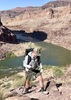
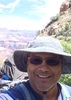
I had three events to work for the Arizona Trail Asociation- two in Tusayan and one in Page. Six days in between and I was determined to spend every second of it in the Grand Canyon. Late Sunday morning, we had a beautiful ceremony for the placement of a memorial bench dedicated to the Father of the Arizona Trail, Dale Shewalter and then I was off to finish writing up the event and last-minute packing. I parked at Grandview and looked for a ride. I didn't have to look long, parked right next to me was a fellow Grand Canyon enthusiast who had just finished a trip.

Day 1

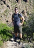
I didn't get hiking until 3:30 pm on the Tanner Trail, but I wasn't planning on going very far. A mile and a half away is 75-mile saddle with good camping spots. The trail was steep, dropping 1700 feet and rocky through the Kaibab, Toroweap and Coconino. My pack was heavy with six days of food and 5 liters of water- enough to dry camp and have plenty for the descent to the river the next day.

It was a warm and windless night, even up at 5600 ft. and I found the perfect spot overlooking 75-Mile Canyon. I could see O'Neill Butte and Horseshoe Mesa and Desert View Watchtower loomed above. Camped under the stars, happy to be back in my beloved Grand Canyon again.

Day 2

The next morning, I had a bit of level trail in the Supai to start my day, contouring under Cardenas and Escalante Buttes. At the Redwall break, there is a short spur trail that goes up to one of the most fantastic views of the Palisades of the Desert, Comanche Point and the Grand Canyon Supergroup area upstream of Tanner. I spent almost two hours looking at the different landmarks and taking pictures.

It was so hard to leave, but the day was heating up and the river was still a long way away. I made quick work of the Redwall and the Muav, happy to have my umbrella for shade. The Dox Sandstone is soft and the trail is mushed into the side of the hill, making the left leg higher than the right. I reached Tanner Beach at 2pm and got in the chilly water to cool off.

The river was running brown from the last round of storms in an unbelievably wet year. It didn't look too silty (whitecaps instead of browncap waves), so I tried it through my Platypus gravity filter. That thing rocks. Filtered with no problems and is a cinch to backflush. Plus I can set up and eat, watch boats go through the rapids and my water is done.

I was getting ready to leave a couple of hours later to start the Escalante Route and hike to Cardenas Beach for the night when a man appeared and said he'd be hiking to the Hermit Trail for the next 11 days. I ran into him a couple of times, and was the only person I saw for the first five days. I had a couple miles to Cardenas, small ups and downs through various ravines. Hit the beach just as I was losing daylight. This is also part of the Hayduke Trail, an 800-mile circuitous route that goes from Arches to Zion.

For the last four summers I have worked as a river guide in the Grand Canyon with Arizona River Runners and Grand Canyon Whitewater. I've run the river over 20 times and hiked pieces of the route I'd be traversing, but it was totally different experience to be here solo. Cardenas is always one of my favorite camps, how blissful to have it all to myself on a warm autumn night (and to not have to get up at 4:30 am to make coffee for 30 people). I did some long-exposure photography and set my bed up on the beach.

The winds kicked up in the middle of the night and I was glad I'd borrowed a tent from a friend. Sleeping under the stars, as much as I love it, was not going to work for most of the trip because of the incoming storm.

Day 3

The next morning the skies were blue above, but as I made the climb to the Hilltop Ruin, I could see dark clouds downstream. Decided to skip the Unkar Overlook spur and keep moving because the rains had started. I put on my rain jacket and my trash-compactor bag rainskirt.

As I hiked along the Unkar Wall, I looked back and saw one of the most amazing rainbows I've ever seen! Dropped the pack and scrambled to get my camera, trying to take shots without getting the camera soaked before the rainbow disappeared. My heart soared- this is why I hike, for the privilege of seeing exquisite moments like this.

I moved on, hiking in the intermittent rain toward Escalante Creek. The trail winds and climbs toward a high saddle and I got another rainbow, a little less intense than the first, but still gorgeous. In Escalante Creek, I found running water and took several liters so I wouldn't have to settle the increasingly silty Colorado. I took a break at Escalante Beach before my last climb up to access 75-mile Canyon. The route climbs and then turns to give a great view of the slot canyon below. I contoured back to the access point and scrambled down into the canyon. It made me uneasy to break the rule of not being in a slot canyon while it's raining.

The cream-colored Shinumo Quartzite slot canyon is a gorgeous place to be. I remembered back to a river trip where I visited not once, but twice in one evening on a full moon. The canyon opened up near the river and I camped at Nevills Beach. Soon after my dinner, it started raining and I got in the tent and fell asleep early.

Day 4

I woke at 4:30 in the morning after plenty of sleep. It was warmer and had stopped raining. Spent some time taking long-exposure pictures and writing in my journal. Yet another thing I love about solo hiking. I can do whatever I want, whenever I want and am never bored.

There are two routes to the Papago Wall, a low and a high route and I stayed low on the slabs above the water. There is a 30 foot scramble up the wall and then the route climbs to a rubble-choked gully called the Papago Slide. I didn't have any problems with the wall, but I took my pack off to hoist it up for one part and it would have been easier to keep it on. At the top of the wall, I saw the backpacker I'd met at Tanner below and he climbed up to join me.

The Papago Slide is a loose and nasty descent filled with every size of rock and I led the way, keeping plenty of room between me and him to avoid rockfall. There is a good route through it and it just takes being thoughtful with your movements. We got to Hance Rapid just as some boaters pulled in to scout from the opposite bank. It was super-fun to watch them go through. I hiked on to spend some quality alone time with Hance.

Hance Rapid is the first "10" on the Colorado River in the Grand Canyon. The powerful waves churn through many rocks and holes and it is one of the most technical rapids on the river. To stand beside it on the rocks was incredible and I spent a long time thinking about my summers working as a river guide. I had decided at the end of this season that I will not be returning next summer- a bittersweet decision, but I am glad for all the things I learned, people I met and the opportunity to teach people about this amazing place. I've got some things in the works- a new website and lots of writing to do and part of that plan is to spend more time in the Grand Canyon on foot.

The rain was coming in again, so I put my trash compactor rainskirt on and got going. Red Canyon marks the beginning of the Tonto Trail, following the Tonto Platform as it began to rise from the river. The trail climbed and I got a good view of the historic Hance Asbestos Mine and the Granite Gorge. It rained on and off and when the clouds lifted there was a dusting of snow on the upper reaches of the Canyon.

I was trying to get to Hance Creek, my next water source, but all the time spent at the rapids was starting to catch up with me. I was probably going to have to roll into camp by headlamp. The trail contoured through Mineral Canyon and at the dry creek crossing, I heard the most wonderful sound- running water! Up a side ravine from the crossing was an ephemeral waterfall and I made my way over to it. This water meant that I didn't have to push to Hance Creek and that I could do a dry camp on the Tonto Platform, one of my favorite types of GC camps.

Even as I filtered water, the waterfall went dry. Right place at the right time, I guess. I Tontoured out of Mineral Canyon, looking for a place to camp and found the perfect spot complete with a little wall for a windbreak and nice sitting rocks. The views were outrageously good of Vishnu Temple, Wotans Throne and Angels Gate. It was the coldest night yet and very windy.

Day 5

The next morning, I was treated to an incredible sunrise and I spent hours writing, taking pictures and looking at maps for an upcoming adventure.

I got going around noon and hiked to Hance Creek. Upstream from the creek crossing are some lovely Tapeats ledges and I settled in for a day of not doing a whole lot. More writing, a short exploration up and downstream, and a nice chat with the other folks that were camped in the area. It was great to have a day to relax.

Day 6

I'd made a habit of listening to Miles Davis Kind of Blue in the morning while I got packed up and got hiking around 9:30 toward Page Springs. In most seasons this shady, fern-lined place would be a welcome place for a break but today it was so chilly I had to put several layers on while filtering. I enjoyed the historic trail construction in the Redwall ascent, especially the portion that has a giant quartz vein going through the trailbed. Got to Horseshoe Mesa and took a long break.

As I hiked up off the mesa I could see the area I'd traversed the last six days and downstream toward Zoroaster and Brahma Temples. Made it through the Supai and it was cold enough to need a fleece and hat while hiking uphill. I love the trail construction in the Coconino- riprap cobblestone and log cribbing to keep the trail on the hillside.

Patches of ice and snow appeared in the Toroweap and Kaibab, but not enough for me to put my traction on- if I'd been going downhill I'd have put them on for sure. I reached the parking lot feeling a lot better than I'd anticipated and made it over to Desert View Watchtower to see the sun set on my latest adventure.

It is hard to express how good this trip was for me. I've had a lot of great backpacking opportunities this year, but I haven't gotten as much solo time as usual. To move through the Canyon for days on foot with time to contemplate life, feeling like I have the whole place to myself- there is nothing better.
 Culture
 Culture [ checklist ]
[ checklist ]  Mascot
 Named place
 Named place [ checklist ]
[ checklist ]  Unkar Creek Rapids
 Meteorology
 Meteorology [ checklist ]
[ checklist ]  Rainbow
foliage observationfoliage observationfoliage observationfoliage observationfoliage observation
Autumn Foliage Observation Isolated
_____________________
 
Apr 23 2015
avatar

 Routes 1
 Photos 356
 Triplogs 31

43 male
 Joined Nov 23 2007
 Tempe, AZ
New Hance TrailNorthwest, AZ
Northwest, AZ
Backpack avatar Apr 23 2015
bballardTriplogs 31
Backpack20.00 Miles 4,435 AEG
Backpack20.00 Miles4 Days         
4,435 ft AEG
 no routes
1st trip
Partners partners
bcollins11
Fresh off our first trip into the canyon last fall- my friends and I could not resist the urge to plan another! This time BJ, Shep, and I descended the New Hance trail- a painful knee-buster! We ran into a couple large groups at Hance Rapids where we spent our first night and witnessed kayaks running the rapids. Beautiful beach-side spot to appreciate the river in all it's glory. The next day it was on to the Tonto heading west, where we ran into our first bout of rain. Sporadic at first and windy, it didn't bother us much. Second night was also busy at Hance Creek. Plenty of water and a great side excursion up the canyon. The wind that night was intense, knocking our tents around, but not too much rain. On our third day we made our way around to the beautiful Page Spring and loaded up on water for the excruciating trek upwards to our last camp on Horseshoe Mesa. After setting up amidst bouts of rain, we headed off to Cave of the Domes. What an adventure exploring a real cave for the first time! On the way back the real rain hit, and throughout the evening all night... Grandview Trail up the next day to our bike-shuttle.

Wonderful journey. The magic of the canyon once again cannot be described in words. The intense weather only added to the mystique- views of cloud formations and rain constantly filtering our views and perception of light, shadow, contrast, color, and depth. Cannot wait until we are lucky enough again to immerse ourselves in this world.
wildflower observationwildflower observationwildflower observationwildflower observationwildflower observation
Wildflowers Observation Substantial
beautiful and constant display of many wildflowers.

water 1 out of 5water 2 out of 5water 3 out of 5water less than max Hance Creek Medium flow Medium flow
flowing really well.
_____________________
  1 archive
Feb 06 2015
avatar

 Routes 78
 Triplogs 93

male
 Joined Nov 11 2011
 
Tanner to Grandview, AZ 
Tanner to Grandview, AZ
 
Backpack avatar Feb 06 2015
charlomechfryTriplogs 93
Backpack32.70 Miles 9,148 AEG
Backpack32.70 Miles3 Days         
9,148 ft AEG
 
no photosets
1st trip
Partners none no partners
_____________________
 
Nov 07 2014
avatar

 Triplogs 1

55 male
 Joined Nov 05 2014
 United States
New Hance Grandview Loop, AZ 
New Hance Grandview Loop, AZ
 
Hiking avatar Nov 07 2014
gerchikovTriplogs 1
Hiking20.00 Miles
Hiking20.00 Miles   13 Hrs      1.54 mph
 no routesno photosets
1st trip
Down New Hance, up Grandview in a dayhike following http://hikearizona.com/gps=7037 route. Spectacular if strenuous, daylight is the biggest issue -- try to get past Horseshoe Mesa and onto Grandview Trail by dusk, the rest of the climb is straightforward and can be done with a good light after dusk. Trailfinding is generally not a problem, cairns help a lot, but a couple of spots require close attention. Manage your water carefully -- there is none on the entire Grandview ascend.
foliage observationfoliage observationfoliage observationfoliage observationfoliage observation
Autumn Foliage Observation Isolated
Mostly around creeks and bottoms of tributary canyons.
wildflower observationwildflower observationwildflower observationwildflower observationwildflower observation
Wildflowers Observation Isolated
Very few this time of year, making the ones spotted more precious still.

water 1 out of 5water 2 out of 5water less than maxwater less than max Hance Creek Light flow Light flow
Plenty to filter.

dry Red Canyon Dry Dry
Not a hint of water in the creek this late in fall in a very dry year.

dry Red Canyon Creek - GC Dry Dry
Not a hint of water in the creek this late in fall in a very dry year.
_____________________
  2 archives
Jun 06 2014
avatar

 Guides 8
 Routes 12
 Photos 1,918
 Triplogs 662

39 female
 Joined Dec 02 2009
 Grand Canyon
Grandview to New Hance, AZ 
Grandview to New Hance, AZ
 
Backpack avatar Jun 06 2014
HippyTriplogs 662
Backpack18.50 Miles 6,200 AEG
Backpack18.50 Miles   20 Hrs      0.93 mph
6,200 ft AEG
 no routes
Kidnapped my buddy Taylor to go on this trip with me, he'd never camped at the river before.

I prefer hiking down Grandview and I remember New Hance was SUPER easy hiking down, knew this trip would be cake!!

We left at 7am due to our ride to Grandview sleeping in, oops.got to the TH round 730,
The hike down GV was cake, made it to Horseshoe Mesa in just over an hour. Stopped to visit the cookhouse and explore the mines then we cruised...more like slid, down the Page Spring trail and took a short break at Hance Creek.

It was already hotter than hades down there by 10am when we cruised the Tonto. We had a mile left to the river when I realized it was Noon on the Tonto in June... "Who does that!?"we said in unison at one point.

It was deadly hot but we had hats, tons of water, at least 3L each plus an extra nalgene (topped off a half liter or so at Hance creek) and we both wore moisture wicking long sleeved shirts. We were both down to half a liter of water by the time we reached Hance Rapids, which is, I think, perfect!

Reached the river well before one in the afternoon, we crushed that trail pretty nicely considering the heat! Spent about 12 hours at the river, we'd picked out a great camp spot about 25ft from the river and a little shallow backeddy, about 2ft deep, just enough to wallow in!
We'd planned to actually camp overnight but the Canyon had other plans!!

We settled in, under the stars, on top of s tarp and super lightweight blanket...then the wind picked up (as usual) and the roar of the rapids all but ceased! I went to add a nalgene to our water container corral in the back eddy, the water had dropped a good 9 inches...ugh. No cold water for our hike out...

Wind got stronger. A tree actually snapped in half, huge clouds of sand and leaves flew from every direction. We wrapped bandanas around our faces and hastily turned my tarp into a tent with rocks, shoelaces, paracord and trekking poles. : rambo :

Then we squeezed in tight, back to back careful not to hit the rocks that held the trekking poles upright in the sand.
The wind lulled us to sleep alongside the muted groan that was Hance Rapids and 45 minutes later I awoke...

With a burning hot, icy cold, stinging, tingling, numb sensation on my left wrist...

You've gotta be kidding me was my first thought. I just got stung 3 times by a little bark scorpion. Really??!! Being awakened by a scorpion in your bed at 1am isn't the greatest wakeup call but whatevs .

We shook everything out, packed up, dunked my arm in the river then hiked out, leaving our riverside campsite around 2am.

New Hance is easy going up. The trail, for me, was pretty tame, obvious to follow in the dark. The longest most annoying part (or so it seemed, could've been lack of sleep) was above the Red wall, the Supai layer felt like it took hours!! (In reality we were moving up the trail for 3 1/2 hours) we stopped at the camp above the red wall and slept for a good 45min then continued on. We made it to the TH at sunrise. Perfect timing!

New Hance was an easy hike but I can imagine hiking out in the heat of the sun in June would not be pleasant!

We then thumbed a ride back to the village from the first car that we saw, score! The drive was a nurse and insisted I let her take us to the clinic for my scorpion stings haha

Despite all the random mishaps the trip was great, red canyon is stunning as always and I discovered I'd rather hike DOWN GV and UP NH from now on!
Haven't tried it? Do it! Its worth it.
_____________________
Canyon Freak Adventures!
 
Jan 25 2014
avatar

 Guides 13
 Routes 38
 Photos 1,651
 Triplogs 577

60 male
 Joined Nov 15 2005
 Jackson, CA
New Hance TrailNorthwest, AZ
Northwest, AZ
Hiking avatar Jan 25 2014
toddakTriplogs 577
Hiking23.00 Miles 5,000 AEG
Hiking23.00 Miles   12 Hrs      1.92 mph
5,000 ft AEG
 no routesno photosets
1st trip
Partners none no partners
Down Grandview (icy for the first half mile or so), east on the Tonto then up the super gnarly New Hance. Road walked between the trailheads.
_____________________
 
Nov 15 2013
avatar

 Guides 8
 Routes 12
 Photos 1,918
 Triplogs 662

39 female
 Joined Dec 02 2009
 Grand Canyon
New Hance to Grandview, AZ 
New Hance to Grandview, AZ
 
Backpack avatar Nov 15 2013
HippyTriplogs 662
Backpack18.50 Miles 6,200 AEG
Backpack18.50 Miles2 Days         
6,200 ft AEG
 no routes
-
Deliver to Captain John Hance, Grand Canyon, AZ
Captain Hance, today I embark on another journey. My first trek down your most recent trail aptly named New Hance. I must point out one thing. Peter Barry has an amazing parking area at the trailhead of his Grandview Trail, your trail deserves better than a "No Parking" sign and a ditch to prevent vehicles from parking in the dirt.
Thanks for your time,
Hippy
-

To John Hance,
Mister Hance, your trail is spectacular, the views are stunning and the trail itself is in great condition, it is much easier than many have previously stated. I am very impressed. I cannot say the same for my hiking companions, they seem to be having a hard time staying on their feet as the trail is a bit steep in places. Have you seen the stromatolites along the creek in Red Canyon?! I haven't but I heard they're there, I'll have to take another trip out there and find out. Speaking of, the water in Red Canyon was a salty sweet, probably not best for drinking but my innards haven't thrown a fit yet.
One of my companions decided to abandon trail just before the red wall break, it was wonderful having him along I do hope to hike with him again sometime soon!
Yours truly,
H
-

Dear John,
Hi again, I just wanted to tell you that your Rapid, Hance Rapids is THE most beautiful site, with the diabase dike in the hakatai shale at the head of the rapid, John I think I love you! You, your stories, your trail, your rapids. Yes, this might be my favorite adventure thus far!
I only hope you had next to nothing to do with the Tonto trail out to Hance Creek, the trail went wonky all over the place at some points and in others it was built up onto giant boulders causing little tiny me to do some climbing up on top of them. Although we both know I loved it!
We saw a beautiful double rainbow along the tonto heading for the creek in your name, we got rained on and hailed on and almost had to bivvy up under the tapeats overhang but the day was young and beautiful and we pressed on.
Camping at Hance Creek was superb, the wind was atrocious but extravagant at the same time! It made for quite a fun evening wrestling with tent ties and poles and wrapping our food up in my rain jacket and stuffing it in the ratsack, it worked quite nicely actually.
This will be my last letter to you...for now. Look into some trail head parking areas, ok?
Love always.
Hippy
-

Dearest Peter Barry,
I know we haven't spoken in some time but I thought I'd drop a hello. I hiked up to Page Spring the other day with my dear friend John, don't be jealous, I will always love you and your trail. I do wonder though, who had the grand idea to make it such a steep ascent to Horseshoe Mesa? Did you put your mules through that hell? I might have to speak with you about animal cruelty laws nowadays because honestly I'd never allow my mules to go up that trail. I on the other hand thoroughly enjoyed it, steep as it was! Page Spring was dripping nicely and the pool was a beautiful Chrystal clear green. We explored two or three of your mine shafts on our way up, the trail is quite straightforward and I thank you for your foresight on such matters.
All my love
Hippy
-

Dear Petey B,
Apparently your trail along Horseshoe Mesa is not as simple and straightforward as previously thought, a family lost their 17 year old son on the mesa, John and I thought nothing of it until I spotted the boy heading out on the east arm of the mesa, so of course I hefted off my pack and tracked him down and reunited him with his family. I must say he was rather baffled when I ran up to him, he pulled off his hat and brushed his hands through his hair and stuttered through his words and attempted to convince me that he was not lost. Boys...
John and I tailed him up the trail briefly when we discovered the reason for his becoming "lost", this explains the goofy grin on his face! The boy was 9Ling like a fool!!
I absolutely LOVE heading up Grandview Trail! Thank you Petey for this lovely historic jaunt through the grandest geology we have to play with!
Love always
Hippy
-

Peter Barry,
Listen, I know we've have our ups and down, mostly downs but today I'm heading UP and I MUST protest, my love! Cobblestones?! Two foot tall stepping stairs?! Peter, darling, I might be stubborn but with my short legs and tiny feet I am no mule! Please my love, reconsider this madness! Cobblestones!! Good grief man!!
Hippy
-

Dear Peter Barry,
I'll take crazy John Hance and his lack of trail head parking anytime, go :pk: yourself.
Love,
Hippy
-
 Meteorology
 Meteorology [ checklist ]
[ checklist ]  Rainbow
_____________________
Canyon Freak Adventures!
 
Nov 15 2013
avatar

 Guides 6
 Routes 183
 Photos 5,612
 Triplogs 1,647

male
 Joined Mar 12 2004
 Scottsdale, AZ
New Hance to Grandview, AZ 
New Hance to Grandview, AZ
 
Backpack avatar Nov 15 2013
John9LTriplogs 1,647
Backpack18.50 Miles 6,200 AEG
Backpack18.50 Miles2 Days         
6,200 ft AEG
 no routes
1st trip
I met up with Hippy for a fun backpack in our favorite Canyon. I departed Phoenix right after work on Thursday night and drove up to the Canyon. We left bright and early on Friday and met up with Niko. He offered to shuttle us from Grandview and would hike the first few miles with us. We started hiking a little before 9am.

Right from the start New Hance aggressively descends through the Kaibab, Toroweap and Coconino layers. The going is a little rough but fine. I did this backpack last year and remember it being very hard on the body especially my knees and ankle. This trip would prove to be much easier. We made quick work of the top three layers and then things level off a bit. We cruised on down and took our first break at the top of the Redwall. The views are just stunning into Red Canyon and the North Rim. From there we began the traverse along the Supai. I remember this section being a little rough last year but it was cake this go around. I don’t know if the trail is easier or if I’m just more experienced. Regardless we cruised to the Redwall break.

Once at the Redwall break Niko waved goodbye and started his return to the rim. Thanks again Niko! Hippy and I continued down the break and then proceeded to Red Canyon. We both felt great and started joking about hiking all the way to Hance Creek. We continued on and passed a couple of hikers on their way out. They said there were two groups below and one was camped out by the river. I said to Hippy we’re continuing on if a group is camped at the Mesquite Tree site. She was game! The rest of the hike to the rapid was uneventful. The only things worth mentioning is we blasted by a group of six guys taking a breather and there was some salty water in the bed of Red Canyon.

We arrived at Hance Rapid around 12:30pm and both of us felt great. We saw the group at the Mesquite Tree and decided to continue to Hance Creek after taking a long break and enjoying the rapid. We enjoyed lunch and relaxed at a fantastic spot nestled above the rapid. After getting some cartwheel pics we continued west on the Tonto. As we proceeded some storm clouds moved in and it started to drizzle. We continued hiking and passed through Mineral Canyon and made our way to an overhang along the Tonto. We took another break here and it was perfect timing. The skies opened and a moderate rain fell followed by hail and lightning. We were both fairly protected and hung out here for a good hour as the storm passed. After we felt it was safe we continued and then saw a fantastic double rainbow. I joked about the Double Rainbow Youtube video and we took some silly pics. From there we continued on and reached Hance Creek as dusk set in.

Once at camp we got the tent set up and started making dinner as darkness set in. It was beautiful out as we boiled water and began eating. While eating another storm rapidly moved in and it brought strong wind and rain. We moved everything into the tent but as we did the wind blew my tent down. I had it set up as a Fastpitch and the wind blew my tent poles down. Hippy said to secure the guy lines on my tent. I quickly secured them to some large rocks and that did the trick because the tent was stable after that. We enjoyed our dinner and then turned in for the night.

We woke on our second day and took our time having breakfast and tearing down camp. From there we made the long and slow hike out the Grandview trail. Our bodies were very sore and achy after the big first day. Along the hike out we spoke glowingly of John Hance and Peter Berry for their wonderful trail construction. Hippy especially loves the cobblestone work along the Grandview Trail.

This was a really great trip and New Hance is one of my favorite trails in the Canyon. It was much easier compared to last year. Definitely add this loop to your list when you’re ready to get off the corridor and want a fun challenge. Route finding is very straightforward along this loop.
 Culture
 Culture [ checklist ]
[ checklist ]  Campsite
 Meteorology
 Meteorology [ checklist ]
[ checklist ]  Double Rainbow  Rainbow
_____________________
 
average hiking speed 1.86 mph
1, 2, 3  Next

WARNING! Hiking and outdoor related sports can be dangerous. Be responsible and prepare for the trip. Study the area you are entering and plan accordingly. Dress for the current and unexpected weather changes. Take plenty of water. Never go alone. Make an itinerary with your plan(s), route(s), destination(s) and expected return time. Give your itinerary to trusted family and/or friends.

helpcommentissue

end of page marker