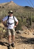
username
X
password
register
for free!
help
ArticlesGuidesRoutes
 
Photosets
 
 Comments
triplogs   photosets   labels comments more
China Wall Trail w/Bronco Creek #287 - 8 members in 20 triplogs have rated this an average 3.5 ( 1 to 5 best )
20 triplogs
login for filter options
Feb 04 2023
avatar

 Guides 12
 Routes 192
 Photos 863
 Triplogs 356

42 male
 Joined Nov 30 2015
 Phoenix, AZ
China Wall - Cottonwood Basin, AZ 
China Wall - Cottonwood Basin, AZ
 
Run/Jog avatar Feb 04 2023
ShatteredArmTriplogs 356
Run/Jog16.59 Miles 3,543 AEG
Run/Jog16.59 Miles   5 Hrs   52 Mns   2.91 mph
3,543 ft AEG      10 Mns Break
 
no photosets
1st trip
Needed something closer to town due to an evening commitment, so I found a couple friends brave enough to check out some abandoned routes. It also provided a reason to finally check off Bronco Trail. Got to the TH amid heavy gunfire, and when we got past the head of Seven Springs Wash, we were finally clear of the bullets flying around.

Bronco trail was prettier than I expected, views aren't bad. The turn onto the old Bronco Creek trail wasn't hard to find, and the trail wasn't terribly hard to follow to the corral. There were even fresh footprints, even beyond the corral.

After we passed the fence, there was no obvious route, and staying in the wash was the easiest path. Used the line on my topo to determine where to exit, and once up to the first saddle, the trail reappeared. There were stretches where we lost the trail, but overall, getting up to the Bronco Butte ridge was a lot more straightforward than expected. The China Wall structure was pretty cool.

Decided to do a short side trip up to Bronco Butte, since it didn't seem likely we'd have another chance any time soon. The west side had no trail we could find, but going parallel to the wall was easy enough, and dropped us right onto the Desert Mountain trail system, which provided a half mile or so reprieve from bushwacking.

Cottonwood Basin trail is basically nonexistent, but there was flagging from the FS boundary most of the way down to Cottonwood Creek. The brush wasn't terrible.

Once we got to the Cottonwood Creek trail, it got easier, and on this stretch I think we saw a majority of the runners attempting the 50 mile run. Even recognized a few faces.

Fun day, although those trails might be one and done for me.

water 1 out of 5water 2 out of 5water less than maxwater less than max Cottonwood Spring Quart per minute Quart per minute

dry Cottonwood Spring Dry Dry
Dry where the trail drops in, better flow a few minutes walk downstream.

dry Jack Springs Dry Dry
Didn't see anything, think it's being pumped out.
_____________________
 
Dec 24 2022
avatar

 Guides 99
 Routes 1,484
 Photos 16,072
 Triplogs 1,374

male
 Joined Jan 07 2017
 Fountain Hills,
Bronco Butte - CarefreePhoenix, AZ
Phoenix, AZ
Hiking avatar Dec 24 2022
DixieFlyerTriplogs 1,374
Hiking15.50 Miles 3,550 AEG
Hiking15.50 Miles
3,550 ft AEG
 
Partners none no partners
It has been a while since I hiked up to Bronco Butte, so I decided to do this one again.

I started and ended at the Bronco TH. The Bronco Trail is in good shape for the 3.25 miles from the TH that I was on it. I left the Bronco Trail and took the China Wall Trail most of the rest of the way to Bronco Butte. The China Wall Trail is not an official trail, but it was fairly easy to follow to a corral about one mile from the Bronco Trail. Past the corral it was more difficult to follow, and was akin to some of the trails in the Supes, minus the catclaw and scratchy vegetation that is often encountered on Supes Trails. I would say that I was hiking in open country more than bushwhacking.

I ascended Bronco Butte from the west, which was fairly gentle slope to the top. There are great 360 degree views at the summit, so I enjoyed being up there. On the way back down, I took a left where I should have taken a right, and took a bit of a detour. This added some miles and elevation gain to the hike.

The high temperature was in the low 60's, which was a bit warm in the full sun.
_____________________
Civilization is a nice place to visit but I wouldn't want to live there
  2 archives
Mar 06 2021
avatar

 Guides 69
 Routes 37
 Photos 3,010
 Triplogs 2,387

55 male
 Joined Oct 24 2010
 Phoenix,Az
China Wall Trail w/Bronco Creek #287Phoenix, AZ
Phoenix, AZ
Hiking avatar Mar 06 2021
mt98dewTriplogs 2,387
Hiking12.81 Miles 1,000 AEG
Hiking12.81 Miles   4 Hrs   47 Mns   2.68 mph
1,000 ft AEG
 no routesno photosets
1st trip
Linked   none no linked trail guides
Partners none no partners
Met up with the Chris to visit China. This had been on my radar years back, fallen off, and then back on when Chris brought it up a month ago. Got to the TH around 6:15am. Just enough light to negotiate the trail without any problems. The Bronco Trail is in fine shape. A little rocky on some of the slopes, but easy to follow. The turn for 287 (Bronco Creek trail) isn’t quite as obvious as I expected. Luckily Chris had downloaded the route and was ready for the turn. Once we got onto to the trail it was fairly easy to follow up to the corral. It appears this portion of the trail gets enough traffic that it is self evident. The corral is still in pretty good shape, though there is now a skull decorating one of the posts. From the corral the trail becomes less established. There is a fence that takes off from the corral and heads in a southerly direction. On the way in we went to the right of this fence and paralleled it until it ended at Jacks Spring where we entered a wash. Followed the wash for a ways (maybe .5 miles) until it “Y”ed. Turned left at this point and quickly left the wash and started going cross country. (On the way back, I noticed that if we had turned right at this first “Y” another 20 feet up the wash there would have been another “Y” with an open, cairned wash that would have gotten us up to the a saddle without all the vegetation that we dealt with on our entry. At the saddle we made a slight inadvertent detour. We hugged the eastern slope, when we should have stayed on the northern slope. Luckily we hadn’t gone too far before we realized our mistake. The northern slope is pretty open. Easy to avoid vegetation. The cairns and the “trail” will come and go as we continued west, gaining elevation in surprisingly mild manner. When you start to see slabs of rock that is the beginning of the China Wall. The Wall was always on our right as we ascended the slope. The Wall would kind of come and go in chunks. Some portions more impressive than others. For me the pay off wasn’t really until we reached the top of the slope and the views opening up to the west. Wow! Much nicer than I anticipated. Added bonus...the wall, unexpectedly, continued up and over the slope, adding a nice foreground characteristic to the expansive view. On the way back, I was pressed for time, so left Chris moving at his own pace. I didn’t save as much time as I anticipated as I veered off trail and had to some minor bushwhacking to get back on trail. Luckily a downed mylar ballon and Chris’s shouts got me back on track without too much time lost. I wished I had had more time to explore the area. Thought I saw a cut in the mountain off to the north and both Bronco Butte and Butte Peak were “baggable”. Might be worth a return visit. Weather was perfect! 60’s for most of the hike with a strong breeze for a good portion of it. No wildlife and no others to be seen. Thanks for the invite Chris, good company solid hike!
_____________________
 
Mar 06 2021
avatar

 Guides 27
 Routes 669
 Photos 12,096
 Triplogs 856

56 male
 Joined Jul 05 2006
 Mesa, AZ
China Wall Trail w/Bronco Creek #287Phoenix, AZ
Phoenix, AZ
Hiking avatar Mar 06 2021
DarthStillerTriplogs 856
Hiking12.51 Miles 2,384 AEG
Hiking12.51 Miles   6 Hrs   5 Mns   2.07 mph
2,384 ft AEG      3 Mns Break
 
1st trip
Linked   none no linked trail guides
Partners none no partners
Route Scout Route Recorded  on Route Scout | Pop | Map | Popup | MapDEX
Brian had a good description of the trail in his triplog. After 245 to the corral, it's very easy to follow. From the corral for a half mile to the wash its a bushwhack, but you just follow the fence and the path of least resistance. Then you follow the wash and head to your right towards the end of it, to the north slopes. We headed to the left because I was following the track I downloaded and missed the turn off to the right. Once we got to some serious thick brush, I decided to check the track and saw we were way off.

After the route up the hill to the China Wall is cairned for the most part. The trail is mostly not there, but then visible at times. Most of the time we kept getting off track and off the trail. For most of the hike past the corral I had to keep checking the route to make sure we hadn't veered off, which it seemed like we did constantly.

Brian and I were both on somewhat tight schedules with errands planned later in the day. As we reached the China Wall, we kept ascending on the hill. I wanted to get to the next saddle/summit, and then turn around, but it seemed like it was a series of false summits. Finally we got to the high point, and it was a very nice payoff. The official track continued about another half mile or so, but that all went downhill. We had enough of a bushwhack back, so we decided against that. When I checked the track against a satellite background, there was a visible trail as some sections, but it was on the other side of the wall from where we were. If we had tried to follow, we likely would have been bushwhacking for quite a bit.

Brian ran ahead of me on the way back because he was on a tighter schedule, then promptly veered too far to the right downhill into the ravine and on the wrong side of a hill. After hiking over a mile and a half on the way back, I could see him not too far away trying to find his way. I yelled to him and pointed the way for him to go. He seemed to have already have it figured out by then. The last glimpse of him I got was just before I entered the wash before the corral, which he had passed on his way out.

The weather was very cool and windy the entire time. On the way back home I noticed the difference in temperature as the elevations got lower. Saw no other hikers, bikers, horseriders, etc, for the entire hike. I was rather surprised by that given this time of year. This seems like a pretty popular area normally. Conditions also seemed pretty dry. the big tank off of 245 on the way in was a big grass bed.
_____________________
 
May 20 2019
avatar

 Guides 47
 Routes 96
 Photos 850
 Triplogs 385

81 male
 Joined Dec 24 2005
 Phoenix, AZ
Bronco Trail #245Phoenix, AZ
Phoenix, AZ
Hiking avatar May 20 2019
MEWhitemanTriplogs 385
Hiking7.00 Miles 1,490 AEG
Hiking7.00 Miles   3 Hrs      2.33 mph
1,490 ft AEG
 no routesno photosets
1st trip
Linked   linked  
Partners partners
hiazny10
Planned to hike to China Wall and back via the Bronco Trail and Bronco Creek Trail, but I had a deadline to return so ran out of time. We got partway up the Bronco Creek trail when we lost the trail. Since a thunderstorm was approaching and we were short on time we turned around. It was cool (high 40s) and we did get wet but we enjoyed the hike. I’d like to try again at some later time.
_____________________
 
Jan 20 2019
avatar

 Guides 1
 Routes 5
 Photos 61
 Triplogs 14

70 male
 Joined Jan 21 2018
 Scottsdale
China Wall Trail w/Bronco Creek #287Phoenix, AZ
Phoenix, AZ
Hiking avatar Jan 20 2019
gad38Triplogs 14
Hiking8.74 Miles 1,565 AEG
Hiking8.74 Miles   4 Hrs   24 Mns   2.28 mph
1,565 ft AEG      34 Mns Break4 LBS Pack
 
1st trip
Linked   none no linked trail guides
Partners none no partners
Great day for a hike today - nice cool breeze, temps in mid to high 60s and blue sunny skies. Left Bronco TH around 11:00 am and hike to where it joins the former trail 287 which drops straight down to the creek bed. We followed the often disappearing trail to an old corral with a cow skull on a fence post, according to Route Scout this was a little over 4.25 miles. (Route Scout was very useful in keeping us on the trail when it disappeared). The heavy rains we have had this winter have made the hike very lush, including one meadow that was covered with green grass and another area with a standing water pool.

Need to learn how to interpret Route Scout info. Though the trail from Bronco TH To China Wall was only 3.5 miles (one way), but after hiking 4miles plus the you’re looked like it had at least 2 more miles to reach the China Wall.
wildflower observationwildflower observationwildflower observationwildflower observationwildflower observation
Wildflowers Observation Isolated
Some yellow California Poppies along trail 245
  1 archive
Dec 17 2018
avatar

 Guides 99
 Routes 1,484
 Photos 16,072
 Triplogs 1,374

male
 Joined Jan 07 2017
 Fountain Hills,
Bronco Butte - CarefreePhoenix, AZ
Phoenix, AZ
Hiking avatar Dec 17 2018
DixieFlyerTriplogs 1,374
Hiking12.90 Miles 2,625 AEG
Hiking12.90 Miles   7 Hrs   18 Mns   2.52 mph
2,625 ft AEG   2 Hrs   11 Mns Break
 
Partners none no partners
Tracie and I were looking for a hike that we haven't done and for a peak to bag, and Bronco Butte fit the bill on both counts, so off we went.

It was a crisp 40 degrees at the TH when we started the hike. The TH was huge -- I can't imagine that there would ever be a shortage of places to park.

Bronco Butte Trail #245 was in good shape and was easy to follow. After a little over 3 miles, we went on the China Wall/Bronco Creek Trail the rest of the way to Bronco Butte. This trail was pretty easy to follow until we got to a barb wire corral. Thereafter, the trail was faint in some places, and I had to use a GPS some on the way to Bronco Butte. On the way back I had an easier time following the trail.

The hike to Bronco Butte was nice. We stopped and looked at a water trough that had a pipe dripping water in it, presumably running from a spring. A drip of water came out about every 2-3 seconds.

The views on top of Bronco Butte were much nicer than I would have thought. We had good views of Quien Sabe Peak, Skull Mesa, New River Mesa, and Elephant Mountain. To the SE, you could see Butte Peak(the City of Scottsdale High Point) and Gold Hill not far away. It looked like the private trails going up to Butte Peak were well constructed and maintained.

Judging from the entries in the log book at the summit, not many people bag this peak. There was only one entry before ours in 2018 -- back on St. Patricks Day.

On the way back we went by some of the China Wall. We didn't spend as much time looking around as I would have liked, but we did see a couple of mining sites where there were holes in the ground where rock had been blasted -- the holes were maybe 4 feet deep.

This was not the greatest hike that I have ever done, but it certainly isn't the worst...and I imagine that I will do the hike again sometime, and will spend a bit more time poking around the China Wall.

EDIT: I came out here again and found the airplane wreckage just west of the northern part of the China Wall. Here are some details on the plane crash, which occured on Feb. 25, 2011: https://aviation-safety.net/wikibase/wiki.php?id=94036
wildflower observationwildflower observationwildflower observationwildflower observationwildflower observation
Wildflowers Observation Light
I noticed quite a few poppies and globemallow in bloom.
_____________________
Civilization is a nice place to visit but I wouldn't want to live there
  2 archives
Nov 11 2018
avatar

 Guides 3
 Routes 25
 Photos 2,216
 Triplogs 237

63 male
 Joined Apr 22 2012
 Fountain Hills,
Bronco Trail #245Phoenix, AZ
Phoenix, AZ
Hiking avatar Nov 11 2018
KBKBTriplogs 237
Hiking9.76 Miles 1,768 AEG
Hiking9.76 Miles   4 Hrs   55 Mns   2.30 mph
1,768 ft AEG      40 Mns Break24 LBS Pack
 no routes
1st trip
Partners none no partners
My wife and I hiked the Bronco Trail for our Sunday afternoon hike. Marilyn wanted to get in 8 miles for the day, so we hiked north for a ways on #247 (Cottonwood) until her GPS passed 4 miles.

On the way back, I explored a bit of the China Wall Trail w/ Bronco Creek. There seemed to be more than a few paths in this area - I'm not certain I was on the right one, but I did eventually find one that seemed like more than just an old cow path or game trail. I got confused on the way back to #245, but my GPS helped me to find the trail that I came in on - I was following the wrong drainage back up to #245.

When I caught up with my wife, she thought that she had lost her phone. We spent a while searching for it. A pair of hunters saw us, thought that we were lost, and provided helpful directions on how to get back. It turned out that she hadn't actually lost her phone - it was in her backpack, but not in the compartment where she normally keeps it. But she didn't figure that out until we were back in our vehicle driving home. We spent perhaps half an hour to forty minutes looking for her phone.

In addition to the hunters, we saw a woman with her dogs hiking behind us for the first two miles of the hike.

This was my first time on the Bronco Trail. I didn't much like the mile and a half or so nearest to the trailhead, but the rest is pretty nice. I also enjoyed my exploration of the China Wall / Bronco Creek area.
_____________________
 
Jan 28 2017
avatar

 Guides 1
 Routes 447
 Photos 4,407
 Triplogs 938

68 male
 Joined Mar 09 2012
 Gilbert, AZ
Bronco Butte - CarefreePhoenix, AZ
Phoenix, AZ
Hiking avatar Jan 28 2017
rayhustonTriplogs 938
Hiking13.04 Miles 2,702 AEG
Hiking13.04 Miles   6 Hrs   48 Mns   2.02 mph
2,702 ft AEG      20 Mns Break
 
1st trip
Partners partners
The_Eagle
Bruce wanted to bag another Bronco Butte and invited me to join him. We started the hike a few minutes before 7am with only a hint of the sunrise to come and the hope that moving fast might warm our shivering bodies. It was cold!

The hike in was was wonderful. We walked the China Wall for a ways, checking out the prospects and the remnants of the plane crash mentioned in previous posts. After gaining the saddle west of Bronco Butte, Bruce wanted to go up to the top of the hill to our right to check out the views. We found another old prospect while we were up there.

We did not follow the China Wall trail to its end. We were on a schedule so we headed up to the Butte. Bruce signed the summit register for us. We took in some wonderful views under sunny skies before starting the really fun part of the hike, some creek hiking that Bruce drew up as an alternate return.

From the summit, we headed down the mountain in a NE direction rather than returning the way we came. This would get us to the creek much faster. It was steep, but we found some nice game/cattle trails that took us to the creek without any blood letting. With the recent rain, the creeks were flowing nicely. The creek portion was fun; easy hiking and the sound of running water made it all the more enjoyable.

Half way down the creek, an old, crumbling, grown over road that crisscrossed the creek became part of the hike. We used the road when the creek wasn't passable. The creek and the road ended on private property. We took a left (west) and looked for a route out of the canyon. The best option looked to be up and over a steep hill. That started a Six Flags roller coaster ride of steep up then down then up again. Soon enough we were back on the Bronco Trail and a return to easy hiking.

This was a very enjoyable hike. I liked the alternate route back along the creek in the Rackensack Gulch area. It wouldn't have been as fun without the water, but Bruce picked the perfect day to do it. Thanks again for the hike, Bruce, and for driving us out there. I had a great time!
_____________________
  1 archive
Jan 28 2017
avatar

 Guides 41
 Routes 1,626
 Photos 14,983
 Triplogs 2,760

69 male
 Joined Jan 20 2009
 Far NE Phoenix,
Bronco Butte-China Wall-Rackensack, AZ 
Bronco Butte-China Wall-Rackensack, AZ
 
Hiking avatar Jan 28 2017
The_EagleTriplogs 2,760
Hiking13.40 Miles 2,711 AEG
Hiking13.40 Miles   6 Hrs   52 Mns   2.05 mph
2,711 ft AEG      20 Mns Break14 LBS Pack
 
1st trip
Partners partners
rayhuston
I needed this one to complete all the Seven Springs / Spur Cross Trails. I'd driven by the Bronco Trailhead dozens of times without stopping.

On the agenda the 2nd Bronco Butte of the month, China Wall and some 'splorin'. Since I prefer Loops to OaB's, toss in Rackensack Canyon, which looked interesting.

Ray and I started just before first light on a chilly, breezy, crisp, clear morning. We were on Bronco #245 for a bit over 3 miles before turning off on an old unsigned, cairned route to China Wall then Bronco Butte.

China Wall is an interesting geologic feature. We followed along the top of the wall until we got to the area of the plane wreckage. Most of the 2011 wreckage has been removed. We made our way to Peak 4600 to check out the views to the west. This is a good vantage point to take in the overview of the Seven Springs, Spur Cross areas.

From here, Bronco Butte was just a short climb. Here you have 360 views of the area. Snow Covered Mazzy's to the East, Supes to the SE, McDowells, Camelback, Squaw to the Southish, Snow covered Bradshaws to the WNW.

We opted for the shorter route off Bronco Butte to Rackensack. Ray led us down, following some game trails into the canyon. It worked out well.

Rackensack was an easy follow for the most part. Water was running for the majority of the length of it, with even some interesting cascades. Towards the end, we skirted some Private property. There were indications of recent, but not current activity.

We improvised our route up and out of the canyon back to the Bronco Trail.

We only saw 2 hikers all day, one with a golf club :doh:

water 1 out of 5water 2 out of 5water 3 out of 5water less than max Head of Rackensack Springs Gallon per minute Gallon per minute
Hard to tell where the source was with all the recent rains

water 1 out of 5water less than maxwater less than maxwater less than max Jack Springs Dripping Dripping
Mainly muddy in overgrown bushy area
_____________________
There is a very fine line between "hobby" and "mental illness."
Dave Barry 🦅
 
Apr 04 2015
avatar

 Routes 268
 Photos 2,969
 Triplogs 541

66 male
 Joined Aug 16 2009
 Mesa,AZ
China Wall Trail w/Bronco Creek #287Phoenix, AZ
Phoenix, AZ
Hiking avatar Apr 04 2015
hikerdwTriplogs 541
Hiking12.08 Miles 2,255 AEG
Hiking12.08 Miles   5 Hrs   20 Mns   2.60 mph
2,255 ft AEG      41 Mns Break
 
1st trip
Linked   linked  
Partners none no partners
I added this hike to my list after reading the triplogs posted by mazatzal and Oregon Hiker when they hiked this area back in December. Really enjoyed hiking this area, lots to explore. The "China Wall" is very interesting, although I was hoping the back side would have been a steeper drop. Very little water found, just a few drops at the two troughs we checked. We did see a nice pool of water just upstream from the 2nd trough. Like Oregon Hiker reported, not too much remains from the plane crash but it was interesting to see what was left, shoes, hydraulic lines, doors, etc. In the cooler months we will make a return trip to summit Bronco Butte, do more exploring, etc.

Temps were pleasant early but did warm up on the way out. There was a slight breeze which provided a A/C effect. Carried 2 liters of water and consumed 1.5.
 Named place
 Named place [ checklist ]
[ checklist ]  Jack Springs
wildflower observationwildflower observationwildflower observationwildflower observationwildflower observation
Wildflowers Observation Light

water 1 out of 5water less than maxwater less than maxwater less than max Jack Springs Dripping Dripping
Dripping only.
_____________________
Expect to self rescue
 
Dec 22 2014
avatar

 Routes 36
 Photos 2,658
 Triplogs 1,347

67 male
 Joined Jul 28 2004
 Scottsdale, AZ
Bronco Butte - CarefreePhoenix, AZ
Phoenix, AZ
Hiking avatar Dec 22 2014
mazatzalTriplogs 1,347
Hiking12.60 Miles 2,514 AEG
Hiking12.60 Miles   8 Hrs   58 Mns   1.49 mph
2,514 ft AEG      30 Mns Break
 no routes
1st trip
Partners partners
Oregon_Hiker
Headed up Bronco Butte with Oregon Hiker. It was a tad chilly when we started in the shade but soon warmed up. We took Bronco trail over to Bronco Creek and headed south on the decommissioned Bronco Creek Trail #287. After passing Jack Springs we headed up to the north part of China Wall where Oregon Hiker found a shallow mine / prospect and we found some mining drill rods. We continued to the crash site and summit for lunch. We checked out the southern part of China Wall and then headed back. Fun trip to Bronco with OH and thank you for driving.

water 1 out of 5water less than maxwater less than maxwater less than max Jack Springs Dripping Dripping
Not much water, dripping slowly.
_____________________
  1 archive
Nov 02 2013
avatar

 Routes 36
 Photos 2,658
 Triplogs 1,347

67 male
 Joined Jul 28 2004
 Scottsdale, AZ
Bronco Trail #245Phoenix, AZ
Phoenix, AZ
Hiking avatar Nov 02 2013
mazatzalTriplogs 1,347
Hiking12.00 Miles 2,850 AEG
Hiking12.00 Miles   7 Hrs      1.97 mph
2,850 ft AEG      55 Mns Break
 no routes
Partners none no partners
Took Bronco trail to Bronco Creek trail to Jack Springs and then followed the cairned route to Bronco Butte passing by 2 springs along the way each was dripping very slowly. This is a great hike although it was better before the CC Complex fire but now getting more enjoyable. At the end of the cairns (unless Bob has been here) you just go off trail to the summit which is very cool. Great 360 views of the Mazzies, all the valley ranges, New River Mtns and ranges to the north as well.

I spotted some metal on the descent and went to investigate - I believe this was plane wreckage from a fairly recent airplane crash site, 2-3 years ago, very sad.

Despite the burn from the CC complex fire this peak is a nice trip.
_____________________
 
Nov 03 2012
avatar

 Routes 36
 Photos 2,658
 Triplogs 1,347

67 male
 Joined Jul 28 2004
 Scottsdale, AZ
Bronco Trail #245Phoenix, AZ
Phoenix, AZ
Hiking avatar Nov 03 2012
mazatzalTriplogs 1,347
Hiking10.50 Miles 1,380 AEG
Hiking10.50 Miles   6 Hrs   20 Mns   2.03 mph
1,380 ft AEG   1 Hour   10 Mns Break
 no routes
Linked   linked  
Partners none no partners
Out and back to Jack Springs. We had two noisy visits from Air Force jets - I guess coming from the Scottsdale air show - Bob's pal and a buddy :) One rocketed sideways through the valley above FR 24. Saw 3 small tarantulas and 2 deer.

water 1 out of 5water less than maxwater less than maxwater less than max Jack Springs Dripping Dripping
_____________________
 
Nov 06 2011
avatar

 Routes 36
 Photos 2,658
 Triplogs 1,347

67 male
 Joined Jul 28 2004
 Scottsdale, AZ
Bronco Trail #245Phoenix, AZ
Phoenix, AZ
Hiking avatar Nov 06 2011
mazatzalTriplogs 1,347
Hiking9.30 Miles 1,810 AEG
Hiking9.30 Miles   5 Hrs   25 Mns   2.19 mph
1,810 ft AEG   1 Hour   10 Mns Break
 no routes
Linked   linked  
Partners none no partners
Out and back on Bronco #245 and Bronco Creek #287 to Jack Springs and Peak 4443. Saw a little tarantula and a deer.
_____________________
  2 archives
Feb 13 2011
avatar

 Guides 116
 Routes 337
 Photos 11,399
 Triplogs 894

63 male
 Joined Dec 20 2010
 Sunnyslope, PHX
Bronco Trail #245Phoenix, AZ
Phoenix, AZ
Hiking avatar Feb 13 2011
kingsnakeTriplogs 894
Hiking8.90 Miles 1,500 AEG
Hiking8.90 Miles   3 Hrs   19 Mns   2.68 mph
1,500 ft AEG
 no routes
1st trip
Partners none no partners
Directions: From Loop 101, north Pima Rd. North on Pima Road, 12 miles. Continue north on Cave Creek Rd / 7 Springs Rd / FR 24 -- it's all the same -- rougly 12 miles to trailhead. No other vehicles present at TH.

Report

Time out: ~8:20 a.m. Weather: Sunny, high 50s (warming to upper 60s), no breeze. I liked the 7 Springs area so much last week, that I decided to return this week. Last week it was the Cave Creek / Skunk Tank Loop (Trails 4 and 246); this week a one-way from Bronco Trail 245, some exploring up Bronco Creek, then Cottonwood Trail 247 up to the Cave Creek trailhead. Trail 245 starts with a short climb that is the steepest I've so far been on, about a 100 meter rise in 500, continuing a slow climb after that. You can actually see Weaver's Needle, some 60 miles distant, from the this rideline.

The first 2 km are old jeep trail, narrowing to single track as you skirt the northern edge of the first hill. There's some parts where the grass has overgrown the trail, but it is still easy to follow. There is another 100 meter climb up to the Hill 4437 saddle before descending to the East Fork tank. Some pretty berries in the saddle. :budrose: Tank was bone dry, and there was a seriously dead horse there. :bdh: Lots bird poo, which probably used to be horse.

At the first T-intersection, where the description says stay right, I purposefully veered left down the wash. I reached this point in 64 minutes, or roughly 70% of the low end of the recommended 3-4 round trip time for Trail 245. There are three roughly parallel creeks here, of which Bronco Creek is the middle and longest. I meant to go up Bronco Creek, but actually got onto the unnamed creek just east of it. I used a cattle trail to cut the small hill back to Bronco Creek. I intended to go all the way past Jack Springs, to the source of Bronco Creek, cut the saddle north to the other small creek, then take that back to the t-intersection. But I got stopped by a barb wire fence about 1.5 km up. The fence runs at an azimuth of roughly 120 degrees on a line that would take it from Head of Cottonwood Spring Head of Cottonwood Spring to Blackberry Spring. Not wishing to intrude, nor go back the way I came, I followed the fence's back azimuth towards Head of Cottonwood Spring. Lots of prickly bushes, and three short but very steep arroyo climbs. Eventually, near Head of Cottonwood Spring, with what I thought was Trail 247 in sight, the fence made a sharp turn right, across my line of travel. B*****d. Not wishing to battle any more prickly bushes, nor travel further than necessary -- wife was expecting me in about an hour up at the Trail 4 trailhead -- I threw my pack over the fence, then crawled under it. :-$ I found the trail, and followed down a ridgeline, which I believe was the ridge immediately northeast of Head of Cottonwood Spring. It may have been Trail 247, but I don't think so, as at the bottom of the ridge it intesected with all the other trails in that area (247 west, 247 north, 245, etc.).

Then I started up Trail 247 North. Or as I call the Critter Crapper Trail, or Cairn Trail. (Seriously, I counted 33 cairns on the easy to follow trail. :roll: ) Trail 247 North is up and down, and winds back and forth across the creek. By the way, every "body of water" I encountered prior to Cave Creek itself, was bone dry. Cairn #7 was kind of amusing, as someone had decorated it with a small animal skeleton. Lots of scat on the trail, including at least one black bear, about 3-4 miles southeast of where I found black bear scat on Trail 4 last week. Caught my hand on a wait-a-minute, causing it to drip blood. :stretch: Cave Creek looks down a little bit since last week, and I was able to find a dry way across. First humans I encountered the whole day were six on horseback just before the Trail 4 trailhead. Time In: 12:50 p.m. Duration: 4h 30m. Hike time, minus breaks, map reading, etc.: 3h 19m. Distance: 14.3 km. Pace: 4.31 km/h.
---
p.s The rednecks were out of hibernation: As we drove back south on FR 24, we almost got clobbered by a couple of yahoos on ATVs.
 Fauna
 Fauna [ checklist ]
[ checklist ]  Wild horse


dry North Bronco Spring Dry Dry
Dry from just below Jack Springs, all the way up Trail 247 to Cave Creek. Not sure if Jack Springs is dry, as I did not make it up that far.
_____________________
http://prestonm.com : Everyone's enjoyment of the outdoors is different and should be equally honored.
 
Dec 28 2010
avatar

 Guides 107
 Routes 249
 Photos 2,067
 Triplogs 514

male
 Joined Nov 18 2005
 Phoenix, AZ
Bronco Trail #245Phoenix, AZ
Phoenix, AZ
Backpack avatar Dec 28 2010
nonotTriplogs 514
Backpack31.70 Miles 6,450 AEG
Backpack31.70 Miles3 Days         
6,450 ft AEG
 
1st trip
Dead horse on Bronco Trail, Dead cow on Cottonwood Trail.

Very little water out there right now. Almost aborted the trip due to lack of finding a good water source until fairly late the first day. Ultimately found 3 good sources in total the entire trip.

The indian fortress is great. The east half of the Skull Mesa trail is terrible. Cottonwood #247 is kinda boring without water or flowers. China wall was interesting. Jacks spring was in good shape. This area will likely be much nicer in the spring with both these missing factors.


Ran into a man who worked the ranches in the area at the end, he gave me a bunch of info about sites less seen. Will have to return someday!
 Flora
 Flora [ checklist ]
[ checklist ]  Machaeranthera
foliage observationfoliage observationfoliage observationfoliage observationfoliage observation
Autumn Foliage Observation Isolated
wildflower observationwildflower observationwildflower observationwildflower observationwildflower observation
Wildflowers Observation Isolated

dry Cottonwood Spring Dry Dry
Found a flowing puddle that surfaces right where #247 drops into Cottonwood Wash. It disappears into the sand a foot later. Please note it was not found where this Cottonwood Springs is located. So I am marking this spring as dry. The only water at this location was stagnant and unfilterable.

water 1 out of 5water 2 out of 5water less than maxwater less than max Cottonwood Spring Quart per minute Quart per minute
Light trickle, a little silty and full of leaves.

dry Head of Cottonwood Spring Dry Dry
No water seen in the creek, perhaps I did not go up far enough...

water 1 out of 5water 2 out of 5water 3 out of 5water less than max Jack Springs Gallon per minute Gallon per minute
Decent flow, heavy signs of cattle use in area though.
_____________________
http://hikearizona.com/garmin_maps.php

Hike Arizona it is full of sharp, pointy, ankle-twisting, HAZmaster crushing ROCKS!!
Hike Arizona it is full of sharp, pointy, shin-stabbing, skin-shredding plants!
Hike Arizona it is full of striking, biting, stabbing, venomous wildlife!
  5 archives
Feb 16 2008
avatar

 Routes 36
 Photos 2,658
 Triplogs 1,347

67 male
 Joined Jul 28 2004
 Scottsdale, AZ
Bronco Trail #245Phoenix, AZ
Phoenix, AZ
Hiking avatar Feb 16 2008
mazatzalTriplogs 1,347
Hiking13.00 Miles 2,210 AEG
Hiking13.00 Miles   6 Hrs   25 Mns   2.03 mph
2,210 ft AEG
 no routes
Partners none no partners
Improvised loop hike to Bronco Butte: Parked at Rackensack canyon, walked a short way on FR24 to the creek bed with a narrow section and went up this creek and along the ridge (small ruin on the ridge). Intersected Bronco TR at about 4000 feet. Took Bronco to the junction with Bronco Creek TR #287 and went south to Jack Springs and took China Wall TR up to within a quarter mile of Bronco Butte. Bagged the summit and headed back. After passing Jack Springs went east off trail and intersected a tributary of Rackensack and took this back to beginning (large cabin in Rackensack :o ) Place on top of hill is called Bella Mantenere :)
_____________________
  1 archive
Dec 29 2006
avatar

 Routes 36
 Photos 2,658
 Triplogs 1,347

67 male
 Joined Jul 28 2004
 Scottsdale, AZ
Bronco Trail #245Phoenix, AZ
Phoenix, AZ
Hiking avatar Dec 29 2006
mazatzalTriplogs 1,347
Hiking8.50 Miles 930 AEG
Hiking8.50 Miles   4 Hrs   15 Mns   2.00 mph
930 ft AEG
 no routes
Linked   linked  
Partners none no partners
Bronco TR as far as Bronco Creek and south towards Jack Springs. Snow on the hills today :)
_____________________
 
Mar 01 2003
avatar

 Routes 36
 Photos 2,658
 Triplogs 1,347

67 male
 Joined Jul 28 2004
 Scottsdale, AZ
Bronco Trail #245Phoenix, AZ
Phoenix, AZ
Hiking avatar Mar 01 2003
mazatzalTriplogs 1,347
Hiking10.50 Miles 1,030 AEG
Hiking10.50 Miles   5 Hrs   15 Mns   2.00 mph
1,030 ft AEG
 no routes
Linked   linked  
Partners none no partners
Bronco TR as far as Bronco Creek and then south on the unmarked trail to Jack Springs. Got caught in a bit of a wet snowstorm. We sheltered under some Cypress trees. The old trail past Jack Springs is very overgrown.
_____________________
 
average hiking speed 2.23 mph

WARNING! Hiking and outdoor related sports can be dangerous. Be responsible and prepare for the trip. Study the area you are entering and plan accordingly. Dress for the current and unexpected weather changes. Take plenty of water. Never go alone. Make an itinerary with your plan(s), route(s), destination(s) and expected return time. Give your itinerary to trusted family and/or friends.

helpcommentissue

end of page marker