username
X
password
register
for free!
help
ArticlesGuidesRoutes
 
Photosets
 
 Comments
triplogs   photosets   labels comments more
Lower Yellowstone Falls - 10 members in 16 triplogs have rated this an average 4.7 ( 1 to 5 best )
16 triplogs
login for filter options
Jun 09 2025
avatar

 Guides 17
 Routes 297
 Photos 1,808
 Triplogs 276

female
 Joined Mar 11 2002
 Gilbert, AZ
North Rim Trail - YellowstoneYellowstone, WY
Yellowstone, WY
Hiking avatar Jun 09 2025
VashtiTriplogs 276
Hiking6.19 Miles 1,044 AEG
Hiking6.19 Miles   3 Hrs   16 Mns   2.20 mph
1,044 ft AEG      27 Mns Break
 
1st trip
Linked   linked  
Partners none no partners
Route Scout Route Recorded  on Route Scout | Pop | Map | Popup | MapDEX
Great weather!

I didn't love all the pavement or people, but the mighty river and the breathtaking views made up for it! 😁😍

Such great geology in this area. I love the light yellow rocks of the Grand Canyon of the Yellowstone River!
wildflower observationwildflower observationwildflower observationwildflower observationwildflower observation
Wildflowers Observation Moderate

water 1 out of 5water 2 out of 5water 3 out of 5water less than max Crystal Falls Medium flow Medium flow

water 1 out of 5water 2 out of 5water 3 out of 5water 4 out of 5 Lower Falls of the Yellowstone River Heavy flow Heavy flow

water 1 out of 5water 2 out of 5water 3 out of 5water 4 out of 5 Upper Falls of the Yellowstone River Heavy flow Heavy flow
_____________________
:D
  5 archives
Jun 22 2024
avatar

 Guides 2
 Routes 127
 Photos 1,478
 Triplogs 129

male
 Joined May 07 2019
 Tempe, AZ
Yellowstone North Rim Trail, WY 
Yellowstone North Rim Trail, WY
 
Hiking avatar Jun 22 2024
mikemcgTriplogs 129
Hiking8.37 Miles 1,227 AEG
Hiking8.37 Miles   4 Hrs   31 Mns   2.47 mph
1,227 ft AEG   1 Hour   8 Mns Break
 
1st trip
Partners none no partners
Route Scout Route Recorded  on Route Scout | Pop | Map | Popup | MapDEX
We began at the Upper Falls Trailhead, and followed the paved walkway down to the overlook at the top of the Upper Yellowstone Falls, which was very wide and powerful, with a tremendous spray that cooled us off. There was no way to reach the bottom of the falls without gear.

We then returned up to the parking lot, and followed the North Rim Trail to Crystal Falls, which is over 120 feet high, but is miniscule compared to the Upper and Lower Yellowstone Falls. We found a use trail that appeared to descend to the bottom of Crystal falls, but reached a dead end at the edge of a cliff.

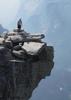
We continued to the Lower Yellowstone Falls overlook, along a trail which descended along 8 switchbacks to a great view of the Lower Falls. We then went back up to the North Rim Trail and followed it to the end, past several other overlooks, to Inspiration Point, which provided great views of the canyon, both upstream and downstream. There were some beautiful and remarkable views of the canyon along the way. We then turned around and headed back, dodging tourists along the way.

Overall, this is definitely worth the experience. It is an easy trail that provides great views of the canyon and falls. However, it generally runs parallel to the road, and passes across 5 parking lots. It is a packed dirt trail between the parking lots, but becomes paved and crowded with tourists at each lot. At each parking lot, there is an overlook of the canyon and/or falls. There are moderate-grade paved descents to each of the falls, which make up most of the AEG along this route. There are better views of the canyon along the trail in between the overlooks. All 3 falls are incredible. Crystal Falls itself is amazing, but it is dwarfed by the size and power of the Upper and Lower Falls. The pictures don't even begin to show the incredible power, volume, and ferocity of these falls.
wildflower observationwildflower observationwildflower observationwildflower observationwildflower observation
Wildflowers Observation Light

water 1 out of 5water 2 out of 5water 3 out of 5water less than max Crystal Falls Medium flow Medium flow

water 1 out of 5water 2 out of 5water 3 out of 5water 4 out of 5 Lower Falls of the Yellowstone River Heavy flow Heavy flow

water 1 out of 5water 2 out of 5water 3 out of 5water 4 out of 5 Upper Falls of the Yellowstone River Heavy flow Heavy flow
  6 archives
Aug 26 2021
avatar

 Guides 16
 Routes 81
 Photos 1,269
 Triplogs 1,145

51 male
 Joined Apr 30 2008
 Tucson, AZ
Yellowstone National Park, WY 
Yellowstone National Park, WY
 
Hiking avatar Aug 26 2021
azdesertfatherTriplogs 1,145
Hiking15.83 Miles 880 AEG
Hiking15.83 Miles
880 ft AEG
 no routesno photosets
1st trip
Spent Aug. 26-27 exploring Yellowstone. Saw pretty much everything in the loop, coming in and out of the south and west entrances.
_____________________
"I went to the woods because I wished to live deliberately, to front only the essential facts of life, and see if I could not learn what it had to teach, and not, when I came to die, discover that I had not lived." — Henry David Thoreau
 
Aug 07 2018
avatar

 Guides 10
 Triplogs 432

63 male
 Joined Feb 25 2002
 Scottsdale
Lower Yellowstone FallsYellowstone, WY
Yellowstone, WY
Hiking avatar Aug 07 2018
TimTriplogs 432
Hiking2.00 Miles 400 AEG
Hiking2.00 Miles      50 Mns   2.40 mph
400 ft AEG
 no routesno photosets
1st trip
Linked   none no linked trail guides
Partners none no partners
I hiked down to the overlook and then a little ways down the North RimTrail.
_____________________
 
Jul 24 2017
avatar

 Guides 94
 Routes 840
 Photos 22,055
 Triplogs 1,993

52 male
 Joined Sep 18 2002
 Tempe, AZ
Touristas in Yellowstone, WY 
Touristas in Yellowstone, WY
 
Hiking avatar Jul 24 2017
chumleyTriplogs 1,993
Hiking5.45 Miles 1,451 AEG
Hiking5.45 Miles   4 Hrs   16 Mns   1.49 mph
1,451 ft AEG      36 Mns Break
 
1st trip
After our adventure on the Teton Crest Trail, I realized I had opted to prepay for a full tank of gas on the rental car. It seemed stupid not to use it, so we set out on a 400-mile driving adventure through the land of Boo Boo and picinic baskets.

Not much to say. Pictures don't do it justice. As much as I dislike touristy spots, they tend to be that way because they are in fact pretty impressive to see. I'd put this place in that category. I bet it would be nice in winter though...
 Geology
 Geology [ checklist ]
[ checklist ]  Mud
_____________________
I'm not sure what my spirit animal is, but I'm confident it has rabies.
 
Jul 24 2017
avatar

 Guides 6
 Routes 183
 Photos 5,612
 Triplogs 1,647

male
 Joined Mar 12 2004
 Scottsdale, AZ
Yellowstone Geysers & Waterfalls, WY 
Yellowstone Geysers & Waterfalls, WY
 
Hiking avatar Jul 24 2017
John9LTriplogs 1,647
Hiking5.45 Miles 1,451 AEG
Hiking5.45 Miles
1,451 ft AEG
 no routesno photosets
1st trip
After spending four days backpacking in the Tetons, we spent a night in a KOA Cabin near Jackson. The next day we woke bright and early and made the long drive into Yellowstone. Our plan is to hike a variety of tourist hikes and then spend the night backpacking to Firehole Falls. We’ll do more tourist stuff the next day and will return to Jackson that evening.

The drive up went fairly well. We followed the main highway and made good time. Along the way we passed a large herd of bison just off the road. We continued on and had to pass through a portion of Teton National Park and then on to Yellowstone. I had an NPS Pass which was very convenient. Once we entered Yellowstone we continued north and headed right for Old Faithful where we picked up our backpacking permit. It was quick and easy getting our permit. The ranger asked if we needed to see the bear safety video and we said no. We spoke about our four days in the Tetons so he was comfortable with us not watching it.

After that we headed over to the general store and then walked over to Old Faithful where the crowds were massing for the eruption. We ended up having to wait 20 minutes for it blow but it was worth it. The geyser launches water into the air roughly 50 feet. We watched for about sixty seconds and I said that’s enough let’s go! So we pulled a Clark Griswold and walked away as Old Faithful continued to erupt. From there we drove over to Biscuit Basin, Grand Prismatic Spring and then Fountain Paint Pot. We made several short stops and did some very light hiking. The geysers and hot springs are amazing and this place is crowded for a reason. We found it best to park on the road and then walk to the attractions. The parking lots were jammed pack especially during the afternoon.

Once it hit mid-afternoon we drove back to the Old Faithful area for lunch. There were only a few options for us. We waited in a very long line at a grille by the general store. The food took a while but it was nice to chill after the go go go the past few days. After lunch we picked up some supplies and headed back to Biscuit Basin where we planned on backpacking to Firehole Falls.

Fast forward to Day 2… We completed our backpack and returned to the rental car parked at Biscuit Basin. We packed up our gear and headed north. Our goal is to complete a loop with short stops along the way and a long stop at The Grand Canyon of Yellowstone. We did a quick drive by along Firehole Lake Drive where we saw several more geysers including White Dome Geyser. From there we continued driving and saw several cool features from the road.

We eventually arrived at the Yellowstone Falls areas and spent an hour eating lunch and doing some shopping. After that we drove over to the very crowded Lower Yellowstone Falls parking area. The area was a zoo and took about ten minutes to secure a parking spot. Once we were parked we spent a couple of hours hiking along the rim and also hiked to the top of the lower falls. The area was very crowded but most people are slow and easy to pass. Once we had our fill we returned to the car and started the return to Jackson Hole. We timed it just right because a moderate rain fell on our drive back.

Our short trip to Yellowstone was over. The geysers and hot springs are amazing and I’m so glad we made the trip up here. Yes it crowded but it’s worth it. Just park off the road and spend the five extra minutes hiking to the start of the attractions. It’s well worth your time and effort.
_____________________
 
Jul 18 2017
avatar

 Guides 37
 Routes 556
 Photos 10,872
 Triplogs 1,052

43 male
 Joined Jan 21 2013
 AZ
The South Rim - Clear Lake Loop - YellowstoneYellowstone, WY
Yellowstone, WY
Hiking avatar Jul 18 2017
FOTGTriplogs 1,052
Hiking6.26 Miles 849 AEG
Hiking6.26 Miles   2 Hrs   35 Mns   2.68 mph
849 ft AEG      15 Mns Break
 
1st trip
Partners none no partners
This was the second stop of my quick tour of Yellowstone.

The falls were great, but the people and pavement detract. I continued down the south rim to some pretty nice overlooks and eventually Ribbon Lake, which I would not really suggest to anyone to be honest. Its a pretty bland, buggy lake and the trail was not even that great. Silver Cord Cascade is hard to see and rather pedestrian as well, so not much going on there either. Clear Lake on the other hand and the rest of the loop were very pleasant. In particular, I liked the geothermal activity along the trail and I thought Clear Lake was a nice destination. The trail ended to some nice meadows and I cut a little corner to shorten the road walk back to my car.
 Named place
 Named place [ checklist ]
[ checklist ]  Clear Lake
_____________________
 
Sep 10 2016
avatar

 Guides 3
 Routes 40
 Photos 47
 Triplogs 60

56 male
 Joined Jul 04 2016
 Phoenix, AZ
Lower Yellowstone FallsYellowstone, WY
Yellowstone, WY
Hiking avatar Sep 10 2016
tdwoodTriplogs 60
Hiking4.20 Miles 857 AEG
Hiking4.20 Miles   1 Hour   56 Mns   2.17 mph
857 ft AEG
 
1st trip
Linked   none no linked trail guides
Partners none no partners
Nice overview of Yellowstone's character: canyons, waterfall, geothermal, opportunities for wildlife sighting. The optional stair climb is a real workout; not for those with weak knees.
_____________________
 
Aug 03 2016
avatar

 Routes 1
 Photos 29,225
 Triplogs 1,447

45 female
 Joined Jan 18 2011
 In the Wild
Lower Yellowstone FallsYellowstone, WY
Yellowstone, WY
Hiking avatar Aug 03 2016
LucyanTriplogs 1,447
Hiking0.50 Miles 308 AEG
Hiking0.50 Miles
308 ft AEG
 no routes
Linked   none no linked trail guides
Partners none no partners
_____________________
 
Jul 25 2016
avatar

 Guides 2
 Routes 9
 Photos 1,486
 Triplogs 944

female
 Joined Apr 28 2010
 Tucson, AZ
Lower Yellowstone FallsYellowstone, WY
Yellowstone, WY
Hiking avatar Jul 25 2016
uphill_junkieTriplogs 944
Hiking3.66 Miles 1,090 AEG
Hiking3.66 Miles   1 Hour   58 Mns   2.01 mph
1,090 ft AEG      9 Mns Break
 no routes
1st trip
Linked   none no linked trail guides
Partners none no partners
Took a hike on the 'trails' along upper and lower Yellowstone Falls. Went past the lower falls and started up some switchbacks, but figured I'd better get back to meet my friend who was waiting for me. Was nice past the upper falls, a LOT less people!
_____________________
No pants!
 
Sep 10 2015
avatar

 Guides 21
 Routes 1,182
 Photos 36,858
 Triplogs 1,570

69 female
 Joined Feb 26 2004
 Phoenix, AZ
Lower Yellowstone FallsYellowstone, WY
Yellowstone, WY
Hiking avatar Sep 10 2015
tibberTriplogs 1,570
Hiking0.70 Miles 308 AEG
Hiking0.70 Miles
308 ft AEG
 no routesno photosets
1st trip
Linked   linked  
Partners none no partners
The last of our hikes for the day and it was a doozie. It was getting very late. We had made an erroneous stop and ended up at the North Rim Overlook at the top of these Falls before realizing the error in our ways. Altho as errors go, this one wasn't too bad at (The Brink of the Lower Falls - at 308 feet Lower Falls is the tallest waterfall in the park. In terms of height alone, it’s more than twice the size of Niagara Falls.). We got back in Snowball for the drive across the bridge to the other side of the canyon (South Rim) for this hike. Needless to say, it's a lot easier driving Rim to Rim for the Yellowstone Canyon than the Grand Canyon.

We were running out of steam after starting our day at Mammoth to Norris to Midway to Upper Geysers and finally to here. We were lucky to find parking for the 34' Snowball for all of these stops. Trust me, that was no easy feat. You'll have to take a moment to check out this page, scroll down to see the picture of how they used to do this hike when Uncle Tom led it. yellowstonepark.com ... ail/ I love this description, "The trip was not for the faint of heart, requiring ropes and rope ladders to offer a measure of safety and prevent guests from tumbling off the steep canyon walls."

It was getting dark now so the light for my filming was not the best. We would only encounter about 1/2 dozen other hikers during this time where we made our way down 300 steel steps (500 feet elevation loss) three quarters the way to the bottom of the canyon while listening to the roar of the Falls get louder and louder and louder. There is another viewpoint you can go out to before continuing down but we were already running behind. There are a couple of photogenic stops along the way but once you reach the viewing platform, The Lower Falls up close and personal is such a sight :y: . We lingered a bit before heading back up the 328 steps pulling on the rail to get us up a little easier.

Before you know it, you're almost to an area where you can see daylight again. It was a fun experience; I highly recommend it. We still had to make our way to our campsite for the nite at Fishing Bridge. But first we made one more stop at the Mud Volcano area which was pretty cool. We did notice on our drive when we cut across on the Norris Road that there was smoke in the distance and that indeed would be a fire but not a bad one. We enjoyed our visit at the Mud Volcano (not very active caldron) that included Dragon's Mouth (turbulent hot spring with a cavernous mouth. Water sloshes rhythmically in and out of the cavern) and Black Dragon's Caldron (This thermal feature did not exist before the winter of 1947-1948, and it was first discovered on June 10,1948.)

My videos include pictures:
Drive from Upper Geyser to Brink of Upper Yellowstone Falls https://youtu.be/A0 ... HQ4E
Uncle Tom's hike https://youtu.be/wm ... mOn0
South Rim to Mud Volcano https://youtu.be/-P ... pQys
_____________________
For me, sometimes it's just as much about the journey as the destination.
Oh, and once in awhile, don't forget to look back at the trail you've traveled.
  1 archive
Jul 28 2015
avatar

 Photos 99
 Triplogs 872

male
 Joined Mar 18 2012
 Goodyear, AZ
Lower Yellowstone FallsYellowstone, WY
Yellowstone, WY
Hiking avatar Jul 28 2015
MikeSTriplogs 872
Hiking2.40 Miles 460 AEG
Hiking2.40 Miles   1 Hour   5 Mns   2.22 mph
460 ft AEG
 no routesno photosets
1st trip
Linked   none no linked trail guides
Partners none no partners
Hike upper and lower falls with kids. Fun waterfalls.
_____________________
Subscribe to my adventure videos at: [ youtube video ]

Follow my adventures on Instagram at: adventures_az
 
Jun 24 2015
avatar

 Guides 5
 Routes 29
 Photos 605
 Triplogs 880

55 male
 Joined Mar 05 2011
 Pocatello, ID
Lower Yellowstone FallsYellowstone, WY
Yellowstone, WY
Hiking avatar Jun 24 2015
WoodsnativeTriplogs 880
Hiking1.50 Miles 308 AEG
Hiking1.50 Miles
308 ft AEG
 no routesno photosets
1st trip
Linked   none no linked trail guides
Partners none no partners
_____________________
If you don't run, you rust.
-T. Petty
 
Aug 14 2013
avatar

 Guides 177
 Routes 249
 Photos 10,213
 Triplogs 2,215

74 male
 Joined Feb 12 2002
 Gold Canyon, AZ
Lower Yellowstone FallsYellowstone, WY
Yellowstone, WY
Hiking avatar Aug 14 2013
AZLOT69Triplogs 2,215
Hiking3.70 Miles 624 AEG
Hiking3.70 Miles
624 ft AEG
 no routesno photosets
1st trip
Linked   none no linked trail guides
Partners none no partners
Took in the falls, upper and lower and the north rim trail to some other viewpoints of Yellowstone canyon.
_____________________
It's best for a man to remain silent and be thought a fool, than to open his mouth and remove all doubt.
--Mark Twain
 
Jul 11 2013
avatar

 Routes 1
 Photos 29,225
 Triplogs 1,447

45 female
 Joined Jan 18 2011
 In the Wild
Lower Yellowstone FallsYellowstone, WY
Yellowstone, WY
Hiking avatar Jul 11 2013
LucyanTriplogs 1,447
Hiking0.50 Miles 308 AEG
Hiking0.50 Miles      30 Mns   1.00 mph
308 ft AEG
 no routes
Linked   none no linked trail guides
Partners none no partners
_____________________
 
Aug 01 2011
avatar

 Guides 13
 Routes 100
 Photos 1,794
 Triplogs 372

51 male
 Joined Jul 27 2011
 Mesa AZ
Lower Yellowstone FallsYellowstone, WY
Yellowstone, WY
Hiking avatar Aug 01 2011
BEEBEETriplogs 372
Hiking0.50 Miles 308 AEG
Hiking0.50 Miles   1 Hour      0.50 mph
308 ft AEG
 no routes
1st trip
Linked   none no linked trail guides
Partners none no partners
After a short walk down the switchbacks I was rewarded with a view of the upper and lower falls Yellowstone is truly and amazing place
_____________________
"I hope we have once again reminded people that man is not free unless government is limited. There's a clear cause and effect here that is as neat and predictable as a law of physics: as government expands, liberty contracts."
 
average hiking speed 1.91 mph

WARNING! Hiking and outdoor related sports can be dangerous. Be responsible and prepare for the trip. Study the area you are entering and plan accordingly. Dress for the current and unexpected weather changes. Take plenty of water. Never go alone. Make an itinerary with your plan(s), route(s), destination(s) and expected return time. Give your itinerary to trusted family and/or friends.

helpcommentissue

end of page marker