|
| | | |
| |
|
| Hiking | 9.40 Miles |
1,600 AEG |
| | Hiking | 9.40 Miles | | | |
| 1,600 ft AEG | | | | |
|
|
| |
| Partners |
|
none
[ show ]
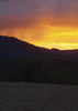
| no partners | | Our goal was to put together a 10 mile hike by parking near the 260 and using the Derrick Spur Trail to join up with the Derrick -Horton Loop. We decided to go counter-clockwise and do the dry and sunny Derrick Trail first and then enjoy the water and shade for the return.
Things started off in less than stellar fashion, as we found the Spur trail to be in poor shape. The trail did not seem to match the topo maps, had very little use, and was scarcely visible under pine needles and leaves. On top of that, there was an unusual amount of dead branches on the trail, from every type of bush. My first impression was that someone had tried to clear the trail but had done a poor job of tossing the cuttings aside. But there was so much debri that my second thought was that someone had tried to cover the trail. As we wandered on and off trail, we realized that the whole hillside had been thinned. There was evidence that a crew had come through and had cut back all the bushes to about 4 inches in height. The result was a hillside with fresh green growth, but intermixed with dead branches. This was particularly annoying when catsclaw was involved. As I carefully stepped around the living catsclaw (easy to see), I often stepped into the dead catsclaw (much harder to see). Eventually we gave up on tracing the trail and just climbed upward through the clearest path. We followed the ridge toward the Derrick Trail, which was a welcome sight.
The Derrick Trail was wide and rocky and easy to follow. The main highlights were the size of the trunks on some very large Alligator Junipers and some impressively tall Manzanita bushes.
The Highline Trail was an improvement over the previous two sections. However, I couldn't help but wonder why the trail has so many up and down sections instead of staying on a more even elevation. Just before reaching Horton Springs, we came upon the East Fork which was dry. That was disappointing, to our stomachs mainly, because it was past lunchtime.
Eventually after one more hill we made it to the springs where we had lunch and got wet. The water was icy so we didn't stay in long, although a few of our group started a head-dunking contest of sorts. The springs did not disappoint and are definitely worth a return trip. Overall, our day improved from beginning to end, and by doing the hard part first, we were all happy to say that it was a good hike. |
| _____________________
If you don't run, you rust.
-T. Petty |
| | |
|
|
|
 Route Editor