|
| | | |
| |
|
| Hiking | 10.00 Miles |
|
| | Hiking | 10.00 Miles | 7 Hrs | | 1.43 mph |
| | | |
| |
| Linked |
|
none
[ show ]
| no linked trail guides |
| Partners |
|
[ show ]
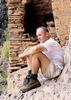
| partners | | Well, I've gotta hand it to my hiking buddy Johnnie, he keeps dragging me to awesome hikes throughout Arizona, in fact, Labor Day weekend 2010, we're doing Keet Seel, stay tuned for picts and triplog...
This time around, we were playing Christopher Columbus... we were looking for passage to Devil's Chasm Ruins from the west. We had scouted the area a month before and decided we would love to get an east looking upper vista view of the Devil's Chasm Ruins. So after much GPS orienteering, and map viewing, we were sure which canyon was which and we decided the best route would be to veer off from Moody Point trail and head to the edge of the Canyon...but I'm getting ahead of myself.
The forest service site:
http://www.fs.fed.us/r3/tonto/wildernes ... ndex.shtml
has a nice interactive map that shows the various trails and their numbers and names, although the descriptions are a bit light, this area is rugged but awesome for hiking!
We spent the night @ Reynolds Creek Group campground with several of our Chandler-Gilbert YMCA Adventure Princess friends and headed out for Workman Creek at 8:00a.
We arrived @ the Murphy Ranch gate and the TrailHead for Trail 141 at approximately 8:45a, loaded up and started our hike @ 9:00a whereupon we headed downhill, dropping about 1,000 feet in a mile and a half, at which point we ended up at the junction of Trails 139,140 and 141. We headed to the right toward Hunt spring. The trail is relatively level hiking, and fairly easy to follow, although it did not appear to be very well traveled of late, although that could be due to the abundance of plant growth.
After another mile and a half we hit another junction of trails, this junction was that of the "Main Moody Point trail", ie the trail that starts at the Moody Point Trailhead, right off FR487a, near the ranger house, and the Rim Trail Tr 139 I believe. The sign at this junction was deceptive in that it indicated it was a mere 1 mile hike to the Moody point trailhead, we liked that as we had already traveled over 2 1/2 miles to reach the current point so we figured on the way back we would hit the Moody point trailhead and be on a level road for hiking back to the truck...but more on that later. We continued to the left heading toward Moody point.
We paused at the "head" to what we convinced ourselves was Devils Chasm Canyon, to see if we could spot "the ruins" lo and behold, using my Nikon 10x36 binos, I spied some ruins, although Johnnie's recall was better than mine as he pointed out that was not the "famous Devils Chasm Ruins Main House" that we had hiked to almost exactly 1 year ago...ah rightly so, but ruins none the less...we were on the right trail.
After about a mile "DevilsSideTr" we veered off trail to the north in hopes of sighting Devils Chasm, but alas the pronounced spire outcropping about 100yds. to the west of the Devil's Chasm main house blocked our view.
We traveled eastward another mile or so and again veered off trail to our left "DevilSidetr2", or North for those who are following this. We weren't actually shooting in the dark, I had waypoints of the Devils Chasm Ruins in my GPS from our previous hike there last September, and whenever the ruins waypoint appeared 90 degrees to my left, we determined that would be a good time to veer off trail to our left. We actually traveled a bit further, east as we knew we had to get past that rock spire for any chance of viewing the ruins. Note there appears to be a "peninsula like mountain between Moody point and the cliff face that the Devil's Chasm ruins are located on, so be sure you go as far east as you can on "Moody Point Mountain" before heading north.
On this second attempt we were successful. We scrambled down the side of Moody Pt about 1/4 mile and were rewarded with an awesome inspiring view of the Devil's Chasm Ruin Main House. During lunch and we actually sighted another ruin about 300 yds east of the Devil's Chasm Main House ruin. We had not remembered this being mentioned in any literature or sights and we thought we might have run across something new, upon our return we did some more searching and found mention of this second ruin several places, from our vantage point and using binoculars we could see timbers and fairly in tact walls, definitely something to explore next time we travel to Devil's Chasm Ruins Main house. We enjoyed the impressive views of the ruins and headed back at about 1:00p
Upon reaching the junction of the Moody Point trail and the Rim Trail we were seduced by what we thought was going to be a 1 mile hike to the road and then back to the truck, we figured we'd be to the truck by 2:30p at the latest. The trail was awesome meandering thru fern covered valleys and knolls, the ferns being knee-high to waist high, which made the trail all but invisible, but we weren't concerned we were @ 7,000 feet and there was a light sprinkle. Well soon enough the sprinkle turned into a downpour. In fact, it poured so hard, we gave up our manly "we don't need no stinkin' protection" attitude and donned our rain ponchos. I had loaded up my new packback with lost of extraneous equipment as I was using this as a shakedown for the upcoming Keet Seel hike. The rain continued for about an hour, I was reminded of the scene from Jurassic Park, where Denis Nedry the computer nerd played by Wayne Knight was taking the dinosaur eggs in the shaving cream can to the dock to sell them and it was muddy and he ran the jeep off the road and the tiny dinosaurs were spitting at him and he kept wiping his eyes and couldn't see....yep that was us, all that was missing was the vicious little dinosaurs...and in fact, mother nature did not disappoint, as she threw a near catastrophic wrench at us, well me anyway...I was in the lead and we were at about 6,800 feet, slip-sliding up a 30 degree incline, walking thru knee-high ferns that made the trail all but invisible, when all of a sudden Johnnie yelled for me to stop, at that point I heard what I thought were grasshoppers or cicadas...not so my friends...apparently unbeknownst to me I had just been "struck at" by a very agitated 4 foot long Arizona Black Rattlesnake, Johnnie had seen the entire scene unfold as he was about 5 feet behind me and he had an angled viewing vantage thru the ferns, the snake was about a foot off the trail and I startled it as I went by and he attempted to exact a toll, fortunately he missed and retreated to a log about 2 feet off the trail. He was very distressed as he was rattling away for a good 10 minutes...whew dodged a bullet on that one as my brother in law, the cop, would have said! Sometimes its better to be lucky than good! That would have made for a miserable time, as at that point in time we were about 3 1/2 miles from the truck and 50 miles and 2 1/2 hours from Globe. See picture #8 from Johnnie's latest photoset for Devil's Chasm to see this impressive specimen of Arizona wildlife. We thought we were too high in elevation for rattlesnakes...plus it was cold and raining, not in my mind prime rattlesnake weather or locale. Well we were quite careful for the remainder of our hike which turned out to be not 1 mile like the marker indicated but closer to 2 miles and by then we had traveled pretty far west from the truck so we still had another 2 miles to hike to get to the truck after we reached the Moody Point trailhead...all in all about a 10 mile that took us 7 hrs. total time, but figure 2 hrs. for photo ops. The hike included a total vertical elevation change of probably 3,000 feet. Beautiful scenery, awesome adrenalin packed adventure! Very nice trail...but watch out for snakes. In 40 years of hiking in the southwest: Arizona and New Mexico, that is the closest I have come to being a snake bite statistic.
Now that we've seen the ruins from above, our next plan is to go to the start of Devil's Chasm Canyon and see if there is anyway to get down to the ruins from the west, we also might try hiking up Devil's Chasm Canyon past the ruins and see how far we can get...ah not enough weekends in a year! |
| _____________________
| | |
|
|
|
 Route Editor


 for driving and JJ3 for Dinner in Globe...


 Thanks Joel for driving and John for dinner. You guys rock!
 The weather was perfect and the scenery was awesome! The hiking in some spots was challenging enough to get and keep my attention.


 Oh and it is very obvious that Bruce and Joe spend way too much time together.


