username
X
password
register
for free!
help
ArticlesGuidesRoutes
 
Photosets
 
 Comments
triplogs   photosets   labels comments more
Peak 4618 - Fraser Benchmark - 8 members in 18 triplogs have rated this an average 4.1 ( 1 to 5 best )
18 triplogs
login for filter options
Apr 07 2024
avatar

 Guides 25
 Routes 376
 Photos 5,897
 Triplogs 346

40 male
 Joined Mar 01 2018
 Chandler, AZ
Peak 4618 - Fraser BenchmarkGlobe, AZ
Globe, AZ
Hiking avatar Apr 07 2024
John10sTriplogs 346
Hiking9.26 Miles 2,394 AEG
Hiking9.26 Miles   8 Hrs   47 Mns   1.54 mph
2,394 ft AEG   2 Hrs   46 Mns Break
 
1st trip
Partners partners
ishamod
Route Scout Route Recorded  on Route Scout | Pop | Map | Popup | MapDEX
I'd had Peak 4618 on my radar for a while, and it worked out for ishamod to join me this weekend. We started at a pullout along FR 172 to avoid the rougher 4x4 roads that would've brought us to Millsite Canyon Trail. After passing a campsite with a few people and vehicles right away, there was plenty of solitude for the rest of the day. We had to wade through a lot of wet knee/thigh-high grass that soaked our boots as we made our way into the creek bed that we followed north toward Quail Spring where the official route starts for 4618. Once we were on #237, the route was very easy to follow, and it's a beautiful area with the creek, saguaros, and cliffs.

We didn't follow the official route and opted instead for the route that triplogs generally agree is the better approach and passes the arches. We left the two-track just north of Millsite Spring to start the climb toward the peak. There are a few long sections of stacked-rock walls in that area that extend up the sides of the canyon on either side...probably built for livestock or to divert run-off? We passed one of the walls as we continued up a ridge--it was a rocky, brushy route but not too many thorns or overly difficult, just slow going at times.

The route leveled off briefly and then climbed again as the ridge narrowed and we worked our way up and around to the first arch, which nicely frames the views to the south. We briefly looked at Fraser Arch on our way up but didn't have the best vantage point, so we saved that for the way down and headed for the summit, which offers great views of a lot of the western Superstition landmarks and a unique vantagepoint looking down on Buzzard's Roost. The summit register had entries going back to 2004 and a lot of HAZ entries from the past 10 years. The peak gets more visitors than I would've expected, but we were the first to sign in 2024.

[ youtube video ]

After a lunch break at the top, we started down and reached a better viewpoint directly across from Fraser Arch, then ishamod wanted to explore around a big cave/alcove on the southwest face of the mountain that was visible on the way up. I waited below while he climbed up and explored...it was obviously empty and looked like a lot of effort with little to no payoff, but he as able to the base of the cave for a better look inside and to satisfy his curiosity.

We followed the same route back down the rocky slopes and reconnected with the road. We saw another rock wall farther south along the road, and an ATV passed us near Campsite Spring. The tall grasses were dry on the hike out, so we didn't have to re-soak our boots, which was nice. Before leaving the creek bed, I spotted a large blueish lizard carrying a smaller, white lizard in its mouth. It ran toward me a several times, which I didn't expect. As I backed off, I got a picture--not a great one--but I'm interested to see if anyone can identify the blue lizard [ photo ] .

It was a fun hike and great to check this one off the list before it gets too got. The weather was just about perfect today, wildflowers were blooming, and the views in this part of the Superstitions are always spectacular. Other than the campers and the ATVers at the end, we didn't see anyone all day.
 Flora
 Flora [ checklist ]
[ checklist ]  Desert Mariposa
  1 archive
Dec 25 2023
avatar

 Guides 99
 Routes 1,484
 Photos 16,072
 Triplogs 1,374

male
 Joined Jan 07 2017
 Fountain Hills,
Peak 4618 - Fraser BenchmarkGlobe, AZ
Globe, AZ
Hiking avatar Dec 25 2023
DixieFlyerTriplogs 1,374
Hiking8.17 Miles 2,411 AEG
Hiking8.17 Miles   7 Hrs   3 Mns   1.41 mph
2,411 ft AEG   1 Hour   15 Mns Break
 
1st trip
Partners partners
SecretMtnLover
Route Scout Route Recorded  on Route Scout | Pop | Map | Popup | MapDEX
I did this hike a little over a year ago and decided to do it again. Some of the slopes were steeper than I remembered being.

My route was basically the same as I did last time.

We stopped by both arches, although we viewed the larger large from the viewpoint. It would take some work to get into that one!

Views are nice at the summit on this hike so you get rewarded for your efforts.

This one is a good hike, but I think doing it 2X will be enough for me!
 Flora
 Flora [ checklist ]
[ checklist ]  Common Cattail
 Geology
 Geology [ checklist ]
[ checklist ]  Natural Arch
 Culture
 Culture [ checklist ]
[ checklist ]  Benchmark
 Meteorology
 Meteorology [ checklist ]
[ checklist ]  Autumn - Color Foliage

water 1 out of 5water less than maxwater less than maxwater less than max Rattlesnake Spring Dripping Dripping
There was some filterable water in the spring.
_____________________
Civilization is a nice place to visit but I wouldn't want to live there
 
Nov 30 2022
avatar

 Guides 99
 Routes 1,484
 Photos 16,072
 Triplogs 1,374

male
 Joined Jan 07 2017
 Fountain Hills,
Down Goes Fraser, AZ 
Down Goes Fraser, AZ
 
Hiking avatar Nov 30 2022
DixieFlyerTriplogs 1,374
Hiking8.37 Miles 2,272 AEG
Hiking8.37 Miles   6 Hrs   50 Mns   1.46 mph
2,272 ft AEG   1 Hour   6 Mns Break
 
1st trip
Partners partners
SecretMtnLover
Route Scout Route Recorded  on Route Scout | Pop | Map | Popup | MapDEX
This hike was to the Fraser Benchmark, which is an infrequently hiked peak in the western Supes.

To give credit where credit is due, my name for this hike comes from a triplog comment that @AZLumberjack made. The phrase, of course, comes from this: [ youtube video ]

I parked off of FR 172, near Peacock Canyon.

We started off going through a wash and then took a forest road over to FR 1900 and made our way through Millsite Canyon. We continued onward to near Millsite Spring, where we went off-trail mostly to the north to get to the summit.

Millsite Canyon was nice, and we saw 3 javelina in the canyon on the way back. I think that these were the first javelina that I have seen in the Supes. There was some cool geology to see along the way.

The first 500 feet or so of the off-trail ascent was a bit tedious through some somewhat tall vegetation -- thankfully it did not have a thorns or stickers. Once past this section, the rest of the ascent was straight forward and was enjoyable I thought. We passed an arch along the way, and we took a detour to go to the viewpoint for the Fraser Arch before going to the summit.

There were some really nice 360 degree views at the summit, so we hung out there for a bit and ate lunch.

We returned the same way that we can up, except that we didn't go back to the Fraser Arch viewpoint on the descent.

The last bit of the descent down to Millsite Spring was tedious with some loose footing, and was the only part of the hike that I did not enjoy.

This hike turned out to be easier than I expected, and it turned out to be a very enjoyable hike!
_____________________
Civilization is a nice place to visit but I wouldn't want to live there
 
Dec 06 2020
avatar

 Guides 2
 Routes 267
 Photos 9,816
 Triplogs 402

62 male
 Joined Dec 02 2014
 Mesa, AZ
Peak 4618 - Fraser BenchmarkGlobe, AZ
Globe, AZ
Hiking avatar Dec 06 2020
adillingTriplogs 402
Hiking5.12 Miles 2,255 AEG
Hiking5.12 Miles   6 Hrs   30 Mns   0.96 mph
2,255 ft AEG   1 Hour   9 Mns Break
 
1st trip
Linked   none no linked trail guides
Partners none no partners
Route Scout Route Recorded  on Route Scout | Pop | Map | Popup | MapDEX
This one has been on my radar for a long time. I have ventured down FS1900 a few times over the years and I really love the area. I wish I would have gone last year to see this one as the Sawtooth Fire just roasted this amazing area.

I left later than I wanted but, I made it as far down FS1900 as far as I could and parked. Off I went. The fire damages started as soon as I got on the road. Mostly the eastern side at first, then it was both sides the further I went it. Some areas were spared or got less damage and others have been altered beyond repair I’m afraid.

I arrived at the base of the peak and started up. From other triplogs I read before heading up here, I was expecting a rough and steep hike to the first saddle. The fire made it to this area, so the first part was in black soot and roasted cacti. It was steep and loaded with loose rocks.

The second section was a little rock hopping and the steady climb up along the tuff ridge. The fire made it here as well. Most of the area below the tuff layer was damaged.

I made it to Fraser Arch and was happy for the break. I had a little snack and explored the area a little. Getting to the arch was possible, but I have a strong desire to live, so I skipped going over to there.

After a little rest, I started up the chute and made it to the summit. I saw some familiar names on the faded registry. The views up top did not disappoint. The views of the western supes were amazing. It was worth the effort to get up there. A little rest and off I went for the decent.

I missed the “bonus” arch on the way up, but I found it one the way down. That area was loaded with some cool erosion.

I knew this would be a steep one and it’s been a while since I have really challenged myself, mostly doing short ones during the COVID times. I was a moving at a snail pace going up and going down. I stopped a lot to take pictures and explore, catch my breath, and give my poor old aching knees a break. But, I made it up and down, so that’s what matters.
 Geology
 Geology [ checklist ]
[ checklist ]  Natural Arch
_____________________
"Jobs fill your pockets, adventures fill your soul."

instagram: @andydilling
 
Feb 07 2019
avatar

 Routes 16
 Photos 628
 Triplogs 45

72 male
 Joined Apr 03 2011
 Mesa, Az
Peak 4618 - Fraser BenchmarkGlobe, AZ
Globe, AZ
Hiking avatar Feb 07 2019
gmaclachlanTriplogs 45
Hiking8.60 Miles 2,200 AEG
Hiking8.60 Miles
2,200 ft AEG
 
1st trip
Linked   none no linked trail guides
Partners none no partners
Started this hike from what I think is Mil-site trail-Head on Rogers Trough road. The objective was photo's of the arch and maybe visiting the top if we have the time and energy. Went north in wash and connected with FS1900. Walking the road from this location wasn't a big deal, I think we (four of us)were starting up the hill in about an hour. Made it to the top and signed in to the register. Attached a track, that's usually better than my description.:-). Quite a "puzzle" to get up there!!
 Fauna
 Fauna [ checklist ]
[ checklist ]  Bighorn Sheep
 Named place
 Named place [ checklist ]
[ checklist ]  Fraser Arch - Millsite Canyon
_____________________
 
Nov 19 2016
avatar

 Guides 2
 Routes 251
 Photos 4,593
 Triplogs 3,212

63 male
 Joined Feb 26 2008
 Scottsdale, AZ
Peak 4618 - Fraser BenchmarkGlobe, AZ
Globe, AZ
Hiking avatar Nov 19 2016
BobPTriplogs 3,212
Hiking6.30 Miles 2,200 AEG
Hiking6.30 Miles
2,200 ft AEG
 no routesno photosets
1st trip
Linked   none no linked trail guides
Partners partners
Tortoise_Hiker
wallyfrack
Great time with Wally and Denny.

I've been waiting 5 years to post this
youtube.com/watch?v ... 2-oU
_____________________
https://www.seeitourway.org
Always pronounce Egeszsegedre properly......
If you like this triplog you must be a friend of BrunoP
 
Nov 19 2016
avatar

 Routes 93
 Photos 7,758
 Triplogs 1,691

64 male
 Joined Mar 11 2003
 AZ
Peak 4618 - Fraser BenchmarkGlobe, AZ
Globe, AZ
Hiking avatar Nov 19 2016
wallyfrackTriplogs 1,691
Hiking7.20 Miles 2,173 AEG
Hiking7.20 Miles   4 Hrs   47 Mns   1.51 mph
2,173 ft AEG
 no routes
1st trip
Linked   none no linked trail guides
Partners partners
BobP
Tortoise_Hiker
When looking at this hike it seemed that FR 1900 was the direct route (drive) and only about 3 miles so why not? If you don't like wild rides, take FR 172 to Millsite Canyon and find a parking spot. The hike up Millsite Canyon to Peacock Canyon would add a mile each way but may be worth it. We drove an extra half mile down FR 1900 because it's so much fun. :lol: The hike down the old jeep road has some nice views and is easier than the off trail. We followed the official route for most of the way and it wasn't bad if you stay on it. Eagle Spring has an interesting spring box and is worth a look. The views from the summit are nice and gave a good look down Fraser Canyon. It was nice to get out on the trail with Bob & Denny again. Thanks for the adventure guys. :D
 Culture
 Culture [ checklist ]
[ checklist ]  Benchmark
_____________________
  1 archive
Nov 19 2016
avatar

 Guides 1
 Routes 148
 Photos 9,924
 Triplogs 3,652

63 male
 Joined Apr 02 2005
 Mesa, AZ
Peak 4618 - Fraser BenchmarkGlobe, AZ
Globe, AZ
Hiking avatar Nov 19 2016
Tortoise_HikerTriplogs 3,652
Hiking7.20 Miles 2,173 AEG
Hiking7.20 Miles   4 Hrs   47 Mns   1.51 mph
2,173 ft AEG
 no routes
1st trip
Linked   linked  
Partners partners
BobP
wallyfrack
One time with Wally (and Bob).... :o . Sometimes you just want to hike with kids your own age... :D . A few weeks a year the 3 of us are the same age so I thought it would be fun to get out on a hike. Bob suggested this one. It was the company for me but it was a good hike too. The drive in was a bonus as Wally showed his four wheeling skills. I wore shorts by mistake so they rerouted a little to keep me out of the catsclaw for the most part. Neat area. Great views, company, and conversation! Topped it off with burgers at Dirtwater Springs in AJ (thanks Beverly). It was great to catch up, my friends. Like Haz, :yr: .
 Named place
 Named place [ checklist ]
[ checklist ]  Fraser Peak 4618
_____________________
Tortoise Hiking. Stop and smell the Petrichor.
 
Jan 24 2016
avatar

 Guides 21
 Routes 1,182
 Photos 36,858
 Triplogs 1,570

69 female
 Joined Feb 26 2004
 Phoenix, AZ
Peak 4618 - Fraser BenchmarkGlobe, AZ
Globe, AZ
Hiking avatar Jan 24 2016
tibberTriplogs 1,570
Hiking6.28 Miles 2,109 AEG
Hiking6.28 Miles   6 Hrs   37 Mns   1.86 mph
2,109 ft AEG   3 Hrs   14 Mns Break
 
1st trip
Linked   none no linked trail guides
Partners partners
FOTG
Oregon_Hiker
trekkin_gecko
I know this is a long triplog. I think sometimes I should wait a week or two and I'll remember much less details but nonetheless, just because I wrote it doesn't mean you have to read it. I just want to be able to look back and remember the hike fondly...or not. Grasshopper added me as an addition to some preliminary Rx emails thinking I might like to tag along. I've always liked this area based on pics I've seen posted so I decided to do the best I could... and I almost stopped about 1/2 way up but powered thru somehow after a little whining to Larry as we were soon left WAY behind; but that was okay with us so we could enjoy the trip and "tibbermode" to our hearts content.

Larry put together the final touches for the trip and offered to get us out there on this terribly rough road. Lee and his crew will attest to how pretty bad it was getting there after driving on the 1900; not a road to be taken lightly. After the meet and greet with people and dogs, we geared up. It was a little chilly as we walked the road to our waypoint area to head straight up and then over to the Overlook. There's lots of running water and green grass alongside the road walk. Once we came out into the sunlight, the temp was just right.

Oh that's a long way up with no trail and so much brush and cactus and other prickly things that make you say to yourself, "ouch". Our first destination was the rock wall fence where we could see the barbed wire fence had also once attached to it.... probably covering the area from the other side of the road that was not walled. It really is an impressive structure and has held up quite well after all these years.

We continued up trying to find the path of least resistance as there was so much ground cover. There were only short moments of a clear route to traverse. Obviously there wasn't going to be much moviemaking heading up this monster. We trudged and trudged our way : rambo : stopping occasionally to check out the incredible view. We came to this section of several rock outcroppings that you stay fairly close to as there is a cliff area above a deep wash that prevents you from going any other way. It's amazing how many of those rock outcroppings there were as you'd get around one and there was another. But at least it wasn't as steep and the footing was a little better.

The last we saw of Kelly, Jackie, Lee and Blanco was above a cliff face. We would not go up quite that way as we found a ledge to sneak around on before we found our up and out of this lower section area to at least now be up on the next tier. So it took us an 1:45 from the start of the bushwhack and 1200 feet to this level based on trying to interpret my route. I was thinking at this point that I bit off more than I could chew and maybe I should throw in the towel :-({|= . I think I mentioned it to Larry and he gave me a one or two line pep talk and up, around, through and over and down and up again we continued to go. Once we got up on this tier, the hike got a whole lot nicer. As we started up this ramp-like area, when we looked back we started to see Weavers Needle and then Miners Needle and more of the Superstitions.

We still couldn't see where we would top out at but we could see a bit of a saddle that looked like it might be the viewpoint. But before that, we saw an Arch and as you go past it and look back, it has a rather nice opening. We didn't explore it however like the first group; glad they did and got some great pics! We could now see the Peak clearly and saw that Kelly was on top. We yelled up but with the wind, they didn't hear us plus it was pretty far away. So we continued on. Surveying the area I was more inclined to head to a ridge saddle to the right for what I thot was going to be the best view of the Arch but Larry headed us upward and as we passed between some boulders and suddenly THERE it was. We made it :y: .

We could hear the other group's voices so I would yell up to let them know we were down here. I sent a text to Kelly to tell her we were at the Arch. When I got home I saw she sent a text at 10:45, "Where are you? Are you at the overlook yet?" We were at the overlook around 11, so "close". Larry sent a text and spot to Grasshopper letting him know we made it. Hank was our cheerleader. He had texted the nite before offering support. I had texted back, "I know it won't be easy but it will be pretty". Hank texted back, "The adrenaline rush alone will get you there ;) ". I thot about that adrenaline several times up to this point :lol: .

The rest of the group finally found us and while I wanted to have my snack break looking at the Arch, Lee decided we should come up to their viewpoint so we did. The break wasn't too long as we decided we might as well hit the Peak and Kelly was willing to take us up even though she had just been there. We were worried that we wouldn't have enough time so that she could make it back in time for kick-off but she thot we would be okay. We said our "adieus" to the dogs, Jackie and Lee and they went down the way they came up. I think that was a smart move and certainly would advise that as the better return route rather than the way we went.

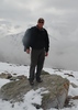
But now let's get to the Peak so up and up we went to reach a bit of a saddle. Kelly says it's not too long to get up to the Peak so up again we went and up some more. And now this non-peak bagger has another peak under her belt. By the way, it's a beautiful peak that has some geological folding on its side. And of course the views from on top are pretty fabulous to say the least :DANCE: . Such a shame about the haze though but you just gotta look past it to see all of the landmarks including the snowy Pinals, FR172, Teapot Mtn, Byous & Roblas Butte, Picketpost and almost the entirety of the western Superstitions and the Four Peaks. We took a group photo, checked out the Benchmarks and signed the summit register.

From here we headed down the way a group of HAZers including Larry had come up to the Summit almost exactly two years back. So we contoured across heading NW before heading straight down 400 feet in 1/4 mile dodging cactus and looking for good footing. We hear Kelly say Rams, so we look up and there they are, coming our direction. I've got the camera out and start shooting but I need to use my electronic viewfinder and even this little delay caused me to miss a couple good shots but I did manage some. I thot there were 1/2 dozen. Needless to say they were quite the site :D and that's when I told Larry I had given some thot to maybe seeing the sheep today.

But now back to figuring out how we get down; we still have quite a way to go. We continue our traverse over and by some rock outcroppings before Larry decided we needed to be a little lower which meant into the brush. This one area was full of sotol that it almost masked Larry ahead of me. We finally maneuvered our way over to a saddle where Kelly was waiting.

Larry consulted the gps; we now went over this downed barbed-wire fence and would veer right around the deep drainage below us. This, my friends, was not fun at all and it went on quite a ways :yuck: as we contoured the mountainside holding on tight with my feet before we could start to drop down. We see the drainage rock bed below and I think Larry said we could go down there. On this trip, like up, it was STRAIGHT down. We get to the bedrock, enjoy the water and the view only to be told we have to go UP again to get around the spring area that was smothered with brush. OMG! And of course what goes up in this case must come down AGAIN (not that I'm whining :whistle: ).

So after hugging the side of the mountain again, we finally get the word we can head down, STRAIGHT down as the brush was less obnoxious now. And low and behold, we strike cairns that lead you to the really old part of the road. Yep, this was a good thing. We were down now. No more STRAIGHT up or STRAIGHT down, just hit the road Jack. Check out the lyrics for that song and just change "woman" to trail :-({|= . Finally we get to the point where we had started our bushwhack up. It's easy to see because of the rock walls.

It was nice to hike this road walk again because now it was lighter and you could see the scenery better and it wasn't quite so cold. We all enjoyed this part of the stroll back to the vehicle admiring the saguaros, the green grass, the running water and of course the mountains around you. In spite of our longer route back, we made it back to Larry's truck at 3; just as scheduled. We had our beer and some snacks before mounting up for the ride on 1900. GOOD job Larry, that was not an easy road by any means, whew!

It was a spectacular day :D shared with fellow HAZers. 1-27-2016 I'll have the movies up by the weekend. I'm still working on my stuff from Yellowstone which I interrupt to work on the hiking treks.
2-1-16
Road walk, bushwhack to rock fence https://youtu.be/pr ... 3e6U
Bushwhack hike continues to little Fraser-Arch https://youtu.be/F5 ... aDE0
to Overlook, peak, heading down, pictures of RAMS https://youtu.be/VF ... TbGk
continuing down to saddle, contouring mtn, to drainage https://youtu.be/HR ... F0_k
old road to better road walk hike https://youtu.be/w4 ... L8K8

drive, it's a fun one https://youtu.be/Gb ... eVk8
 Geology
 Geology [ checklist ]
[ checklist ]  Chevron Folds
_____________________
For me, sometimes it's just as much about the journey as the destination.
Oh, and once in awhile, don't forget to look back at the trail you've traveled.
  2 archives
Jan 24 2016
avatar

 Guides 9
 Routes 473
 Photos 8,433
 Triplogs 626

79 male
 Joined Dec 07 2010
 Phoenix, AZ
Peak 4618 - Fraser BenchmarkGlobe, AZ
Globe, AZ
Hiking avatar Jan 24 2016
Oregon_HikerTriplogs 626
Hiking6.00 Miles 2,136 AEG
Hiking6.00 Miles   6 Hrs   33 Mns   0.92 mph
2,136 ft AEG
 
Linked   none no linked trail guides
Partners partners
FOTG
tibber
trekkin_gecko
The plan for this hike got started by ssk44 after he spotted an arch on the east side of Fraser Peak from the top of Roblas Butte on Dec 26, 2015. He provided us a proposed route he had plotted on Google Earth which we followed to the arch and ended up also probably being a better route to Fraser Peak than the current official route. Thanks, Eric. There would be five of us on this hike plus three dogs. I was the only one of the group who had been to Fraser Peak before (2 years ago) and unfortunately due to a problem with selective memory I had forgotten a couple of key things. Like how rough the last 1.4 miles of road to the TH at Quail spring can be and that the official track has some sections which are a real pumpkin.

Trekkin Gecko, Tibber and I arrived at the trail head at Quail Spring after having an unexpected (due to my selective memory) opportunity to test the 4x4 capabilities of my FJ and to confirm that its modest suspension lift had been well worth the investment. When we stopped to survey the area for a suitable parking spot, FOTG who had been following us in his Xterra walked up to our car and started whining about the road being so rough that they were going to turn back if we had to drive any further - the dogs had been complaining. Well, that was too bad, but I did feel sorry for the dogs.

The hike starts up Millsite Canyon on an old 4x4 road which we followed for 2 miles before starting the off-trail scramble up the hill side following ssk44's planning track. It was a steep climb with some route finding to avoid all the prickly stuff and to bypass rock outcroppings. FOTG, Jackie, the Gecko and the three dogs soon left Tibber and I behind due to our incessant picture taking and also being considerable slower on the steep hill. The going got a little easier once we topped the initial climb to the ridge line. Finding a small bonus arch along the way was nice and the views were fantastic. We reached a viewpoint directly across a small drainage from Fraser Arch but climbing up to the arch was out of the question. Probably better suited to someone with technical climbing skills and gear. After stopping for a photo shoot, Tibber and I reconnected with the rest of the group just below the summit. By that time they had already been to the arch, summitted Fraser Peak and were on their way back down.

Tibber and I continued on up to Fraser Peak after the break guided by Trekkin Gecko. FOTG, Jackie and the dogs headed back down taking the route they had come up. At the summit we discussed which route to take back to the car. Again my selective memory kicked in and I suggested that the official route back was not as steep though being a little longer. So off we went and had only gone about 200 yards when we discovered that this route had sections that were at least as steep if not steeper than the route we had taken up to the peak. And to make matters worse, descending down the drainage towards Eagle Spring got us into some nasty catclaw that required some re-routing. There was no whining, at least not that I heard (I also have selective hearing), but all agreed that the ssk44 route was definitely a better way to go. There was however a major plus to taking this route. On the way down the ridgeline Trekkin Gecko was about 200 yards ahead of us and out of sight over a small rise when Tibber and I heard her yell. We looked up just in time to see six beautiful large bighorn rams headed our way closely followed by the Gecko. My camera was turned off and by the time I got it fired up the rams were gone but the Gecko got a couple of great photos and hopefully, Tibber did too.

We made it back to the car by our 3:00 pm planned departure time where we enjoyed snacks and cold drinks thanks to Tibber. It had been another beautiful and rewarding day in the Superstitions.
 Flora
 Flora [ checklist ]
[ checklist ]  Saguaro
 Geology
 Geology [ checklist ]
[ checklist ]  Natural Arch
_____________________
  1 archive
Jan 24 2016
avatar

 Guides 10
 Routes 673
 Photos 7,281
 Triplogs 4,660

67 female
 Joined Nov 17 2008
 phoenix, az
Peak 4618 - Fraser BenchmarkGlobe, AZ
Globe, AZ
Hiking avatar Jan 24 2016
trekkin_geckoTriplogs 4,660
Hiking6.53 Miles 2,580 AEG
Hiking6.53 Miles   6 Hrs   30 Mns   1.54 mph
2,580 ft AEG   2 Hrs   16 Mns Break
 
1st trip
Linked   none no linked trail guides
Partners partners
FOTG
Oregon_Hiker
tibber
got an invite from oregon hiker to hike to an overlook of fraser arch
some neat photos from the new year's day hike had put this peak on my radar
rough ride to the starting point
first time hiking with lee, nice to meet jackie, too
fun to have the dogs along
headed out around 8:30
a little chilly at the start, but warm enough once we started ascending
first mile and a half was on an old road
steeper off trail dodging some cactus but with good footing
close to the overlook, we found another arch - very cool bonus
fraser arch was across a drainage, with a pretty stiff climb
there would be no getting closer than the overlook point today
lee, jackie and i headed up to a saddle and then the summit
lee and i checked out another high point to the north
spent a few minutes up there, then went down to find angela and larry
they were across from the arch, and we all agreed that they had to hit the summit, too
after a quick snack break, lee and jackie headed down and the three of us went on up
great views, although a little hazy
this time found the summit register and signed us all in
larry suggested we go down the way that he, randy, beebee and hank had come up before
good travel to the saddle, and a highlight to see several bighorn sheep
got a photo of four big rams
from the saddle down to the road was a little challenging
followed a drainage, but had to stay high most of the time due to sticker bushes
this was not my favorite part
soon enough reached a cairned path, and then hit the old road
easy hiking the rest of the way
angela had refreshments for us all - thank you :)
larry, thanks for including me in this one and for driving
loved it!
a worthy peak, two nice arches, and half a dozen bighorn sheep
great day with good company

p.s. posted a track that goes by the two arches and up to the peak
highly recommend this for an up and back
 Fauna
 Fauna [ checklist ]
[ checklist ]  Bighorn Sheep
 Geology
 Geology [ checklist ]
[ checklist ]  Natural Arch
_____________________
hazhole
  1 archive
Jan 24 2016
avatar

 Guides 37
 Routes 556
 Photos 10,872
 Triplogs 1,052

43 male
 Joined Jan 21 2013
 AZ
Peak 4618 - Fraser BenchmarkGlobe, AZ
Globe, AZ
Hiking avatar Jan 24 2016
FOTGTriplogs 1,052
Hiking6.42 Miles 2,225 AEG
Hiking6.42 Miles   5 Hrs   15 Mns   1.51 mph
2,225 ft AEG   1 Hour    Break
 
1st trip
Linked   none no linked trail guides
Partners partners
Oregon_Hiker
tibber
trekkin_gecko
I got an invite to do this one a while back. This high point was not really on my radar, but I figured it would offer some great views into the Supes and I have always liked knocking out the less traveled summits. Plus it was a chance to finally get out for a hike with trekkin gecko. Originally, there were a few more HAZers on the hike, but I think we lost a few to cancellations. Not to worry though, I augmented their absences with Jackie and three dogs.

A pretty manageable off-trail route. Myself, trekkin gecko, Jackie and the dog pack did the summit together. We hit up the arch view point on the way and uncovered a bonus arch as well. We hung out at the summit for several minutes and then took a nice break with Tibber and Oregon Hiker just below the summit. Tibber fed the dogs an entire bag of beef jerky and then we were on our way. Trekkin headed up for a second summit run with Larry and Angela and we made our way back down to the trail and the Xterra.

A very nice peak and hike overall. Nice to reconnect with some HAZers and add a new one to the list. The flowing creek for most of the way back to the TH made the day for the pups, who endured through a pretty tough one today.
 Geology
 Geology [ checklist ]
[ checklist ]  Natural Arch
 Culture
 Culture [ checklist ]
[ checklist ]  Throwing a Wendy
_____________________
  4 archives
Feb 26 2015
avatar

 Guides 1
 Routes 259
 Photos 10,458
 Triplogs 293

male
 Joined Jan 28 2010
 Fountain Hills,
Peak 4618 - Fraser BenchmarkGlobe, AZ
Globe, AZ
Hiking avatar Feb 26 2015
FLYING_FLIVERTriplogs 293
Hiking6.34 Miles 2,158 AEG
Hiking6.34 Miles   7 Hrs   29 Mns   2.08 mph
2,158 ft AEG   4 Hrs   26 Mns Break
 
1st trip
Linked   none no linked trail guides
Partners none no partners
Background:
Five years ago, I downloaded the datasheet for Fraser Triangulation Station from the NGS (National Geodedic Survey) website, with the plan to hike up Pk 4618 and locate Fraser and its two reference marks. I put it on my ‘List of disks to locate’. Five years later I finally got around to hiking up Pk 4618.

Fraser was monumented atop Pk 4618 in 1938 by the NGS.
I studied the datasheet quite a long time, especially the route the 1938 surveyors used to the top. In 1946, two separate survey groups (one NGS and one USGS) took the same 1938 route to the benchmark. The 1938 route must work.
(A side note - 1966 surveyors used a helicopter to go up (down?) to the benchmark).

Cannondalekid basically used the same 1938 surveyor track also, when he hiked up Pk 4618 a year ago. (another verification that the 1938 route still works).
Cannondalekid also uploaded to HAZ, a drive-track to the ‘TH’ at Quail Spring in Millsite Canyon. Many thanks to him for the drive info - It worked perfectly. - Wow, what a ‘fun ride’ it was on FR1900).
Grasshopper, et al, also made use of the same basic 1938 surveyor track last year.
I decided I better get up there too.

The hike:
First, hike up a road (full of round, ankle-rolling rocks), then cross a vegetation-thick drainage when the road stops, then hike up high, and along side the drainage, then purposely hike up ‘and away’ from Pk 4618 to a skinny ridgeline, and then (finally) hike up in an arc, from left to right for the last portion to the peak, where the benchmark lives.
I modified the last portion of the ‘proven’ track by leaving the skinny ridge and going straight up to the top, without the arc. (I must have had a ‘Rambo’ moment).
I stopped many times going up, taking photos, and marveling at the interesting views of well known mountains etc. I always find those views the best. Due to cloud cover atop the peak, those ‘mid-climb’ photos were more worthy.

I made it to the very little top of Pk 4618, and noticed that this mountain is decaying on a fast track, verified by some of its absolutely shear drops on most sides. It reminded me of Saddle Mtn - Tonopah.

The 3 survey disks are very close together, as there’s little room to wander very far. (There’s actually a higher point on the peak, but not by much).
A quote from one of the survey groups; “THE STATION MARK IS A BRONZE DISK STAMPED--FRASER 1938, SET IN OUTCROPPING BEDROCK FLUSH WITH GROUND ON THE HIGHEST POINT OF A ROUNDED PEAK, 8 PACES NORTH OF THE SOUTH BRIM AND 8 PACES SOUTH OF NORTH BRIM.”
I guess they thought the ‘rounded peak’ was tiny also.
I normally search for the associated azimuth disk (also placed in 1938), but I determined that a ‘typo’ was probably made on the datasheet, as to its true course from the benchmark. From other information on the datasheet, the given azimuth course didn’t make any sense, so I didn’t waste my time ‘guessing’ its location.

After more photos (and lunch), I started down the same way I went up. The initial ‘straight down’ route was slow, due to alot of loose rocks. Tall grass inconveniently hid other rocks and cactus also. Actually, no big deal, as I just took my time.
The rest of the hike-out was uneventful, except for that brush-infested-drainage, just before the road. I was happy to see the road, even if it was full of ankle turning round rocks.

After getting to the car, the drive-out on the narrow, one-lane FR1900 got interesting, as 4 ATVs came roaring toward me from over a high hill. After a bit of a standoff, I persuaded the teenagers to use their reverse gear to backup to a more open area.
They must have thought I was old and tired and threatening. They were correct on the first two anyway.
This was a challenging, fun mountain to climb, with spectacular scenery all along the way.
I recommend it, if you can get to the trailhead.
 Flora
 Flora [ checklist ]
[ checklist ]  Saguaro
 Meteorology
 Meteorology [ checklist ]
[ checklist ]  Moon
_____________________
Not All Those Who Wander Are Lost
J.R.R.TOLKIEN
 
Jan 27 2014
avatar

 Guides 9
 Routes 473
 Photos 8,433
 Triplogs 626

79 male
 Joined Dec 07 2010
 Phoenix, AZ
Peak 4618 - Fraser BenchmarkGlobe, AZ
Globe, AZ
Hiking avatar Jan 27 2014
Oregon_HikerTriplogs 626
Hiking6.30 Miles 2,200 AEG
Hiking6.30 Miles
2,200 ft AEG
 
Linked   none no linked trail guides
Partners partners
BEEBEE
Grasshopper
rwstorm
Grasshopper and BeeBee suggested a hike to this peak in the Superstition Mtns. Cannondalekid preceded us to the peak on 1/10/2014 and we made good use of his gps track on the way up which kept us out of the worst of the brush. Grasshopper asked me to plot an alternate planning track for us to follow going back down the mountain which I did using Google earth, Mytopo and some of CK's photos as a guide. This made the hike a lollipop loop The route planning worked out well and the combination of good company, great weather and awesome views of the eastern Superstitions made this a hike to remember.

Our hike started at Quail Spring in Millsite Canyon. We followed Cannondale Kids gps track for the drive. The last 1-2 miles were rough with high clearance 4x4 required. With 4 people in my FJ I was glad the FJ had the 2 inch lift modification made in mid-January. No clanging rocks hitting the underside on this trip. The first two miles of the hike were made easy by the old jeep trails. Then it was a mostly thorn free bushwack if you detoured around the catsclaw for a short way up the side canyon before breaking out onto the fairly open higher ridge side. There was plenty to see along the way. I was tempted to explore a cave on the way up but decided I should conserve energy for the primary objective - a good decision. A telephoto view of the cave opening did not reveal anything of interest as was the case for another cave nearer the top.

We took a leisurely break on the peak with BeeBee setting up his Ham radio gear and contacting other ham operators all over the country. After a long lunch and lots of picture taking we packed up for the trek down the alternate return track I had plotted. We stayed fairly close to the planning track but with a lot of zig zagging following a maze of downward slopping wide ledges that luckily were interconnected providing a path through the many cliff like rock outcroppings. I wouldn't recommend taking this route on the way up to the top but it made for a great return loop.

On the way home GH, BeeBee and I stopped at the La Casita in AJ for a most delicious Mexican dinner at a very reasonable price. Thanks, BeeBee, for recommending it. It was crowded so it took a while to get our meals but it was worth the wait.
_____________________
 
Jan 27 2014
avatar

 Guides 1
 Routes 136
 Photos 22,415
 Triplogs 1,041

77 male
 Joined Feb 28 2003
 Tucson, AZ
Peak 4618 - Fraser BenchmarkGlobe, AZ
Globe, AZ
Hiking avatar Jan 27 2014
rwstormTriplogs 1,041
Hiking6.30 Miles 2,200 AEG
Hiking6.30 Miles
2,200 ft AEG
 
1st trip
Linked   none no linked trail guides
Partners partners
HAZ - Group
BEEBEE
Grasshopper
Oregon_Hiker
Recent trips to Hackberry Butte led to this memorable hike. Thanks guys for inviting me to get in on the action! :D I rate it sort of special because of its remoteness and superb scenery and views. I had often wondered about what it was like in Millsite Canyon. Figured there was plenty of water with all the springs. Sure enough. :)

The bushwhacking was toughest in the lower portions, but was pretty mellow up high. Views from the saddle and top are simply primo! Following a long break on the summit we followed Larry's most excellent alternate route down. Virtual reality rocks! :lol:

Sprinkles of rain were encountered north of Florence as I drove up in the morning darkness, but not too long into the hike the cloud cover burned off to let the sun shine on this wonderful landscape. :)

Oddly enough, after not visiting the Superstitions since November 2012, this was my third foray up there in January 2014 (and all along the road to Rogers Trough)!

Hit the Taco Bell in Coolidge on the way home to refuel.

:thanx: again Larry for driving us over to the start point.
wildflower observationwildflower observationwildflower observationwildflower observationwildflower observation
Wildflowers Observation Isolated
_____________________
 
Jan 27 2014
avatar

 Guides 48
 Routes 510
 Photos 9,555
 Triplogs 578

79 male
 Joined Dec 28 2006
 Scottsdale, AZ
Fraser Peak 4618 Loop, AZ 
Fraser Peak 4618 Loop, AZ
 
Hiking avatar Jan 27 2014
GrasshopperTriplogs 578
Hiking6.10 Miles 2,245 AEG
Hiking6.10 Miles   8 Hrs   17 Mns   1.29 mph
2,245 ft AEG   3 Hrs   34 Mns Break
 
1st trip
Partners partners
BEEBEE
Oregon_Hiker
rwstorm
From my first March-2007 hike experience on this south section of Millsite Canyon Trail #237, I had always recalled being in awe at the scenic, rugged canyon beauty of this entire area which lies just outside of the Eastern Superstition Wilderness Boundary. I never thought I would have the opportunity or have the off-trail experience level to hike some of these imposing inner canyon areas in from Trail #237.

Fast forward a few years.. On 12/24/13, Brian (BeeBee) and I hiked to the summit of Hackberry Butte 4230 which resides off-trail on the north section of this same Trail #237. Later the same week from Brian's "Summits On The Air" (SOTA) Club listing, he located an interesting Benchmark Peak in the area named Fraser Peak Benchmark 4618. I soon reviewed HAZ-MapDEX to locate it and compared my 12/24 Hackberry Butte 4230 picset and located it :D http://hikearizona.com/photo=382880 . I soon started the wheels turning with some initial off-trail route planning and needed second opinions from Larry (Oregon Hiker) and Brian with our group hike date set for Mon-1/27/14.

I had initially planned this hike to head in off-trail from the north side of Fraser Peak to initially exit off-trail from Coffee Flat Trail #108. Larry reviewed my plans and concluded that it could be "iffy" with possible dense vegetation and that we (he & myself) were probably not in good enough physical condition to take on what he estimated to be my 10 mile R/T with 3190 AEG :sweat: (I still think my initial plan might work with some route tweaking and a younger body :) . I might still post on HAZ my planning "drawn non-field data" GPS Route with WPs in case others might consider it. Only a 2WD high clearance vehicle is needed to reach my proposed Park/TH Start at the very end of FR172 where as a 4WD high clearance vehicle is required to reach the now recommended Hike Description Park/TH Start location).

Prior-to our 1/27/14 hike date, the "official hiking route in" was posted and confirmed. I thought it would be particularly sweet and rewarding if we could come up with a viable "lolly pop loop" return route from Fraser Peak summit. I asked Larry to check this possibility out and he spent considerable time planning and drawing this, our return GPS Loop Route. My sincere thanks to Larry for not only planning our recommended and very successful return loop route, but also leading us four hikers safely down it which was an exceptional effort in itself : app : .

This is a very impressive area to off trail hike. My first time ever taking 110 snaps on a 6 mile R/T hike and after review and editing still ending up with a total of ~84 keepers for my personal files and still the need to eliminate more prior-to my HAZ picset posting. I did attempt to do a decent job of documenting in pics our entire return loop section for any others who may be interested in this same loop hike.

An excellent and most memorable hiking day out with Brian, Larry, and Randy that I will always remember :D
 Flora
 Flora [ checklist ]
[ checklist ]  Saguaro
wildflower observationwildflower observationwildflower observationwildflower observationwildflower observation
Wildflowers Observation Isolated
_____________________
(Outside.. "there is No Place Like It!!")
 
Jan 27 2014
avatar

 Guides 13
 Routes 100
 Photos 1,794
 Triplogs 372

51 male
 Joined Jul 27 2011
 Mesa AZ
Peak 4618 - Fraser BenchmarkGlobe, AZ
Globe, AZ
Hiking avatar Jan 27 2014
BEEBEETriplogs 372
Hiking6.30 Miles 2,200 AEG
Hiking6.30 Miles   8 Hrs   33 Mns   1.32 mph
2,200 ft AEG   3 Hrs   46 Mns Break25 LBS Pack
 
1st trip
Linked   linked  
Partners partners
Grasshopper
Oregon_Hiker
rwstorm
After doing the Hackberry Butte on Christmas Eve I pointed this peak out to Hank as one that would be fun to activate for SOTA. Hank got Larry involved and figured out a plan.

We stated the hike up Mill site canyon and in about 2 miles the road ended and we began our climb to the start of the ridgeline. At the saddle we took a break for a while and enjoyed the view of the Superstition interior. I updated my Ham Radio friends in the valley of our progress and eta to the peak.

The climb up the ridge line was steep but not un manageable. Before we knew it the peak was in view and we were looking at the benchmarks.

I ate some lunch got my antenna and radio configured and called CQ on 12m CW(Morse Code) and began working stations. After working about 25 stations on CW I switched to Sideband (Phone voice) and worked some more on phone. After about an hour of operating a total of 34 contacts from all over the USA were made. I broke the equipment down packed up we all took one last view from the top. I filled out and dropped my peak card in the summit log.

We headed down the alternate route down that Larry planned. Larry did an awesome job on the down route. The terrain was very manageable and in short order we were back on the road.

On the way home we hit La Casita in AJ for Mexican.

Thanks Hank, Larry and Randy for the great day

Update: States contacted from peak AZ, UT, IN, WA, OR, PA, NC, NJ, DE, GA
 Named place
 Named place [ checklist ]
[ checklist ]  Fraser Peak 4618
wildflower observationwildflower observationwildflower observationwildflower observationwildflower observation
Wildflowers Observation Light
_____________________
"I hope we have once again reminded people that man is not free unless government is limited. There's a clear cause and effect here that is as neat and predictable as a law of physics: as government expands, liberty contracts."
 
Jan 10 2014
avatar

 Guides 44
 Routes 162
 Photos 24,766
 Triplogs 2,411

75 male
 Joined May 04 2004
 Mesa, AZ
Peak 4618 - Fraser BenchmarkGlobe, AZ
Globe, AZ
Hiking avatar Jan 10 2014
CannondaleKidTriplogs 2,411
Hiking6.30 Miles 2,200 AEG
Hiking6.30 Miles   5 Hrs   20 Mns   1.18 mph
2,200 ft AEG15 LBS Pack
 
1st trip
Linked   none no linked trail guides
Partners none no partners
Near the top of my list for over a year, with the time and weather just right it was time to git'er done!

It was a rough drive on FR1900 once I left FR172 but nothing the Cherokee couldn’t handle with ease. Within a few hundred yards of the TH the old Jeep road becomes quite serious, fit more for rock crawlers, and even walking on it can be a rough proposition. 1.5 miles of that I turned off onto an ATV trail and followed it until it’s conclusion near Eagle Spring. The first part of the trail is reasonably easy to follow but it quickly fades when a combination of GPS track and rare cairn sightings kept me on track.

At the beginning of the thick and thorny stuff I wanted to go up the right side where it appears more open, but a sheer wall on the north side of the drainage prevented going up that way. So I crossed over to the left (west) side of the drainage and continued just out of the brush until I was adjacent to Eagle Spring. Remembering just how bad it was going through there in December 2012 I figured I’d stay on the left.

So I began to steadily climb up the slope on the left as I continued up toward the saddle. Farther up there are taller dry falls and some steep drops so I continued climbing higher to the left until I was above the start of the drainage where I crossed to the right and up to the saddle. Just below the saddle I looked across an open area just below the ridge and thought, hmmm, that looks like a nice route over toward the summit… if, and only if it doesn’t end at a steep wall. Not wanted to chance a lot of extra work if it didn’t pan out, I decided just to follow the route the USGS folks did when they first placed the benchmark in 1938, which was along and sometimes slightly below the north side of the ridge. Once I hit the top of the ridge it was pretty easy going although still a steady climb.

Once I was on the first high point of the ridge I realized what I had surmised earlier, that the most prominent part of the mountain from the start of the hike was not, in fact, the summit. So now, not being able to see any part obviously taller than the rest, I just continued on. As I started what would be the last steep part of the climb I cold not tell from the GPS if it was over the top of the slope I was on or the next one to the right. But with another drainage in between I kept to the left. Although it didn’t take me up and over to the summit, as I would find out later, this slightly longer route would be the better route.

When I finally got high enough I knew where the summit would be I cut across a conveniently located saddle followed by a quick cruise to the summit. Both Reference Mark #1 and Fraser Benchmark disks were quite visible, and it only took a few minutes to locate Reference Mark #2 next to a bush to the north. After the requisite summit panorama photos and videos I took the time to soak in the awesome surrounding views, especially the southern Superstitions.

Ok, time to head back down... I tried a slightly more direct route from the summit toward the upper part of the ridge but quickly found out it was a bad decision. Although it had more vegetation, with the open grassy areas it appeared to be a smoother route, but the myriads of loose rocks were just hiding, waiting for the opportunity to roll an ankle. In hindsight it's too bad I didn't just as quickly decide to bail on it and take the same route as my ascent.

Back on the ridge it was just a matter of following it to the saddle then back down the same route. But oh NO, I can't possibly do that! I've just got to try the other side of the drainage... maybe, just maybe I can find a better route? Uhhh, well here's a hint... you tried it in 2012, why would it be any different now? Are you obtuse? (with credit to Shawshank Redemption)

Guess I am because I tried it once more and it came up wanting... my blood. But being very careful I lost no blood on this day. (Now tomorrow... well as I will find out, the blood will flow... whoops, that's an unauthorized preview of coming attractions.)

But back to this hike... I thoroughly enjoyed it, I highly recommend it and will be back soon for more exploring.

Photos: Overall I took 108 photos so it took some weeding to get it down to the manageable 40 I'm posting here on HAZ.
The full set is here:
http://changephoenix.com/jpserver/web/public/album.php?id=666

Wow, check out the end of that link... album ID #666. Must be the devil :x made me do it? [-X

Videos: Summit video is here:
http://youtu.be/aT2YF10QrZo

The 2 hours of filming while I was climbing... well that will be a while. Good thing I'm retired or I'd never get any of this done.

GPS routes: I posted my climb route and the driving route from Hewitt Station Road but I did not post my descent, as I wouldn't recommend it. I hope to post an alternate GPS route based on FS Topo, Satellite and visual observations during this hike.
_____________________
CannondaleKid
 
average hiking speed 1.43 mph

WARNING! Hiking and outdoor related sports can be dangerous. Be responsible and prepare for the trip. Study the area you are entering and plan accordingly. Dress for the current and unexpected weather changes. Take plenty of water. Never go alone. Make an itinerary with your plan(s), route(s), destination(s) and expected return time. Give your itinerary to trusted family and/or friends.

helpcommentissue

end of page marker