|
| | | |
| |
|
| Hiking | 7.70 Miles |
2,037 AEG |
| | Hiking | 7.70 Miles | 4 Hrs 4 Mns | | 1.95 mph |
| 2,037 ft AEG | 7 Mns Break | 18 LBS Pack | | |
|
|
| |
| Partners |
|
[ show ]
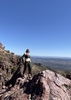
| partners | | Coming up on a full decade since our one-and-only hike onto Black Ridge it seemed like a good time for a return trip. While the goal on the previous trip was actually the high point on the far SW end of Black Ridge (Peak 5047), we weren't prepared for the longer hike with an extra 1K of AEG so we stuck close to the hike as described.
(Oh yeah... Tracey was NOT about to sign on for the extra 3 miles of OFF-trail stuff it would take, due more likely to having been chased some distance by a huge gopher snake when we were on the push to the summit)
Ok, back to today...
Inventory at the TH:
Two vehicles & one fresh plastic bag of doggy-do within 10 feet of the TH gate. MAYBE they will take it home when they return??
Whatever, w began from the 'new' McFarland TH taking a left at the Sunflower/Little Saddle/AZT intersection, following it South until reaching the waypoint I had for the old ranchers trail, yup, from 10 years ago. And while there was a small haphazard cairn of sorts, there really wasn't any trail to be found. Eventually we just set off in the general direction of where it should be, but it would be more than 1/8 mile before we began to see an indication of 'something' passing this way, which was a faint crushing of grass. Only when we hit the first elevation gain did there appear to be an actual trail of sorts. I say 'of sorts' because for a significant portion of the hike to Brunson Tank the trail would fade, split or simply disappear, leaving us with a few times when we each went off to the side until one of us located what appeared to be 'the trail'.
On the last climb to Brunson Tank it appeared there were numerous well-traveled trails (at least by cattle) which left us wondering which to follow. By the end of the climb we had traversed parts of three separate trails, only one at any time seemed better than the others.
Finally, with Brunson Tank in sight we both came to the same downcast what a sight! conclusion. Unlike 10 years ago when it was a literal lake, this time Brunson was dry. A bit of roughed up dirt in the center, but none of it exhibited any moisture, and the rest was bone dry.
As we approached from the East we encountered found the remains of a fabric & folding-pole tent(?) at the edge of the tank. It was so decrepit it took us a moment to realize it was a hunting blind. Yup, right at the edge of the tank. ](https://hikearizona.com/dex2/images/smilies/eusa_wall.gif "Brick wall")
While it was a little ahead of time for lunch, we found a few of the largest rocks on the West edge of the tank and took break. Good thing I ate most of my lunch as the next part would burn much more energy than expected for the 'downhill' portion of the hike.
Having read triplogs from the past few years I didn't expect the route down toward Upper Sheep Creek Spring to be that hard to follow. Similar to earlier in the hike, as soon as we hit a well-traveled cow path, it would split and/or disappear through thick/low brush necessitating more than a little thrashing through brush before locating another part of the trail.
Unfortunately, it appeared even the cows weren't sticking to the easiest route down. Even with a track to follow, there were times we were well off to one side or the other. Eventually we hit the 'bottom' and a bit of serendipity struck... since we had taken a side-trip off the AZT last year to locate Upper Sheep Creek Spring, things were familiar enough I no longer sought to follow the official Black Ridge Loop route. The few times I checked to see how close the routes were, I liked our route deviations better. For the last part of our climb to reach the AZT we purposely stayed away from the official route, and following the route we took last year was almost a breeze.
Once on the AZT for the return leg, with no need for route-finding I pretty much went into self-driving mode... my legs knew what to do so I let them do whatever they wished. There were a few trickles of water here and there but not enough to dampen more than the bottom of our footgear.
We both noticed a tree we had to step over last year that had been cut recently, so along with the fresh erosion control we were appreciative of the trail maintenance.
The only downer of sorts was the bag of doggy-do... It was STILL THERE!
Both vehicles which there before were gone. I guess nobody wants to drive their doggy-do 50 miles back home when they could just leave it??
Why didn't they just kick the doggy-do off to the side of the trail, next to the coyote scat and nobody would be the wiser?
Can't get no respect anymore. |
| _____________________
| | |
|
|
|
 Route Editor