Route Editor

| Guide | ♦ | 162 Triplogs | 0 Topics |
details | drive | no permit | forecast | 🔥 route |
stats |
photos | triplogs | topics | location |
| 1.3k | 162 | 0 |
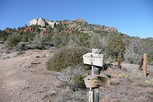
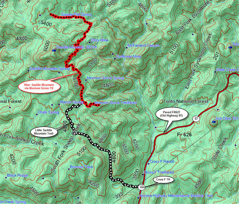
The other TH to Saddle Mountain by gpsjoe  Note NoteThe description below speaks of the trailhead being alongside the old highway alignment as depicted on historical 24k (7.5 minute) USGS topographical maps. The trailhead moved just under a quarter-mile west with plenty of parking. Overview The LSM or Little Saddle Mountain Trail #244 is the only trail in this area that starts right off of a paved road (old Highway 87), allowing access by all types of vehicles. In addition, it goes for 4.2 miles and 1,900 feet of cumulative elevation to its endpoint at the intersection with the Saddle Mountain Trail #91. At this intersection, the hike can be continued almost indefinitely. On this site, you will find other hikes that go through this intersection. They are Saddle Mountain via Mormon Grove TH and Saddle Mountain To Plateau Overlook Point. Other nearby hikes include Saddle Mountain Mine Tour from FR25A and Cornucopia-Thicket Spring Loop and Mazatzal Divide: Peely to Y-Bar from the Mount Peely trailhead at the end of FR201.
The LSM is a lovely scenic hike that starts from the Cross F trailhead at Sycamore Creek. After 0.75 miles, you come to the Sunflower Trail intersection (344) with the LSM, and both trails are incorporated into the Arizona Trail. Continuing on the LSM, you will follow the path of an intermittent stream that had plenty of rapidly flowing water when I did this hike in January 2008. The LSM climbs gently to expose great views of the mountains ahead and at your back, as well as the Sunflower valley floor and Sycamore creek. You pass through a few gates and come upon a red prickly pear cactus field and an unusual cactus I can't identify. You will pass through 3 gates, and after a mile or so, you will do your first of many (more than 12) stream crossings. These are relatively easy, but you will have fun on some of them finding where the trail picks up again. Sometimes it is directly across and sometimes a little upstream. I loved the fact that right now, there is plenty of water there. Water was near me for most of the first 2.5 miles. As I got higher, the trail became slightly overgrown with Manzanita but not catclaw or any pricky sticky growth types, so the bushwhacking was easy. At 2.8 miles, there are two cairns and a couple of choices of ways to go. Hike right between these two, and the trail goes downhill for a short while and turns right. At 3.0 miles, you come to an old jeep trail that goes left and right. Turn right here (but look back and note this area since it's easy to hike right by this turn on the return trip). The remainder of the trail is in the open and easy to follow. There are cairns and red streamers in the trees throughout the hike, which are more visible than cairns when hiking in vegetated areas. Both of these markers are reliable. At the intersection of LSM and Saddle Mountain trails, you can go back the way you came or continue the hike by turning left onto the Saddle Mountain trail, which is easy to hike and navigate. It is an old mining road. The Saddle Mountain Trail will also expose incredible views along the way. Have fun!! I love this area. Gate Policy: If a gate is closed upon arrival, leave it closed after you go through. If it is open, leave it open. Leaving a closed gate open may put cattle in danger. Closing an open gate may cut them off from water. Please be respectful, leave gates as found. The exception is signage on the gate directing you otherwise.
Check out the Official Route and Triplogs. Leave No Trace and +Add a Triplog after your hike to support this local community. | ||||||||||||||||||||||||||||||||||||||||||||||||||||||||||||||||||||||||||||||||||||||||||||||||||||||||||||||||||||||||||||||||||||||||||||||||||||||||||||||||||||||||||||||||||||||||||||||||||||||||||||||||||||||||