|
| | | Fossil Springs via Nash Point, AZ | | | |
|
|
Fossil Springs via Nash Point, AZ
| | |
| |
|
| Hiking | 13.91 Miles |
2,900 AEG |
| | Hiking | 13.91 Miles | 9 Hrs 8 Mns | | 1.78 mph |
| 2,900 ft AEG | 1 Hour 20 Mns Break | | | |
|
|
| |
| Partners |
|
[ show ]
| partners | | It was a cloudy morning, and we had some light rain on the way to the trailhead--an unmarked, spacious and empty dirt parking lot along Highway 260. The route started along FR 9365R, which had some large puddles. We passed a few electrical boxes along the road in the general vicinity of the quarry, and there were enough trash piles scattered around that I felt like I was in the Goldfields--bags and bins of garbage, a tire, random metal, and various pieces of clothing left along the road.
We planned to hit Nash Point on the way out, so just under two miles in, we veered left down a rocky two-track and made our way to Nash Pasture Trail. Based on the guide and triplogs, I expected that would be the slowest section of the day. As advertised, it was steep and overgrown, but the upper portions of the trail weren't as bad as I expected--there were occasional cairns, and the trail was reasonably easy to follow. I had clippers out and did a lot of clearing along the way.
The last tenth of mile before connecting with Bob Bear was terribly overgrown--no sign of anything resembling a trail, and I mostly gave up on cutting branches and just pushed through and let the scratches pile up. I got lucky and immediately noticed when a zipper broke on my backpack during the bushwhack, and I transferred everything to another pocket before I lost any valuables...it would have been impossible to find anything in the brush. The rain picked up around that time, too, further cementing that as one of the less enjoyable parts of the hike.
We finally connected with Bob Bear, and the intersection is virtually invisible--you'd never know Nash Pasture Trail is there just passing by. Hiking down Bob Bear, to use ShatteredArm's words, felt like a highway after Nash Pasture. We finally saw a few other hikers, along with more scattered trash, graffiti, and an abandoned (?) campsite just off the trail with a Jetboil, a full new-looking backpack, and other equipment, all of which was still there on the hike out.
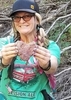
It was nice to get down near the water and into more greenery and flowers. I hadn't been to Fossil Creek in 6+ years, and this was my first time hiking in from this side. As expected, there was no shortage of people near the creek. We hiked over to the dam and Toilet Bowl and watched the crowds of bros with GoPros cliff diving near the waterfall. The sun finally came out for a while, and we took short food break before starting the climb out. [ youtube video ]
That was mostly uneventful...I wasn't excited about repeating the bushwhack on the lower part of Nash Pasture again, but once we got up a little higher, the clearing I'd done on the way in helped a lot. After a little more light rain, we were done with that portion and took a more direct route up to the rim. It was only ~ a mile roundtrip to Nash Point from there, so I headed over there quickly to check out the view. It was nice but would've been more impressive on a clearer day--the top of Humphreys was hidden in clouds, and the red cliffs nearby weren't as colorful without sunlight. But I was glad I made the detour--well worth the minimal time/effort it took to get there.
[ youtube video ]
Over the last two miles along FR 9365R, the sun finally returned and stuck around for good, and it turned into a beautiful end to the hike. The temperature was comfortable all day, and it never rained too hard. We had plenty of solitude other than the area around Fossil Springs, though the only wildlife we saw was some elk in Pine as we drove through town. |
| | |
|
|
|
 Route Editor