|
| | | |
| |
|
| Hiking | 3.00 Miles |
800 AEG |
| | Hiking | 3.00 Miles | | | |
| 800 ft AEG | | | | |
|
|
| |
| Linked |
|
none
[ show ]
| no linked trail guides |
| Partners |
|
[ show ]
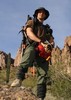
| partners | | 3 Days of Camping, Hiking, Fishing, Spectating, Laughing, and even a little Baseball with a "Twist". With 3 Good Friends and 2 New Ones...Mike brought his Wife and Carlos came, so he could beat Ken over the Head with a Paddle when Ken swam the wrong way... 
Mike, his Wife and I planned to Meet up there Friday Afternoon, with the Rest coming up Saturday Morning...I left the House about 12:30 and didn't get up there until about 4:30...My ADD kicked in and I was Chasing Thunderstorms between Fountain Hills and Payson for a good 2 1/2 Hours...  I've never been to Chevelon, so when I got there, I immediately Hiked down to the Lake to check it out...After Hiking back up, I secured a Campsite and got Camp set up...There were already quite a few People there and Campsites near the Gate were Scarce...Mike and his Wife showed up a little bit later and the 3 of us settled in around a Nice Campfire. The People that Camped there before us left a Hummingbird Feeder up, so we were Treated to a Show all Weekend as the Birds tried to claim Territory of the Feeder...I did make sure to take it down when we left on Sunday... I've never been to Chevelon, so when I got there, I immediately Hiked down to the Lake to check it out...After Hiking back up, I secured a Campsite and got Camp set up...There were already quite a few People there and Campsites near the Gate were Scarce...Mike and his Wife showed up a little bit later and the 3 of us settled in around a Nice Campfire. The People that Camped there before us left a Hummingbird Feeder up, so we were Treated to a Show all Weekend as the Birds tried to claim Territory of the Feeder...I did make sure to take it down when we left on Sunday...
Next Morning after Sleeping in a bit and messing around Camp, (me, with the Camera), we grabbed the Fishing Gear and Mike grabbed 1 of the 2 Kayaks he brought, and we all eventually ended up down at the Lake...I took my Time and had the Camera going of course... Fishing was very slow and as it ended up, we got Skunked for the Weekend...I'm not terribly surprised, as it was a Full Moon Cycle...I ended up on the other side of the Dam eventually and after a few hours, the Rest of our Compadres started showing up...Carlos and Ken first, followed by Scott and Rincon a little later...
Ken messed around a bit in his Kayak that he brought and then went for a Short Swim with Carlos following him in Mike's Kayak...After Scott and Rincon showed up, we Hiked down the Spillway of the Dam and checked out the Pools below...
It threatened to Rain on us just about all Day, but we didn't have to break out any Rain Gear until about an Hour before we Hiked back up to Camp. I started Hiking up before the others, and was about 100 Yards from Camp when the Skies finally just flat out opened up...The Others ended up Hiking up in a pretty torrential Downpour...  It Rained for the next 5 Hours, but luckily Mike had brought a Pop-Up, so everyone didn't have to huddle under my Tarp. We set the Pop-up over the Picnic Table and had Dinner. The Rain tried to Stop a few Times and there was even a Small Rainbow. I kept thinking that it was going to End, but some Dude, that just got his Doctorate, had other Opinions and he was Right... I kind of wondered how Steve (nonot) was faring, as I knew he was Backpacking the Telephone Ridge Trail and there was a lot of Lightning around as well...It finally stopped for Good around 8:30ish and we enjoyed a Camp Fire for awhile... It Rained for the next 5 Hours, but luckily Mike had brought a Pop-Up, so everyone didn't have to huddle under my Tarp. We set the Pop-up over the Picnic Table and had Dinner. The Rain tried to Stop a few Times and there was even a Small Rainbow. I kept thinking that it was going to End, but some Dude, that just got his Doctorate, had other Opinions and he was Right... I kind of wondered how Steve (nonot) was faring, as I knew he was Backpacking the Telephone Ridge Trail and there was a lot of Lightning around as well...It finally stopped for Good around 8:30ish and we enjoyed a Camp Fire for awhile...
I ended up getting up really early Sunday Morning not feeling so well...I opted to not go down to the Lake with the others and hung around Camp feeling a little yuck...Was pretty Bummed because Ken was going for a long Swim and I wanted to Watch...  They all showed back up at Camp late Morning with the Kayaks and after a bit, started breaking down Camp...After some Lunch it was Time for Goodbyes until next Time...I felt better as the Day went on, but even the Drive Home wasn't much Fun...Was fine the next Day, so whatever it was, it was pretty Temporary... They all showed back up at Camp late Morning with the Kayaks and after a bit, started breaking down Camp...After some Lunch it was Time for Goodbyes until next Time...I felt better as the Day went on, but even the Drive Home wasn't much Fun...Was fine the next Day, so whatever it was, it was pretty Temporary... 
It was a Good Weekend though...Chevelon is Awesome and so is the Crew...Hope to do it again next Year... |
|
Wildflowers Observation Light
The Creosote is Blooming like Crazy, the Firecracker Plant is going well and there were even a few Paintbrush trying to show off... |
|
 |
Deer Lake |
76-100% full |
76-100% full |
| | | Almost Overflowing the Road.... | | _____________________
| Life is not a journey to the grave with the intention of arriving safely in a pretty & well preserved body, but rather to skid in broadside, totally worn out & proclaiming, "Wow What a Ride!" |
| | |
|
|
|
 Route Editor