username
X
password
register
for free!
help
ArticlesGuidesRoutes
 
Photosets
 
 Comments
triplogs   photosets   labels comments more
Death Valley - 5 members in 13 triplogs have rated this an average 4.8 ( 1 to 5 best )
13 triplogs
login for filter options
Feb 19 2023
avatar

 Guides 10
 Routes 673
 Photos 7,281
 Triplogs 4,660

67 female
 Joined Nov 17 2008
 phoenix, az
Death Valley - Badwater Road, CA 
Death Valley - Badwater Road, CA
 
Hiking avatar Feb 19 2023
trekkin_geckoTriplogs 4,660
Hiking9.84 Miles 2,337 AEG
Hiking9.84 Miles
2,337 ft AEG
 no routes
1st trip
Partners partners
johnlp
The_Eagle
up around 0600 as it was just getting light
coffee and breakfast, of course
nice seeing the sun gradually light up the mountains from our valley campsite
we got going around 0800 with a stop at ashford mill ruins
our first hike was sidewinder canyon
we went all the way to where the canyon opened up about 2.5 miles in
then explored several side slot canyons on the return
the hike description has three, but we counted at least five
we went up five, four and two and the return - three was very short and not as interesting
all of the slots featured narrow passages and scrambling - fun :)
two had more climbing with a top out overlooking the basin
we didn't get to the first one
our recommendation would be to hit that one, then the last two and return from there
estimating our mileage at six since my track bounced around
had lunch in the parking lot
next stop was badwater trail with 1000 of our closest friends
the lowest point in the usa is right at the trailhead
a flat walk out on the salt flats with views of the mountains to the east and west
this was a fun stroll even with all the people
we did get past the crowds for a few photos
finished the day with the natural bridge trail
another gravel uphill to an arch
we went past the arch to a dryfall
that section was more scenic and less crowded
camped this time off trail canyon road
rougher road, rocky terrain, weird shenanigans from the neighbors all night
a bit warmer and good star gazing
_____________________
hazhole
  2 archives
Feb 19 2023
avatar

 Guides 1
 Routes 14
 Photos 7,202
 Triplogs 5,208

68 male
 Joined Mar 16 2008
 chandler,az
Death Valley - Badwater Road, CA 
Death Valley - Badwater Road, CA
 
Hiking avatar Feb 19 2023
johnlpTriplogs 5,208
Hiking10.50 Miles 2,737 AEG
Hiking10.50 Miles
2,737 ft AEG
 no routes
1st trip
Partners partners
The_Eagle
trekkin_gecko
Day two of our DV tour. Lots of diversity in our hikes this day. Plenty of people at Badwater & Natural Bridge as expected on a three day weekend, not so much in Sidewinder.
Sidewinder has lots of side canyons to be explored besides the main canyon. Some very slotty. Very cool.
Long fun day. :)
wildflower observationwildflower observationwildflower observationwildflower observationwildflower observation
Wildflowers Observation Isolated
_____________________
“Good people drink good beer.” Hunter S Thompson
  1 archive
Feb 29 2016
avatar

 Routes 1
 Photos 29,248
 Triplogs 1,448

45 female
 Joined Jan 18 2011
 In the Wild
Death ValleyDeath Valley, CA
Death Valley, CA
Hiking avatar Feb 29 2016
LucyanTriplogs 1,448
Hiking5.75 Miles 730 AEG
Hiking5.75 Miles
730 ft AEG
 no routes
1st trip
Linked   none no linked trail guides
Partners none no partners
wildflower observationwildflower observationwildflower observationwildflower observationwildflower observation
Wildflowers Observation Substantial
_____________________
 
Jan 20 2016
avatar

 Routes 16
 Photos 628
 Triplogs 45

72 male
 Joined Apr 03 2011
 Mesa, Az
Death ValleyDeath Valley, CA
Death Valley, CA
Scenic Drive avatar Jan 20 2016
gmaclachlanTriplogs 45
Scenic Drive
Scenic Drive
 no routes
1st trip
Linked   none no linked trail guides
Partners none no partners
Although this is not a hike I wanted to share some photos at the south end of Death Valley. The highway down into the park from Shoshone is closed from washout so decided to drive the Harry Wade Road up to Furnace Creek. The 32 mile road was washboard but passable for anything as long as you took your time. We connected to the main park road near Ashford Mill, took time for a short hike to Natural Arch and continued north to Furnace Creek. Day was shot so will have to go back to see the north end of the Park another time.
 Geology
 Geology [ checklist ]
[ checklist ]  Natural Bridge
 Named place
 Named place [ checklist ]
[ checklist ]  Badwater Basin - DVNP
_____________________
 
Jan 05 2015
avatar

 Photos 792
 Triplogs 48

64 male
 Joined Nov 29 2009
 Gilbert, AZ
Death ValleyDeath Valley, CA
Death Valley, CA
Hiking avatar Jan 05 2015
JohnnieTriplogs 48
Hiking
Hiking   96 Hrs      0.00 mph
 no routes
1st trip
Linked   none no linked trail guides
Partners partners
glutz
Greg and I spent 4 days exploring Death Valley doing numerous day hikes and 4 wheel drive excursions, We had both passed thru Death Valley before but never stayed to see it. It's big and it takes a lot of time to see everything. We are already planning another trip to see more.I think I'll let the photos speak for themselves but I will have to say the high light of the trip was going to the "Race Track" where the moving rocks are located. Last year they finally figured out exactly how the moving rocks move, search on line to see the details
 Culture
 Culture [ checklist ]
[ checklist ]  Humor
_____________________
 
Apr 30 2012
avatar

 Guides 177
 Routes 249
 Photos 10,213
 Triplogs 2,215

74 male
 Joined Feb 12 2002
 Gold Canyon, AZ
Death ValleyDeath Valley, CA
Death Valley, CA
Hiking avatar Apr 30 2012
AZLOT69Triplogs 2,215
Hiking5.25 Miles 455 AEG
Hiking5.25 Miles   3 Hrs      1.75 mph
455 ft AEG
 no routesno photosets
1st trip
Linked   none no linked trail guides
Partners none no partners
Cool morningsstill made this outing possible
_____________________
It's best for a man to remain silent and be thought a fool, than to open his mouth and remove all doubt.
--Mark Twain
 
Mar 13 2011
avatar

 Guides 5
 Photos 1,229
 Triplogs 181

female
 Joined Mar 18 2008
 Flagstaff, AZ
Death ValleyDeath Valley, CA
Death Valley, CA
Hiking avatar Mar 13 2011
fotogirl53Triplogs 181
Hiking5.00 Miles 500 AEG
Hiking5.00 Miles
500 ft AEG
 no routes
1st trip
Linked   none no linked trail guides
Partners none no partners
Can you believe I've never been to Death Valley??!! My idea of fun is not hanging around a desert, but this seemed like a good place to explore over spring break--not too far away and not too expensive.

We got to Stovepipe Wells and I headed out to Mesquite Dunes for afternoon/sunset pictures. This area is much bigger than it seems. The distance to the biggest dune is deceiving, and so is the height! I found out quickly that ditching the shoes was the only way to go. There are no trails, so you just make your way up and down the dunes. The sky was overcast most of the time, but the sun broke through for about 20 minutes before sunset, resulting in some nice light. It also brought out the sand bugs--I'm very tasty, apparently.

Next morning I was back at the dunes before sunrise. It wasn't a spectacular sunrise, but the light was nice. I brought my coffee and had a beautiful view for breakfast. There were lizard, snake, rabbit and bird tracks around the dunes, but I didn't see anything except bees.

Mr. fotogirl (that sounds terrible!) wanted to explore some of the back roads. We did the Hole in the Wall road and tried to find Ryan--no luck. Then we took the "good" road to Chloride City and the 4x4 road back to the highway. Mr's truck is a new GMC 4x4 with the off road package and we needed every bit of muscle and nerve to get down that track. I've been on some scary roads but this one beat them all! Mr. had a blister on his hand from wrestling the truck by the time we were down. I have to admit that I closed my eyes a couple times--you know that helps!

Then off to Titus Canyon and Leadville. Very cool drive, but I wouldn't do it in a car due to washboards and rocks. The light was poor again--overcast most of the day.

Plans to explore the Keane mine were not to be--the NPS has closed the area. I'm sure they are going to close off all the shafts to ensure our safety. I just love it when bureaucrats decide what is safe for me. I guess that's why I usually stay away from national parks--regulations everywhere.

Next day we went to Badwater. The salt formations aren't organized like the iconic pictures of the area. Maybe in the fall when things dry out. I think I'll come back here again for some hiking as long as the bureacrats don't stop that too for my own good.
 Geology
 Geology [ checklist ]
[ checklist ]  Sand Dune
 Culture
 Culture [ checklist ]
[ checklist ]  Fraley Pose
 Named place
 Named place [ checklist ]
[ checklist ]  Mesquite Flat
 Meteorology
 Meteorology [ checklist ]
[ checklist ]  Sunrise
wildflower observationwildflower observationwildflower observationwildflower observationwildflower observation
Wildflowers Observation Light
_____________________
Allergic to cities.
 
Nov 22 2010
avatar

 Guides 71
 Routes 98
 Photos 9,967
 Triplogs 1,009

65 male
 Joined May 14 2003
 Ahwatukee, AZ
Death ValleyDeath Valley, CA
Death Valley, CA
Hiking avatar Nov 22 2010
Randal_SchulhauserTriplogs 1,009
Hiking0.75 Miles 100 AEG
Hiking0.75 Miles      30 Mns   1.50 mph
100 ft AEG
 
Linked   none no linked trail guides
Partners none no partners
Part of our Oregon Trail Tale 2010 => http://hikearizona.com/TL.php?ID=56595
foliage observationfoliage observationfoliage observationfoliage observationfoliage observation
Autumn Foliage Observation Isolated
wildflower observationwildflower observationwildflower observationwildflower observationwildflower observation
Wildflowers Observation Isolated
_____________________
 
Feb 12 2010
avatar

 Guides 71
 Routes 98
 Photos 9,967
 Triplogs 1,009

65 male
 Joined May 14 2003
 Ahwatukee, AZ
Death ValleyDeath Valley, CA
Death Valley, CA
Backpack avatar Feb 12 2010
Randal_SchulhauserTriplogs 1,009
Backpack19.00 Miles 1,000 AEG
Backpack19.00 Miles5 Days         
1,000 ft AEG
 
Death Valley February 2010

THE PLAN
Friday 2/12 - 7am rendezvous @ Chez Schulhauser. Furnace Creek Ranch cabin. Hank & Joe @ 7pm for dinner.

Saturday 2/13 - Trail Canyon day hike. Ghost towns and mining relics. Camp in Trail Canyon. Camping restrictions? Camp fire restrictions?

Sunday 2/14 - Eureka Singing dunes hiking. Scotty's Castle. Camp @ Eureka Dunes Dry Camp.

Monday 2/15 - The Racetrack. Homestake Dry Camp

Tuesday 2/16 - head home?

Mike -> 3x breakfast
Randal -> 3x dinner

Lunch will be hiking snacks


THE EXECUTION

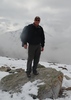
This was a trek at least 6 months in the making, having had my first "taste" of Death Valley when we skirted the Panamints on our return from climbing Mount Whitney (see [ photoset ] and [ photoset ] ). Letty's recent triplog, photos, [ photoset ] and insightful PM's only made us drool in anticipation. My 25th work anniversary year is rewarded with a 1 week bonus vacation and I earmarked it for this trek. Well 1391 road miles, 19 hiking miles, 616 photos and 5 days later, here's the scoop...

Day 1 - Friday February 12th, 2010
Day starts with a 7am phone call from Mike Mattes. He's lost in the twisted maze of Ahwatukee trying to find my house. I guide him on the cell phone to my doorstep, load up his modified Jeep Wrangler and we are off! We decide to avoid rush hour traffic by looping south towards Gila Bend and up to Wickenburg via Vulture Mine Road. Plan seem to be working fine as we pull onto US93 heading northwest towards Las Vegas NV without any traffic delays. We pass the anomalous forest of Joshua Trees. A sudden "PING" sound punctuates the air and I ask "What's that?". At the same time we pass a sign indicating Wikieup 41 miles, Mike says, "That's my low gas indicator and we have 30 miles driving range left". Yikes! Drastically dropping our speed and with a few uphill anxious moments, Mike is able to guide the sputtering Jeep into the first gas station sighted in Wikieup. We pump 14.9 gallons into the Jeep's 15 gallon tank. Let's just say that increased vigilance to our half tank rule on unknown routes has been invoked... To help settle Mike's nerves, we grab a burger from the "Eat at Joe's BBQ". I make a couple of cell calls checking up on my Dad (released from hospital earlier that day having had a cardiac procedure the day before). He picked up the phone at home so he's mobile and I'd call it a "best case" scenario. Back on the road we soon join some traffic at Boulder Dam. My first visit to the area so I went into "tourist mode". I hopped out of the Jeep and walked most of the way while Mike did the stop-and-go thing through the traffic jam. Quick comment - the new arch bridge looks like it will be a design engineering masterpiece. Know many others will think it is a pox on the landscape (and John McCain was on the local radio declaring it "A bridge to nowhere"), but I think "it works"... Onto Vegas and an exit via US95. Believe it or not, but this is my first "non-airport layover" visit to Vegas. I'm surprised by the snowy peaks, local ski resorts, and preponderance of Joshua Trees. With PM warnings of $4 per gallon gas in DVNP, we gas up at the intersection of NV373 and US95. Interesting business combination of gas station and brothel (I'll hold onto the Cherry Patch II photos for future blackmailing...). We soon pull into the Furnace Creek Ranch parking lot at "ground minus 200" in Death Valley National Park. Suddenly our $226 per night room seems like a bargain as multiple people are turned away at the reception desk due to "No Vacancy". We pull up to our room in the 900 block and see Hank and Joe in the parking lot. Hank starts to give us the "data dump" on multiple closures in the park due to flooding. West Side Road is closed so there's no access to Trail Canyon, Racetrack Valley Road is closed so there's no access to the Racetrack, no data on Eureka Dunes. Over dinner we hear some alternate plans pitched - Marble Canyon on Saturday and hold off on Trail Canyon until Monday with fingers crossed that West Side Road will be dried and opened. Sounds like a plan!

Day 2 - Saturday February 13th, 2010
6am wake-up call to room 936 in Furnace Creek Ranch. $12.95 removed from our pockets by the Xanterra Pirates to attend the breakfast buffet. Mike and I arrive at the morning rendezvous spot at 7:35am and we're given a hard time for being 5 minutes late... Hank and Joe lead the way towards Stovepipe Wells and the doubletrack heading towards Marble Canyon. As we bounce our way towards the TH, I'm scouting out an unexpected sight - Mesquite Dunes. We soon bend into a gap in the mountain wall which surprisingly continues to an inner basin area. The trail splits to the south for Cottonwood Canyon Road whereas the trail heading west is Marble Canyon Road. You even have a street sign indicating this remote intersection! A barrier sign marks the end of our 4WD trek and we hop out to start our hike. First narrows, the chokestone, second narrows, and third narrows as described in our Digonnet's "Hiking Death Valley" https://amazon.com/Hiking-Death-Valley- ... ikearizona. I begin to doubt Digonnet's claim that "Marble Canyon is blessed with more petroglyph sites than any other canyon in the park". As I blurt that out Mike points out our first rock art panel. We break for lunch about 3.25 miles up canyon before the fourth narrows. A little exploration after lunch and we head back to the trailhead. Mike and I opt for a late afternoon visit to Mesquite Dunes - an unexpected delight even with the human population explosion scurrying like ants over multiple anthills. This is like a trip to the beach! We meet up with Joe and Hank again to be guided to our evening camp in Echo Canyon. A traditional camp dinner of dogs and beans with some beverages of choice and Mike and I retreat to our tents calling it an early star-filled night...

Day 3 - Sunday February 14th, 2010
Up at mornings' first light and Mike prepares a hot camp breakfast. We soon pack up our Echo Canyon Camp in anticipation of setting up in Trail Canyon later that day. Zabriskie Point is the first destination to catch some morning light off Manly Beacon. A music video shoot is in progress attracting a curious crowd. Can't say I recognized the musician... A second stop in Furnace Creek for gasoline and Valentine's Day phone calls back home to our wives. Zero cell phone coverage in Death Valley, so a pay phone at the General Store is our only option. We check out the Borax Museum - a treasure trove of local history. With conflicting reports about Racetrack Valley Road closure, we head Mike's Jeep up towards the Grapevine/Scotty's Castle area. Signage along the route warns us of the road closure, but the barriers are all open. Racetrack Valley Road has some washouts, but no issue for the lifted Jeep. Death Valley is always full of surprises - lava and cinder fields around Ubehebe Crater, a Joshua Tree forest near Tin Mountain Gap, and eclectic Teakettle Junction. Top it all off with a walk on the moon at Racetrack Playa. The playa has dried out so no risk of muddy footprints. I find the spot for Hommage de Shellye Poster https://amazon.com/gp/product/088150789 ... ikearizona. I crisscross the playa multiple times - I'm stunned... With the sun starting to get low we hit the road towards West Side Road and Trail Canyon. We arrive at the intersection of Badwater Road and West Side Road to have our fears realized - the road closure barrier is still up! With our planned Monday morning 7:30am rendezvous with Hank and Joe at our Trail Canyon Camp now a washout, Mike and I head over to Furnace Creek Ranch to deliver the news and leave Joe's radio at the front desk with Raul. Always have a back-up plan. Ours is re-establish Camp Echo Canyon in the Funeral Mountains and go explore the upper canyon ghost towns and Lee mining district. Ravioli and a French loaf console our disappointment...

Day 4 - Monday February 15th, 2010
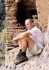
Mike cooks up some chocolate chip pancakes and bacon to start the day. A prickly pear vodka and O.J. to open the eyes. We leave our tents up at Camp Echo Canyon and head up towards Inyo Mine and ghost town https://mojavedesert.net/mining-history/inyo/ . We explore multiple satellite mines and continue up the 4WD path to the Lee mining district. We locate the drag cable to the Furnace Mine site. The pristine mining relics and smelting furnace was worth the steep climb up to the Furnace Mine site. After a late lunch we head into town for a couple of trivial supplies (paper towels and Doritos) and the Keane Wonder Mine site https://www.ghosttowns.com/states/ca/keane.html . A late afternoon trek into Golden Canyon and beyond to Manly Beacon and an aborted climb to Zabriskie Point https://www.americansouthwest.net/calif ... l-map.html . Heading back to Camp Echo Canyon we catch the Eye-of-the-Needle sunset shadow. Evening camp meal of chili and dogs and it's time to call it a night.

Day 5 - Tuesday February 16th, 2010
We have a return route plotted from Furnace Creek to Badwater to Shoshone to Mohave National Park to Joshua Tree National Park dumping onto the I-10 for a straight shot east to Phoenix. After gassing up in Furnace Creek, we capture plenty of reflection images off the flooded saltflats near Badwater. As we exit DVNP near Shoshone, I'm feeling satisfied that our Plan "B" delivered just as much as our Plan "A" promised. Mother Nature wreck our DVNP trek? Never! On CA127 towards Baker we "discover" the Dumont Dunes. Cross over the I-15 and into the Mohave National Preserve https://www.nps.gov/moja/index.htm . The Lava Beds and Kelso Dunes are interesting, but slightly imperfect bordered by hydro right-of-ways and railroad mainlines. An old section of Route 66 comprises part of the connection between Mohave and Joshua Tree. Commercial table salt operations are a curious sight. At Twenty-Nine Palms we enter Joshua Tree National Park https://www.nps.gov/jotr/index.htm . There's plenty of eye candy here from the whimsical (Skull Rock) to the fascinating (Joshua Tree forests). Onto the I-10 and I take over the driving chores until we reach our Valley homes.

Final Thoughts
Racetrack Playa was by far my Death Valley highlight. The diversity of DVNP attractions is the big takeaway. And the pristine appearance (nary a piece of trash found anywhere in the park) a pleasant bonus. And a trivia factoid - a GPS can't record an elevation below sea level. I'm sure Mohave National Preserve has some hidden attractions, but we didn't get any hint during our traverse. Joshua Tree National Park has a smorgasbord of potential and it will get a return visit some day soon!

Helpful Death Valley Backroads Map contained in this Forum thread => [ Death Valley travel alert ] :)

Thanks again to Hank and Joe for their help with some of the planning logistics. And special thanks to Mike for being my "ride". His Jeep [ photo ] certainly has backcountry capability beyond my F-150! :D
 Geology
 Geology [ checklist ]
[ checklist ]  Sand Dune
 Culture
 Culture [ checklist ]
[ checklist ]  HAZ Rides
wildflower observationwildflower observationwildflower observationwildflower observationwildflower observation
Wildflowers Observation Isolated
_____________________
  2 archives
Aug 06 2009
avatar

 Guides 71
 Routes 98
 Photos 9,967
 Triplogs 1,009

65 male
 Joined May 14 2003
 Ahwatukee, AZ
Death ValleyDeath Valley, CA
Death Valley, CA
Hiking avatar Aug 06 2009
Randal_SchulhauserTriplogs 1,009
Hiking2.50 Miles 200 AEG
Hiking2.50 Miles   2 Hrs   30 Mns   1.00 mph
200 ft AEG
 
Linked   none no linked trail guides
Partners none no partners
Death Valley CA - Panamint Valley sector

My first trip to the Sierra Mountains and Mt. Whitney http://hikearizona.com/photoset.php?ID=8725 afforded an opportunity for my first visit into Death Valley.

Northern Panamint Valley is a recent addition to Death Valley National Park having been incorporated in 1994. This explains why it doesn't appear as part of the park on many maps. The southern sections of Panamint Valley seem to be a mix of BLM and private lands. Plenty of opportunities for backcountry adventure - many trails and mining ghost towns.

I've always been an admirer of Letty's stunning images (see http://hikearizona.com/photoset.php?ID=4987 and http://hikearizona.com/photoset.php?ID=4158 ) from this part of the world and this "day trip" has only whet my appetite for more. Also recall Norber15's inspiring images http://hikearizona.com/photoset.php?ID=8989

The planning has begun...
 Culture
 Culture [ checklist ]
[ checklist ]  Truck Remains/Wreckage
_____________________
  1 archive
Oct 15 1989
avatar

 Photos 1,345
 Triplogs 298

67 male
 Joined Jan 15 2010
 Avondale
Death ValleyDeath Valley, CA
Death Valley, CA
Hiking avatar Oct 15 1989
leonesiegelTriplogs 298
Hiking4.00 Miles
Hiking4.00 Miles
 no routesno photosets
Linked   none no linked trail guides
Partners none no partners
_____________________
 
Oct 14 1989
avatar

 Photos 1,345
 Triplogs 298

67 male
 Joined Jan 15 2010
 Avondale
Death ValleyDeath Valley, CA
Death Valley, CA
Hiking avatar Oct 14 1989
leonesiegelTriplogs 298
Hiking6.00 Miles
Hiking6.00 Miles
 no routesno photosets
Linked   none no linked trail guides
Partners none no partners
_____________________
  1 archive
Dec 24 1987
avatar

 Photos 1,345
 Triplogs 298

67 male
 Joined Jan 15 2010
 Avondale
Death ValleyDeath Valley, CA
Death Valley, CA
Hiking avatar Dec 24 1987
leonesiegelTriplogs 298
Hiking8.00 Miles
Hiking8.00 Miles
 no routesno photosets
Linked   none no linked trail guides
Partners none no partners
Up and over the marvelous badlands, one of my first hikes!
_____________________
  4 archives
average hiking speed 1.42 mph

WARNING! Hiking and outdoor related sports can be dangerous. Be responsible and prepare for the trip. Study the area you are entering and plan accordingly. Dress for the current and unexpected weather changes. Take plenty of water. Never go alone. Make an itinerary with your plan(s), route(s), destination(s) and expected return time. Give your itinerary to trusted family and/or friends.

helpcommentissue

end of page marker