username
X
password
register
for free!
help
ArticlesGuidesRoutes
 
Photosets
 
 Comments
triplogs   photosets   labels comments more
Arch Canyon - Organ Pipe NM - 13 members in 36 triplogs have rated this an average 4 ( 1 to 5 best )
1, 2  Next
36 triplogs
login for filter options
Feb 17 2024
avatar

 Guides 33
 Routes 286
 Photos 445
 Triplogs 251

35 male
 Joined Oct 23 2017
 Tempe
Arch Canyon - Organ Pipe NMSouthwest, AZ
Southwest, AZ
Hiking avatar Feb 17 2024
KingLeonidasTriplogs 251
Hiking3.20 Miles 1,353 AEG
Hiking3.20 Miles   2 Hrs   29 Mns   1.40 mph
1,353 ft AEG      12 Mns Break6 LBS Pack
 
no photosets
1st trip
Linked   none no linked trail guides
Partners none no partners
Route Scout Route Recorded  on Route Scout | Pop | Map | Popup | MapDEX
Hiked Arch Canyon with Victoria as our first hike in our Organ Pipe National Monument trip

We did this one for the first time on the way to our campsite at twin peaks. We originally expected this to be a easy on-the-way type hike but it was much more than that.

With the benefit of hindsight, this was probably the best hike that we did in Organ Pipe (and we did a lot). Access is a bit interesting as it requires a long drive down a one-way high clearance vehicle road. We were well equipped to do so with the Colorado but there were plenty on the road with economy cars and campers that could not make any time. Fortunately, everyone was very aware (and self-aware) and let us get past otherwise it could have taken quite a while to get to the trailhead. Fair warning the trail is very dusty so have a well sealed bed cover or bring all your camping gear inside before driving the access road (ask me how I know).

After arriving at the trailhead, the Arch is immediately visible, indeed there are actually two arches (one smaller above the namesake of the trail) that you approach by following the canyon. The arches are best viewed from the trailhead as progressing into the canyon puts them above you and they are obscured by the ridge.

The maintained trail ends inside the canyon but there is an unmaintained trail marked by cairns that supposedly leads the to arch itself. It doesn't but more on that later.

The terrain in this area is interesting with what looks like lava flows, volcanic tuff and rhyolite being predominant (don't cite me on that, I am not a geologist). In any event there is very grippy and porous stone along both the maintained and unmaintained sections of the trail.

Towards the end of the maintained trail we came across an interesting rock feature that resembled an Easter island figure incredibly well (see triplog photo). This was just the beginning of the interesting views.

Once you leave the maintained trail and start following the route to the arch things get much more interesting. The terrain get much more technical and steep and navigation gets much more difficult. The advice to "follow the cairns" is not good, mostly because multiple individuals have left multiple trails of cairns to different end destinations. We followed cairns to the highest point on the ridge and several spectacular viewpoints but did not make it to the arch itself. We actually ran out of daylight, we (think) we found the route to the arch but if we added that to our route we likely would have had to descend in darkness (not recommended given the difficulty of the terrain). However, I am not convinced that the view from the arch is any better than the view we saw from the peak; at the arch the ridge is very narrow and if you are able to scramble into the arch you likely cannot take a photo from sufficient distance to show that it is an arch (at least not without at drone or similar device) and so hiking to the arch itself may not be the goal to aspire to.

We took several spectacular photos from along the ridge (including the highest point) that are probably better than the view from the arch itself.

With our adventure curtailed by sunset we descended to the trailhead and continued on to the campsite.

There was a very interesting spot for potential rock climbing routes near the back side of the arch with great juggy holds in the porous volcanic rock (a pin can be found in the route appended to this triplog). While planning for this trip I specifically looked for rock climbing routs (to see if I should throw my gear in the back of the truck) but only found one site that was difficult to access with a few Trad routes. This spot immediately struck me as having great rock climbing potential but I did not see any bolts or chalk residues indicating that anyone had climbed it or set a rout here before. This strikes me as a missed opportunity as it looked like a great piece of slab for climbing and there is almost no climbing opportunities in this national monument. I will have to see if I can find a route setter to coordinate with the national park service and make sport routes on the back side of arch canyon a reality, that looks like some suburb rock and I want to climb it!

Anyway this was a great trail and probably one of the best in the monument. IF we come back we will definitely do this one again.
[ youtube video ]
_____________________
  1 archive
Feb 10 2024
avatar

 Photos 268
 Triplogs 17

female
 Joined Mar 12 2021
 Seattle, WA
Peak 4540 Organ Pipe Cactus NM, AZ 
Peak 4540 Organ Pipe Cactus NM, AZ
 
Hiking avatar Feb 10 2024
rubywranglerTriplogs 17
Hiking5.00 Miles 2,040 AEG
Hiking5.00 Miles
2,040 ft AEG
 no routes
1st trip
Linked   linked  
Partners none no partners
My last day in the Ajo range for awhile, and it was a good one. The route description for this hike on Debra Van Winegarden's blog says "this rugged and difficult five-mile hike easily feels double the distance." I was skeptical. She was not wrong. It is officially the third-highest peak in the range.

A big storm came through overnight and the mountains were still socked in, but clearing, when I left Twin Peaks campground at 11am. By 11:45 I was heading up the Arch Canyon trail. I passed the standard warning sign about smuggling, etc. and followed a good trail down into the canyon. The route follows the main canyon for about a mile and half. I was surprised to find so much water! But should have expected it. Super pretty, but it definitely slowed me down a bit. No significant obstacles on the first stretch, just a lot of low hanging branches ready to snag hats and stowed trekking poles.

The weather was unsettled. About 30 minutes in I had to duck under a tree to get out of a hail shower. After passing under a big cave (about 0.5 miles upcanyon), there is an obvious bypass trail on the left. Then a little further along there’s a chockstone blocking the canyon, but an easy bypass on ledges is available to the right. Next I came to a large pool that I wasn't sure how to get around. As I considered it, sprinkles turned into a downpour and I ducked into an alcove between boulders on the left to wait it out and each lunch. To bypass the pool, I ended up wiggling up through a hole in this alcove.

After nearly 2 miles, the main canyon makes a turn to the right, and the route goes left. A trail leads out of the canyon up to a rock shelf. Follow the side canyon on it's north side, then cross over and aim for the north side of a large rock outcrop on the ridge. There is a decent trail leading across the wash, and again alongside the rock outcrop to the ridge. Once you hit the ridge, turn left and it's an easy hike to the summit. Views are excellent!! I got snowed on. Didn't stay long because I wanted to get to an overlook on Ajo Mtn Drive for sunset photos. Retraced my steps and made it back to the trailhead in half the time. 8)

water 1 out of 5water 2 out of 5water 3 out of 5water 4 out of 5 Arch Canyon Heavy flow Heavy flow
  2 archives
Feb 09 2024
avatar

 Photos 268
 Triplogs 17

female
 Joined Mar 12 2021
 Seattle, WA
Lower Boulder Canyon - Arch Canyon loop OPCNM, AZ 
Lower Boulder Canyon - Arch Canyon loop OPCNM, AZ
 
Hiking avatar Feb 09 2024
rubywranglerTriplogs 17
Hiking4.00 Miles
Hiking4.00 Miles
 no routes
1st trip
Linked   linked  
Partners none no partners
This was an afternoon recon mission for a future attempt to climb peak 4740, the second highest mountain in the Ajo range. I'd seen two previous reports from the Arch Canyon side and neither was very appealing. The first one featured extremely complicated navigation, and the second one featured "a horrible bushwhack" and "the remains of a young human female". Um, no thanks. So I decided to try approaching from Boulder canyon. The slope angle shading in Caltopo suggests that it might go. After seeing it up close, I think it probably does, but I ran out of daylight. Also, the terrain in the canyon pushes you north, right up to the saddle below "platform 3760" and above the arch...which has a trail going right to it. So one could save themself some trouble and time and skip lower boulder canyon altogether. :doh: However, the lower canyon presents no real difficulties - just requires picking a route though huge namesake boulders at the entrance, then there is some fun scrambling on solid rock. It seems you should approach from the northwest to avoid the worst brush (I didn't). Don't skip the side trip to 3760' though. Both the north and south ends of the platform have excellent views. I descended the Arch trail but skipped the Arch since I'd been there before. The trail has a ridiculous number of cairns!
 Culture
 Culture [ checklist ]
[ checklist ]  Ghost?
 Meteorology
 Meteorology [ checklist ]
[ checklist ]  Sunset
  6 archives
Mar 31 2023
avatar

 Guides 1
 Routes 148
 Photos 9,925
 Triplogs 3,654

63 male
 Joined Apr 02 2005
 Mesa, AZ
Organ Pipe NM hikes, AZ 
Organ Pipe NM hikes, AZ
 
Hiking avatar Mar 31 2023
Tortoise_HikerTriplogs 3,654
Hiking13.71 Miles 2,041 AEG
Hiking13.71 Miles   7 Hrs   10 Mns   2.06 mph
2,041 ft AEG      30 Mns Break
 no routes
1st trip
I was hoping there would be a good flower showing at Organ Pipe this year. There was a nice variety but Brittlebush was they main attraction along with the cacti! Bruce hadn’t been here before so he joined me for a nice sample size of the park.

Arch Canyon
I only did the easy part of this hike. It was cool to see Bruce from down below and shows you how big the Arch is!

Bull Pasture lookout loop
Some nice sections of Organ Pipe Cactus and Brittlebush on this hike with a pretty good climb.
Views for miles up there. We ran into an older group of 3 we had seen on our first hike. Bruce made their day telling them jokes and taking their pictures. He can be a nice guy! 😂

Victoria Mine/Lost Cabin
This was a flatter hike but I was wore out by the second half. Both stops had partial buildings and I’m sure they had some stories to tell. Some good vegetation in parts of this hike. The pics of the red Ocotillo don’t do them justice. I also spotted a Bursera tree and the start of a crested Saguaro!
Bruce spotted one garter snake on way back.

Nature trail
You can loop through visitor center but we were an hour late so did the out and back. They have a pond with the pupfish.

Thanks for the adventure Bruce!
Like HAZ, you rock!
wildflower observationwildflower observationwildflower observationwildflower observationwildflower observation
Wildflowers Observation Substantial
_____________________
Tortoise Hiking. Stop and smell the Petrichor.
 
Mar 31 2023
avatar

 Guides 41
 Routes 1,626
 Photos 14,983
 Triplogs 2,762

69 male
 Joined Jan 20 2009
 Far NE Phoenix,
Organ Pipe NM hikes, AZ 
Organ Pipe NM hikes, AZ
 
Hiking avatar Mar 31 2023
The_EagleTriplogs 2,762
Hiking15.21 Miles 3,103 AEG
Hiking15.21 Miles   7 Hrs   10 Mns   2.19 mph
3,103 ft AEG      14 Mns Break10 LBS Pack
 
1st trip
Route Scout Route Recorded  on Route Scout | Pop | Map | Popup | MapDEX
Denny wanted to get down to the Organ Pipe NM to check out the flower show down there. I'd never been there before, so I was a go. To knock out 3ish new trails for me. The first 2 are on the 21 mile loop drive. The drive itself had some great views and some impressive Organ Pipe cactus.

Arch Canyon
3.08 Miles
1328 AEG

You can see both of the arches from the TH. This was my favorite hike of the day. A steady grade until you hit the canyon and make the turn to the south. It then climbs steeply to the top. Once up top you make an initial drop to a saddle area where you can see the TH, but will need to make an additional drop to be able to get to the big arch. Stick to the east side of this canyon and follow the cairns.

Denny stayed back to try and get photos of me in the arch. He called out from down below close to the TH. I could hear him, but never was able to see him.
[ youtube video ]

Flowers were poppin on the hike and everything was green, green, green.
Brittle bush was the main player, but there were numerous others in abundance.

Bull Pasture - Estes Canyon Loop
4.51 miles
1198 AEG

2nd favorite hike of the day. We did this CCW and went to "The Overlook" on the Bull Pasture Trail and then went to the peak above The Overlook.
[ youtube video ]

After a short break, we headed down and hit the Estes Canyon trail. This was a steeper drop down, but rollercoastered nicely back to the TH.
Same variety of flowers poppin' here. We had lunch back at the TH where I noticed of the 6 cars I could see at the TH, all were from different states.

Victoria Mine - Lost Cabin Trail
7.28 miles
675 AEG

This one will be a one and done for me. Off to Victoria Mine first everything is covered over here, to protect the bat habitat. A longish walk to get over to the Lost Cabin and mine area.
The afternoon sun was a bit warm making this seem to be longer than it was. Following the lead from a @Joebartels / @Darthstiller track, we went off trail short-cutting the route back. Quite a bit of this was on a worn use trail. The predominate flower on the hike were the carpets of Rock Daisies.

Nature Trail
.32 miles
5 AEG!

Last up, was one Denny talked about all day. This one was supposed to be a loop, but since we were there after the Visitors Center was closed, it turned into a much longer Out and Back

All in all, a great day with plenty of flora in a new area for me.

Thanks for the idea, hike and driving Turtle!
 Fauna
 Fauna [ checklist ]
[ checklist ]  Desert Tortoise
wildflower observationwildflower observationwildflower observationwildflower observationwildflower observation
Wildflowers Observation Substantial
_____________________
There is a very fine line between "hobby" and "mental illness."
Dave Barry 🦅
 
Feb 28 2022
avatar

 Guides 104
 Routes 256
 Photos 16,118
 Triplogs 528

53 male
 Joined Dec 30 2005
 Tucson, AZ
Arch Canyon - Organ Pipe NMSouthwest, AZ
Southwest, AZ
Hiking avatar Feb 28 2022
Mike_WTriplogs 528
Hiking4.27 Miles 1,210 AEG
Hiking4.27 Miles   1 Hour   55 Mns   3.01 mph
1,210 ft AEG      30 Mns Break
 no routes
1st trip
Linked   none no linked trail guides
Partners none no partners
Hiked with Brian W. on the way to Ajo Peak. We originally planned on just hiking Mt Ajo to the top, but saw this one on the way out there are decided it would be fun to hike this one also. There's a very steep gravelly section before getting to the arch.
But, aside from that the trail was maintained pretty well. Beautiful 80 degree day with cloud cover, light breeze. If we had more time, we could have climbed up toward the higher arch. Not sure how difficult it is to get under that arch without ropes. Maybe someday we'll go back and see.
_____________________
Michael Williams
IT Professional
Rocky Point Vacation Rentals
Ocean Front Condo in Rocky Point, Sonora, Mexico
www.beachfrontmexico.us
Image
 
Jan 27 2022
avatar

 Guides 7
 Routes 79
 Photos 2,440
 Triplogs 652

34 male
 Joined Jan 10 2010
 Pomona, CA
Arch Canyon - Organ Pipe NMSouthwest, AZ
Southwest, AZ
Hiking avatar Jan 27 2022
PatrickLTriplogs 652
Hiking0.50 Miles 75 AEG
Hiking0.50 Miles
75 ft AEG
 no routesno photosets
1st trip
Linked   none no linked trail guides
Partners none no partners
Partial walk to see the arch. Nice warm up before Ajo Peak. I would have done this last but I didn’t realize the road in is one-way.
_____________________
 
Feb 06 2021
avatar

 Triplogs 1

male
 Joined Dec 16 2016
 
Arch Canyon - Organ Pipe NMSouthwest, AZ
Southwest, AZ
Hiking avatar Feb 06 2021
carneyTriplogs 1
Hiking2.60 Miles 1,210 AEG
Hiking2.60 Miles   3 Hrs   33 Mns   0.82 mph
1,210 ft AEG      22 Mns Break
 no routesno photosets
1st trip
Linked   none no linked trail guides
Partners none no partners
Began the hike on a Saturday, a little before noon. The trailhead was busy, with NPS vehicles taking up three spaces for a crew doing trail work. While putting on our boots, several cars pulled up but with nowhere to park they had to continue on.

The trail started out gentle and easy. When the unmaintained section began, it climbed steeply up a sideways sloping rock incline. From there it zigzagged further upward through multiple steep segments with a few brief sections requiring both hands and feet to ascend. After a heart pounding ascent reminiscent of the last third or so of flatiron, we reached the flatter section up top. Beautifully constructed large cone shaped cairns led us in the direction of the arch.

Taking the split to the left brought us to a dramatic overlook, and the trail appeared to continue downhill but faded into obscurity. Continuing about 30 feet in this direction on a horizontal rock scramble, one can see a steep, loose social trail below leading to the arch. Alternately, hiking back to the former left turn and taking a right instead follows a different set of cairns to that same steep, loose social trail.

That trail loses another 200 ft in elevation before turning into a flat section along the base of the wall out of which the arch is carved.

The arch itself is staggering, as are the views from underneath. It is difficult to fit the whole arch in a single photograph due to its massive size, but you can come close if you scramble over to the far side from where the trail terminates.

The descent was a bit brutal on the knees, but quicker than the ascent. Overall a very worthwhile hike! :y:
_____________________
 
Dec 27 2019
avatar

 Guides 2
 Routes 25
 Photos 1,890
 Triplogs 604

41 male
 Joined Sep 13 2009
 Mesa, AZ
Arch Canyon - Organ Pipe NMSouthwest, AZ
Southwest, AZ
Hiking avatar Dec 27 2019
jochalTriplogs 604
Hiking1.20 Miles 200 AEG
Hiking1.20 Miles
200 ft AEG
 no routesno photosets
1st trip
Linked   linked  
Partners none no partners
We only went to the end of the maintained trail, since we were carrying a 2 month old and 3 year, and the rock was wet. Will have to come back.
_____________________
 
Dec 04 2019
avatar

 Guides 99
 Routes 1,486
 Photos 16,077
 Triplogs 1,376

male
 Joined Jan 07 2017
 Fountain Hills,
Pinkley Peak and Arch Canyon, AZ 
Pinkley Peak and Arch Canyon, AZ
 
Hiking avatar Dec 04 2019
DixieFlyerTriplogs 1,376
Hiking7.20 Miles 2,857 AEG
Hiking7.20 Miles
2,857 ft AEG
 
1st trip
Partners partners
SecretMtnLover
Having hiked Mount Ajo the day before, Tracie the Intrepid and I decided to do a couple of other hikes while in the area. We had intended to add in the Diablo Mountains High Point, but the hike to Pinkley Peak took longer than anticipated, so we just did Pinkley Peak and Arch Canyon.

We did Pinkley Peak first. We drove on North Puerto Blanco Drive and parked at the Pinkley Peak picnic area. Pinkley Peak is NW from the picnic area, so we headed in that direction through open desert. Going through the desert was fairly easy, but the fun began as we got nearer the peak. Route finding was a bit of a challenge, and the going was steep and very, very slippery. We managed to make our way to the precipice of the summit on the east side of the peak. There was no safe way that we could see to ascend from the east side, so we went around the south side of the peak and looped around the west side. Just below the peak we found an easy way to ascend to the summit.

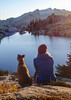
We sat up there and took a break to enjoy the 360 degree views. Tracie decided to explore a bit on the peak, and about 50 feet or so from the summit, she discovered a cave-like overhang that had all manner of evidence of illegal activity in it: empty food cans, blankets, clothes, empty butane canisters, empty water bottles, carpet shoes, trash, etc. There was also something up there that almost looked like a makeshift solar panel, but it could have been something else. On the way up to the peak we had seen an occasional empty water bottle, but I was surprised to see so much stuff right on the summit.

We made our way back to the picnic area the same way that we came up. It was very slow going though, as the steep and slippery slopes were not conducive to fast hiking -- it took us almost 4.5 hours to do this 3.9 mile hike, although we did spend a fair amount of time on the summit.

After getting back to our vehicle, we drove on Ajo Mountain Drive to the parking area at Arch Canyon. We hiked up Arch Canyon on a pretty decent trail, and then took a social trail up to the Arch. The ascent to the Arch was a bit steep and slippery in places, but it was a piece of cake compared to hiking up to Pinkley Peak. We got up near the Arch, and we may not have known where the Arch was except that it was a sunny afternoon and we could see the sun shining through the Arch. We found a trail that we could descend and take to get inside the arch. The arch is huge, and we enjoyed sitting in the arch. I enjoyed the hike to the arch, and I would do it again.

The distance and elevation gain for the 2 hikes is below. The stats above are the sum of the 2 hikes.
Pinkley Peak: 3.9 miles with an AEG of 1,604'
Arch Canyon: 3.3 miles with an AEG of 1,253'
 Geology
 Geology [ checklist ]
[ checklist ]  Natural Arch
_____________________
Civilization is a nice place to visit but I wouldn't want to live there
  2 archives
Dec 02 2018
avatar

 Guides 8
 Routes 70
 Photos 3,208
 Triplogs 273

59 male
 Joined Oct 07 2017
 Chandler, AZ
Arch Canyon - Organ Pipe NMSouthwest, AZ
Southwest, AZ
Hiking avatar Dec 02 2018
YoderTriplogs 273
Hiking3.70 Miles 1,640 AEG
Hiking3.70 Miles   3 Hrs   15 Mns   1.69 mph
1,640 ft AEG   1 Hour   4 Mns Break10 LBS Pack
 no routes
1st trip
Linked   none no linked trail guides
Partners none no partners
The description of this hike is Flatiron with an Arch, This about sums it up. Scramble wasn't very fun, but the arch is quite neat. As described the top has entirely to many cairns, make sure to pay attention to the old GPS because you can find yourself wondering all around the top of the mountain.
_____________________
J. Yoder
 
Dec 23 2017
avatar

 Routes 189
 Photos 7,244
 Triplogs 1,742

57 male
 Joined Apr 25 2011
 Goodyear, AZ
Arch Canyon - Organ Pipe NMSouthwest, AZ
Southwest, AZ
Hiking avatar Dec 23 2017
NightstalkerTriplogs 1,742
Hiking2.72 Miles 1,300 AEG
Hiking2.72 Miles   2 Hrs   1 Min   1.37 mph
1,300 ft AEG      2 Mns Break8 LBS Pack
 no routes
1st trip
Linked   none no linked trail guides
Partners none no partners
The wife and I were camping in Ajo and made the trek down to Organ Pipe NM. Driving the loop, we stopped to check out the arch. An impromptu hike followed. Since I didn't do any recon before the hike, I naively thought I could just follow the plentiful cairns. Well, I didn't end up any where near the arch and wasn't in the exploring mood. I was solo, it late in the afternoon and the winter sun was making a dash for the horizon, oh, and my wife was waiting [patiently?] back at the truck. I did my best not to kill myself scrambling back down the steepness to the canyon floor. My wife pretended not to mind the 2 hours she had to wait for me to return :)
_____________________
 
Feb 11 2017
avatar

 Guides 100
 Routes 63
 Photos 2,548
 Triplogs 184

76 male
 Joined Nov 21 2015
 Grand Junction,
Arch Canyon - Organ Pipe NMSouthwest, AZ
Southwest, AZ
Hiking avatar Feb 11 2017
Steph_and_BlakeTriplogs 184
Hiking2.40 Miles 1,210 AEG
Hiking2.40 Miles   5 Hrs      0.56 mph
1,210 ft AEG      45 Mns Break
 
1st trip
Linked   none no linked trail guides
Partners none no partners
Blake and I and two friends enjoyed this short, but fun, and somewhat strenuous hike while camping at Organ Pipe Cactus National Monument. We chose this place to camp and hike as it's only a 3-hour drive from Phoenix and it has good overnight temps in mid-February. We were very pleased with the campground (Twin Peaks) and the beauty of the area. Right from the trailhead you can see the main arch and there appears to be a small arch on top, but we'd have to get up there to be sure. The first half of the hike to the main arch was a well-worn path without much elevation gain (0.6 miles). The second half (another 0.6 miles) was where we gained the majority of the elevation. The second half was well-cairned (is that a word?) except that at the top there were cairns going off in different directions. You'll see from our route that we did a bit of wandering around before we found where to turn to reach the main arch. While wandering around we found a third arch (see photos 14 and 15). Finally, we dropped down a very loose trail to get to the main arch (probably no worse than certain areas on Picketpost). We had lunch while admiring the views from both sides of the arch. After leaving the main arch and carefully going back up the loose trail, I took a hard left to get a look at the smaller arch sitting above the main one. It is, in fact, a full arch. We came back down the same way we came up (although we turned our inReach off after lunch). We were the only ones on the trail that day after leaving the relatively flat part of the trail.
wildflower observationwildflower observationwildflower observationwildflower observationwildflower observation
Wildflowers Observation Isolated
Indian paint brush
_____________________
Stephanie and Blake Barnard
 
Nov 26 2016
avatar

 Routes 596
 Photos 9,608
 Triplogs 2,401

58 male
 Joined Jan 30 2011
 Chandler, AZ
Arch Canyon - Organ Pipe NMSouthwest, AZ
Southwest, AZ
Hiking avatar Nov 26 2016
JuanJaimeiiiTriplogs 2,401
Hiking2.89 Miles 1,378 AEG
Hiking2.89 Miles   1 Hour   39 Mns   1.75 mph
1,378 ft AEG
 no routes
1st trip
Linked   none no linked trail guides
Partners partners
Tortoise_Hiker
First time up to the Arch. Pretty darn cool. Not quite sure I understand the ocean of cairns up there? Just makes it more confusing in my opinion. Where is BobP when you need him. :lol:
_____________________
 
Nov 26 2016
avatar

 Guides 1
 Routes 148
 Photos 9,925
 Triplogs 3,654

63 male
 Joined Apr 02 2005
 Mesa, AZ
Arch Canyon - Organ Pipe NMSouthwest, AZ
Southwest, AZ
Hiking avatar Nov 26 2016
Tortoise_HikerTriplogs 3,654
Hiking2.89 Miles 1,378 AEG
Hiking2.89 Miles   1 Hour   39 Mns   1.75 mph
1,378 ft AEG
 
Linked   none no linked trail guides
Partners partners
JuanJaimeiii
JJ said he would take me to do the Sierra Del Ajo and this one was on the way and on a one way road, so.... :) . It's a good Arch hike so I was in. My third time and I only got off course once :) . The weather was great but an overcast sky makes it hard on the picture taking :( . It was still a great hike and good way to start our hiking day.
Thanks JJ! :D
_____________________
Tortoise Hiking. Stop and smell the Petrichor.
 
Apr 02 2016
avatar

 Routes 67
 Photos 966
 Triplogs 694

51 female
 Joined Jan 05 2012
 Phoenix,AZ
Arch Canyon - Organ Pipe NMSouthwest, AZ
Southwest, AZ
Hiking avatar Apr 02 2016
slowandsteadyTriplogs 694
Hiking3.24 Miles 1,390 AEG
Hiking3.24 Miles   3 Hrs   43 Mns   1.47 mph
1,390 ft AEG   1 Hour   31 Mns Break
 no routesno photosets
1st trip
Linked   none no linked trail guides
Partners partners
BiFrost
rwstorm
tibber
trekkin_gecko
uphill_junkie
_____________________
 
Apr 02 2016
avatar

 Guides 2
 Routes 9
 Photos 1,486
 Triplogs 944

female
 Joined Apr 28 2010
 Tucson, AZ
Arch Canyon - Organ Pipe NMSouthwest, AZ
Southwest, AZ
Hiking avatar Apr 02 2016
uphill_junkieTriplogs 944
Hiking3.94 Miles 1,969 AEG
Hiking3.94 Miles
1,969 ft AEG
 no routesno photosets
1st trip
Linked   none no linked trail guides
Partners partners
BiFrost
rwstorm
slowandsteady
tibber
trekkin_gecko
Super cool arch. Tons of cairns to seemingly nowhere. A lot of cairn happy people in this area! Based on the description of the hike, we should have seen the arch easily once on top of it. However, I'm blaming it on the sun, as Kelly, Karl and I swept right past it! You'd think something 700' across would be hard to miss! We managed to. :lol: When we got there, it was worth it!
_____________________
No pants!
 
Apr 02 2016
avatar

 Guides 21
 Routes 1,182
 Photos 36,858
 Triplogs 1,570

69 female
 Joined Feb 26 2004
 Phoenix, AZ
Arch Canyon - Organ Pipe NMSouthwest, AZ
Southwest, AZ
Hiking avatar Apr 02 2016
tibberTriplogs 1,570
Hiking3.24 Miles 1,390 AEG
Hiking3.24 Miles   3 Hrs   43 Mns   1.47 mph
1,390 ft AEG   1 Hour   31 Mns Break
 
1st trip
Linked   none no linked trail guides
Partners partners
BiFrost
rwstorm
slowandsteady
trekkin_gecko
uphill_junkie
First hike of our multi-hike and camping weekend. We all met up at the VC, paid for our passes and then set up at the Twin Peaks campground. They now have some ramadas.

I thot the Arch hike would be a great place for lunch based on the pics I saw from John and Denny's recent hike up there. So we drove over in two vehicles. It's at the north end of the Ajo Loop drive. It's a beautiful drive in and of itself. I knew the first part of the hike was easy but the next 1/2 mile was going to be a :pk: kicker. It was all that and more. Thankfully it was scenic on the way up and lots of cool geology. It was really rather surprising how quickly the topography and geology changed in this short hike straight up.

We grudgingly made our bodies go up and up with a moment or two to take a picture and in my case, make a movie. Once at the saddle or ridge area, it was even cooler, both in scenery views and temperature. Kathy took the lead and about 10 minutes later she says, "I see it". We continued to follow the cairns ignoring the ones that led further south and up the hill. We crossed down and up a ravine and got cliffed out to the west. However, I saw a little bit of a trail leading back toward the ravine. Kathy meanwhile found a "baby" arch so I had her sit in front of it for a pic before we decided to check out the possible route to the Arch.

Well this way didn't look the best either so we crossed back thru the ravine and started toward the other cairns we saw. At that time we saw Karl, Amy and Kelly coming back down from where they were. So they took the route we did and decided to go right down into the ravine from there. Kathy went back to the top of the ravine and as we came down it we spotted the cairns in the ravine and some above on the east side. It was a bit of a scramble to get down the ravine and then head toward the arch... a bit like Devil's Chasm except it's shorter and there's still stuff to hang onto.

We finally arrived at the Arch :DANCE: . I was sure hungry by then. We didn't spend much time as the wind picked up big time. It's a really cool sitting under the Arch and hoping a chunk of it wouldn't decide to come down. It is so massive you can't get the whole thing in a picture. But the views are quite sweet! As the wind blew us on our way, we headed back up the ravine which was a little easier as you really didn't need to worry about slipping.

The other 3 took off so quickly we really didn't see them again until the bottom. But that's okay with the 3 of us as we needed to be a bit more gingerly about getting straight down from here. There are about 3 areas that are a little tricky but other than that, not bad. Unfortunately, my trekking poles didn't do much good for Randy as they need to be tightened and would collapse too easy. We did encounter 3 people coming up and 2 others passed us going down.

We had paused at the 1/2 way tier and looked up to see some more holes in rock above us. I zoomed in and took some photos and discovered the people we saw were in that area :o ; not sure where that was in relationship to the route that's for sure. But imagine my surprise to see those people that I couldn't see at the time I took the photo. This last part is not as difficult as the top half so we made pretty good time on it. When we arrived at the trail, someone had put back up the sign about the ruggedness of the trail.
Now "the hiking for beer" part of our trek.

That "up" part was certainly a little steeper than I thot it would be when you go up a little over 700 feet in a 1/2 mile or so :sweat: . A great adventure to start our weekend at the Monument.
Part 1 - https://youtu.be/Hl ... _YVY
Part 2 - https://youtu.be/4Q ... E2Ls
Part 3 - into the Arch and back to the TH https://youtu.be/Zn ... 8DIE
_____________________
For me, sometimes it's just as much about the journey as the destination.
Oh, and once in awhile, don't forget to look back at the trail you've traveled.
  1 archive
Apr 02 2016
avatar

 Guides 4
 Routes 491
 Photos 10,890
 Triplogs 1,257

55 male
 Joined Nov 20 2012
 Phoenix, AZ
Arch Canyon - Organ Pipe NMSouthwest, AZ
Southwest, AZ
Hiking avatar Apr 02 2016
BiFrostTriplogs 1,257
Hiking3.75 Miles 1,510 AEG
Hiking3.75 Miles   3 Hrs   10 Mns   1.56 mph
1,510 ft AEG      46 Mns Break
 
1st trip
Linked   none no linked trail guides
Partners partners
rwstorm
slowandsteady
tibber
trekkin_gecko
uphill_junkie
Short hike up to a very cool Arch in Organ Pipe National Monument. First part of the hike is straight forward but once the route nears the top of the ridge we couldn't find the arch. You would think an arch that large would be easy to find but there were erroneous cairns all over the ridgeline so we ended up ascending about 1/2 mile further up the ridgeline than we needed to hike. Finally realized our mistake and headed back down and found the arch. Very cool to have lunch under the arch and relax with a nice cool breeze whipping through the opening. Enjoyed the views and a beverage before heading back down to the TH.
 Culture
 Culture [ checklist ]
[ checklist ]  Cag Shot
_____________________
  1 archive
Apr 02 2016
avatar

 Guides 1
 Routes 136
 Photos 22,415
 Triplogs 1,041

77 male
 Joined Feb 28 2003
 Tucson, AZ
Arch Canyon - Organ Pipe NMSouthwest, AZ
Southwest, AZ
Hiking avatar Apr 02 2016
rwstormTriplogs 1,041
Hiking2.78 Miles 1,237 AEG
Hiking2.78 Miles   3 Hrs   41 Mns   0.75 mph
1,237 ft AEG
 
1st trip
Linked   none no linked trail guides
Partners partners
HAZ - Group
BiFrost
slowandsteady
tibber
trekkin_gecko
uphill_junkie
One of the two hikes we did Saturday after establishing our camp sites at Twin Peaks Campground. For me this was part of three days in the Ajo/Organ Pipe area. I drove over to Ajo Friday and spent the night at a motel before meeting up with the others at the monument Saturday morning for the camping part of the trip. In all my previous visits to Organ Pipe the only hike I ever did was the Bull Pasture/Estes Canyon/Mt. Ajo one (this was also the first time I ever camped there). I didn't have any problems after doing Wasson Peak the week before, so I figured I would be alright on this one. It was pretty short, but I didn't bargain on it being like a mini-Flatiron! :o That's why I stopped up by the saddle above the arch. My knees were shot at that point, and though it was only about another 200 foot down climb to the arch, I decided to stop there while the others went on.

It's actually is a cool little hike, but the knee issues make going back down this kind of stuff really tough for me these days. Lots of pain and very slow going, but of course as long as there is cold beer waiting in my ice chest, I will always get the job done! :lol:

My only regret was not taking my trekking poles! :roll:
_____________________
  1 archive
average hiking speed 1.45 mph
1, 2  Next

WARNING! Hiking and outdoor related sports can be dangerous. Be responsible and prepare for the trip. Study the area you are entering and plan accordingly. Dress for the current and unexpected weather changes. Take plenty of water. Never go alone. Make an itinerary with your plan(s), route(s), destination(s) and expected return time. Give your itinerary to trusted family and/or friends.

helpcommentissue

end of page marker