username
X
password
register
for free!
help
ArticlesGuidesRoutes
 
Photosets
 
 Comments
triplogs   photosets   labels comments more
Heliograph Peak from Arcadia CG - 8 members in 21 triplogs have rated this an average 3.9 ( 1 to 5 best )
1, 2  Next
21 triplogs
login for filter options
Aug 31 2024
avatar

 Guides 16
 Routes 81
 Photos 1,269
 Triplogs 1,144

51 male
 Joined Apr 30 2008
 Tucson, AZ
Heliograph Peak from Arcadia CGTucson, AZ
Tucson, AZ
Hiking avatar Aug 31 2024
azdesertfatherTriplogs 1,144
Hiking10.50 Miles 3,489 AEG
Hiking10.50 Miles   6 Hrs   24 Mns   1.94 mph
3,489 ft AEG   1 Hour    Break20 LBS Pack
 no routesno photosets
1st trip
Linked   linked  
Partners none no partners
Started out at noon, with my sweet wife. Great day, great weather. Trail mostly in good shape. One water source with flowing water just under a mile from the parking lot, clear and running 3-5 gal/min.

Saw three baby snakes, they possibly eastern diamondbacks, but too small to tell as they went by fast. Only the thickness of my finger and maybe a foot long or just past that. Few butterflies, squirrels, birds as well. Also enjoyed some tiny wild raspberries, they were delicious!

This hike is a steady climb all the way.

Enjoyed a nice late lunch on the top, with beautiful views underneath the hum of the towers on top.

water 1 out of 5water 2 out of 5water less than maxwater less than max Wet Canyon Light flow Light flow
3-5 gal/min, very clear and clean
_____________________
"I went to the woods because I wished to live deliberately, to front only the essential facts of life, and see if I could not learn what it had to teach, and not, when I came to die, discover that I had not lived." — Henry David Thoreau
  3 archives
Jun 10 2024
avatar

 Guides 13
 Photos 15,617
 Triplogs 323

male
 Joined Oct 23 2010
 mesa
Heliograph Peak from Arcadia CGTucson, AZ
Tucson, AZ
Hiking avatar Jun 10 2024
gummoTriplogs 323
Hiking17.32 Miles 3,232 AEG
Hiking17.32 Miles   7 Hrs   58 Mns   2.23 mph
3,232 ft AEG      11 Mns Break
 no routes
1st trip
Linked   none no linked trail guides
Partners none no partners
Longest hike and definitely out of my comfort zone. I choose this trail to look for twin-spotted rattlesnakes and bears. I started from Shannon CG. I hiked down slowly because I was not feeling well. My back was hurting and then pain appeared on the upper right portion of my knee, a pain that I never experienced before. The pain did not last but did come back at the end of the hike. It was sharp and did not return the next day as I type this. I opted to not hike up the trail but choose to walk the road back. I felt that it would be easier on my knee, which it was, and I felt that I would have a better chance of seeing a bear on the road, which I almost did.

It was 10 miles back to the car via road. I didn't see much on the road except a Western tanager, which flew away as soon as I got my camera out. I regret not taking Turkey Flat trail to Ladybug Trail because it would have reduced the distance and provided more shade along the way.

About 2 miles from the car, I saw a van driving toward me. I abruptly stopped. I assumed he saw a bear. I tried to run toward it, but my legs were not having it. The driver told me what I assumed. I tried to find the bear down the hill. I heard it rumbling down the hill but could not see it.

I was going to stay an extra night here, but I was too exhausted after this hike and decided to leave. Plus, I am going to Kenya soon and need to prepare for my trip.
_____________________
  1 archive
Jun 12 2022
avatar

 Routes 15
 Photos 128
 Triplogs 16

male
 Joined Mar 20 2022
 Safford, Arizona
The Raspberry Laden Heliograph Trail, AZ 
The Raspberry Laden Heliograph Trail, AZ
 
Hiking avatar Jun 12 2022
RockinronnieFTriplogs 16
Hiking2.06 Miles 355 AEG
Hiking2.06 Miles   1 Hour   29 Mns   1.96 mph
355 ft AEG      26 Mns Break10 LBS Pack
 
1st trip
Route Scout Route Recorded  on Route Scout | Pop | Map | Popup | MapDEX
The best hike when family are in town! Or, perhaps your wife is a rare hiker. The soft footed covered Trail to Heliograph Peak is a great choice. You can hike the mile to Eagle Rock like we did, to the dramatic Eagle Rock. Rest, and hike back to Shannon's n Campground. The view to the north is expansive, inspiring. You do climb gradually 300 feet for good exercise. Come in late July and join the bears for sweet Mt Graham raspberries. :D
wildflower observationwildflower observationwildflower observationwildflower observationwildflower observation
Wildflowers Observation Substantial
Raspberry, Locust, Aspen
 
Jun 04 2022
avatar

 Routes 15
 Photos 128
 Triplogs 16

male
 Joined Mar 20 2022
 Safford, Arizona
The 10 000 ft Heliograph still cool, AZ 
The 10 000 ft Heliograph still cool, AZ
 
Hiking avatar Jun 04 2022
RockinronnieFTriplogs 16
Hiking4.68 Miles 1,072 AEG
Hiking4.68 Miles   4 Hrs   20 Mns   1.96 mph
1,072 ft AEG   1 Hour   57 Mns Break
 
1st trip
Linked   linked  
Partners none no partners
Route Scout Route Recorded  on Route Scout | Pop | Map | Popup | MapDEX
The Heliograph Peak provides an easy access to a 10,000 altitude arrival, and, is the top, and, cool! The loop has 3 main attractions, the crazy high tower at the spacious top, raspberry bushes along the way, and, our beautiful quaking aspens line the entire loop. We started about 9:30 and done about 1:30 pm. The walk up is a smooth dirt road, down, a beauty through the forest. So wish list this 1000' altitude hike, and, the one of a kind drive up Mt Graham Swift Trail
wildflower observationwildflower observationwildflower observationwildflower observationwildflower observation
Wildflowers Observation Substantial
Raspberry Bushes, Quaken Aspen
 
Nov 20 2021
avatar

 Guides 73
 Routes 176
 Photos 10,174
 Triplogs 2,324

46 male
 Joined Sep 08 2006
 
Heliograph Peak from Arcadia CGTucson, AZ
Tucson, AZ
Hiking avatar Nov 20 2021
JimTriplogs 2,324
Hiking10.00 Miles 3,489 AEG
Hiking10.00 Miles   5 Hrs   30 Mns   1.90 mph
3,489 ft AEG      15 Mns Break10 LBS Pack
 no routes
Linked   none no linked trail guides
Partners none no partners
It has been warm enough lately I thought I could hike above 10,000' once more this year before winter. While everything looks like winter minus the snow, it was pretty mild for late November on Heliograph. Then again, for being about 600' higher than Wrightson, it was cold compared to last weekend. I was in shorts there. Here, I had on some layers. It might be nice to snowshoe on Heliograph or up the High Peak Road, if there is enough snow this winter.k

I also wanted to see about the trail work. Well, despite claims, the trail is not open all the way to the Noon Ridge. Close, but there are a couple hundred feet which remain thorny and are as they were in summer; terribly overgrown. Most of the trail has been opened up above this, but there is still a lot of locust and currents with thorns in that one section. Otherwise, no changes.

Also, the gully crossing remains. No new trail or improvements, so expect to use the rope, if you attempt this from Arcadia.
_____________________
🍭
 
Jun 26 2021
avatar

 Guides 73
 Routes 176
 Photos 10,174
 Triplogs 2,324

46 male
 Joined Sep 08 2006
 
Heliograph Peak from Arcadia CGTucson, AZ
Tucson, AZ
Hiking avatar Jun 26 2021
JimTriplogs 2,324
Hiking10.00 Miles 3,489 AEG
Hiking10.00 Miles   6 Hrs   30 Mns   1.74 mph
3,489 ft AEG      45 Mns Break10 LBS Pack
 no routes
Linked   none no linked trail guides
Partners none no partners
Most hikers will probably want to avoid the Arcadia Trail. I agree with, "MAP", the last 3/4 to 1 mile of trail before the junction with the Shannon Trail is really over grown. It's approaching impassable, and already is for a lot of people. It's heavy with NM Locust and wild rose, both of which have thorns, and also aspen and a current with flowers which create a tangle of stems leaning over the trail at chest and head height. At times it was more like a wall of vegetation than a trail. Bring Danny Trejo, who is Machete, and you might have an easier time. Still, with really cut legs and torn shorts, I got through.

It was nice to be back in the Pinalenos, since I have only ever hiked here one time. This was in 2015, just over 6 years ago, and right before I moved to Phoenix. I had driven up as far as Soldier Creek CG in 2005, but that was it. I planned to return 4 years ago, but the Frye Fire forced me to cancel and I went to Utah, where I had a great time.

I read about the wash out in one of the logs from the 2018 group that did this, and decided to wait for that to be dealt with. It never was, and the solution is a half-assed one: a rope to make the climb down and up the washed out slope manageable. It can't be an Official FS solution the way they close trails for "danger" post fire, so I think this is another ignored trail with little hope of maintenance anytime soon.

Once past the wash out, the trail is pretty good. It gradually gets more covered with ferns and locust as you move higher, before you make the traverse around what I think is upper Noon Creek and encounter the terrible over grown conditions. I don't know if the upper Noon Creek Trail even exists anymore. There is no evidence of it near Arcadia.

Because I came here to hike this, I did. I still enjoyed my outing, I just would have enjoyed it more if my shorts didn't get torn. Same with my skin. I won't do this trail again until it gets attention, or burns. Which ever comes first. I don't have a preference. In it's current state, I won't hike it again. At least now I know why there are basically no logs for this, when compared to the 2 Heliograph options from the Shannon TH. I probably should have taken up the friendly offer to be driven down to Arcadia CG from the Shannon TH, as a camper from the Arcadia CG was on the summit. He had hiked from Shannon CG TH after he had given up on the Arcadia around the wash out, but I felt I had to hike down. Oh, well.

The good news is that there is a lot of solitude on this, and plenty of enjoyable birds. I heard fewer hummingbirds than in 2015, but the columbines and penstemons are still abundant. Hermit thrush were common around Heliograph, and in the lower trail around the campground. You can't hear much of anything besides a roaring diesel engine for the microwave towers on the summit, however. Oh! Lots and lots of bear scat, all over the trail. If this isn't a bear highway, it's a bear toilet. Some was fresh, too.

Finally, I'll have to return a few more times to this range before the road closes. While I do want to hike some of the shorter trails on top, since there are basically no longer ones, or no longer ones that come from lower down and a paved road. I "discovered" the Angle Orchard just off the Swift Trail slightly above the 5000' level. It's not new, I just didn't notice the sign in 2015 or 2005, unless the signs are new. Lots of apples and summer peaches.
 Flora
 Flora [ checklist ]
[ checklist ]  Yellow Columbine
wildflower observationwildflower observationwildflower observationwildflower observationwildflower observation
Wildflowers Observation Moderate
_____________________
🍭
  1 archive
Oct 23 2020
avatar

 Routes 137
 Photos 1
 Triplogs 105

44 female
 Joined Oct 21 2016
 Tempe, AZ
Heliograph Peak from Arcadia CGTucson, AZ
Tucson, AZ
Hiking avatar Oct 23 2020
MAPTriplogs 105
Hiking9.58 Miles 3,525 AEG
Hiking9.58 Miles   7 Hrs   6 Mns   1.50 mph
3,525 ft AEG      43 Mns Break
 
no photosets
1st trip
Linked   none no linked trail guides
Partners none no partners
Words of wisdom for this trail: wear long pants and bring a machete. It is not as overgrown as some trails I've been on recently but pretty overgrown in some places and, as you get closer to the top, everything has long sharp thorns. My shoes are ripped, my hand cut open. Seriously, a machete or clippers would be a favor to all. Views are beautiful the entire hike. I think the spot that threw me off most was the creek crossing toward the beginning of the trail. The trail seems to have experience fallout from fire damage and the place I went down was a climb up through loose dirt and steep climb down through loose dirt. I saw other paths going down to the creek as I was first coming from the campground & I think taking one of those to get down to the creek sooner may be the way to go.
_____________________
 
May 07 2016
avatar

 Routes 7
 Triplogs 11

43 male
 Joined Mar 18 2017
 Dallas, TX
Heliograph Peak LoopTucson, AZ
Tucson, AZ
Hiking avatar May 07 2016
zlewisTriplogs 11
Hiking4.20 Miles 1,070 AEG
Hiking4.20 Miles   2 Hrs   54 Mns   1.45 mph
1,070 ft AEG
 
no photosets
1st trip
Partners none no partners
Second hike of the day after Graham and friends. Took a few minutes to scramble up Eagle Rock on the way up Arcadia.
_____________________
"He who climbs Mt. Fuji is a wise man; he who climbs it twice is a fool." - Japanese proverb
  1 archive
Jun 11 2015
avatar

 Guides 73
 Routes 176
 Photos 10,174
 Triplogs 2,324

46 male
 Joined Sep 08 2006
 
Heliograph Peak from Arcadia CGTucson, AZ
Tucson, AZ
Hiking avatar Jun 11 2015
JimTriplogs 2,324
Hiking10.00 Miles 3,322 AEG
Hiking10.00 Miles   5 Hrs   45 Mns   1.88 mph
3,322 ft AEG      25 Mns Break15 LBS Pack
 no routes
Linked   none no linked trail guides
Partners none no partners
Personally, if you weren't me, I wouldn't read this very long log, but...

I had wanted to return to the Pinalenos since I first drove up the Swift Trail in mid-October of 2005; Columbus Day Weekend. It took nearly 10 years, but something always seemed more interesting as a trip, or the weather wasn't very good for a trip this spring. The range isn't as big as I remember, but then I've been out here for 8 years. Also, I recall more pine, but the transition to fir and sub-alpine species was much faster than I remembered.

Last time, I spent no more than 3 hours, and probably more like 2, driving up the road as far as Soldier Creek Campground before turning around. Views were spectacular, as I recall it was cold and dry, and I didn't camp (which might have been nice) due to a lack of real food and the forecast for a hard freeze for elevations above a level below the campground. I had previously spent the night camped at Hannigan Meadow and woke up to 9 inches of snow that morning, so a hotel was more appealing. Besides that, I think my summer camping gear was wet, from the snow. I do remember drying my boots ( used those then) in the motel in Wilcox, and my tent and sleeping bag at a warm sunny spot off I-10 in New Mexico. Still, I always wished I camped there.

This time, before the hike (to be fresh and have energy) I opted to drive the road to Chelsey Flat and turned back from there as I had enough of driving. My impression was that most of the views were from the paved section, and that it was still cold. It was only hovering around 60 to 62 degrees along the road, in the shade of the trees and the shade from the persistent clouds from the tropical mass. It was also very humid, so the cool temperatures felt clammy, and not crisp. It did appear to have rained, as the soil surface was moist, at Chelsey.

After turning around, I slowly drove back to the Arcadia CG to hike what I had read is one of the true, and few peaks on the range to have views, Graham being off limits and covered in dead trees which block the views, and dead from the fire. This one also has significant AEG, unlike many other peak hikes in the range. Initially, I was unable to located the TH. This is partly due to the new signs for THs on the road, and partly due to the name change for the area. This is now a group camp site at the Upper Arcadia CG, and no longer a picnic area. The sign is small, brown, and doesn't stick out at you when a van is parked next to it. The new signs are large and have big maps on them, like the other new signs throughout the Coronado NF. Eventually, I noticed the small brown sign, but what was more confusing, is that the arrows for the trail, point to the left, and not up, so I expected the trail to leave from some spot other than the rear of the group campsite. If you hike this when the group campsite is occupied, you will have to walk right by the group, which might be strange. Hopefully, they don't mind and don't have tents set up to block the trail, or even on the trail, which will complicate things.

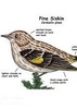
The trail reminded me variously of the AB Young( pre-fire); because it is well worn and yet overgrown, The Elden Lookout Trail; from the aspen and dead trees on top, and the Navajo Mountain Trail/ Hike; due to the appearance of the summit and lack of any wide views, or so it felt. Other trails come to mind, too, Guadalupe Mountain Trail in Texas, but not as much. The trail and hike are enjoyable, but in time the thorns from the locust and other plants might make this less so. Birds were very, very plentiful, and after doing this once, I would almost just walk slowly in the area to listen to birds and stop at the vistas, rather than attempt to gain AEG or bag some summit.

The summit was rather dull. It was my first time over 10,000 feet since I was on the Peaks early last October, and I felt it by going slower and feeling sluggish at the higher elevations. I'm not acclimated to high elevation, anymore. I had read on SP that MT Graham is a dull summit hemmed in with trees and has no views. That author recommended Heliograph, among others, but aside from a few directions, the views here were confined and actually a little better from the road. It's still a nice summit but with the towers, and several diesel generators running to power several microwave, and other radio towers, it was a place I would leave rather than stay. At least Elden doesn't have that Truck Stop feel! I was able to see New Mexico and the Mogollon Mountains in the Gila NF, as well as what should be the White Mountains, and then the Chiricahua Mountains. Off summit, the Catalinas, Rincons, Galiuros, and even Santa Ritas, were all visible. The aspen covered parts near, but off summit, were really enjoyable.

Hiking down I was happy to have done this, but felt that if I was to return to this part of the range, I would either do a shorter hike to go slower and enjoy the birds, or just wander the road up to the peak. Not that the trail was bad, but sometimes the best part of a hike is simply being in the forest enjoying what that particular area has to offer. In this case, stopping at a view point and relaxing while listening to what seemed like a hundred different bird species, might be preferable to going 10 miles, 8 of those while having a tuna can (from lunch) clanging away in your pack. Keep in mind that I left the summit after 5, and wanted to drive down the road to see some of the views. Watching the hummingbirds and listening to a few other species on the upper slopes was a particular highlight, as was the running water in the section of Noon Creek, a large Arizona Black Walnut along the creek, the variously alive and dead old growth trees, and a seep spring right on the trail up higher.

I opted to skip camping, as with the humidity and after getting my legs scratched up, I wanted a shower. So, I drove to Safford, had a Carl's Jr 1/2 lb Avocado burger, and drove home while attempting to take several of those photos of people who slept on the ride home. This hike is about my limit for a day hike, with regard to the driving distance, especially on the ride home. Though, it might not be so if I didn't spend a couple of hours touring the upper Swift Trail.

I want to return to the Pinalenos, and hopefully it is weeks or months, and not years. Ideally, I would camp, and if I didn't just wander around the range, I would do a series of small and lazy hikes, or an easier one that allows for more stops and a slower pace to enjoy the sounds. Why would I want to race through a trail here and miss the attractions? Blue Jay Peak loop comes to mind, as does Webb Peak, and a few others.
 Flora
 Flora [ checklist ]
[ checklist ]  Arizona Pine
wildflower observationwildflower observationwildflower observationwildflower observationwildflower observation
Wildflowers Observation Moderate
Lots of hummingbirds buzzing around them, too.
_____________________
🍭
 
Aug 24 2014
avatar

 Routes 596
 Photos 9,604
 Triplogs 2,400

58 male
 Joined Jan 30 2011
 Chandler, AZ
Heliograph Peak from Arcadia CGTucson, AZ
Tucson, AZ
Hiking avatar Aug 24 2014
JuanJaimeiiiTriplogs 2,400
Hiking10.00 Miles 3,322 AEG
Hiking10.00 Miles   3 Hrs   27 Mns   3.05 mph
3,322 ft AEG      10 Mns Break
 no routes
1st trip
Linked   linked  
Partners none no partners
This was my second hike for the day. My original plan was to do this one yesterday and then hike Bassett Peak today. On my way down I took a side trip to Mexico to get a haircut and for some reason the border was all backed up. It took me 2.5 hours to cross back over. Normally about 15 minutes. Anyway that put a wrench in my Saturday hiking plans.

This hike was freaking fantastic and I hit it at the perfect time. Tons of wild flowers of all colors. My favorites are the Columbines. Then after mile 3 I hit the raspberry jackpot. Boom they were still there and there were tons of them. They were just falling off into my hands. It pretty much slowed my roll but that is fine by me. I don't ever buy raspberries in the grocery store but I sure do love them out on the hiking trail.

The trail is in great shape overall and was much improved since my last visit a couple years ago. I couldn't have asked for a better day to be out on these two great trails!
_____________________
  1 archive
Aug 07 2011
avatar

 Routes 596
 Photos 9,604
 Triplogs 2,400

58 male
 Joined Jan 30 2011
 Chandler, AZ
Arcadia Trail #328Tucson, AZ
Tucson, AZ
Hiking avatar Aug 07 2011
JuanJaimeiiiTriplogs 2,400
Hiking4.90 Miles 2,830 AEG
Hiking4.90 Miles   5 Hrs      0.98 mph
2,830 ft AEG
 no routesno photosets
1st trip
Partners none no partners
Got rained out about a mile or so into this one yesterday so I had to abort. Today however was a perfect day to come back and hike the Arcadia Trail up to the Heliograph Lookout Tower and then over to Shannon Campground and back down to the Arcadia Trailhead.

This is an amazing trail except for one big problem! From Mile 2 to the end of Mile 4 going up it is VERY overgrown and littered with fallen trees. Needless to say wearing shorts was a mistake. My legs are all cut up from the thorny plants that are everywhere. Once up near the Heliograph turn and up to the Tower it gets much better. Then the last mile from the Heliograph trail over to the Shannon Campground it is nearly perfect.

What was super cool was from mile 3.5 and up there were TONS of wild raspberries. I couldn't resist and must have had somewhere between 50 and a 100 of them round trip! Soooo Good! The best way to get to them if you are into such a thing would be to drive the road up to the Shannon Campground and then work your way down to them. It wouldn't take long and you wouldn't have to deal with the overgrowth and fallen trees.

Heliograph Tower was neat to see but sadly it isn't open to the public. I would have loved to climbed up and gone inside. It has a cool history and the elevation at the base of it is 10,028 so it is worth the side trip either way in my humble opinion.

On the way back down it started to sprinkle lightly which was just perfect and made the mountain with all its plant life super fragrant. I was enjoying the view and making good time when I nearly stepped on a 5 foot long rattler. He was right in the middle of the trail. Once I saw him I must have jumped a couple feet in the air and then away from him! He was not at all happy with me and coiled right up and was ready to strike. I asked him to smile for a couple photos and then went on my way.

It continued to sprinkle but never got muddy. What was amazing to me is that the whole time I was hiking I only saw one other couple on the trail.

I really enjoyed so many things about this one and would strongly recommend it. If you are going to do the middle section at all you may want to wear pants and save the shins. :)
_____________________
 
Dec 12 2010
avatar

 Guides 170
 Routes 148
 Photos 5,914
 Triplogs 2,097

48 male
 Joined Apr 12 2004
 Tucson, AZ
Heliograph Peak from Arcadia CGTucson, AZ
Tucson, AZ
Hiking avatar Dec 12 2010
PrestonSandsTriplogs 2,097
Hiking10.50 Miles 3,559 AEG
Hiking10.50 Miles
3,559 ft AEG
 
no photosets
1st trip
Linked   none no linked trail guides
Partners none no partners
I had done the bottom and the top of this trail, but never the middle section. Blessed with an unusually warm December day, I hiked the entire thing. Even with all the fire damage, I still found this to be a great hike. Plenty of steep terrain and nice views: yeah! All the new aspen shoots in the burn areas are encouraging. A trail crew cleared the trail of logs earlier this year, but a number of big ones have crashed down since then.

https://www.youtube.com/user/PrestonTheY ... fk6oTatW-4
_____________________
"…you never know when a hike might break out" -Jim Gaffigan
 
Oct 30 2010
avatar

 Routes 5
 Photos 2,001
 Triplogs 50

56 male
 Joined Oct 11 2010
 Phoenix, AZ
Heliograph Peak from Arcadia CGTucson, AZ
Tucson, AZ
Hiking avatar Oct 30 2010
Kel1969Triplogs 50
Hiking10.00 Miles 3,322 AEG
Hiking10.00 Miles   5 Hrs      2.00 mph
3,322 ft AEG
 no routes
1st trip
Linked   none no linked trail guides
Partners none no partners
Great Hike. Trail is in good shape. Lost it only once on a way up :). One regret: did not do this trail before the fire, but scenery is still amazing.
 Flora
 Flora [ checklist ]
[ checklist ]  Coral Bells
foliage observationfoliage observationfoliage observationfoliage observationfoliage observation
Autumn Foliage Observation Substantial
_____________________
 
Aug 16 2009
avatar

 Photos 832
 Triplogs 173

47 female
 Joined Oct 13 2007
 Loveland, CO
Heliograph Peak from Arcadia CGTucson, AZ
Tucson, AZ
Hiking avatar Aug 16 2009
hhwolf14Triplogs 173
Hiking12.00 Miles 3,322 AEG
Hiking12.00 Miles
3,322 ft AEG
 no routes
1st trip
Linked   linked  
Partners none no partners
Wow, that was miserable! I hiked this trail from the Upper Arcadia CG, to the summit, down the gravel road to the Shannon CG, and back to the Arcadia TH. The trail from the Shannon CG and the hike to the top from the trail junction were actually very sweet, a beautiful area. However the trail from Arcadia is SIGNIFICANTLY overgrown, and unfortunately I packed light, no pants for protection. :o The raspberry bushes are insanely thick and sharp! There is a lot of deadfall too, which I don't mind, but between that and the overgrowth, staying on the trail was a bit challenging. Again, this would be a beautiful trail from the Shannon CG. Or with a machete and football pads : rambo :
_____________________
 
May 25 2008
avatar

 Guides 7
 Photos 216
 Triplogs 41

48 male
 Joined Jun 17 2002
 Boulder, CO
Heliograph Peak from Arcadia CGTucson, AZ
Tucson, AZ
Hiking avatar May 25 2008
ferazamboniTriplogs 41
Hiking10.00 Miles 3,322 AEG
Hiking10.00 Miles   2 Hrs      5.00 mph
3,322 ft AEG
 no routesno photosets
1st trip
Linked   none no linked trail guides
Partners none no partners
We spent memorial day 2008 camping at Arcadia campground. It was perfect! It had rained/snowed on the mountain that Friday, but because the camp is at 6500ft it menlted by early Saturday morning.

The Arcadia Trail starts at the Arcadia camp ground "group site". This is located just above the main Arcadia camp ground, and you can actually walk up to it from camp site 11, and then bear right. Optionally you can park at the group site, which is the first right turn after the main Arcadia camp ground.

The trail is amazing. It is certainly a steady workout, but the views along the way are awesome. We did not complete the trail because there was a great deal of snow once the trail reached 8000ft.
_____________________
 
Sep 08 2007
avatar

 Guides 17
 Routes 297
 Photos 1,808
 Triplogs 276

female
 Joined Mar 11 2002
 Gilbert, AZ
Arcadia Trail, AZ 
Arcadia Trail, AZ
 
Hiking avatar Sep 08 2007
VashtiTriplogs 276
Hiking3.00 Miles
Hiking3.00 Miles   2 Hrs      1.50 mph
 no routesno photosets
1st trip
Linked   linked  
Partners none no partners
We went up part of the Arcadia trail on Mount Graham. The Arcadia trail connects the Arcadia campground at the bottom to the Shannon campground at the top. The Arcadia trail looks to have suffered some damage from the last burn about two years ago. Possibly as a result of the burn, the trail is somewhat overgrown with new growth and a victim of erosion. This being said, there was no question of where the trail is. It was slightly precarious going into the ravine, and also on the edge going up. Again, I believe this may be a result of erosion post burn. As we had Kiddos in backpacks, we didn't go too far given the discomfort with the trail condition.

The forest service description of this trail is located at:
http://www.fs.fed.us/r3/coronado/forest ... adia.shtml

There are good views from the trail, and according to the ranger, we were in the area at the peak of wildflower season. We did see a number of wildflowers of all colors. There was water flowing in the ravine. There were some bugs, but not too bad. We only saw one other party on the trail, so it wasn't crowded despite the Arcadia campground being fairly full.
_____________________
:D
 
Oct 01 2006
avatar

 Guides 93
 Routes 397
 Photos 4,984
 Triplogs 4,124

49 male
 Joined Jun 20 2003
 Tucson, AZ
Heliograph Peak from Arcadia CGTucson, AZ
Tucson, AZ
Hiking avatar Oct 01 2006
fricknaleyTriplogs 4,124
Hiking10.00 Miles 3,322 AEG
Hiking10.00 Miles   4 Hrs   30 Mns   2.22 mph
3,322 ft AEG
 no routes
Linked   none no linked trail guides
Partners none no partners
FInally came back to complete my climb of Heliograph peak after getting turned back by lightning a few years ago. Nice tough climb for the distance. HUGE assortment of wildflowers still going strong. Lot of lizzards, butterflies and deer to. Also saw quite a few woodpeckers, which always crack me up.

Though different after the fires, this remains a sensational climb.
_____________________
hi
 
Sep 11 2003
avatar

 Triplogs 1

male
 Joined Sep 14 2003
 Apache Junction,
Heliograph Peak from Arcadia CGTucson, AZ
Tucson, AZ
Hiking avatar Sep 11 2003
runnerTriplogs 1
Hiking7.60 Miles 3,322 AEG
Hiking7.60 Miles
3,322 ft AEG
 no routesno photosets
1st trip
Linked   none no linked trail guides
Partners none no partners
I learned about this website camping at Arcadia this week, what a wonderful resource. My wife and I love to drive down here and this is one of our favorite trails. It takes us 3 hours to get to the summit. There aren't a whole lot of views from the trail itself but from the tower you can get a good persepctive on the area. We've been lucky and have been allowed up into the tower twice but sometimes they won't let you. More than making up for the lack of views from the trail is the opportunity to spot wildlife. We always see deer and even a few black bear.
_____________________
 
Aug 10 2003
avatar

 Guides 93
 Routes 397
 Photos 4,984
 Triplogs 4,124

49 male
 Joined Jun 20 2003
 Tucson, AZ
Heliograph Peak from Arcadia CGTucson, AZ
Tucson, AZ
Hiking avatar Aug 10 2003
fricknaleyTriplogs 4,124
Hiking7.60 Miles 3,322 AEG
Hiking7.60 Miles
3,322 ft AEG
 no routes
Linked   none no linked trail guides
Partners none no partners
First trip to the Pinalenos. Arcadia trail was awesome before the fire. Shaded and fragrant the whole way. Steady climbing up to Heliograph where we got turned back by lightning just shy of the summit.
_____________________
hi
 
Jun 05 2003
avatar

 Guides 8
 Photos 48
 Triplogs 66

55 male
 Joined Mar 07 2003
 Apache Junction,
Heliograph Peak from Arcadia CGTucson, AZ
Tucson, AZ
Hiking avatar Jun 05 2003
whereveriroamTriplogs 66
Hiking7.60 Miles 3,322 AEG
Hiking7.60 Miles   6 Hrs      1.27 mph
3,322 ft AEG
 no routesno photosets
1st trip
Linked   none no linked trail guides
Partners none no partners
We did this hike on a Thursday in early June and encountered no one until the Shannon CG trail intersection. We found that besides the very start of this trail it was an excellent and easy trail to follow although we encountered several downed trees. Since it's about a 3 hour 30 minute drive from Phoenix we drove up the day before and camped at Arcadia CG which is were the trail starts from. Great thing about camping and hiking in the middle of the week is that we usually have everything to ourselves :) From the looks of the trail and campground this area seems to get much use. all thought there weren't any views along this trail it was very green, cool with lots of shade from the pines. We hiked thru some old burn area's along the way that seem to be recovering nicely with some miniature fern forests to wade thru. Near the top you come across an aspen lined meadow that seems to have been created by a bulldozer as a fire line some time ago, from here it's about a 2 minute hike to summit. There's a nice Forest Service cabin up top along with communication equipment and a staffed fire watchtower. The fire tower is the tallest in the Coronado n.f. but unfortunately it's closed to public access. The views are limited from the peak but I would do this trail again, it's that nice. Oh! I forgot to mention the bottom half of the trail was SWARMING with various bugs. Our guess was that they were due to left over winter and spring moisture that was drying up quickly, I hope. They were so bad we donned our bandana's for the bank robber look so you might want to bring lots of bug repellent just in case. Happy Trails
_____________________
Arizona Backpackers ClubCopper State Backpackers
 
average hiking speed 1.75 mph
1, 2  Next

WARNING! Hiking and outdoor related sports can be dangerous. Be responsible and prepare for the trip. Study the area you are entering and plan accordingly. Dress for the current and unexpected weather changes. Take plenty of water. Never go alone. Make an itinerary with your plan(s), route(s), destination(s) and expected return time. Give your itinerary to trusted family and/or friends.

helpcommentissue

end of page marker