|
| | | |
| |
|
| Hiking | 7.35 Miles |
2,070 AEG |
| | Hiking | 7.35 Miles | 2 Hrs 40 Mns | | 2.85 mph |
| 2,070 ft AEG | 5 Mns Break | | | |
|
|
| |
| Linked |
|
none
[ show ]
| no linked trail guides |
| Partners |
|
none
[ show ]
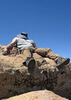
| no partners | | Storm clouds parted to reveal freshly snow frosted San Francisco Peaks, which seemed ideal for a spur of the moment snow hike on Abineau-Bear Jaw loop. I hit the trail at 3:50 pm, with no snow, sunny skies, 35 degrees, and one other car at the trailhead. Went up Abineau first. A dusting of snow appeared at the bottom of Abineau, which gradually began to get heavier as I climbed higher. A few other boot prints belonged to two descending hikers, the only others I saw on the whole loop.
When I left the tree cover in Abineau avalanche alley, the bitter wind was racing through the canyon, which was covered in several inches of fresh snow. Humphreys stood high above, caked in white, while ragged clouds sailed quickly across the skyline.
At the Abineau/Waterline junction, I fought to keep my jacket from sailing off into the canyon winds like an errant windsock as I changed into dry layers and added more. I questioned my decision to hike in low 20s, windy weather, but was committed and determined at that point. The scenery was absolutely worth it though.
I warmed up as I cruised quickly along Waterline, thinking of my last hike on this trail with Joe and Liz 12 years earlier. I turned onto Bear Jaw Trail at sunset, and thankfully the wind had died down. Bear Jaw was a straightforward cruise to the bottom, with steadily diminishing snow cover. Only needed a headlamp for the last half mile or so. 26 degrees at the trailhead at dark. A very fun and memorable hike! |
|
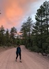
Autumn Foliage Observation Light
Most aspens were bare on the north slope of the Peaks in this area. |
|
| _____________________
| "…you never know when a hike might break out" -Jim Gaffigan |
| | |
|
|
|
 Route Editor