|
| | | Trumbull - Logan - Vulcan - Toroweap, AZ | | | |
|
|
Trumbull - Logan - Vulcan - Toroweap, AZ
| | |
| |
|
| Hiking | 8.10 Miles |
2,639 AEG |
| | Hiking | 8.10 Miles | | | |
| 2,639 ft AEG | | | | |
|
|
| |
| Partners |
|
none
[ show ]
| no partners | | After making the ascent of the Kaibab Plateau highpoint the day before, we drove to the Trumbull TH and car camped for the night. There was a very clean vault toilet there and a water spigot, so it was a good place to camp
Mount Trumbull
We got up early, had a quick breakfast and a cup of coffee, and hiked up to Trumbull. This was a class 1 walkup on a nice trail. We gained about 1,000 feet of elevation in the first 1.4 miles or so; thereafter, the grade was much more gradual. The hike was in a forest, which was nice, and there were some decent views off to the south. The trail got a bit more faint about 75% of the way to the summit, but there were lots of cairns which made route-finding a non-issue. With all the trees, views were limited at the summit. We walked a short distance to an overlook on the north side of the mountain which had some decent views. At the summit there was a benchmark, two reference marks, a height of light pole stuck in a summit cairn, and a register log.
We went back the way that we came, broke up our campsite, and headed out on the 7 mile drive to the Mount Logan TH.
Mount Logan
This was a short hike on a nice trail that was easy to follow. The hike was in a forest, but things opened up at the summit where there were some surprisingly good views. This was an easy, enjoyable hike!
Vulcan's Throne
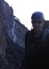
After hiking Mount Logan, we drove toward Toroweap. The BLM roads were really good to drive on, but the roads were quite a bit worse once getting into the Granc Canyon NP. We took a road toward the Lava River Trail, and it was getting really sandy and we were lucky not to get stuck in my buddy's AWD CRV. Thankfully he had some new all terrain tires. I would not recommend driving the road without 4WD. We found a pullout to park and made the off-trail ascent of this peak, which was my 2nd Grand Canyon summit. We basically followed the route that @chumley used when he ascended this peak. As we ascended we were mostly next to a gully that went up to a ridgeline just west of the summit.
On the way up we saw the biggest jackrabbit that I have ever seen -- at first I thought that it was a deer!
The climb up was a bit steep, but the footing was not as bad as I thought that it would be. Views at the summit were great, and were worth the climb up. It was crazy windy on this day -- gusts were 40+ mph -- so we didn't stay as long as I would have liked. The descent was fairly easy -- even though there was no trail we could see the car the whole way down so route finding was no issue.
Toroweap
After getting back to the car we drove to the Toroweap overlook. The road was pretty crappy, and even though we made it in the CRV, it is really a 4WD road. We had a snack break at a picnic table and checked out some views of the Colorado River. However, winds were really crazy and we didn't really want to spend too much time on the edge of a cliff with 3,000 foot dropoffs, so we didn't spend as much time there as I would have liked. I had originally intended to hike the Saddle Horse Loop, but with the wind we decided to pass on it.
Summary
This was a fun day of hiking, although the ridiculous winds in the afternoon took some of the fun out of it.
Distance and elevation gain for the 3 hikes (I didn't count Toroweap) are below. The stats above are the sum of the 3.
Trumbull: 5.4 miles with 1,629 feet of AEG
Logan: 1.1 miles with 272 feet of AEG
Vulcan's: 1.6 miles with 738 feet of AEG |
| _____________________
| Civilization is a nice place to visit but I wouldn't want to live there |
| | |
|
|
|
 Route Editor