|
| | | |
| |
|
| Hiking | 13.23 Miles |
4,468 AEG |
| | Hiking | 13.23 Miles | 8 Hrs | | 1.90 mph |
| 4,468 ft AEG | 1 Hour 3 Mns Break | | | |
|
|
| |
| Partners |
|
[ show ]
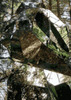
| partners | | Haven’t done this one in a couple of years. Met Kelly & Daniela at the carpool lot at 0500 and drove down to Tucson, starting the hike around 0645. Cool to start, but nowhere near cold. Passed two hikers not far from the trailhead, then saw nobody else until we were at the summit. Trail is rough, but in decent condition, and the best shape of the several times I’ve done this hike. Some burn is noticeable up high, but really not too bad. I was dragging on the uphills, whined a lot, but survived.
Took a long snack break at the summit, enjoyed the views, chatted for a moment with the one other hiker up there. Straightforward hike back down. The breeze was nice, but warm for the last two or three miles. Saw less than a dozen hikers on the way down. Did see two coyotes on the drive in, and two coatimundi about halfway down, but they were too fast for pics. Great day, great hike, and good to see Kelly & Daniela. |
|
Wildflowers Observation Moderate
Good variety and amount, but drying out quickly. |
|
  |
Pima Canyon |
Light flow |
Light flow |
| | | Light flow of water for most of the lower four miles of Pima Canyon | | _____________________
| Stop crying and just go do the hike. |
| | |
|
|
|
 Route Editor