username
X
password
register
for free!
help
ArticlesGuidesRoutes
 
Photosets
 
 Comments
triplogs   photosets   labels comments more
Ben Avery Trail - Indian Spring Petroglyphs - 13 members in 34 triplogs have rated this an average 3.6 ( 1 to 5 best )
1, 2  Next
34 triplogs
login for filter options
Nov 18 2023
avatar

 Triplogs 71

male
 Joined Jan 23 2025
 Seattle, WA
Ben Avery Trail - Indian Spring PetroglyphsSouthwest, AZ
Southwest, AZ
Hiking avatar Nov 18 2023
dhelderTriplogs 71
Hiking6.68 Miles 490 AEG
Hiking6.68 Miles
490 ft AEG
 no routesno photosets
1st trip
Linked   none no linked trail guides
Partners none no partners
 
Jan 21 2023
avatar

 Guides 4
 Routes 491
 Photos 10,890
 Triplogs 1,257

55 male
 Joined Nov 20 2012
 Phoenix, AZ
Ben Avery Trail - Indian Spring, AZ 
Ben Avery Trail - Indian Spring, AZ
 
Hiking avatar Jan 21 2023
BiFrostTriplogs 1,257
Hiking10.26 Miles 676 AEG
Hiking10.26 Miles   5 Hrs      2.36 mph
676 ft AEG      39 Mns Break
 
1st trip
Partners partners
John9L
Managed to get a couple of hikes in before knee surgery. Headed out to the Eagletails with 9L. Saturday morning starting from the Ben Avery Trail hiked into the range past Courthouse Rock. Good trail in open desert for the first few miles.

Eventually we left the trail and dropped into a wash leading to Indian Spring our basic objective. Along the way we passed some decent petroglyphs and passed a few pools of good water if we needed any. At the spring area and not really sure the exact location of the spring there were more pools and a small tickle in spots.

After a break decided to continue hiking downstream in the wash just to check it out. Found more petroglyphs and the canyon became more narrow with nice canyon walls. I believe we went about ¾ of a mile past Indian Spring before turning around.

Another break and we returned back the way we hiked in. Back at the trailhead we searched for a campsite nearby in the vicinity of Courthouse Rock. We setup camp and chilled rest of the evening!

water 1 out of 5water 2 out of 5water 3 out of 5water less than max Indian Spring Gallon per minute Gallon per minute
not sure where the spring was exactly but there was light flow and some clear pools in the drainage

water 1 out of 5water 2 out of 5water 3 out of 5water less than max Water Tank 726 51-75% full 51-75% full
water in trough within the game enclosure
_____________________
  2 archives
Jan 16 2021
avatar

 Guides 34
 Routes 138
 Photos 931
 Triplogs 111

68 male
 Joined Dec 26 2018
 Phoenix, AZ
Roam in the Eagletail Wilderness, AZ 
Roam in the Eagletail Wilderness, AZ
 
Backpack avatar Jan 16 2021
GrangerGuyTriplogs 111
Backpack16.00 Miles
Backpack16.00 Miles2 Days   2 Hrs      
34 LBS Pack
 
1st trip
In mid-January 2021, I took a two-day wander in the Eagletail Mountains Wilderness. I hoped to enjoy some solitude, some stars, check out the petroglyphs, and check on the various water sources.

I parked at the Ben Avery Trailhead. The road is pretty much as described in various logs and guides. My Cherokee had no trouble getting to the trailhead. Some of the road is definitely high clearance, and the last little bit is best handled in 4WD.

Since I had two days, I didn't try to get an early start. I left my car around 10:45 am and followed the trail up toward Indian Spring. One of the main things I wanted to do was check out the various water sources in this area. I headed first for Water Tank 726, and found a highly engineered facility, with signs indicating it had been built by the AZ fish and game department to provide water for wildlife. One of the signs was even an admonition to sportsmen not to vandalize it. There was a deer there as I approached. The wildlife drinking tank was about half full. Certainly this would be a viable source of water for people as well. It really surprised me the high level of engineering within a wilderness area.

I then went on to Indian Springs. The spring was dry, but the petroglyphs are awesome. I spent a half hour up close and personal with the cliffs, taking photographs. My iPhone camera does a remarkable job of enhancing the images of the petroglyphs. There was a hawk eyeing me as I approached.

From Indian Springs, I headed up the wash to the northwest, loosely following the route of the Eagletail Mountains Wander. Eventually the route leaves the wash and follows pieces of old jeep tracks. Where the Eagletail Mountains Wander takes a sharp right up the ridge, I continued northwest, following a very discernable old jeep track for a ways. Where the jeep track heads west and away from the mountains, I followed another wash more or less north toward a small pass. This is where I discovered an interesting feature of these mountains. What appear to be game trails become very clear routes over the various passes. Some of these trails are as defined as constructed trails; they traverse to avoid steep climbs, too. They made the travel really easy. Perhaps these are human caused, but I am doubtful.

I continued northwest, sometimes crossing some very deep washes, until turning northeast toward Triple Eye Catchment. There are two more heavily engineered water features here. The catchment itself sits in a very steep watercourse, and there are about 3 constructed basins. The whole thing is surrounded by a fence, which is really nothing more than something to hang onto so you don't fall over the cliff. The Catchment was dry, but the nearby game trough had several inches of water in it. Again, if you needed water, you could get it here. There are several game cameras around the water trough. At least some of them appeared to be official.

This area was to be my resting spot for the evening, so I headed back down the hill from the water a respectful distance, and set up my tarp near a nice sitting rock, where I could watch the stars come out.

In the morning I lightened my load by getting rid of excess water. I started out with 9 liters Saturday. I used about 4, and only needed 3 to get back to the car.

Sunday morning I headed up the nearby wash on my way to the pass above Dead Deer Tank. It was cool at first, but I quickly warmed up as I walked due east into the the rising sun. The wash is easy walking. Eventually, once again, game trails become preferable to the wash as you approach the pass. I followed the trail over the pass, and down the other side, arriving at Dead Deer Tank which had a lot of water in it.

Coming down from the Tank is a little tricky. The wash is steep and choked with vegetation at points. I found the best bet was to stay to the right when the vegetation closed in, staying up against the boulders, and fighting the Manzanita, rather than the more stickery things. Eventually the canyon opens up, and travel along side the wash on game trails becomes easy.

I had flirted with the idea of heading up the next valley to the left, and over a couple more passes, but decided to save that adventure for another day. I followed the main wash down until intersecting my path of the day before, and continued southeast back in the direction of Indian Spring. I left that route, though, and stayed close to the mountains on the left, eventually picking up the nominal route of Eagletail Mountains Wander back to the parking lot.

That cross country route looks easier on the map than it is in practice. Every 1-2 minutes you end up crossing another wash at right angles. Sometimes small, sometimes very big. It gets old after a while. Also you have to cross a barbed wire fence, which took a little searching to find just the right place.

26 hours
1 deer
1 coyote
4 hawks (or one, 4 times)
1 jackrabbit
1 campfire ring
0 people
 Culture
 Culture [ checklist ]
[ checklist ]  Cactuscat Pose

water 1 out of 5water 2 out of 5water less than maxwater less than max Dead Deer Tank 26-50% full 26-50% full
The natural pothole had good clean water, although no flow.

dry Indian Spring Dry Dry
No water here.

water 1 out of 5water less than maxwater less than maxwater less than max Triple Eye Catchment 1-25% full 1-25% full
The catchment itself was dry, but the nearby wildlife tank was 25% full.

water 1 out of 5water 2 out of 5water less than maxwater less than max Water Tank 726 26-50% full 26-50% full
There was a deer here when I arrived. The wildlife tank had plenty of water in it.
  2 archives
Jan 09 2021
avatar

 Routes 175
 Photos 2,335
 Triplogs 191

44 female
 Joined Jan 21 2019
 Pine, AZ
Ben Avery Trail - Indian Spring PetroglyphsSouthwest, AZ
Southwest, AZ
Hiking avatar Jan 09 2021
jillyonanadventureTriplogs 191
Hiking8.25 Miles 501 AEG
Hiking8.25 Miles   4 Hrs   10 Mns   2.18 mph
501 ft AEG      23 Mns Break
 
1st trip
Linked   none no linked trail guides
Partners partners
jharvey33
klfranz
Route Scout Route Recorded  on Route Scout | Pop | Map | Popup | MapDEX
Easy, casual hike on a well defined trail/in a wash. Interesting petroglyphs to look at (be sure to go around the whole rock formation). Explored down the canyon a bit; it was all dry, some interesting geology. Camped by the TH and celebrated a friend’s birthday with delicious cake with caramelized apples : app : Awesome night around our campsite (propane since it was a bit windy). This is my first time out in this area & I wasn’t too impressed but would be open to trying other things in the area if there was more of a wow factor.
 Geology
 Geology [ checklist ]
[ checklist ]  Quartz
 Culture
 Culture [ checklist ]
[ checklist ]  Camp-fire

dry Indian Spring Dry Dry
water report recorded in the field on our app Route Scout
_____________________
Restless between adventures...
 
Jan 02 2021
avatar

 Guides 25
 Routes 376
 Photos 5,897
 Triplogs 346

40 male
 Joined Mar 01 2018
 Chandler, AZ
Eagletail Arches and Petroglyphs, AZ 
Eagletail Arches and Petroglyphs, AZ
 
Hiking avatar Jan 02 2021
John10sTriplogs 346
Hiking11.97 Miles 1,134 AEG
Hiking11.97 Miles   7 Hrs   55 Mns   1.97 mph
1,134 ft AEG   1 Hour   51 Mns Break
 
1st trip
Partners partners
TboneKathy
I hiked in the Eagletails for the first time six days ago and enjoyed it so much that I decided to come back for the second straight weekend, this time to visit the "touristy" area at Ben Avery Trail/Indian Spring Petroglyphs and to check out a few of the off-trail arches marked on the topo maps. We accessed the trailhead via El Paso Natural Gas Access Road again, this time from farther east. The road was rougher in that area than it is farther to the west--probably not suitable for passenger cars/low clearance vehicles from this this side. The dirt between El Paso and the trailhead was in better shape except for one rough, rocky stretch near 1731' that others have noted in triplogs...if someone managed to get a low clearance vehicle in that far, they'd probably want to park before that last stretch and walk the rest of the way.

The parking lot was empty when we arrived, and we had a nice sunrise as we started down the trail/jeep road past Courthouse Rock. We left the trail just past Courthouse and headed southeast toward the first arch. As others had noted in triplogs, there a lot of washes to cross (and part of the official trail follows one of the washes for a while) so the pace was a little slower even though it looked like a relatively flat route across open desert.

The first arch was located up along the ridgeline--it looked like it would be a fun climb up there, but we opted to view it from below and give ourselves more time to explore the area. From below the arch, we could see another natural window in a big, unique rock formation to the east that looked a little like an "okay" emoji (👌). From that point, we headed back across the washes and connected with the Ben Avery Trail toward Indian Spring.

The geology approaching Indian Spring was impressive and varied, and near the spring we found the first wall of dark rock and scattered boulders that were covered with hundreds of petroglyphs and included drawings of big horn sheep, turtles, snakes, and various symbols. We spent quite a bit of time exploring all the impressive panels spread across the walls and boulders before continuing to Indian Spring.

There were more petroglyphs on the boulders between the first set and the spring. As expected, the spring was bone dry, and we didn't initially see petroglyphs in that area, but after a closer look, they were all over the the walls and boulders on the south side of the spring--a lot more animals and symbols...and, unfortunately, some modern graffiti mixed in. In one area we noticed what looked like a small cliff dwelling wall with mortared rocks built up on a small ledge on the natural wall near some of the petroglyphs. It was only ~ 3' x 3' in size and built flush against the rock wall, so it didn't look like it was a shelter or storage, and it wasn't clear what purpose it may have served.

We wanted to make sure we had time to check out the other arch, but every time we started moving that way, we'd notice more petroglyphs and climb back up toward the walls to check them out--it was an impressive area. We finally tore ourselves away and hiked west toward the arch. As we got closer, we realized it was a double arch, and it was an easy approach up a hillside.

We stopped for lunch there and admired the fantastic landscape all around us. We could see the jagged peaks of the Kofa Mountains to the west, Eagle 3186 in front of us, and Eagletail Peak, Anvil Mountain, and the other peaks of the Eagletails to the southeast, with Indian Spring in the foreground. The arches were impressive, and there was a tiny third arch, about four inches high, off to the side on the rock formation with the larger arches. [ youtube video ]

Before we started back, I checked out a few alcoves to the west, then we made a straight shot across the washes toward Courthouse Rock to complete the loose figure-eight loop. Like our last visit, we didn't see much wildlife today, just a few large black-tailed jackrabbits on the way out. We finished with ~12 miles of hiking, and there were three or four vehicles near the trailhead when we returned, confirming that this is the "crowded" part of the Eagletails, though we still didn't see anyone during the hike. I'd hoped we might be able to try climbing 3186, but like the previous visit, we ran out of time, so I still have more reasons to come back. This was an interesting historical site with some interesting off-trail features and a nice hike to kick off 2021.
 Geology
 Geology [ checklist ]
[ checklist ]  Natural Arch
 Culture
 Culture [ checklist ]
[ checklist ]  Graffiti
 Meteorology
 Meteorology [ checklist ]
[ checklist ]  Sunrise

dry Indian Spring Dry Dry
water report recorded in the field on our app Route Scout
 
Nov 07 2020
avatar

 Guides 264
 Routes 2,797
 Photos 14,494
 Triplogs 5,894

55 male
 Joined Nov 20 1996
 
Ben Avery - Arches - Indian Spring Petroglyphs, AZ 
Ben Avery - Arches - Indian Spring Petroglyphs, AZ
 
Hiking avatar Nov 07 2020
joebartelsTriplogs 5,894
Hiking12.03 Miles 1,222 AEG
Hiking12.03 Miles   5 Hrs   58 Mns   2.34 mph
1,222 ft AEG      50 Mns Break
 
1st trip
Partners partners
The_Eagle
Route Scout Route Recorded  on Route Scout | Pop | Map | Popup | MapDEX
A parliament of owls continuously moving forward in the trenched ravine was probably a once in a lifetime experience. No photographic evidence of the group so I'm skeptical myself.

As learned with BobP, sweet-talking the cholla is key for desert off-trail. No clue if verbal respect helps you focus, but it's proven.

Fantastic Sonoran exploring.
 Flora
 Flora [ checklist ]
[ checklist ]  Apache Hedgehog
_____________________
- joe
 
Nov 07 2020
avatar

 Guides 41
 Routes 1,626
 Photos 14,983
 Triplogs 2,760

69 male
 Joined Jan 20 2009
 Far NE Phoenix,
Ben Avery - Arches - Indian Spring Petroglyphs, AZ 
Ben Avery - Arches - Indian Spring Petroglyphs, AZ
 
Hiking avatar Nov 07 2020
The_EagleTriplogs 2,760
Hiking11.77 Miles 1,387 AEG
Hiking11.77 Miles   5 Hrs   57 Mns   2.21 mph
1,387 ft AEG      37 Mns Break13 LBS Pack
 
1st trip
Partners partners
joebartels
Route Scout Route Recorded  on Route Scout | Pop | Map | Popup | MapDEX
This is another that's been on my list for awhile. With most of my hiking in the last 7 months being at elevation to escape the orb, the weather finally made a turn for the better allowing this one.

First, I would not take a passenger car on the El Paso Natural Gas Road. Sandy entry and exits from the numerous small washes will have you bottoming out your car.

A chance of rain on the day had us starting under cool blue skies. The first goal on the day was to hit up the natural arches to the south and west of the TH. We followed the Ben Avery Trail for awhile, before heading crosscountry to access the arches.
The theme of the day is navigating your way the best you can, across the MANY washes. A short climb to the Arches and we took a break in them. [ youtube video ]

Next cross country again to check out the Indian Spring Petroglyphs. There is quite an abundance of glyphs in at least 2 different areas that we saw. As others had reported, the Indian Spring Spring Box has not seen water for quite some time. The large bedrock area that others had reported holding water, was bone dry.

Back on the Ben Avery Trail for awhile, until going off trail to search out the other arch on the Topo. Navigating the washes theme was still in effect. This arch (from our viewpoint) was not as impressive. Of course in hindsight, after checking out the 2018 description, route and photos from @Metalrunner, this arch is pretty darn impressive when viewed up close.

All in all a very enjoyable day the the Eagletails
 Named place
 Named place [ checklist ]
[ checklist ]  Courthouse Rock  Indian Spring

dry Indian Spring Dry Dry
The springbox has not seen water in many years. The bedrock pool that others reported having water, was completely dry.
_____________________
There is a very fine line between "hobby" and "mental illness."
Dave Barry 🦅
 
Apr 14 2020
avatar

 Guides 73
 Routes 176
 Photos 10,174
 Triplogs 2,324

46 male
 Joined Sep 08 2006
 
Ben Avery Trail - Indian Spring PetroglyphsSouthwest, AZ
Southwest, AZ
Hiking avatar Apr 14 2020
JimTriplogs 2,324
Hiking7.00 Miles 600 AEG
Hiking7.00 Miles   4 Hrs   30 Mns   1.56 mph
600 ft AEG10 LBS Pack
 no routes
1st trip
Linked   none no linked trail guides
Partners none no partners
Testing the toe on something out of town. Interesting area, but I guess I am a peak bagger. Walked further down the wash and came back on the hills to the south.
 Flora
 Flora [ checklist ]
[ checklist ]  Owl Clover
 Named place
 Named place [ checklist ]
[ checklist ]  Water Tank 726

dry Indian Spring Dry Dry
Pools in the wash.

water 1 out of 5water 2 out of 5water 3 out of 5water 4 out of 5 Water Tank 726 76-100% full 76-100% full
Seemed quite full.
_____________________
🍭
 
Mar 29 2020
avatar

 Guides 38
 Routes 182
 Photos 1,602
 Triplogs 232

40 male
 Joined Dec 09 2014
 Gilbert, AZ
Ben Avery Trail - Indian Spring PetroglyphsSouthwest, AZ
Southwest, AZ
Hiking avatar Mar 29 2020
jacobemerickTriplogs 232
Hiking6.79 Miles 566 AEG
Hiking6.79 Miles   5 Hrs   39 Mns   1.68 mph
566 ft AEG   1 Hour   36 Mns Break
 
1st trip
Linked   none no linked trail guides
Partners none no partners
Route Scout Route Recorded  on Route Scout | Pop | Map | Popup | MapDEX
Hike w/ kiddos. Trail was beautiful, great desert area, and plenty of flowers to slow down the pace. Petroglyphs were amazing. Was a bit disappointed in Indian Spring, there were puddles in the rock tanks and washes the entire hike, but the bedrock proper looked to be maybe a foot deep? I didn't explore enough to see if there was a huge puddle hiding further back. The distance turned out to be right at my kid's limit with the exposure, they were asleep five minutes into the long drive home.

Oh, and the drive was decent - Centennial had a few sluffs to slow down around, Pipeline had several thousand sandy washes to bounce over, and the final forest road was great except for the jug around 1731', which my 2WD was able to handle with a bit of coaxing. I think an adventurous sedan could make it all the way to 1731', which is a stone's throw from the trailhead. Also, there was a small army parked along the forest road in the morning, complete with contractor trailers and a helo, who were doing maintenance on the water tanks back there. Good people. Finally, only saw one couple on trail all the day #socialdistancing
 Named place
 Named place [ checklist ]
[ checklist ]  Courthouse Rock  Indian Spring

water 1 out of 5water less than maxwater less than maxwater less than max Indian Spring Dripping Dripping
"bedrock" tank had a foot of cool water up the side drainage
_____________________
 
Jan 25 2020
avatar

 Guides 4
 Routes 52
 Photos 1,303
 Triplogs 75

female
 Joined Feb 04 2017
 Sun City
Eagletail Mountains WanderSouthwest, AZ
Southwest, AZ
Hiking avatar Jan 25 2020
caragrueyTriplogs 75
Hiking10.00 Miles 1,000 AEG
Hiking10.00 Miles
1,000 ft AEG
 no routes
1st trip
Partners partners
Nate_F
Came back for arches hunting...success. And a quick flyby on the rock art. I love this place and its Solitude!!! I guess I'll be exploring here until the heat drives me out.
wildflower observationwildflower observationwildflower observationwildflower observationwildflower observation
Wildflowers Observation Light
_____________________
 
Jan 23 2020
avatar

 Guides 4
 Routes 52
 Photos 1,303
 Triplogs 75

female
 Joined Feb 04 2017
 Sun City
Ben Avery Trail - Indian Spring PetroglyphsSouthwest, AZ
Southwest, AZ
Hiking avatar Jan 23 2020
caragrueyTriplogs 75
Hiking6.68 Miles 490 AEG
Hiking6.68 Miles
490 ft AEG
 no routes
1st trip
Linked   linked  
Partners none no partners
We set off for a light adventure around 9ish. Found heaps and never ending heaps of glyphs. Unfortunately we didn't get the time for the two arches. They must wait for the weekend!
wildflower observationwildflower observationwildflower observationwildflower observationwildflower observation
Wildflowers Observation Light
_____________________
 
Feb 02 2019
avatar

 Routes 189
 Photos 7,236
 Triplogs 1,740

57 male
 Joined Apr 25 2011
 Goodyear, AZ
Ben Avery Trail - Indian Spring PetroglyphsSouthwest, AZ
Southwest, AZ
Hiking avatar Feb 02 2019
NightstalkerTriplogs 1,740
Hiking7.20 Miles 835 AEG
Hiking7.20 Miles   3 Hrs   56 Mns   2.50 mph
835 ft AEG   1 Hour   3 Mns Break13 LBS Pack
 no routes
1st trip
Linked   none no linked trail guides
Partners partners
Gallydoll
SCA
Had the full harem join me today for a long drive into the west valley to knock off one of my wish list hikes. Comfortable temps and overcast skies made the hike out and back to the petroglyphs pleasant and allowed us to take in the beautiful surroundings. Driving the Jeep in, the only rough parts were on the pipeline road and one short section on the road from the pipeline to the trailhead. The directions in the description were spot on and easy to follow. We spent a good bit of time scouting around the glyphs and Indian Spring before returning the way we came in. Concrete mixers at Culvers in Buckeye afterwards!
 Culture
 Culture [ checklist ]
[ checklist ]  Gallydoll Pose
wildflower observationwildflower observationwildflower observationwildflower observationwildflower observation
Wildflowers Observation Isolated

dry Indian Spring Dry Dry
_____________________
 
Nov 17 2018
avatar

 Guides 1
 Routes 2
 Photos 472
 Triplogs 38

female
 Joined Apr 27 2015
 cave creek, az
Ben Avery Trail - Indian Spring PetroglyphsSouthwest, AZ
Southwest, AZ
Hiking avatar Nov 17 2018
thirstylizardTriplogs 38
Hiking9.64 Miles 567 AEG
Hiking9.64 Miles   4 Hrs   26 Mns   2.44 mph
567 ft AEG      29 Mns Break
 no routes
1st trip
Linked   none no linked trail guides
Partners none no partners
West Side Story...

A few jets overhead and (land) sharks on the ground. We managed an exclusive showing of the Eagletails. While it is easy to be a soloist on this trail, a duet is nice so someone can take photos of you on a grand stage, with a backdrop so beautiful, you will be singing “I feel pretty, oh so pretty!”

Follow the written driving directions for the trailhead as a digital vortex must exist as you near La Paz County. Cairns guide you through a flat trail ending at the canvas wall. Meander up and down and scout around for petroglyphs and other life forms. Fully exposed trail so better done in cooler temperatures. Higher clearance vehicle preferred although I have seen some Corollas in unexpected places.
wildflower observationwildflower observationwildflower observationwildflower observationwildflower observation
Wildflowers Observation Isolated
_____________________
  2 archives
Oct 22 2017
avatar

 Guides 1
 Routes 38
 Photos 3,193
 Triplogs 467

55 male
 Joined Jul 26 2008
 San Tan Valley,
Ben Avery Trail - Indian Spring PetroglyphsSouthwest, AZ
Southwest, AZ
Hiking avatar Oct 22 2017
TheNaviG8RTriplogs 467
Hiking7.00 Miles 490 AEG
Hiking7.00 Miles
490 ft AEG
 no routes
1st trip
Linked   none no linked trail guides
Partners none no partners
 Fauna
 Fauna [ checklist ]
[ checklist ]  Red-tailed Hawk
 Culture
 Culture [ checklist ]
[ checklist ]  HAZ Rides
_____________________
 
Oct 14 2017
avatar

 Guides 4
 Routes 205
 Photos 9,282
 Triplogs 526

72 male
 Joined Apr 06 2005
 Phoenix, AZ
Ben Avery Trail - Indian Spring PetroglyphsSouthwest, AZ
Southwest, AZ
Hiking avatar Oct 14 2017
HansenazTriplogs 526
Hiking8.73 Miles 1,229 AEG
Hiking8.73 Miles   5 Hrs   5 Mns   1.73 mph
1,229 ft AEG      2 Mns Break
 
1st trip
Linked   none no linked trail guides
Partners none no partners
My wife and I made a first trip to the Eagletails with a couple "guides". We walked the Ben Avery trail around Courthouse Butte but then mainly went cross country through the nice open desert toward Indian Springs.

We started finding petroglyphs as we got nearer the Springs and when we got to that area we toured the cliffbands looking at thousands of petroglyphs. These are mainly of the archaic style meaning they are simple geometric patterns probably a couple thousands years old. The bedrock in the creek bottom here had many mortar holes left by these people.

We walked a ways further down the wash and noticed more glyphs that looked newer, probably from later inhabitants.

We saw four small deer go over the hill on the way back - the wildlife management and watering is working here. Nice area, the drive in was no trouble for my Subaru.
 Fauna
 Fauna [ checklist ]
[ checklist ]  Tarantula
_____________________
  1 archive
Jan 25 2017
avatar

 Guides 1
 Photos 1,513
 Triplogs 108

69 male
 Joined Apr 19 2008
 Phoenix, AZ
Ben Avery Trail - Indian Spring PetroglyphsSouthwest, AZ
Southwest, AZ
Hiking avatar Jan 25 2017
Alston_NealTriplogs 108
Hiking8.30 Miles 680 AEG
Hiking8.30 Miles
680 ft AEG
 no routes
1st trip
Linked   none no linked trail guides
Partners none no partners
As much as we wander the Eagletails, it's been a few years since we visited the petros. I had heard about the 500 cupules wall in a crevice and was curious to find them. Very interesting, I wonder if it is for counting something. Saw a mountain lion that was about 80 feet away and then poof.....it disappeared into the desert. Beautiful animal. We never tire of the Eagletails, just something about them.
_____________________
Semifunctional adult


Our humble abode..
https://www.territorialindianarts.com/
  1 archive
Jan 01 2017
avatar

 Routes 36
 Photos 2,658
 Triplogs 1,347

67 male
 Joined Jul 28 2004
 Scottsdale, AZ
Ben Avery Trail - Indian Spring PetroglyphsSouthwest, AZ
Southwest, AZ
Hiking avatar Jan 01 2017
mazatzalTriplogs 1,347
Hiking7.30 Miles 850 AEG
Hiking7.30 Miles   4 Hrs      2.04 mph
850 ft AEG      25 Mns Break
 no routes
Linked   linked  
Partners partners
guitar
jhelfers
Headed west hoping to avoid the rain... worked out great: no rain once we got to the Eagletails :) saw two javelina on the way. Lots of water and a few of the washes across the road were flowing but all were okay to cross.

We took the Ben Avery trail to Indian Springs and admired the petroglyphs on both sides of the hill and some more a little into the canyon. On the return we took the short detour to AZGFD water tank. Saw a mountain lion monitoring camera at the tank, Great trip to start of 2017.
_____________________
  1 archive
Feb 14 2016
avatar

 Guides 94
 Routes 840
 Photos 22,055
 Triplogs 1,993

52 male
 Joined Sep 18 2002
 Tempe, AZ
Ben Avery Trail - Indian Spring PetroglyphsSouthwest, AZ
Southwest, AZ
Hiking avatar Feb 14 2016
chumleyTriplogs 1,993
Hiking7.51 Miles 561 AEG
Hiking7.51 Miles   2 Hrs   58 Mns   2.89 mph
561 ft AEG      22 Mns Break
 
1st trip
Linked   linked  
Partners none no partners
After a day exploring the northern end of the Eagletails, I decided to hit the tourist circuit. It's an easy hike out to the historic Indian Spring area and the rock art does not disappoint. Looks like the spring box at Indian Spring has dried up permanently, but I was happy to find water in a narrow slot of bedrock in the side drainage just below the springbox. I'm sure it dries up in summer, but I think it also holds water for a surprisingly long time. It is 100% shaded.

Detoured to 726 on the way back, another AZGFD engineered wildlife watering tank. Busy day in the wilderness -- saw two other people. No sheep today. :( Great area.
 Fauna
 Fauna [ checklist ]
[ checklist ]  Tick

water 1 out of 5water less than maxwater less than maxwater less than max Indian Spring Dripping Dripping
Spring box was totally dry and appears that it is permanently out of commission. But 100 feet up the side drainage just below the springbox was a cold deep pool of water in bedrock that appears that it would hold water much of the year.

water 1 out of 5water 2 out of 5water 3 out of 5water less than max Water Tank 411 51-75% full 51-75% full

water 1 out of 5water 2 out of 5water 3 out of 5water 4 out of 5 Water Tank 726 76-100% full 76-100% full
Reservoir tank under the shade structure was full to the top.
_____________________
I'm not sure what my spirit animal is, but I'm confident it has rabies.
 
Mar 16 2015
avatar

 Guides 116
 Routes 337
 Photos 11,399
 Triplogs 894

63 male
 Joined Dec 20 2010
 Sunnyslope, PHX
Ben Avery Trail - Indian Spring PetroglyphsSouthwest, AZ
Southwest, AZ
Hiking avatar Mar 16 2015
kingsnakeTriplogs 894
Hiking10.77 Miles 784 AEG
Hiking10.77 Miles   4 Hrs   33 Mns   2.37 mph
784 ft AEG
 
1st trip
Linked   none no linked trail guides
Partners none no partners
Had not been hiking much in the last two weeks due to a family medical situation. Finally got out today, despite refrigerator needing attention. I was starting to feel bloated, so I had to get out anyway, and thanx to my wife staying behind I was able to. :kf:

When we travel west on I-10, we usually stop at the rest stop west of Tonopah. I've never had occasion to use the stalls until today. :o It was so vile, I turned around at the Salome Rd exit to hit the east bound stop on the opposite side of I-10. It was marginally better. Luckily, I had a large bottle of alcohol cleanser in my emergency kit, and I liberally swabbed the seat. After I was done, I repeated the liberal swabbing on my nether regions to hopefully kill off any cooties. I really feel for you gals that have to use those! Still, it was not as bad as the outhouse on the Cree reservation in northern Canada, nor the latrine at the Pakistani infantry battalion in Bosnia. :scared:

Now heading east, instead of doubling back on I-10, I got off at Tonopah, taking Indian School Rd. -- you read that correctly -- west to the Salome Rd. exit, where I followed the default driving instructions to the trailhead. The easy dirt ends after seven miles, at the first wilderness sign, which currently also has a port-a-potty. Wish I'd know that earlier. :| Couldn't be any worse than the rest stop. From there, I split right on the pipeline road. For a SUV, it was no problem, though speed generally needs to be kept to 20 mph or less. Cars could do it, but watch out for sand in the washes and sometimes small ledges entering/exitting the washes. There is a graffiti'd tank at 3 miles, after which the road actually gets smoother. At four miles, at the second wilderness sign, turn left on the trailhead road. The road curves around a small hill. If I were driving a car, I would stop just short of the hill. It's only another half mile to the trailhead / wilderness boundary / third wilderness sign.

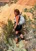
I went clockwise around Courthouse Rock, checking out a "rain apron" (learned a new word), and several old mines. Only found one identifiable shaft, and it was mostly collapsed in. The ocotillo on the east side of Courthouse Rock were flowering more abundantly than those on the west of the formation. Some were stunning. There were some small purple flowers, but mostly it was brittlebush and creosote providing what color there was. There were no clouds, and no shade. The jeep trail I was on began curving away from my intended route (wrabbitdog's uploaded route), so I began cutting west across washes towards the "official" route. The washes are not big, but the constant up & down is slow & tiring. I would not have wanted to continue on wrabbitdog's route. Eventually, I found a cairned foot trail, following that the rest of the way to the petroglyph zone.

Not sure where, exactly, the petroglyphs were, I first checked out a small canyon a few hundred yards northeast of the small, dark hill. I found one small panel, but more importantly, I found shade. I ate lunch and cooled off. Then I began working my way towards the small hill. I started on it east edge, working counter-clockwise. I began encountering extensive panels on its northwest corner, and the petroglyphs continued around to the southern side. Despite looking for snakes, I failed to see one which gave me a "Hey, I'm over here, please don't come closer rattle." (As opposed to a angrier sound, it just felt more like a friendly warning -- if that makes sense? -- and perhaps from a smaller snake.) Whoever did the petroglyphs really liked their checkerboard shapes. I also found some samples from the, presumably, 1920s and 30s. I then checked, with no success, a half mile up the canyon southeast of the small hill.

Hot flashing once I stood up too quick, it was time to head back. I followed the old jeep trail, following it left (northwest) where it crossed the wash, sloping up. It appeared to be curling away from the trailhead's direction, so I dropped back into the wash, following it a bit, before picking up another cairned old jeep trail back to the trailhead. (Turns out, the old jeep trail I started back on, and the one I finished on, are the same.) It was 91° when I finished.

I used some ice in a sandwich bag to ice down my sun burnt neck & head as I drove back on the pipeline road. When I got back to Harquhala Valley Rd., rather than turning left towards I-10, I continued east on paved Courthouse Rd. After a brief stop in Tonopah, I stayed on that same road, and Baseline Rd., all the way into Buckeye. Wierdest thing all day was spotting a taxi (!) 12 miles west of Tonopah on that little country road. :-s

Video: youtu.be/6p3C_xreSms
 Named place
 Named place [ checklist ]
[ checklist ]  Courthouse Rock
_____________________
http://prestonm.com : Everyone's enjoyment of the outdoors is different and should be equally honored.
  1 archive
Jan 23 2015
avatar

 Routes 2
 Triplogs 2

52 male
 Joined Jan 15 2015
 Seward
Ben Avery-Indian Spring / Courthouse circuit, AZ 
Ben Avery-Indian Spring / Courthouse circuit, AZ
 
Hiking avatar Jan 23 2015
wrabbitdogTriplogs 2
Hiking8.68 Miles 380 AEG
Hiking8.68 Miles   5 Hrs   30 Mns   2.89 mph
380 ft AEG   2 Hrs   30 Mns Break10 LBS Pack
 
no photosets
1st trip
Partners none no partners
We live in Alaska and my wife and I left the kids with friends and headed down to AZ for a long weekend. We stayed in Tonopah at the El Dorado Hot Springs, which was pretty cool - a bit pricey, but filled to the brim with hot mineral water and stories about other guests and the 'volunteers' running the place. One of the nice parts was that we were only 10 miles east on I-10 from the road to the Ben Avery Trailhead.

The description on the main page to get to the trailhead was perfect. There was no way we would have found the trailhead without these great directions. We had a Jeep Liberty rental car, and we got to the trailhead pretty easily. There were a few sketchy parts on the pipeline access road, and we probably would have been in deep doodoo if we had run into trouble with the rental car, but I'm used to driving on poor roads so we didn't have any problems. The other gravel roads up to the first Eagle Tail sign and the pipeline road were in great condition.

The trail was in great shape. We fairly quickly wound up in the wash about a mile or so into the trail, and after deciding that it wasn't as much fun as walking on the beach (because there was no ocean), decided to go overland. Because we had the route map on my cellphone, going off trail was no problem and worked out GREAT for us! The only problem with the mobile app was that I didn't realize I would have to cache the map to view it when we were out there without cell service. It wasn't a huge deal, though, since we still had the GPS route on the phone, so it would have been absolutely impossible to get lost. Having the GPS route was enough even without the topographic map.

The hiking was very easy - we had great weather, with temps around 66 and good sun (we really need our vitamin D from the sun during the winter)

We found the large wall with petroglyphs before getting to the spring and decided to have lunch. We wandered around the face before walking around to the right and up behind the large wall. We wandered around on top of the hill before walking down the other side where the spring was. It was a bit of a climb to get down and then up into the spring which is not as hard to find as I had presumed. There is an old signpost in the wash that probably led to the spring.

After taking more pictures, we headed back towards the trailhead, and decided to again avoid the wash. We walked up the valley directly opposite the spring and hugged the side of the mountain as we paralleled the trail which was in the wash. We found a few large rocks with more petroglyphs that probably aren't seen by many folks due to their distance from the trail.

Having some wilderness experience, we spread out and wandered the hillside on the way back to avoid making a trail. I do wonder about the fence that ran perpendicular to the trail here. We also crossed this fence in the wash on the way out. I presume that there are still some nearby cattle, and the fence is there to protect some resource, but was surprised to find a fairly well-maintained fence in the middle of a lower-48 Wilderness area. Since we're talking about Wilderness, I did want to bring up the topic of ethics and access here. I am in a quandary, since I typically consider myself more of a 'purist'. IMHO, Wilderness areas shouldn't have designated trails and even this website and ability to share routes and specific notes runs the risk of causing long term damage to specific areas. I was VERY happy to see no recent trash (we did find and remove a few VERY OLD soda cans that had probably been there long enough to be considered relics) and minimal graffiti near the petroglyphs (although any graffiti is too much) I greatly appreciate the ability to share stories, routes, and notes, and hope that others who read this description share my desire to keep this land as 'wild' as it can be for as long as possible. The fact that an area as wild and beautiful as this is very untrammeled, despite being so close to a major city, is a true testament to the outdoor ethics of Arizonans! GREAT JOB! I only wish we could train my fellow Alaskans to treat our land with as much respect as I observed in AZ.

Once we got close to Courthouse rock, we decided that we had enough time to circumnavigate the rock and avoid the trail on the way back to the trailhead. This was a pretty easy add-on and gave a neat perspective of this great mountain. Check out our route if you're interested. We took a ton of breaks along the way and the whole trip took 5 1/2 hours and wound up being almost 9 miles. The entire time after leaving the pavement we saw a total of two other people, and they were driving a side-by-side ATV on the pipeline road near 557th and Centennial Road (you'll know the intersection when you get there). We saw some planes, and on our way out a camper near the small stock tank near the trailhead, but other than the fence we didn't see any improvements and had a great Wilderness experience!

Wildlife seen:
Mule deer on the far side of courthouse rock
tarantula south of the trail at about the midway point
underwater snails in Indian Spring
2 Cows in the valley just North of the spring and petroglyphs
Tons of little lizards
_____________________
 
average hiking speed 2.22 mph
1, 2  Next

WARNING! Hiking and outdoor related sports can be dangerous. Be responsible and prepare for the trip. Study the area you are entering and plan accordingly. Dress for the current and unexpected weather changes. Take plenty of water. Never go alone. Make an itinerary with your plan(s), route(s), destination(s) and expected return time. Give your itinerary to trusted family and/or friends.

helpcommentissue

end of page marker