|
| | | |
| |
|
| Hiking | 12.08 Miles |
1,444 AEG |
| | Hiking | 12.08 Miles | 4 Hrs 28 Mns | | 2.70 mph |
| 1,444 ft AEG | | | | |
|
|
| |
| Partners |
|
none
[ show ]
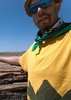
| no partners | | My favorite movies, not necessarily in order, are "Apocalypse Now" (not Redux), "The Godfather", "The Great Race" (with Jack Lemmon, Tony Curtis, etc.) and "Billy Jack". I still get choked up when Billy rides off at the end, with "One Tin Soldier" playing. 
Hopefully, I haven't told this story before, but when I first moved to Arizona in the Fall of '84, I drove through Prescott. As I drove down the street, I looked around and thought "I've seen this before. But where?"  It was Courthouse Square. Eventually, quite some time later, I realized that I had seen it in "Billy Jack", where it is part of many scenes, most famously where Tom Laughlin fights half the town. At that time, I had seen the movie once, 12 years before. Sometime earlier this year, on one of many drives past Courthouse Square to one hike or another, it occured to me to Google "Billy Jack" locations. Turns out Lynx Lake was where the Corvette scene was filmed. Thus, this hike was born. It was Courthouse Square. Eventually, quite some time later, I realized that I had seen it in "Billy Jack", where it is part of many scenes, most famously where Tom Laughlin fights half the town. At that time, I had seen the movie once, 12 years before. Sometime earlier this year, on one of many drives past Courthouse Square to one hike or another, it occured to me to Google "Billy Jack" locations. Turns out Lynx Lake was where the Corvette scene was filmed. Thus, this hike was born. 
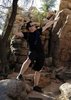
However, Lynx Lake by itself is not long, maybe three miles, so to add enough miles to motivate me to fight Prescott traffic, I tacked on Homestead Trail #305, Hilltop Trail #312 (for the hell of it -- definitely not the miles) and, because my wife has bad feet, Lynx Ruins Trail #301.
Observations ...
The pit toilet at the Trail #62 trailhead is so high class it has not one ... not two ... not three! ... but four air fresheners. 
Trail #305 is very popular with mountain bikes. The trail surface was covered with tracks the entire seven miles. Yet, I saw not one MTB.
Trail #305 crosses Walker Rd. once, and various Lynx Lake access roads more times than I could count. In fact, you are never more than a few hundred yards from Walker Rd.  It was only in Smith Ravine, or on the east side of Lynx Lake, that I got away from traffic noise. On the bright side, you are also never far from one of many pit toilets. It was only in Smith Ravine, or on the east side of Lynx Lake, that I got away from traffic noise. On the bright side, you are also never far from one of many pit toilets.
Lynx Lake, however, is a very popular locals trail. The west half is paved, and has multiple benches. Bikes are not allowed on Trail #311, but there are lots of dog walkers and urban hiker-types.
I lost track of how many spider web strands were across the various trails, including one that was probably 20 feet from tree branch to ground.
Not many flowers, but a surprising amount of fall color, particularly around Lynx Lake (various yellows), and in Smith Ravine (which was turning brown a bit sooner).
To figure out where the "Billy Jack" Corvette scene was filmed, and then stand on that ground, was pretty cool. (And not all wierd like it would have been if I stood in Courthouse square doing the same thing. )
-----
Video : http://youtu.be/yxiOTUHQ-s4 |
|
Autumn Foliage Observation Moderate
Lots of gold, including some that looked like they were spun from the precious metal. |
|
 |
Lynx Lake |
76-100% full |
76-100% full |
| | | Looked good to me. No dry ring above the lake surface. Couple of side creeks trickling in. (In fact, none of the creeks appeared to drain *out* of the lake ...) | | _____________________
| http://prestonm.com : Everyone's enjoyment of the outdoors is different and should be equally honored. |
| | |
|
|
|
 Route Editor