username
X
password
register
for free!
help
ArticlesGuidesRoutes
 
Photosets
 
 Comments
triplogs   photosets   labels comments more
Davey Gowan Loop - 8 members in 18 triplogs have rated this an average 2.5 ( 1 to 5 best )
18 triplogs
login for filter options
Jun 22 2024
avatar

 Routes 4
 Photos 134
 Triplogs 19

54 male
 Joined Jan 07 2004
 Phoenix, AZ
Davey Gowan LoopPayson, AZ
Payson, AZ
Backpack avatar Jun 22 2024
louieTriplogs 19
Backpack5.50 Miles 1,500 AEG
Backpack5.50 Miles
1,500 ft AEG
 no routes
1st trip
Linked   none no linked trail guides
Partners none no partners
I was determined to do this loop and camp at Gowan camp, but Mr. Gowan did us in. Except for maybe the 1st hundred yards or so it's pretty much a non-stop bushwhack. We followed the GPS track and thankfully it saved us from getting lost. After what was around 3 hours or so we got to the washout area and had zero clue where to go. It was just bushes everywhere, the terrain kept getting steeper, and could not figure it out. We didn't want to end up on the news so proceeded to return the way we came and took Deer Creek trail down to Gowan camp. Gowan camp is stellar, particularly when the stream is running, but on this trip (6/22), there was no water to be seen.

It's baffling as there continues to be a signed Forest Service trail marker at the beginning of the trail that instills hope, but the Forest Service no longer supports this trail.

Those who have completed this loop recently have my utmost respect and admiration. Enjoy!!!
_____________________
Not all who wander are lost...
  4 archives
Nov 19 2021
avatar

 Routes 3
 Photos 75
 Triplogs 14

47 male
 Joined Apr 11 2009
 tempe, az
Davey Gowan LoopPayson, AZ
Payson, AZ
Hiking avatar Nov 19 2021
easytecTriplogs 14
Hiking5.50 Miles 1,500 AEG
Hiking5.50 Miles   12 Hrs      0.55 mph
1,500 ft AEG   2 Hrs    Break10 LBS Pack
 
Linked   none no linked trail guides
Partners none no partners
Hiked this loop "trail" again to see the condition. It has only gotten worse. We started at the top and worked counter clockwise around the loop, going down the switchbacks to deer creek, up to the Mt. Peeley trailhead, and then took the road from there back to the Davey Gowan trailhead. The section down the switchbacks is completely overgrown and we had to "swim" through a half mile of bushes. The 120ft GPS route did keep us on "trial" but most all the flags folks have put up have disintegrated over the last few years. I love this area but I cannot recommend this "trail".
_____________________
 
Aug 26 2018
avatar

 Routes 92
 Photos 885
 Triplogs 160

30 male
 Joined Sep 27 2015
 Phoenix
Davey Gowan LoopPayson, AZ
Payson, AZ
Hiking avatar Aug 26 2018
kelly14Triplogs 160
Hiking2.65 Miles 1,283 AEG
Hiking2.65 Miles   3 Hrs   40 Mns   0.80 mph
1,283 ft AEG      20 Mns Break
 
1st trip
Linked   none no linked trail guides
Partners none no partners
Was torn on going to the Bradshaw’s or Mazzies this weekend but went with the mazzies. Haven’t been here in a while and saw they have gotten decent rain the last few weeks. Decided on ATTEMPTING the Davey Gowan loop and failed miserably. Incredibly beautiful terrain and overwhelmingly rugged are how I would describe this hike. The Mazzies are a butt kicker!

Knew that this trail was not really a trail anymore but wanted to explore it and see how far we would get. The loop was a pipe dream to say the least. Not 50 yds in and already was saying “where the heck is the trail” lol. Pretty much described the entire hike. Hiking on the ridge in the beginning stretch wasn’t horrible but we decided to drop down into the pines and avoid bushwhacking. Worked out well and eventually met up with the Davey Gowan trail on the nicest tread we saw all day! Lasted 50 yds 😳

Directly after this spooked a huge bull elk! Huge! Wasn’t expecting to see elk here. So much sign of them they must really like this area.

Like the description said we dropped into some manzanita and it was a maze. So many game trails and washes were confusing the daylights out of us. We managed to stay relatively on trail during these switchbacks mainly in part to the Ribbons! They were life saving. After this the only way to describe the rest of our hike was borderline torture.

It was 95% bushwhacking with 5% OMG the trail! Oh nvm😢. I knew it was gonna be rough but not that rough. The wet ground combined with all the re growth from the monsoons created natures muddy slip and slide with thorns prodding at you as you slid down. It was borderline impossible to locate the trail at times.

We had a later start then we wanted combined with it getting cloudy made us nervous. We were not ready to be bushwhacking for 3 more hours. And so finally at the biggest washout we encountered yet decided to call it. With the huge elk shed I just found in 1 hand and walking stick in the other we climbed the side of that mountain and made it back to the truck. The Climb out was incredibly tough and steep but better than who knows how many more hours of bushwhacking.

My wife and I love a good adventure but that was just a little bit too much today! Had to have fallen 20-30 times. But funny thing is we already talked about going back the other direction and seeing how far we can get 😬. Guess we are crazy. Saw 2 deer as well and some bear crap so lots of wildlife here!
 Fauna
 Fauna [ checklist ]
[ checklist ]  Elk
_____________________
 
May 20 2017
avatar

 Guides 38
 Routes 182
 Photos 1,602
 Triplogs 232

40 male
 Joined Dec 09 2014
 Gilbert, AZ
Deer Creek Loop, AZ 
Deer Creek Loop, AZ
 
Backpack avatar May 20 2017
jacobemerickTriplogs 232
Backpack31.16 Miles 6,757 AEG
Backpack31.16 Miles2 Days         
6,757 ft AEG
 
1st trip
Inspired by a recent read (John Alcock's 'After the Wildfire') I decided it was time to visit the Deer Creek area. Plus I needed to finish up a chunk of the Mazatzal Divide Trail, which is like right there.

Deer Creek #45
The first four miles of this is a breeze. Everything is well trimmed and easy to follow, and even the gravesite has also been cleaned up. Things start to get hairy after 4.5 miles. The trail begins to criss-cross the creek, with massive cairns to mark the crossings, though the actual paths on the banks are not always easy to pick up. Ivy and deadfall complicate things. It's not terrible, just something to be aware of. Gowan Camp is pleasant and there were a few stagnant ponds in the creek to pull from. The last section from the camp up to Peeley trailhead is much easier.

Mazatzal Divide #23 (Peeley :next: Bear Springs)
Oh man, the views. Kept tripping over my jaw this whole time. Plus the stands of pines spared from wildfire behind Peeley... This was heavenly. As usual, the AZT was easy to follow and a cruise to hike. Recent maintenance has been done around the Bear Springs area (and it looks great!).

Deer Creek Connector
This was my first dedicated off-trail section in the Mazzies and it could have been worse. The creek starts off rocky and easy to follow, eventually gaining deadfall and thorny brush and sharp drops. There was some plastic tubing along/buried in the rocky bed that was confusing... Did one of the ranches pull water from Bear Spring at some point? Or maybe a leftover from Gowan Camp? Also a lot of bear sign and some game trails on the banks that looked too good to be game trails...

Aside: I ended up setting up camp along this 'connector', about 1/2 mile from Gowan. Couldn't pass up an idyllic cascade and some perfectly spaced trees for the hammock. Anyways, had a visitor of the bear-kind in the middle of the night that made for some heart-pounding entertainment. One of these days I'll get smart enough to bring a weapon/mace along, until then I'll just have to use my charming demeanor and quick wit to keep the wildlife from eating me.

Davey Gowan #48
Must have been fantastic back in the day. Finding the start from Deer Creek Trail is easy thanks to a few blazes (thanks @Grasshopper!) and the tread is still very defined, if a bit narrow. First half mile is beautiful, then the burn area takes over and there is deadfall, washouts, and rampant brush to deal with. Not the worst Mazzie trail - the tread sticks around, even if you have to crawl around to find it.

Gold Ridge #47
My initial plan was to take South Fork down, but after dealing with thorny stuff in Deer Creek and Davey Gowan I just didn't want to earn any more stripes. So I figured Gold Ridge might be easier. And it was, almost too easy. Manzanita was beat back to a respectable distance and the views were great. Easy way to finish the weekend.

Mazatzal Miles: 109.2/275 (39.7%)
 Flora
 Flora [ checklist ]
[ checklist ]  Columbine
 Named place
 Named place [ checklist ]
[ checklist ]  David D. Gowan  Pigeon Spring

water 1 out of 5water 2 out of 5water less than maxwater less than max Bear Spring - Fisher Quart per minute Quart per minute

water 1 out of 5water less than maxwater less than maxwater less than max Deer Creek / Canyon - Mazatzal Wilderness Pools to trickle Pools to trickle
Lots of dry sections, but where the pools were they were clear and welcoming.

water 1 out of 5water less than maxwater less than maxwater less than max Pigeon Spring Dripping Dripping
Small pools below spring, trough was maybe 1/2 full of pea soup.
_____________________
 
Jul 06 2014
avatar

 Photos 32
 Triplogs 4

45 male
 Joined Aug 08 2012
 Prescott, AZ
Davey Gowan LoopPayson, AZ
Payson, AZ
Hiking avatar Jul 06 2014
owenbTriplogs 4
Hiking4.30 Miles 1,400 AEG
Hiking4.30 Miles
1,400 ft AEG
 no routesno photosets
1st trip
Linked   none no linked trail guides
Partners none no partners
This trail is very overgrown. For the first mile or so there are plastic ribbons tied to branches here and there that make it easier but after that the trail is extremely hard to follow. I didn't see any signs of people having been on it recently. My guess is this one will have returned to nature completely within a few years. Take a gps track and a machete if you're going to try it!
_____________________
Owen
 
Jun 24 2013
avatar

 Guides 1
 Photos 1,891
 Triplogs 131

47 male
 Joined Feb 13 2006
 Phoenix, AZ
Davey Gowan LoopPayson, AZ
Payson, AZ
Hiking avatar Jun 24 2013
david_allen_3Triplogs 131
Hiking4.30 Miles 1,400 AEG
Hiking4.30 Miles
1,400 ft AEG15 LBS Pack
 no routesno photosets
1st trip
Linked   none no linked trail guides
Partners none no partners
Beautiful hike down to Gowan Camp. Fire damage is minimal to none at Gowan and most of the way...I cleared the trail from Peeley Trailhead to Gowan. Its wide open now and I also threw up a few new cairns over the down tree section. Lots of bear sign. Saw one black rattlesnake. Mazzie Wilderness sign was down again put it back up. Water trickling in creek in a few spots was able to use for drinking. Lots of raspberries/blackberries. :D
wildflower observationwildflower observationwildflower observationwildflower observationwildflower observation
Wildflowers Observation Isolated
_____________________
Wherever you go there you are.
 
Apr 29 2011
avatar

 Guides 48
 Routes 510
 Photos 9,555
 Triplogs 578

79 male
 Joined Dec 28 2006
 Scottsdale, AZ
Davey Gowan LoopPayson, AZ
Payson, AZ
Hiking avatar Apr 29 2011
GrasshopperTriplogs 578
Hiking0.50 Miles 84 AEG
Hiking0.50 Miles      15 Mns   2.00 mph
84 ft AEG
 
Partners none no partners
On 11/1/10 GPSjoe and I hiked this very difficult to navigate loop, our last hike together.. http://hikearizona.com/photo.php?ZIP=164339
http://hikearizona.com/photo.php?ZIP=163610

Today on the way back to Camp Grasshopper I hiked a short .25ml exploratory on this Davey Gowan TR48 to checkout how well GPSjoe and my 11/1/10 Survey Route Taping of this TR48 is holding-up; I am very sorry to report that it now appears that possible all our 11/1 efforts to correctly tape route this very difficult to follow trail to its ending intersection with Deer Creek TR45 (for at least the .25ml distance I hiked in), has all been removed;

With no TH signage at the parking location for sometime now and probable confirmation of the route taping being removed, I'm guessing that the responsible Tonto NF ranger district must now consider this TR#48 to be decommissioned. My posted 11/1/10 default GPS track for this loop hike is the correct hiking track and will now be a required download by most who choose to on-trail hike this TR48;
_____________________
(Outside.. "there is No Place Like It!!")
 
Dec 05 2010
avatar

 Routes 3
 Photos 75
 Triplogs 14

47 male
 Joined Apr 11 2009
 tempe, az
Davey Gowan LoopPayson, AZ
Payson, AZ
Hiking avatar Dec 05 2010
easytecTriplogs 14
Hiking5.80 Miles 1,400 AEG
Hiking5.80 Miles   6 Hrs      0.97 mph
1,400 ft AEG
 
Linked   none no linked trail guides
Partners none no partners
Thanks to Grasshopper and GPSJoe, I did not even use my GPS to stay on trail today, they did a great job flagging the route. They took what was a very unfollowable, extreme, 13hr bushwacking hike and turned it into a manageable (though masochistic, as Joe described it) day hike. I did not know Joe but I know he loved this area and the challenges it possesses; I will think of his strength, persistence, and his love of the outdoors every time I visit the Mazatzals.
foliage observationfoliage observationfoliage observationfoliage observationfoliage observation
Autumn Foliage Observation Moderate
_____________________
  1 archive
Nov 01 2010
avatar

 Guides 48
 Routes 510
 Photos 9,555
 Triplogs 578

79 male
 Joined Dec 28 2006
 Scottsdale, AZ
Davey Gowan LoopPayson, AZ
Payson, AZ
Hiking avatar Nov 01 2010
GrasshopperTriplogs 578
Hiking5.80 Miles 1,613 AEG
Hiking5.80 Miles   8 Hrs   35 Mns   0.68 mph
1,613 ft AEG
 
Partners partners
gpsjoe
Since the devastating August'04 "Willow Fire" in our Mazatzal Wilderness much has changed to date with this once easy to follow and enjoyable loop hike. Especially changed is the 2 mile Davey Gowan TR48 connection between its TH Start at FR201 and ending at its intersection with Deer Creek TR45 (at the Gowan Camp area). Having had no obvious trail maintenance since the fire, the significant dead tree downfall, major trail overgrowth, and trail washouts have pretty much taken over.

GPSjoe (in Oct'03) and Preston Sands (in June'06) are the only two HAZ members I know who have posted against this loop hike and successfully completed it "on trail". After this "Willow Fire", in May'09 I made an unsuccessful and very frustrating attempt to "on trail" hike this loop. The Deer Creek TR45 section of this loop was a challenge but doable, the Davey Gowan TR48 section of this loop was just not possible. Ever since my May'09 unsuccessful attempt, I've had this burning desire to return to correctly route find this original trail segment and mark it before it completely returns to our Mother Nature.

TODAY WAS THE DAY! Joined by GPSjoe and his excellent route finding abilities, loaded with his previous and correct Oct'03 GPS Track for the Davey Gowan TR48 segment, and with my determination to "let's get it done", I knew all we needed was enough daylight to correctly find and survey tape this illusive trail section. I'm now very happy :D to report that for any advanced hikers that would now like to attempt this Davey Gowan Loop hike, that TR48 segment is now completely tape marked and doable. Also, no guarantees how much longer it will ~safely be hike-able due to continuing tree downfall, overgrowth, trail drainage washouts, and erosion, but if this kind of hiking challenge is for you, then do plan to give it a try soon. Also, I suggest you don't wear light colored hiking clothes.. ;) Also, for your reference and use I have posted what I consider the recommended default (98% on trail for TR48 and 100% on trail for TR45) GPS Route for this entire loop hike. Also, my posted and geocoded pic set with detailed captions for this 11/1/10 trip tells the visual story of what you should now expect along this hiking route loop.

Ref: Recommended Default GPS Route with all "key" way points included:
http://hikearizona.com/map.php?GPS=21197
foliage observationfoliage observationfoliage observationfoliage observationfoliage observation
Autumn Foliage Observation Substantial
_____________________
(Outside.. "there is No Place Like It!!")
 
Nov 01 2010
avatar

 Guides 16
 Routes 123
 Photos 2,810
 Triplogs 140

83 male
 Joined Feb 13 2004
 Mesa, AZ
Davey Gowan LoopPayson, AZ
Payson, AZ
Hiking avatar Nov 01 2010
gpsjoeTriplogs 140
Hiking5.30 Miles 1,600 AEG
Hiking5.30 Miles
1,600 ft AEG
 
1st trip
Linked   none no linked trail guides
Partners partners
Grasshopper
In October, 2003 (before the Willow Creek fire) I hiked a 17 mile loop from the Deer Creek trailhead off highway 87 and recorded a GPS track for that hike. Good thing because we needed it to follow the mysterious Davey Gowan trail which has received no maintenance in recent history and the trail signs have been taken down as well. The trail is overgrown, eroded and difficult to follow. Some drainage crossings are challenging because parts of the trail have been washed away.

Fortunately, Hank (Grasshopper) wanted to tag the trail with pink ribbon tape and he did that very well. So now hikers should be able follow the trail by hiking from ribbon to ribbon knowing that they are off trail if they don't see the next ribbon after 100 feet or so.

The Davey Gowan trail is for advanced hikers with masochistic tendencies. You will bushwhack and maybe draw a little blood. You also might fall a few times hopefully not off the mountain. If that sort of hike interests you then go for it.
 Culture
 Culture [ checklist ]
[ checklist ]  Trail Maintenance
_____________________
Become a skilled GPS user and it will set you free!
comments disabled by a moderator
 
Apr 17 2010
avatar

 Triplogs 25

64 male
 Joined Oct 02 2009
 Phoenix, Az
Davey Gowan LoopPayson, AZ
Payson, AZ
Hiking avatar Apr 17 2010
steveforbesTriplogs 25
Hiking4.30 Miles 1,400 AEG
Hiking4.30 Miles
1,400 ft AEG
 no routesno photosets
1st trip
Linked   none no linked trail guides
Partners none no partners
overniter with Berk. Good camp,cold night,great time. Steaks for dinner!!
_____________________
 
Apr 17 2010
avatar

 Photos 34
 Triplogs 63

39 male
 Joined Mar 18 2008
 phoenix
Deer Creek Trail #45Payson, AZ
Payson, AZ
Backpack avatar Apr 17 2010
berkforbesTriplogs 63
Backpack4.00 Miles 1,000 AEG
Backpack4.00 Miles
1,000 ft AEG
 no routesno photosets
1st trip
Linked   linked  
Partners partners
steveforbes
Quick overnighter with my pops.. trail is kinda tough to follow, easier going out than going in. we didnt do the whole loop, just parked at the peeley th and then hiked down to deer creek and camped at gowan camp. Very seldom used trail, and same goes for the camp spot near the creek. Definitely reccomend this trip as a quick escape from the valley. creek was flowing nicely, some say it runs year around, i doubt thats the case, but im sure it does retain pools of water during the dryer months. bugs were a bit obnoxious but nothing a little smoke from the fire cant handle.

Guinness and steaks for dinner, cant beat that!

dont let the directions confuse you, take the exit off the beeline signed for Sycamore, stay on that road until you see the signed turn on the right for FR 201.
_____________________
"Rather love, than money, than fame, give me truth."
-Henry David Thoreau
  1 archive
Aug 22 2009
avatar

 Routes 3
 Photos 75
 Triplogs 14

47 male
 Joined Apr 11 2009
 tempe, az
Davey Gowan LoopPayson, AZ
Payson, AZ
Hiking avatar Aug 22 2009
easytecTriplogs 14
Hiking4.30 Miles 1,400 AEG
Hiking4.30 Miles   13 Hrs      0.33 mph
1,400 ft AEG
 
Linked   none no linked trail guides
Partners none no partners
Trail was non-existent for most of the trail when I completed this hike solo in Aug. 2009. I started at dawn from Mt. Peeley TH (going up the road) and finished right after sundown back at Mt. Peeley TH. Bushwacked the whole mid section using GPS waypoints. I did spook a bull elk at 30yds near a spring in a cut above the creek. Hike was extreme.
 Flora
 Flora [ checklist ]
[ checklist ]  Arizona Grape
_____________________
  2 archives
May 24 2009
avatar

 Guides 48
 Routes 510
 Photos 9,555
 Triplogs 578

79 male
 Joined Dec 28 2006
 Scottsdale, AZ
Davey Gowan LoopPayson, AZ
Payson, AZ
Hiking avatar May 24 2009
GrasshopperTriplogs 578
Hiking9.00 Miles 2,400 AEG
Hiking9.00 Miles   11 Hrs   5 Mns   0.81 mph
2,400 ft AEG
 
Linked   linked  
Partners partners
topohiker
Plan: Park at the Peeley TH & hike the 4.3ml Davey Gowan Loop counter-clockwise by starting east on FR201 for 1.5mls to the official start of the Davey Gowan TH/TR#48. Hike the Davey Gowan TR to its end (~1.5mls) at the intersection of Deer Creek TR#45. Hike NE on DC#45 through Gowan Camp and continue "on trail" down DC#45 for ~2.0mls to where Ken, James Lyding, & I ended our 11/8/08 hike (coming in from the Hwy 87 DC#45 TH Start). Then hike back this ~2.0ml section to the above DG#48 intersection, then continue up DC#45 for 1.5mls (following nonot's JE'08 posted GPS Route) to end back at the Peeley TH... Such a solid, well thought-out plan for hiking in our Mazatzal Wilderness which would also provide an official HAZ-GPS Route for all but nonot's 1.5mls of this total days hike! :D


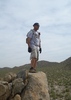
Actual: Mother Nature & the Mazatzal's win again!! but still an amAZing day.. We started hiking on schedule at 8:35am from the Peeley TH. The 1.5ml hike on FR201 was uneventful until we reached the Davey Gowen TH/Trail Start which was not signed and had numerous down trees around the TH area. We spent a good 10 minutes trying to determine how to get started on this TR#48. Once we figured it out, then the fun really began (see my attached pic set/log for a "blow by blow" of all the action, some quite scenic). I had spent a considerable amount of time trying to prepare correctly for this hike. We were geared to spend the night if need be unexpectedly. I had read and re-read Preston's hike description and viewed his pic set. We had three GPS units and a copy of Preston's topo map from his pic set. I also had nonot's corrected GPS Route for the known difficult upper 1.5ml segment of the Deer Crk TR#45 downloaded in my Garmin 60CSx. Also, having hiked the Mazatzal's many times before, Ken and I are OK with doing some route finding, but we have learned to never take the Mazatzal Wilderness for granted!

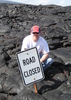
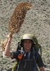
Eventhough we had the Davey Gowan TR#48 on Ken's new DeLorme GPS Basemap, we still lost the trail less than .5mls in from the TH. Due to trail overgrowth, numerous down trees from the Aug'04 Willow Fire, and washouts, we saw no cairns and very few signs of any previous trail. We ended up trying to parallel the trail on the DeLorme as best we could, but ended up dropping into a steep drainage off trail that we knew flowed into Deer Creek. We arrived Deer Creek/Canyon NE of Gowan Camp at around 12noon. We decided to first hike the lower 2ml segment of Deer Creek, hoping to stay on trail, but it was not to be. We only located about .1ml of trail (we placed cairns at both ends) then continued the slow, time consuming trip down the creek boulder/rock hopping and down tree hopping. At 2:45pm (not yet having a lunch break), and only .24mls from our planned stopping point, we reached a difficult area to proceed with down trees/brush(see pic), and a two waterfall drop area that was probably doable, but would just be too time consuming for an additional 2mls back up creek "plus" 1.5 difficult miles up DC#45 from Gowan Camp to reach our start at the Peeley TH. We arrived together safely the Peeley TH at 7:40pm (dark at 7:50pm). I arrived without my Camelbak hose mouthpiece and without my $$$ Garmin GPS-60CSx. :cry: (lost somewhere in the first .50mls down the DC#45 in from the Peeley TH). My contact info is on the boot-up first screen IF anyone finds it.. I need to go back & look for it, but I have not yet done so.
wildflower observationwildflower observationwildflower observationwildflower observationwildflower observation
Wildflowers Observation Moderate
_____________________
(Outside.. "there is No Place Like It!!")
 
May 24 2009
avatar

 Guides 14
 Routes 115
 Photos 4,830
 Triplogs 3,536

male
 Joined Oct 29 2005
 Scottsdale, AZ
Davey Gowan LoopPayson, AZ
Payson, AZ
Hiking avatar May 24 2009
topohikerTriplogs 3,536
Hiking10.50 Miles 2,645 AEG
Hiking10.50 Miles   10 Hrs   30 Mns   1.00 mph
2,645 ft AEG
 no routesno photosets
1st trip
Linked   none no linked trail guides
Partners none no partners
Our plan was to hike the Davey Gowan trail to the Deer Creek and go down (North) the creek to where we stopped last October, then take the Deer Creek trail to the Peely TH. We parked at Peely and walked to the Davey Gowan TH. There was no signs at all, just a bunch of fallen trees. I had the Davey Gowan trail on my base maps on the Delorme GPS. Even with that we had tough time staying on the trail. The only thing that really remains of this trail is some cut stumps. We wound up bushwacking down to an un-named drainage that feed into the Deer Creek. Then we took the Deer creek north looing for a trail. We only found a short 1/4 mile section of a trail. The rest of the time we were rock & tree hoppng. We stopped about a 1/4 mile from our destination because time was running out and we were looking at some serious water falls. We started to head back. We keep a sharp lookout for where the deer creek trail left the creek. There was a cairn at that point (one of the only cairns we saw all day!). Now grasshopper had this section loadedin his GPS. Even with that it was not a piece of cake to stay on trail. The trail is in very bad shape. It disappears several times, even near the TH. I would not recommend these trails to anyone. This loop is now more a bushwack, off-trail hike. I think the forst service shouls decommission these trails.
_____________________
"Everywhere is walking distance...If you have the time"
-Stephen Wright
 
May 05 2007
avatar

 Guides 111
 Routes 433
 Photos 4,307
 Triplogs 788

51 male
 Joined Feb 16 2007
 Walnut Creek, CA
Davey Gowan LoopPayson, AZ
Payson, AZ
Hiking avatar May 05 2007
JimmyLydingTriplogs 788
Hiking1.50 Miles 1,400 AEG
Hiking1.50 Miles
1,400 ft AEG
 no routes
1st trip
Linked   none no linked trail guides
Partners none no partners
Got lost (forgot my map....), and a member of my hiking group couldn't handle bush-whacking any further so we went back. Beautiful area, however. Will post some pics and a link to a weird story when I get a chance. Looking forward to going back soon.
_____________________
 
Jun 10 2006
avatar

 Guides 170
 Routes 148
 Photos 5,914
 Triplogs 2,097

48 male
 Joined Apr 12 2004
 Tucson, AZ
Davey Gowan LoopPayson, AZ
Payson, AZ
Hiking avatar Jun 10 2006
PrestonSandsTriplogs 2,097
Hiking4.30 Miles 1,400 AEG
Hiking4.30 Miles   3 Hrs      1.43 mph
1,400 ft AEG
 no routes
1st trip
Linked   none no linked trail guides
Partners none no partners
My wife let me go hiking on Saturday morning, with the understanding that I be back by lunchtime. I assumed she meant lunch time in Hawaii's time zone, and off I went. :wink: This was my third weekend of hiking in the same general area of the Mazatzals, and I'm hoping for a fourth.
_____________________
"…you never know when a hike might break out" -Jim Gaffigan
 
Sep 04 1999
avatar

 Routes 36
 Photos 2,658
 Triplogs 1,347

67 male
 Joined Jul 28 2004
 Scottsdale, AZ
Davey Gowan LoopPayson, AZ
Payson, AZ
Hiking avatar Sep 04 1999
mazatzalTriplogs 1,347
Hiking4.30 Miles 1,400 AEG
Hiking4.30 Miles   3 Hrs   15 Mns   1.66 mph
1,400 ft AEG      40 Mns Break
 no routesno photosets
1st trip
Partners none no partners
Nice little loop back then... Not so nice now - burned, eroded and overgrown. :(
_____________________
 
average hiking speed 1.1 mph

WARNING! Hiking and outdoor related sports can be dangerous. Be responsible and prepare for the trip. Study the area you are entering and plan accordingly. Dress for the current and unexpected weather changes. Take plenty of water. Never go alone. Make an itinerary with your plan(s), route(s), destination(s) and expected return time. Give your itinerary to trusted family and/or friends.

helpcommentissue

end of page marker