|
| | | |
| |
|
| Hiking | 10.00 Miles |
100 AEG |
| | Hiking | 10.00 Miles | | | |
| 100 ft AEG | | | | |
|
|
| |
| Linked |
|
none
[ show ]
| no linked trail guides |
| Partners |
|
none
[ show ]
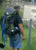
| no partners | | This hike is fairly easy. Easy to find and easy to hike. Do bring water. I looked all over the internet, Tonto National Forest and HAZ but could not find this hike. I live less than a mile from the trail head so I know it exists. I finally found information on the Town of Payson web site which tells all about it. This trail is part of PATS - (Payson area trail systems) imagine that!! Moving to this location 3 years ago and hiking this trail almost every weekend, I've become fairly familar with it. Since I started hiking this Houston Mesa Trail someone has done alot of work on it. Such as clearing debris, rerouting the trail that had been washed out, and the trail markings are very clear.
During the hike you will be in Ponderosa pine, Manzanita, lots of acorn bush, and various cactus and desert shrubbery. The trail is wide and you may run into horse back riders, mountain bikers,(maybe me on a M. bike) and the occasional quad rider, but not very often. There is a north loop and a south loop which begin about 3 miles in. Both loops are approximatly 3 miles also. So, 3 mile to the loop, 3 mile loop, and 3 miles back to the trail head. With mileage being a hair more then the 3,3,3, we come up with 10 miles for the hike.
There are other approaches to get you to just the loop, I haven't been to them and whats the fun in that?
Anyway, this hike is enjoyable to me, clearly marked, some nice veiws of the area, including the Rim. |
| _____________________
| | |
|
|
|
 Route Editor