|
| | | |
| |
|
| Hiking | 1.00 Miles |
900 AEG |
| | Hiking | 1.00 Miles | 1 Hour | | 1.00 mph |
| 900 ft AEG | | | | |
|
|
| |
| Partners |
|
none
[ show ]
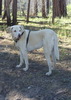
| no partners | | 4th of July hike and maybe a little fly fishing is what we hoped for on this overnight trip. What we found was a lot of traffic just trying to get away and the beginning of the monsoon's. The dogs, wife & I had breakfast at basecamp (my toy hauler parked east of Heber)then headed east towards Big Lake to do the Thompson trail hike that midday before our final destination of West Fork Black river. The parade was just letting out in Show Low and ended taking about an hour and a half to get thru town. Getting to the Thompson trailhead, we were just in time for the afternoon showers, so after waiting to see if the weather would pass we decided just to head over to the Black River. The rain was just as bad there, so we set up our camp at the trailhead parking lot and waited it out.
It rained all night, but finally stopped in the morning. So we geared up and were preparing to hike all day. We were not sure to start heading east or west, everything was so brushy and "thick". There was a fairly new looking trail sign that was pointing us east, so that is the way we went. The river seamed to be flowing well, but along the bank and the trail everything was so thick. Tried the fly rod a few places where I could get in between the brush, but no luck. The trail seemed to end about a mile in, died into a big canyon wall. We back tracked to see if the trail crossed the river at some point but did not find anything. We were bummed it only went in that far, but decided to go back and try the west route. The west route was worse than the way we had just come from. After passing under the bridge there was no sign of a trail. It was just to thick, especially for the dogs. So we decided to load up and head back and do that Thompson trail hike, the sun was out and it looked like it was going to be a beautiful day.
Pulled up to the trailhead and there had to be 15 to 20 cars parked there. Oh why cant I get away from the crowds UGH! Oh well, let's do this. Turned out to be a very nice "picturesque" hike. Reminded me of the Mount Baldy hike. Went in a few miles, very well established trail and an old jeep trail up top above the river, 2 choices both very easy. Thru the fly rod in a few times and stopped to have lunch by the river and just enjoyed the time with the family. There was a monsoon cloud forming above us so we decided to head back after lunch, instead of doing the whole way. I think I convinced the wife to do her 1st backpacking trip with me after doing this one. Maybe Mt. Baldy! |
| _____________________
| | |
|
|
|
 Route Editor