|
| | | |
| |
|
| Hiking | 4.20 Miles |
1,903 AEG |
| | Hiking | 4.20 Miles | 5 Hrs | | 0.84 mph |
| 1,903 ft AEG | | 10 LBS Pack | | |
|
|
| |
| Linked |
|
none
[ show ]
| no linked trail guides |
| Partners |
|
none
[ show ]
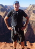
| no partners | | Not too much to add to what has already been posted but once parked in the dirt parking area on the right of #88 just beyond the shops/museum, I walked through a gate that had a "No Trespassing" sign. After a few steps, I walked over some brush and gained access to the south bank, above the wash as described in original report. I get too hung up following the gpx route. In hindsight, give the rock chimney a wide berth to the left while staying well above the wash and make for the saddle. Brush/growth is moderate so while a serpentine path is required, I never arrived at a point where I had to back track during this initial ascent.
From saddle #1 to saddle #2, great views to the west with plenty of cairns to guide the way although again, just make for the next saddle while favoring the right, lower line. The distance between saddle #2 and #3 is short but what I found the most problematic. There is a rock structure in the middle of the far bank. The route goes toward the left draw and some cairns available. Just know you have to drop down a scree covered slope prior to heading back up via the left of the rock structure. At the top of saddle #3, more great views and plenty of cairns to guide down to a wash coming in from the left. I found additional cairns leading up the opposite bank but the route went left to follow the wash. To saddle #4 and the overlook to Boulder Canyon/Lower LaBarge is a longish slog through moderate brush. I stayed out of the wash, first on the west/right side then on the east/left side. Once at the saddle, make a hard right and proceed to the top and the reward of awesome views. With an extended break at the top and fruitless search for a register, it took me exactly 5 hours, round trip. |
| _____________________
| | |
|
|
|
 Route Editor