 Route Editor

| Guide | ♦ | 4 Triplogs | 0 Topics |
details | drive | permit | forecast | map |
stats |
photos | triplogs | topics | location |
| 15 | 4 | 0 |
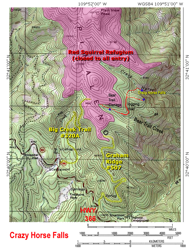
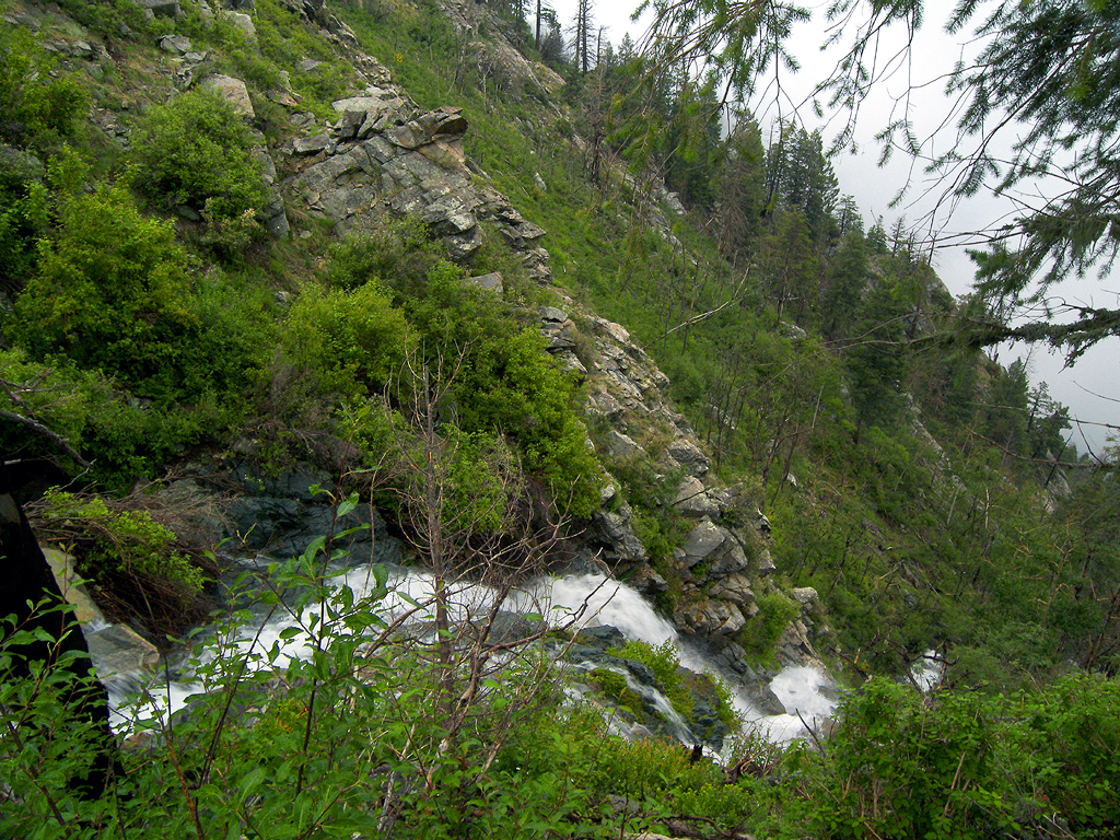
tough to get there, worth the effort by PrestonSands  Overview OverviewA hike to Crazy Horse Falls, located on the east side of the high ridge running south from Mount Graham, takes one through a beautiful and seldom-visited area of the Pinaleno Mountains. The best time to see the falls is likely during spring snowmelt or summer monsoon runoff. Bear Trail Creek (unnamed on U.S.G.S. topographical maps) is the logical starting point for this off-trail hike. However, legally accessing Bear Trail Creek presents some difficulty due to the Mount Graham Red Squirrel Refugium closed to all public entry. Please see this map link for clarification. Warning The legal way to reach the starting point on Bear Trail Creek is to hike up the Graham Ridge #507 road to the Refugium boundary at elevation 9,800 feet, leave the road and follow the 9800-foot contour north for a half-mile to Bear Trail Creek for a one-way distance of about 2.4 miles. The drawback to this approach is that the last half mile is a tangled mess of fallen trees and aspen thickets.
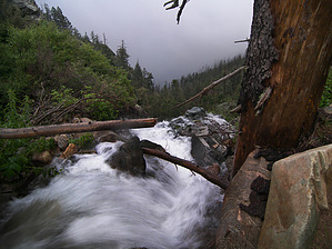
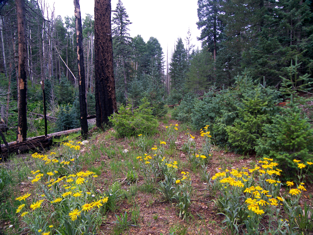
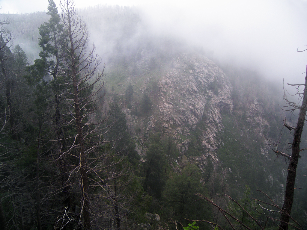
The hike statistics listed are for a round trip hike to the falls from Bear Trail Creek. A round trip hike to the falls via the Graham Ridge #507 road is about 6.8 miles, with 1055 feet of accumulated elevation gain. A round trip via the Big Creek Trail #320A is 5.2 miles, with 1290 feet of accumulated elevation gain. Hike From the 9800 foot contour on the upper end of the Bear Trail Creek drainage (mile 0 for this description), head east down the floor of the little valley into the trees. Although scarred by the 2004 Gibson Fire, the burned areas are recovering nicely, with aspen thickets everywhere. The valley breaks into a long meadow at 9750 feet and soon reaches Bear Trail Cienega (again, not on the U.S.G.S. topo). At Bear Trail Cienega (32.67628 N, 109.86267 W), groundwater wells up in a small marsh covered in cow parsnip and false hellebore, giving birth to Bear Trail Creek. Continue past the Cienega down the lush course of Bear Trail Creek. At 0.3 miles, careful eyes will spot an old logging road that crosses the creek. Although almost completely overgrown, it can be recognized by a dense cluster of short blue-green fir trees growing in the middle of the creek (32.67534 N, 109.86049 W). Follow the old logging road along the north bank of the creek. It soon forks, with a branch continuing down the creek. Take the left fork, which climbs the hillside. Turning north around a small ridge, the road becomes choked with young aspens as it enters a side drainage. Your destination is visible: a low saddle at the top of the side drainage that overlooks Crazy Horse Creek. Once you reach the saddle (32.67819 N, 109.85916 W), you have two options for viewing Crazy Horse Falls. The easiest is to follow the crest of the ridge east for a few hundred yards to where it terminates at a cliff edge overlook (32.6778 N, 109.85577 W). The view is incredible, with Crazy Horse and Marijilda canyons dropping away thousands of feet below. Crazy Horse Falls is somewhat obscured by trees, though. Another option is to descend the north side of the saddle into another side drainage. The footing is tricky due to fallen logs and post-fire growth, but you will reach Crazy Horse Creek within a few hundred yards. Make your way down Crazy Horse Creek to the falls. Watch out for stinging nettle along the creek's edge. Crazy Horse Falls pours out of a notch at the cliffs' edge (32.67935 N, 109.85611 W) and cascades hundreds of feet down the mountainside before disappearing in the trees below.
Check out the Triplogs. Leave No Trace and +Add a Triplog after your hike to support this local community. | |||||||||||||||||||||||||||||||||||||||||||||||||||||||||||||||||||||||||||||||||||||||||||||||||


