 Route Editor

| Guide | ♦ | 4 Triplogs | 0 Topics |
details | drive | permit | forecast | route |
stats |
photos | triplogs | topics | location |
| 57 | 4 | 0 |
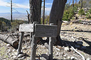
Ol' Grizz Playground by HAZ_Hikebot   The bears this trail is said to have been named for were grizzlies. They are now extinct in the southwest, but you can still find black bears in the area! People who come here say Bear Canyon retains more of a feeling of wildness than other canyons in the area. Perhaps that's because of its name, or maybe it's because this out-of-the-way place is a bit more remote and less visited than others in the Huachucas. The bears this trail is said to have been named for were grizzlies. They are now extinct in the southwest, but you can still find black bears in the area! People who come here say Bear Canyon retains more of a feeling of wildness than other canyons in the area. Perhaps that's because of its name, or maybe it's because this out-of-the-way place is a bit more remote and less visited than others in the Huachucas.Bear Canyon is an area of big trees, towering cliffs, and abandoned mines. It is a steep canyon, and the ordinarily dry streambed that runs through it is punctuated with precipitous plunges that become waterfalls during the spring snowmelt and after summer rains. The area surrounding Bear Canyon is the source of several legends; of lost gold mines, buried treasure, and ghosts left over from battles with the Apaches. And there are other ghosts here as well. The remains of a wooly mammoth were discovered in this canyon fairly recently. Travelers on the Bear Canyon Trail may not find many mammoth remains, but they will run across evidence of old mining digs and miner's cabins. The trail follows what's left of the primitive roads these fortune-hunting pioneers carved into the mountainside in several places.
Check out the Official Route and Triplogs. Leave No Trace and +Add a Triplog after your hike to support this local community. One-Way Notice This hike is listed as One-Way. When hiking several trails on a single "hike", log it with a generic name that describes the hike. Then link the trails traveled, check out the example. | ||||||||||||||||||||||||||||||||||||||||||||||||||||||||||||||||||||||||||||||||||||||||||


