Dixie Summit Trail is a moderate quarter-mile summit trail that provides a view from 2,277 feet, providing panoramic views of all the peaks of the Phoenix preserve system including Camelback Mountain, North Mountain, Shaw Butte and Piestewa Peak.
It is the second-highest peak in the Sonoran Preserves. Union Peak is the highest at 2,383, nearby 2,080 (unnamed/unnumbered) to the west is lower. Dixie is slightly more aggressive grade-wise. 2,080 has a 13.5% grade accessed via Western Vista Trail vs Dixie Summit Trail at 17%. However, the footing on Dixie seemed a little better due to more solid rock slivers in the base.
Hike
In ~40 feet you are on what I've dubbed Dixie Saddle. Short zipper switchbacks make the ascent easier. After 5 switchbacks (10 turns) you get a refreshing straight stretch for 300+ feet. Then another 5 irregular(smashed zipper) gets you to the small peak.
There isn't much room, nor much in terms of sitting options at the top. The views on the other hand are worthy if you are debating this peak while looping Dixie Mountain. A few points of interest are Black Mesa(NE), Four Peaks(E), White Tank Mountains(SW), Pyramid Peak(W). You might be able to squint out Woolsey Peak just south of White Tanks. If not, Hayes is super easy.
When hiking several trails on a single "hike", log it with a generic name that describes the hike. Then link the trails traveled, check out the example.
WARNING! Hiking and outdoor related sports can be dangerous. Be responsible and prepare for the trip. Study the area you are entering and plan accordingly. Dress for the current and unexpected weather changes. Take plenty of water. Never go alone. Make an itinerary with your plan(s), route(s), destination(s) and expected return time. Give your itinerary to trusted family and/or friends.
Permit $$
None
Directions
Road
Paved - Car Okay
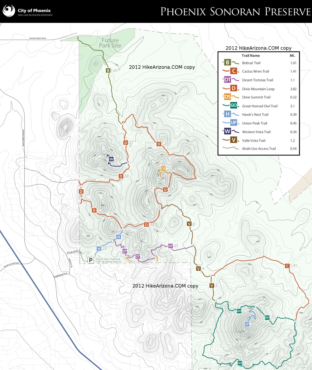
To Desert Vista Trailhead From I-17 and Jomax Rd, take Jomax to it's east end. Turn left on North Valley Pkwy, right on Copperhead Trail, left on Melvern Trail, and right on Desert Vista Trail to go behind the neighborhood community center. Desert Vista dead ends at the trailhead parking lot. Studying a map before you go is recommended as the trailhead is somewhat hidden in the neighborhood.
Address: 1901 W Desert Vista Trail, Phoenix
From PHX (I-10 & AZ-51) 29.4 mi, 34 mins From TUC (Jct 1-10 & Grant) 134 mi, 2 hours 4 mins From FLG (Jct I-17 & I-40) 122 mi, 1 hour 54 mins
 Route Editor

 Dixie Summit Trail is a moderate quarter-mile summit trail that provides a view from 2,277 feet, providing panoramic views of all the peaks of the Phoenix preserve system including Camelback Mountain, North Mountain, Shaw Butte and Piestewa Peak.
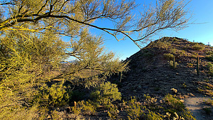


