username
X
password
register
for free!
help


Great Horned Owl Trail - Sonoran Preserve, AZ

Guide 106 Triplogs  1 Topic
  3 of 5  
Fav
Wish
1
details
drive
no permit
forecast
route  
stats
photos
triplogs
topic
location
1k 106 1
Statistics
tap row or icons for details
Distance One Way 3 miles
Trailhead Elevation 1,804 feet
Elevation Gain 204 feet
Accumulated Gain 440 feet
Avg Time One Way 1.5 hours
Kokopelli Seeds 4.47
 Backpack No
feature photo
Photos Viewed All MineFollowing
Will recalculate on button tap!
10  2025-07-12 DarthStiller
9  2025-04-02
Union Dixie and one makes Three
The_Eagle
4  2025-02-01
Tortoise Vista Wren GO Lasso
tibber
5  2024-12-27
Union Peak
The_Eagle
7  2024-02-24
Phoenix Sonoran Preserve South
trekkin_gecko
6  2024-02-24
Phoenix Sonoran Preserve South
johnlp
15  2023-11-19
Tortoise UP Loop plus - Valle Dixie
tibber
2  2023-11-06
Union Peak Trail - Sonoran Preserve
Nightstalker
Page 1,  2,  3,  4,  5 ... 7
Author
author avatar Guides 4
Routes 5
Photos 8
Trips 2 map ( 5 miles )
Age Male Gender
Location Phoenix, AZ
Associated Areas
list map done
Phoenix Region
Historical Weather
Trailhead Forecast
Radar Map
Expand Map
Preferred Nov, Dec, Feb, Feb
Seasons   Late Autumn to Late Spring
Sun  6:05am - 6:47pm
Official Route & 6 Rts
 
59 Alternative


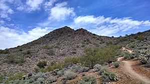
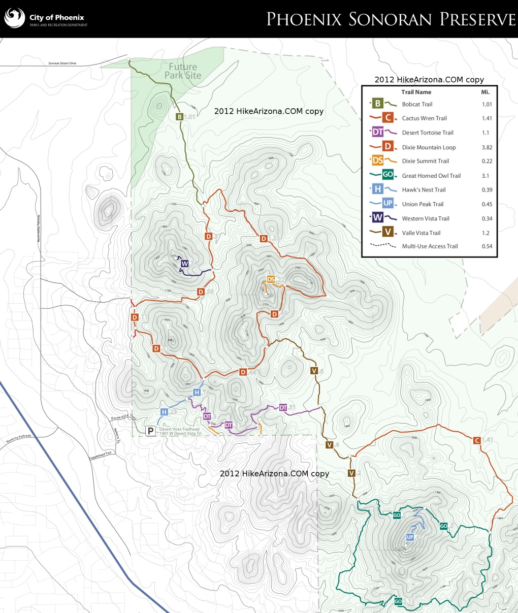
Nice 8 mile loop from Vista Trailhead
by batman1

 
Overview
A 3-mile loop hike around Union Peak in the Phoenix Sonoran Preserve. Requires a 2-mile each-way cherry stem hike to get to it. Which is a 7.9-mile / 1.1k-AEG hike including Union Peak Trail.


Hike
The hike begins at the Desert Vista Trailhead. There is lots of parking and lots of cars. There is not a lot of privacy in this area. The Great Horned Owl Loop is accessed by hiking 1/4 mile of the Hawks Nest Trail, the Desert Tortoise Trail's full length, and then the eastern part of the Valle Vista Trail. From Valle Vista Trail's end, the Great Horned Owl Trail goes East or South making a 3-mile loop.
remove free decal offer
Taking the trail South (counter-clockwise), the trail drops a couple of hundred feet and loops around the south side of Union Peak. Views of the sparsely populated neighborhoods to the south and east are seen as the trail winds back and forth around the peak. The trail then climbs steadily as it goes around the east side of the peak until it meets the Cactus Wren Trail. The Trail then continues to climb along the north side of the peak, reaching the Union Peak Trail, a nice 1/2 mile side trip with excellent views in all directions. From the Union Peak Trail, the trail continues downhill to reach the conclusion of the loop at the Valle Vista Trail.

The return to the trailhead is via the same route, or there are many longer trail options to explore the Preserve.

Water Sources
There is no water available on the trail. Bring your own as needed. The weather will be hot in the summer.

2021-02-20 batman1
  • SPS 2016
    area related
    SPS 2016
  • map
    area related


Check out the Official Route and Triplogs.
Leave No Trace and +Add a Triplog after your hike to support this local community.

One-Way Notice
This hike is listed as One-Way.

When hiking several trails on a single "hike", log it with a generic name that describes the hike. Then link the trails traveled, check out the example.
WARNING! Hiking and outdoor related sports can be dangerous. Be responsible and prepare for the trip. Study the area you are entering and plan accordingly. Dress for the current and unexpected weather changes. Take plenty of water. Never go alone. Make an itinerary with your plan(s), route(s), destination(s) and expected return time. Give your itinerary to trusted family and/or friends.

 Permit $$
None


 Directions
or
 Road
Paved - Car Okay

To Desert Vista Trailhead
From I-17 and Jomax Rd, take Jomax to it's east end. Turn left on North Valley Pkwy, right on Copperhead Trail, left on Melvern Trail, and right on Desert Vista Trail to go behind the neighborhood community center. Desert Vista dead ends at the trailhead parking lot. Studying a map before you go is recommended as the trailhead is somewhat hidden in the neighborhood.

Address: 1901 W Desert Vista Trail, Phoenix

From PHX (I-10 & AZ-51) 29.4 mi, 34 mins
From TUC (Jct 1-10 & Grant) 134 mi, 2 hours 4 mins
From FLG (Jct I-17 & I-40) 122 mi, 1 hour 54 mins
page created by hippiepunkpirate on Feb 20 2021 9:40 pm
 90+° 8am - 6pm kills
helpcorrectionissue

end of page marker