join hands or share a group hug on the peak by joebartels
Hike
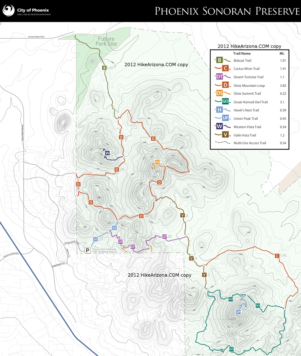
Union Peak Trail begins at the 0.45-mile point of the Great Horned Owl Trail from its NW origin. Lazy switchbacks weave two rock outcrops 0.32-mi up to a mini ridgeline. A false summit is encountered before the 2383 ft summit of Union Peak. The entire trail is a forgiving 11% grade. With the exception of a steep spot, this seems like a worthy mountain bike ride to a peak.
Options Great Horned Owl Trail and Cactus Wren Trail make nice looping options with iconic desert cacti that sing at sunrise. For a complete overview of the southern Sonoran Preserve, include Dixie Summit in your hike.
Synopsis
I approached this trail to document and check it off as done. Let's not get all teary-eyed but the layout of the trail won me over. That said, the views did not grasp me. All the popular mountain ranges are in place but distant homes caught my eye more than atop Piestewa in the city.
Mild Fun Fact
The north end of the trail is ~near parallel with 2nd St downtown Phoenix. The summit is parallel with Central Ave.
When hiking several trails on a single "hike", log it with a generic name that describes the hike. Then link the trails traveled, check out the example.
WARNING! Hiking and outdoor related sports can be dangerous. Be responsible and prepare for the trip. Study the area you are entering and plan accordingly. Dress for the current and unexpected weather changes. Take plenty of water. Never go alone. Make an itinerary with your plan(s), route(s), destination(s) and expected return time. Give your itinerary to trusted family and/or friends.
Permit $$
None
Directions
Road
Paved - Car Okay
To Desert Vista Trailhead From I-17 and Jomax Rd, take Jomax to it's east end. Turn left on North Valley Pkwy, right on Copperhead Trail, left on Melvern Trail, and right on Desert Vista Trail to go behind the neighborhood community center. Desert Vista dead ends at the trailhead parking lot. Studying a map before you go is recommended as the trailhead is somewhat hidden in the neighborhood.
Address: 1901 W Desert Vista Trail, Phoenix
From PHX (I-10 & AZ-51) 29.4 mi, 34 mins From TUC (Jct 1-10 & Grant) 134 mi, 2 hours 4 mins From FLG (Jct I-17 & I-40) 122 mi, 1 hour 54 mins
 Route Editor

 Hike
Hike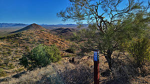


