| Guide | ♦ | 21 Triplogs | 1 Topic |
details | drive | permit | forecast | route |
stats |
photos | triplogs | topic | location |
| 349 | 21 | 1 |
Ash Rival by whereveriroam  After a long 5 years, I decided a return trip to the Galiuros was long overdue. On my prior trips the destination had been either Powers Garden or the Ash Creek/Bassett Peak areas. This time it was time for something new! After recently seeing the documentary "Power's War" I decided on a return trip to "Shootout Cabin" a.k.a. "Powers Cabin". The route we hiked to Powers Cabin utilized High Creek #290, East Divide #287, Rattlesnake #285, Powers Garden #96, and the West Divide #289 trails. After a long 5 years, I decided a return trip to the Galiuros was long overdue. On my prior trips the destination had been either Powers Garden or the Ash Creek/Bassett Peak areas. This time it was time for something new! After recently seeing the documentary "Power's War" I decided on a return trip to "Shootout Cabin" a.k.a. "Powers Cabin". The route we hiked to Powers Cabin utilized High Creek #290, East Divide #287, Rattlesnake #285, Powers Garden #96, and the West Divide #289 trails.I've always wanted to hike the High Creek trail due to what appeared easy access. However there was one major problem, a local rancher closed the portion of the FS road that ran through his property to public access. I had heard a few years back conflicting stories on present-day access. I had heard two versions; either a bypass had been built around the rancher's property or a deal had been struck and the road was reopened.
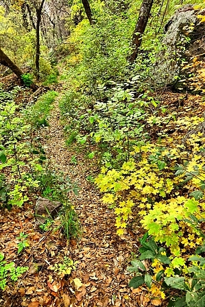
Once the rays of morning sunlight warmed us up (the night low was 34F) we finished packing up and went TH hunting. We found out in the daylight that we had been on the right track the night before in trying to find the TH but turned back. The lack of info, TH signage and out-of-date maps/directions I obtained were at fault. After finding the TH I'd love to hear the real story of how the modern access to High Creek came about. There could be a story here that the media and aspiring criminals (I mean politicians) could sink their teeth into. When Barack Obama got elected to be president in 2008 if one remembers this country was in deep poop. One of his first actions was a massive stimulus package to pump money into the sinking economy. The term "Shovel Ready" was widely used on where that money would be spent. Unless some Republican pranksters decided to plant one of those "American Re-investment Act" signs along this road (I highly doubt) it appears public access was restored via "Shovel Ready"! My hunch tells me the rancher is either a hard-core Republican or anti-government type and this was done to get under his skin. Anyway once you drive the scenic bypass (directions below) around the rancher's property you'll get back onto FS 159. FS 159 is such a short and pretty road, it reminded me so much of what the Pinery Canyon road (FR 42) that goes through the Chiricahua's used to look like )-: Drive it as far as you comfortably feel to the TH (unmarked), its car-friendly to a point and then becomes HC in spots. There are some sweet car camping spots along the new bypass road and FR 159, I'd like to camp at every one of them. This trail is posted at its high junction with the East Divide/Sunset Peak trails as being only 1.7 miles long but since we didn't make it to the end of the road it ended up about 2.25 miles for us. The High Creek trail IMO would rival the Ash Creek/Bassett Peak trail for fall foliage but this trail is an uphill workout the whole way (1600'). The entire trail passes through an unburned (for now) forest on a well-cut back trail (Shovel Ready?) crossing High Creek a bunch of times to its junction with the East Divide and the long-forgotten and probably decommissioned Sunset Peak trail. The last 0.5 mile or so of this trail has some somewhat steep switchbacks. We made a lot of noise talking on our hike both up and down this trail and had to scare away all the wildlife. We did find a fly-invested pile of very green bear poop along this trail. After a very wet fall and winter, we did not find much water along the High Creek trail. We did find flowing and pooled water near the end of the road when it turns into a hiking trail, that lasted for about 0.5 mile up the trail. High Creek was dry where we parked on FS 159 and probably didn't resurface at all below the parking spot. A couple of afterthoughts come to my mind and I think should be mentioned. Near the start of the trail if you look carefully you will notice what appears to be a power line crossing the creek overhead. We didn't have the energy to check it out but it will probably lead to the remnants of mine activity. The other for you SE AZ people, Sunset Peak needs visitation to take back this trail from lack of use, it looks like it deserves it. Check out the Official Route and Triplogs. Leave No Trace and +Add a Triplog after your hike to support this local community. One-Way Notice This hike is listed as One-Way. When hiking several trails on a single "hike", log it with a generic name that describes the hike. Then link the trails traveled, check out the example. | |||||||||||||||||||||||||||||||||||||||||||||||||||||||||||||||||||||||||||||||||||||||||||||||||||||||||||||||||||||||||||||||||||||||||||||||||||||||||||||||||||||||||||||||||||||
 Route Editor


