username
X
password
register
for free!
help
 

Ridgeline Trail - Thunderbird, AZ

Guide 14 Triplogs  0 Topics
  2.7 of 5  
Fav
Wish
0
details
drive
no permit
forecast
route  
stats
photos
triplogs
topics
location
28 14 0
Statistics
tap row or icons for details
Difficulty 1 of 5
Distance One Way 0.35 miles
Trailhead Elevation 1,374 feet
Elevation Gain 149 feet
Accumulated Gain 149 feet
Avg Time One Way 5-15 min
Kokopelli Seeds 0.85
unreported if dogs are allowed
editedit > ops > dogs to adjust
feature photo
Photos Viewed All MineFollowing
Inaugural Calculation on Button Tap!
13  2025-03-12
Thunderbird Peak - Glendale HP
DixieFlyer
3  2024-12-18
Thunderbird
The_Eagle
1  2024-05-07
Thunderbird Conservation Park
trekkin_gecko
3  2024-05-07
Thunderbird Conservation Park
johnlp
11  2023-03-29
Tbird Triple
The_Eagle
22  2022-01-16
Thunderbird Parks East and West
tibber
18  2020-03-23
Iguana Coachwhip Ridgeline Sunrise Chuckwalla
joebartels
Author
author avatar Guides 264
Routes 2,797
Photos 14,494
Trips 5,894 map ( 29,783 miles )
Age 55 Male Gender
Location
Associated Areas
list map done
Phoenix Region
Historical Weather
Trailhead Forecast
Radar Map
Expand Map
Preferred Feb, Jan, Dec, Nov
Sun  6:05am - 6:51pm
Official Route
 
7 Alternative


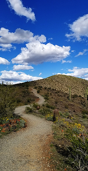
Character in a Sea of Average
by joebartels

Overview
Originates off of the Coach Whip trail and intersects with the Sunrise trail. Formerly known as H-4b.


Hike
Ridgeline Trail begins at a signed junction ½ mile in on the Coach Whip Trail from the 67th Ave & Patrick Lane Trailhead. 14 mini switchbacks make a 150 ascent painless. The back and forth views give way to a likewise gentle rollercoaster over to Sunrise Trail.
remove free decal offer
Synopsis
After Sunrise 1,682, this was my second favorite trail in the western hill group of Thunderbird Conservation Park.

2020-03-24 joebartels
  • 2013 Map
    area related
    2013 Map
  • area related


Check out the Official Route and Triplogs.
Leave No Trace and +Add a Triplog after your hike to support this local community.

One-Way Notice
This hike is listed as One-Way.

When hiking several trails on a single "hike", log it with a generic name that describes the hike. Then link the trails traveled, check out the example.
WARNING! Hiking and outdoor related sports can be dangerous. Be responsible and prepare for the trip. Study the area you are entering and plan accordingly. Dress for the current and unexpected weather changes. Take plenty of water. Never go alone. Make an itinerary with your plan(s), route(s), destination(s) and expected return time. Give your itinerary to trusted family and/or friends.

 Permit $$
no fees or permits reported

if incorrect tell us about it


 Directions
or
 Road
Connector trail - Not Applicable

To hike
page created by joebartels on Jul 30 2017 10:18 am
 90+° 8am - 6pm kills
helpcorrectionissue

end of page marker