Route Editor

| Guide | ♦ | 9 Triplogs | 0 Topics |
details | drive | permit | forecast | route |
stats |
photos | triplogs | topics | location |
| 28 | 9 | 0 |
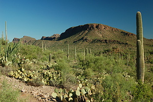
Ironwood and Saguaros by markthurman53  Overview OverviewIronwood Forest Trail can be used for a longer hike using Picture Rocks Wash Trail or the Brittlebush Trail to form loop trails. The trailhead is at the parking lot along Picture Rocks Road just west of Contzen Pass and ends at Picture Rocks Wash, 1.4 miles later. Start on the Ringtail Trail for 0.1 miles, then on the Cam-Boh Trail for 0.2 miles to the Ironwood Trail. The first third of the Ironwood Trail follows along a wash, and the last two-thirds is an actual trail. The southern part near Picture Rocks Wash has numerous young Ironwood Trees. Hike The Ringtail Trail starts in a wash on the south side of Picture Rocks Road. After 0.1 miles, turn right (west) onto the Cam-Boh Trail, follow this for 0.2 miles to signed Ironwood Trail. This trail follows a wash and doesn’t appear to be a trail, but just as you begin to wonder if you may have missed the trail exiting the wash, at 0.1 miles, there will be a sign indicating the junction with the Mule Deer Trail. The Mule Deer heads off to the east and will connect up with the Ringtail Trail. Continue along the wash, and after 0.5 miles from the start of Ironwood Trail, the trail heads out of the wash to the left (There was no sign indicating this, but there was a rock Cairn). The trail continues south, climbing a small saddle before dropping down about 40 feet and crossing two small streams. The trail then climbs about 40 feet over a ridge before dropping into Picture Rocks Wash and the end of the Trail. There is a sign at this junction indicating the Picture Rocks Wash Trail. This is an easy trail to follow as long as you follow the wash, then exit at the right spot and follow the well-defined trail. I had no issues with this spot because I was heading north, and the trail just entered the wash, and it didn’t come out. There are many young Ironwood trees along this trail (young is relative), I did not see any large Ironwood trees. From the end of this trail, you can take the Picture Rocks Wash Trail to the east to the Ringtail Trail and back to the start point or continue to the Brittlebush Trail to form a larger loop.
Check out the Official Route and Triplogs. Leave No Trace and +Add a Triplog after your hike to support this local community. | |||||||||||||||||||||||||||||||||||||||||||||||||||||||||||||||||||||||||||||||