 Route Editor

| Guide | ♦ | 5 Triplogs | 0 Topics |
details | drive | no permit | forecast | 🔥 route |
stats |
photos | triplogs | topics | location |
| 59 | 5 | 0 |
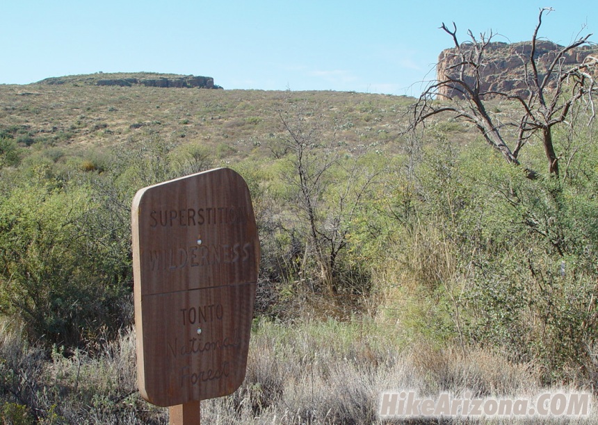
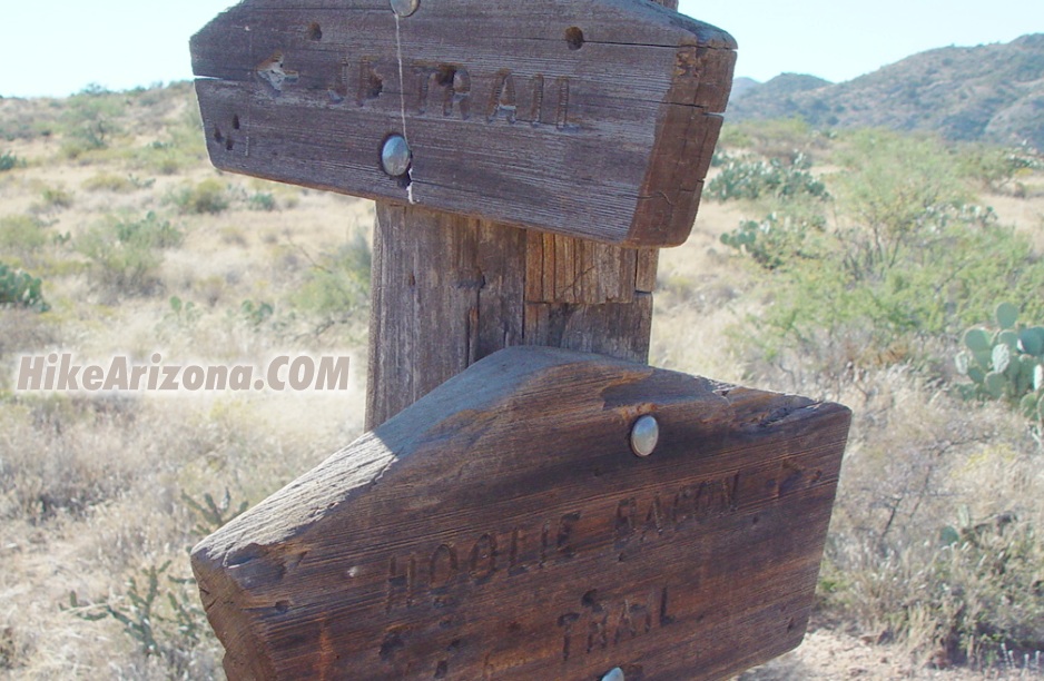
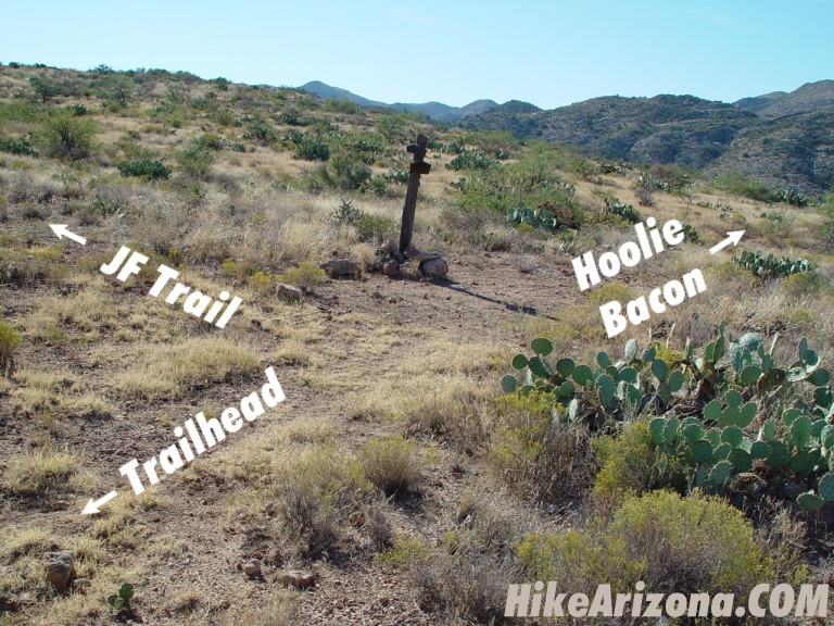
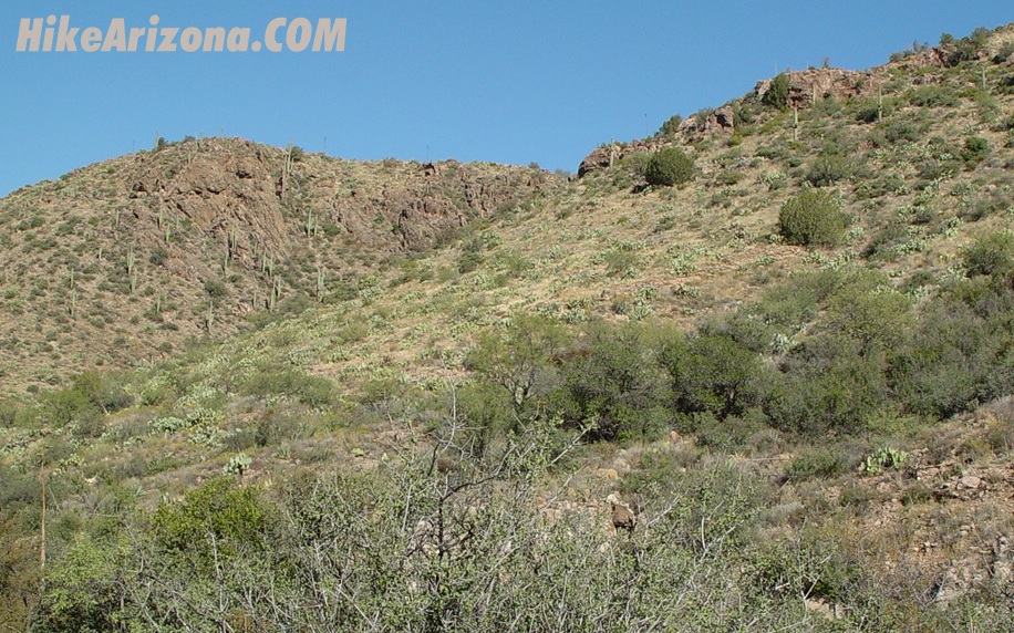
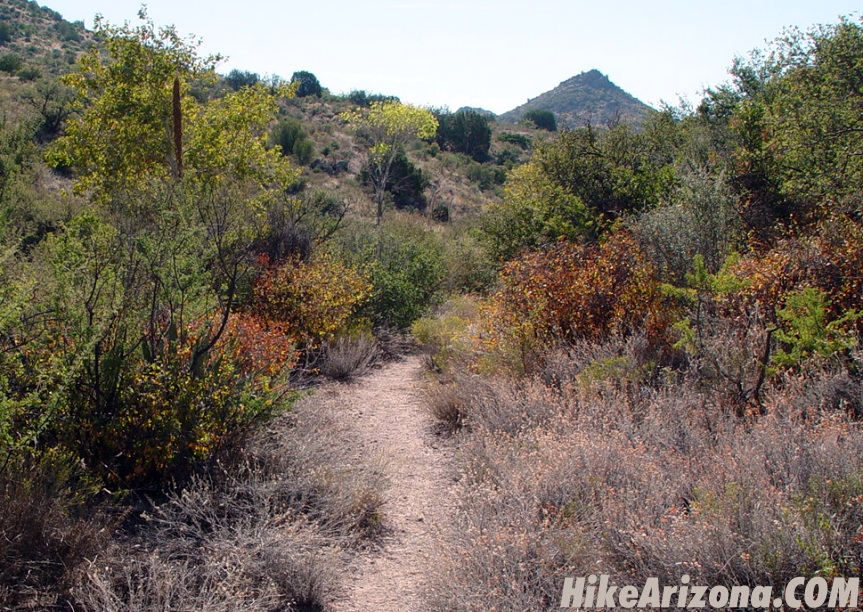
360 Wilderness View by joebartels   Overview OverviewThe Hoolie Bacon Trail #111 is a connector trail that runs 4 miles. From the JF Trailhead, you can follow the JF Trail #106 a short distance to access the northern end. The southern end is accessed mid-way through the Red Tanks Trail #107. Which is in La Barge Canyon north of Coffee Flat Mountain. The trail as of this writing is slightly overgrown with catclaw. Trail data and description here are from JF Trailhead to the top of Peak 4143 and back. Hike From the JF Trailhead follow the old jeep road out. Immediately you pass the Superstition Wilderness / Tonto Forest sign. JF Trailhead has no signs as of this writing. About three-quarters of a mile into the hike you come to the signed junction of JF Trail and the Hoolie Bacon Trail. The JF Trail heads off on a very faint trail. The Hoolie Bacon is straight ahead on a somewhat visible trail.
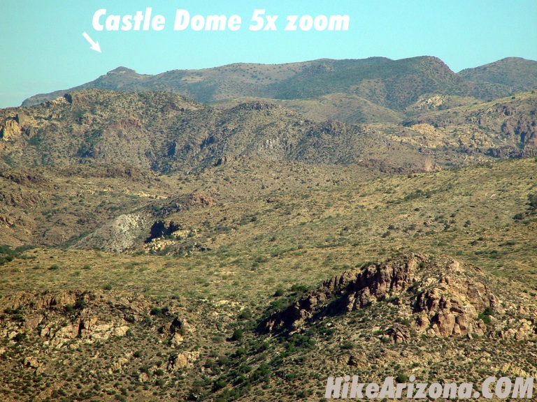
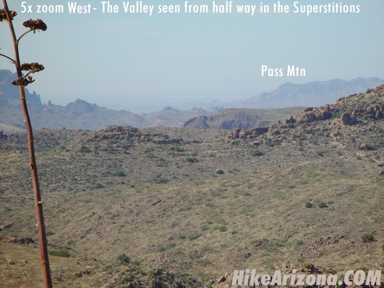
Once around the bend and across another creek, you start a mild 600-foot ascent. You're heading up to the high point of the Hoolie Bacon Trail. This is about 200 feet below Peak 4143. It's not much a saddle, more just a part of Horse Ridge. After 350 feet up you think the ascent is over. It's easy, but not that easy. Continue and you'll see the trail levels out for a short distance then picks up the remaining 250 feet. The trail is slightly overgrown with catclaw. However, I don't think it's as bad as Peters Trail #105 nearby. Maybe I'm just getting used to it, not! My hiking time was slower at 1.8 mph compared to an average of 2.1 mph so it must be overgrown a bit. From the high point on Horse Ridge, you need to scramble off-trail. It's only 200 feet up and west to Peak 4143. There's no trail whatsoever. It only took me about 8 minutes each way. It would help if you were careful not to step on cacti or loose rocks. Each step must be evaluated. The good news is there's not much catclaw on the slope! Bring the binoculars. There are great views and landmarks to be spotted in all directions. However, they're all far away. Most folks would probably find the Peters Trail a little more exciting. Personally I thought it was pretty cool to be able to see Castle Dome and Phoenix from the same spot. Other views from Peak 4143 include the Four Peaks, Tortilla Mountain, Superstition Mountain, the Superstition Ridgeline, Weavers Needle, Music Mountain, Miners Needle, Coffee Flat Mountain, and several other eastern landmarks I'm not familiar with yet. Return to the trailhead the way you came in. You might check out a topographical map and consider a loop with the Peters Trail. Beware this involves off-trail travel through heavy catclaw. The Hoolie Bacon Trail continues down the south side of Horse Ridge passing through Horse Camp Basin. Then drops off into La Barge Canyon north of Coffee Flat Mountain. Which is mid-way along the Red Tanks Trail. If you plan on continuing down as a day hike, keep in mind you must come back over the ridge. Check out the Official Route and Triplogs. Leave No Trace and +Add a Triplog after your hike to support this local community. | |||||||||||||||||||||||||||||||||||||||||||||||||||||||||||||||||||||||||||||||||||||||||||||||||||||||||


