 Route Editor

| Guide | ♦ | 47 Triplogs | 1 Topic |
details | drive | permit | forecast | 🔥 route |
stats |
photos | triplogs | topic | location |
| 233 | 47 | 1 |
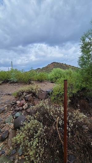
Geology peppered with Culture by joebartels  History HistoryThis trail is a section of the Old Stage/Military Trail, that ran between Prescott and Phoenix in the late 1800s. Whether a true alignment or not, Old Stage Road intriguingly continues north through the neighborhoods. Go John Canyon was saved from development in 1998 by a 1996 state law that allows state trust land to be reclassified for preservation. This small canyon contains Hohokam archaeology sites, a riparian habitat, and goodies galore.
The preserve was named in honor of Patricia Ann Seitts, a former executive director for the Land Trust who was instrumental in its preservation. She was focused on saving the land for future generations to enjoy this natural treasure. At the age of 52, Patricia died as a result of colon cancer. Overview Military Trail connects Slate Trail and Flat Rock Trail. Quartz Trail is used to create a loop. Hike From the south junction with Slate Trail, nearby is an old post with three faint 3s at the top. The distinct junction yards away is Slate Trail to the west and Military trail going north. This old route is a nice single-track winding through the lush desert. You can easily fall in love with this trail. Cottontails occasionally hopped in view and hid off-trail. Curve-billed thrashers offered pleasant songs along the trail with Abert's Towhee in the background. The backup choir included Cactus wren, Sage thrasher, and Pyrrhuloxia. The first 0.45-mile only gains 20 feet of elevation paralleling Cave Creek. It had rained approaching from Slate Trailhead and baby Red Spotted Toads were abundant in areas. On the upper perimeter of the Valley of the Sun, I was impressed with Skull Mesa, Quien Sabe and Continental Mountain towering to the NE. You reach a distinct unsigned junction. Right is part of the preserve along Cave Creek sandwiched between private property and ultimately a golf course. Our trail bends left in a northwest direction and leads you 150 feet in elevation up Go John Canyon! Geology in the tread can not escape your curiosity unless you are blind. Either a walloping dose or somewhere in the mix lies Foliated Phyllite. Foliated is repetitive layering. Whatever it is or is morphing into, it goes from a soft (fingernail scratchable) green to a darker blue or gray that is hard. It is remarkable, the best I can guess is that it is morphing into the finest grained foliated metamorphic rock... slate. I expected but did not see signage pleading to tread lightly as is the case at Coyote Buttes. Later realized, the local equestrians practice smash-to-hell leave-horseshoe-trace all over Slate Trail. But wait, there is more. The rock turns purple and then you are blind-sighted by a splash of Sedona red and cream. This trail appears to end at the junction with Flat Rock Trail. The path and preserve continue a short distance but there is a sign that says not to proceed. For pondering minds, there is private land before N Old Stage Rd. Synopsis I drove out here with ultra-low expectations and fears I could offer more than a hollow paragraph. Rain en route almost had me aborting but I couldn't afford to abort and return. As it turned out, I was humbled by the history and immensely enjoyed this little trail, probably because it had just rained too. With little to go on, the name and such may be incorrect but will adapt as it surfaces. 30-second Video Check out the Official Route and Triplogs. Leave No Trace and +Add a Triplog after your hike to support this local community. One-Way Notice This hike is listed as One-Way. When hiking several trails on a single "hike", log it with a generic name that describes the hike. Then link the trails traveled, check out the example. | ||||||||||||||||||||||||||||||||||||||||||||||||||||||||||||||||||||||||||||||||||||||||||||||||||||||||||||||||||||||||||||||||||||||||||||||||||||||||||||||||||||||||||||||||||||||||||


