 Route Editor

| Guide | ♦ | 37 Triplogs | 2 Topics |
details | drive | permit | forecast | 🔥 route |
stats |
photos | triplogs | topics | location |
| 401 | 37 | 2 |
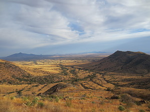
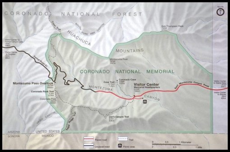
Hike to the Trail by HAZ_Hikebot   A spur from the Joe’s Canyon Trail, the trail descends steeply to the US/Mexico border. One must hike 1 mile from Montezuma Pass along the Joe's Canyon Trail to reach the Yaqui Ridge spur, making the total length 4 miles round-trip from the Pass. Here you can view International Boundary Marker 102 located at the southwestern corner of the park. This trail marks the southern terminus of the Arizona National Scenic Trail, an 800+ mile diverse and scenic trail that extends from Mexico to Utah. For your safety, please do not cross over the fence into Mexico. A spur from the Joe’s Canyon Trail, the trail descends steeply to the US/Mexico border. One must hike 1 mile from Montezuma Pass along the Joe's Canyon Trail to reach the Yaqui Ridge spur, making the total length 4 miles round-trip from the Pass. Here you can view International Boundary Marker 102 located at the southwestern corner of the park. This trail marks the southern terminus of the Arizona National Scenic Trail, an 800+ mile diverse and scenic trail that extends from Mexico to Utah. For your safety, please do not cross over the fence into Mexico.Coronado National Memorial NPS Details Descends steeply from Joe's Canyon Trail down to International Boundary Marker 102 located at the southwestern corner of the park. This trail is the southernmost point of the Arizona Trail. Please do not cross over fence into Mexico and remember what goes down must come back up. Check out the Official Route and Triplogs. Leave No Trace and +Add a Triplog after your hike to support this local community. One-Way Notice This hike is listed as One-Way. When hiking several trails on a single "hike", log it with a generic name that describes the hike. Then link the trails traveled, check out the example. | |||||||||||||||||||||||||||||||||||||||||||||||||||||||||||||||||||||||||||||||||||||||||||||||||||||||||||||||||||||||||||||||||||||||||||||||||||||||||||||||||||||||||||||||||||||||||||||||


