Route Editor

| Guide | ♦ | 63 Triplogs | 2 Topics |
details | drive | no permit | forecast | 🔥 route |
stats |
photos | triplogs | topics | location |
| 699 | 63 | 2 |
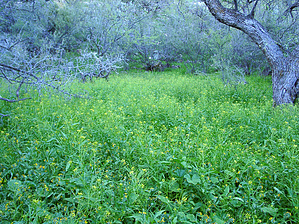
Strenuous by arizonaheat  Overview OverviewDutchman Trail #104, Coffee Flat Trail #108, Red Tanks Trail #107, Whiskey Spring Trail #236, Dutchman Trail #104 Hike Arizonaheat has wanted to do this loop for quite some time but has been debating whether to do it as a day hike or an overnighter. Well, I decided to make a day trip out of it. The loop itself is 19 miles and I threw in another 5-mile, off-trail loop, for a grand total of 24 miles.
I dropped down into Barkley Basin, crossing Lower Barks Canyon and the trail to the grave of the unknown soldier. I continued across Barkley Basin, where I ran into Victoria, Jarrod, Nick, and Heath Barkley (for those of you who remember them), to my dismay Audra wasn't with them, but to my delight, I would run into her later in my journey. After a short visit with them, it was on past Miners Needle, to where the Dutchman and Coffee Flat Trails intersect. Wildflowers and blooming cactus were scattered along this stretch of trail. I headed down the Coffee Flat Trail #108 and this is where sensory overload really began to kick in. My eyes and brain could barely process what I was seeing. It was like an oasis in the desert (see numerous photos). I soon found myself at Whitlow Corral. The trail forks at a point shortly before the corral. The better-worn portion of the trail will take you to Whitlow Corral, where you open a gate to continue toward the Circle U Ranch. If you are heading to Dripping Springs as I was you will want to bear left at the fork, but the corral is definitely worth checking out. I took a short break here. From the corral, I got back on the Coffee Flat Trail, taking in all the lush greenery. I soon found myself dropping down into an oasis called Reeds Water, complete with windmill, water running down the creek, cottonwood trees and a plethora of other flora (see pictures). A word of caution, shortly after Reeds Water you will come upon a cliff face in which the trail will fork. If you are going to Dripping Springs bear left. It was at the point where the trails fork, that I left the trail and went on my loop, which ended up being an adventure in itself. Basically what I did was follow the flowing creek for about 2.5 miles. Then I plugged the coordinates for Dripping Springs into my GPS and it said it was two and a half miles. So off I went up a drainage slightly to the North of Buzzards Roost. I then left the drainage and ascended to the summit close to Buzzards Roost following an old Forest Service boundary fence line, with a USGS corner stake marker dated 1917. From the summit, I descended the other side and intersected the Coffee Flat Trail to Dripping Springs. There was some bushwhacking involved and very steep terrain to climb, on this off-trail adventure. It took me 3 hours to cover 2.5 miles. (see photos). Once back on the Coffee Flat Trail, I was at Dripping Spring in no time. I stopped here and ate lunch along the flowing Red Tanks Canyon drainage and reflected on my off-trail excursion. This is a truly beautiful spot. And this is where I ran into Audra Barkley. After lunch, it was onto the Red Tanks Trail #107, which intersects with the Coffee Flat Trail right there at Dripping Springs. The Red Tanks basically follows the drainage for a distance, before making the climb toward Red Tanks Divide. After reaching Red Tanks Divide the trail makes a turn and intersects with the Hoolie Bacon Trail after a distance. Sections of this trail were very difficult to follow because much of it was obscured by the green carpet covering the desert floor right now. After passing the Hoolie Bacon trail you entered Upper LaBarge Box, which is a very rugged very scenic stretch of trail. Soon you will find yourself on the Whiskey Spring Trail #238, which will hook you back up with the Dutchman and take you back to Peralta. This was a very enjoyable although long excursion, I would rate it as very difficult for a day hike due to length and roughness of terrain. If I include my off-trail excursion I would have to say it was a more difficult and physically demanding 24 miles than the Rim to Rims I have done. Pictures are worth a thousand words and will tell the story better than me. Gate Policy: If a gate is closed upon arrival, leave it closed after you go through. If it is open, leave it open. Leaving a closed gate open may put cattle in danger. Closing an open gate may cut them off from water. Please be respectful, leave gates as found. The exception is signage on the gate directing you otherwise. Check out the Official Route and Triplogs. Note This is a difficult hike. It would be insane to attempt this entire hike without prior experience hiking. Leave No Trace and +Add a Triplog after your hike to support this local community. | |||||||||||||||||||||||||||||||||||||||||||||||||||||||||||||||||||||||||||||||||||||||||||||||||||||||||||||||||||||||||||||||||||||||||||||||||||||||||||||||||||||||||||||||||||||||||||||||||||||||||